File:Portugal topographic map-fr.svg
Jump to navigation
Jump to search

Size of this PNG preview of this SVG file: 339 × 599 pixels. Other resolutions: 136 × 240 pixels | 272 × 480 pixels | 435 × 768 pixels | 579 × 1,024 pixels | 1,159 × 2,048 pixels | 1,738 × 3,070 pixels.
Original file (SVG file, nominally 1,738 × 3,070 pixels, file size: 11.35 MB)
Captions
Captions
Add a one-line explanation of what this file represents
| Description |
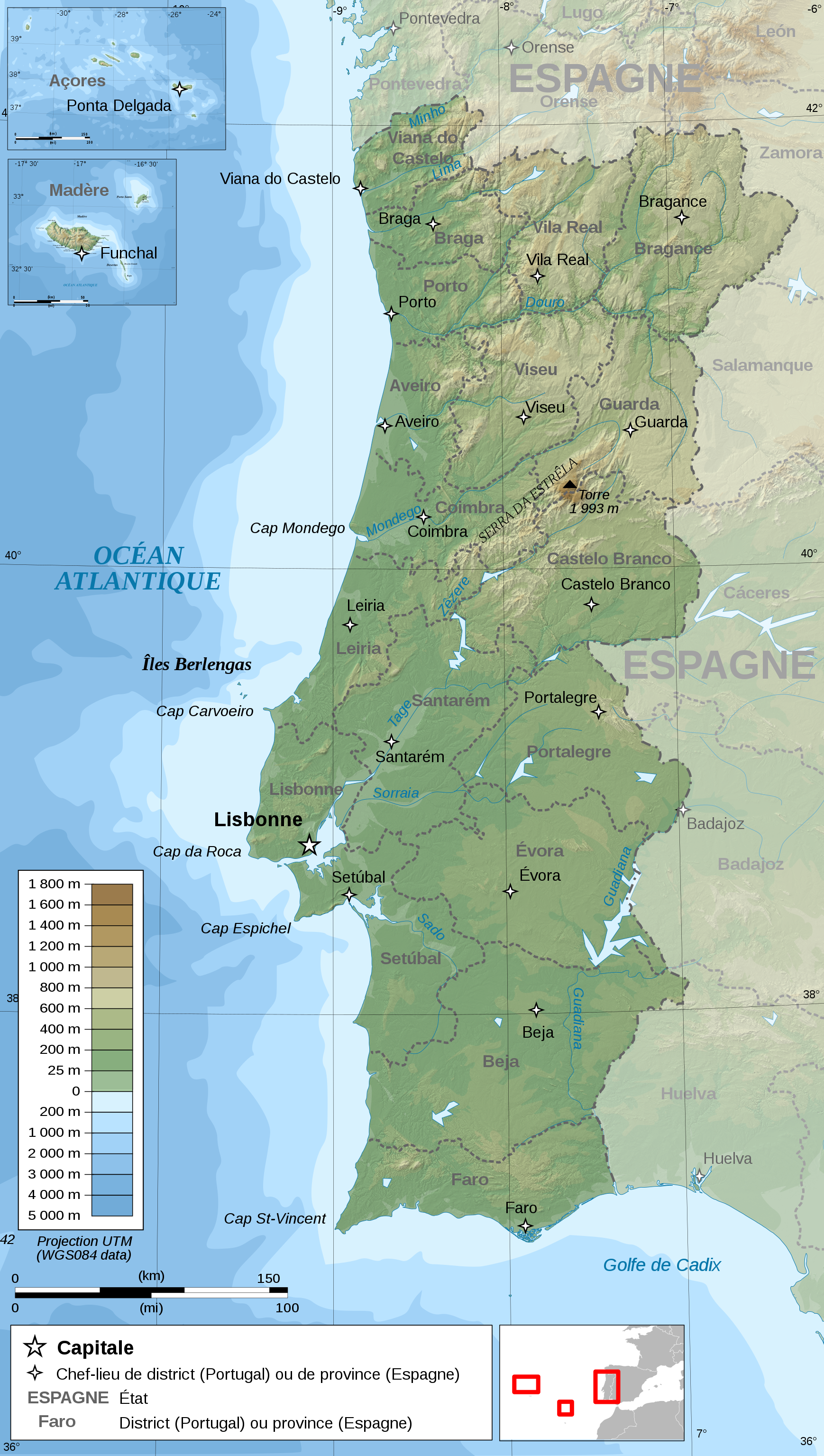
Français : Carte topographique et administrative en français du Portugal
Português: Carta topográfica e da administração do Portugal, em francês
Deutsch: Topographische Karte von Portugal, französische Version English: Topographic and administrative map in French of Portugal Español: Mapa topográfico y administrativo en francés de Portugal Italiano: Carta topografica e amministrativa de Portogallo 日本語: フランス語で表示したポルトガル地形·行政地図 |
||
| Date | |||
| Source |
English: Own work ;
Français : Création personnelle ;
|
||
| Author | Bourrichon - fr:Bourrichon | ||
| Permission (Reusing this file) |
I, the copyright holder of this work, hereby publish it under the following licenses:
This file is licensed under the Creative Commons Attribution-Share Alike 3.0 Unported, 2.5 Generic, 2.0 Generic and 1.0 Generic license.
You may select the license of your choice. |
||
| Other versions |
Derivative works of this file: Portugal topographic map-en.svg
|


|
This SVG file contains embedded text that can be translated into your language, using any capable SVG editor, text editor or the SVG Translate tool. For more information see: About translating SVG files. |
This W3C-unspecified vector image was created with Inkscape .
File history
Click on a date/time to view the file as it appeared at that time.
| Date/Time | Thumbnail | Dimensions | User | Comment | |
|---|---|---|---|---|---|
| current | 17:08, 15 February 2010 | | 1,738 × 3,070 (11.35 MB) | Bourrichon (talk | contribs) | simplification |
| 17:57, 28 April 2009 |  | 1,738 × 3,070 (12.42 MB) | Bourrichon (talk | contribs) | key | |
| 12:04, 26 April 2009 |  | 1,738 × 3,070 (12.42 MB) | Bourrichon (talk | contribs) | +corr bathy color | |
| 17:47, 25 April 2009 |  | 1,738 × 3,070 (12.42 MB) | Bourrichon (talk | contribs) | d.e. | |
| 17:08, 25 April 2009 |  | 1,738 × 3,070 (12.42 MB) | Bourrichon (talk | contribs) | +corr bathy | |
| 16:34, 25 April 2009 |  | 1,738 × 3,070 (12.27 MB) | Bourrichon (talk | contribs) | corr bug | |
| 16:18, 25 April 2009 |  | 1,738 × 3,070 (7.43 MB) | Bourrichon (talk | contribs) | {{Information |Description= {{fr|Carte topographique et administrative en français du fr:Portugal}} {{po|Carta em francês topográfica e da administração do Portugal}} {{de|Topographische Karte von Portugal, fra |
You cannot overwrite this file.
File usage on Commons
The following 5 pages use this file:
File usage on other wikis
The following other wikis use this file:
- Usage on fr.wikipedia.org