File:Post-medieval anti-slavery medal (FindID 740443).jpg
Jump to navigation
Jump to search
Size of this preview: 800 × 440 pixels. Other resolutions: 320 × 176 pixels | 640 × 352 pixels | 1,024 × 563 pixels | 1,280 × 704 pixels | 2,560 × 1,408 pixels | 7,329 × 4,032 pixels.
Original file (7,329 × 4,032 pixels, file size: 10.77 MB, MIME type: image/jpeg)
Captions
Captions
Add a one-line explanation of what this file represents
Summary
[edit].jpg&action=edit§ion=1)
| Post-medieval anti-slavery medal | |||
|---|---|---|---|
| Photographer |
Derby Museums Trust, Alastair Willis, 2015-11-13 14:05:27 |
||
| Title |
Post-medieval anti-slavery medal |
||
| Description |
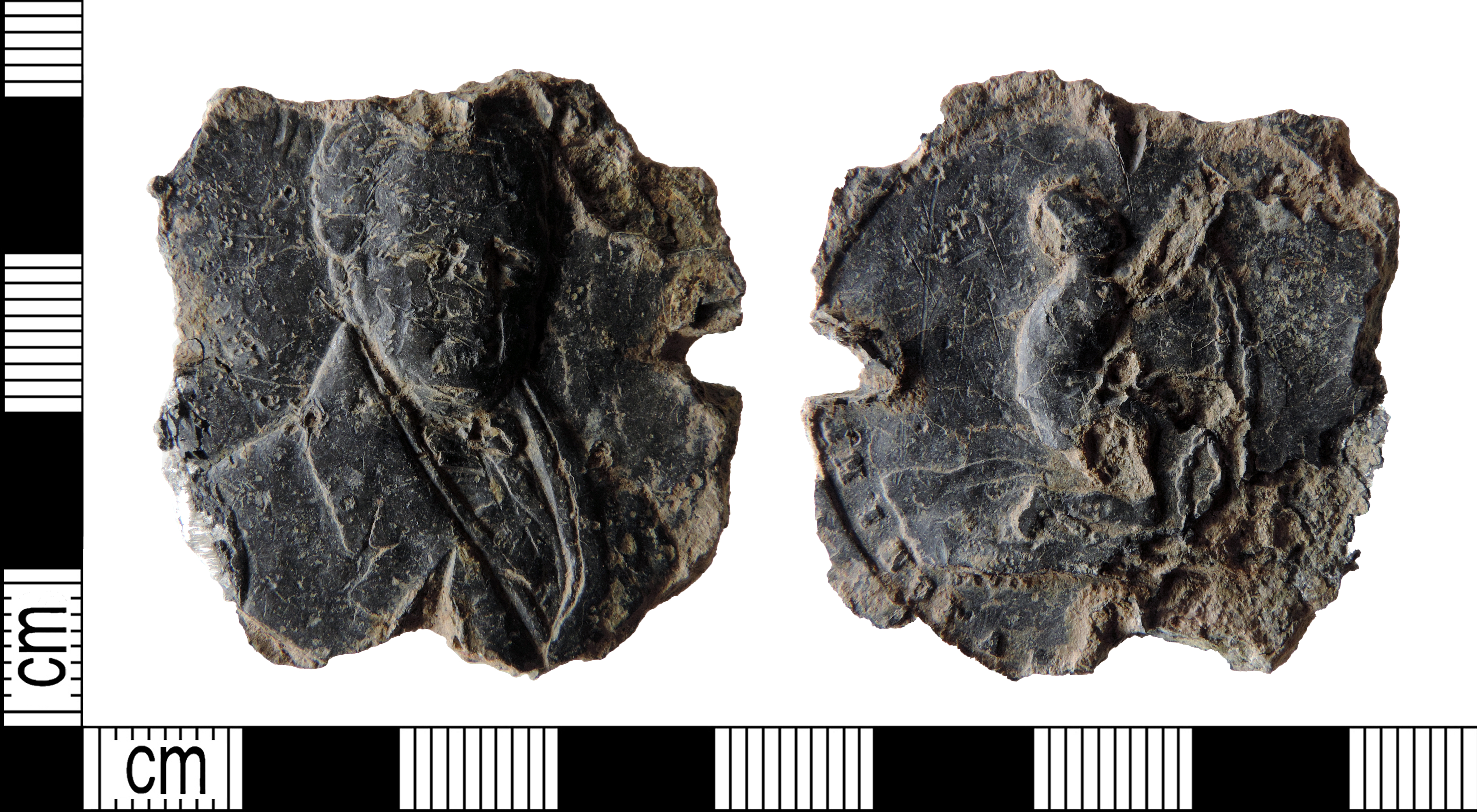
English: An incomplete lead alloy post-medieval (AD 1787-c.1833) anti-slavery medal, missing almost all its edge. Overall, the object measures 39.3mm in diameter and 4.6mm thick. It weighs 16.07g.
Obverse: bust, probably of Thomas Clarkson. Reverse: enchained slave kneeling right. Inscription: AM I NOT A M[AN AND A BROTHER] Thomas Clarkson was a leading abolitionist, who, with Granville Sharp, formed the Committee for the Abolition of the Slave Trade in 1787. The Slavery Act passed in 1807 abolished the slave trade but slavery persisted across the British Empire until 1833. Medals and medallions like this were produced as a way of spreading the anti-slavery message. |
||
| Depicted place | (County of findspot) Derbyshire | ||
| Date | between 1787 and 1833 | ||
| Accession number |
FindID: 740443 Old ref: DENO-6C7E1B Filename: DENO6C7E1B.jpg |
||
| Credit line |
|
||
| Source |
https://finds.org.uk/database/ajax/download/id/540795 Catalog: https://finds.org.uk/database/images/image/id/540795/recordtype/artefacts archive copy at the Wayback Machine Artefact: https://finds.org.uk/database/artefacts/record/id/740443 |
||
| Permission (Reusing this file) |
Attribution License | ||
| Object location | | View this and other nearby images on: OpenStreetMap |
|---|
.jpg¶ms=052.928400_N_-001.675390_E_globe:Earth_class:object_type:object__&language=en)
Licensing
[edit].jpg&action=edit§ion=2)
This file is licensed under the Creative Commons Attribution 2.0 Generic license.
Attribution: Derby Museums Trust
- You are free:
- to share – to copy, distribute and transmit the work
- to remix – to adapt the work
- Under the following conditions:
- attribution – You must give appropriate credit, provide a link to the license, and indicate if changes were made. You may do so in any reasonable manner, but not in any way that suggests the licensor endorses you or your use.
File history
Click on a date/time to view the file as it appeared at that time.
| Date/Time | Thumbnail | Dimensions | User | Comment | |
|---|---|---|---|---|---|
| current | 20:34, 17 February 2019 | | 7,329 × 4,032 (10.77 MB) | Fæ (talk | contribs) | Portable Antiquities Scheme, DENO, FindID: 740443, post medieval, page 5265, batch count 6404 |
You cannot overwrite this file.
File usage on Commons
The following page uses this file:
.jpg)
.jpg&oldid=546663456)