File:Reichskarte 100 Vest Recklinghausen.pdf
Jump to navigation
Jump to search

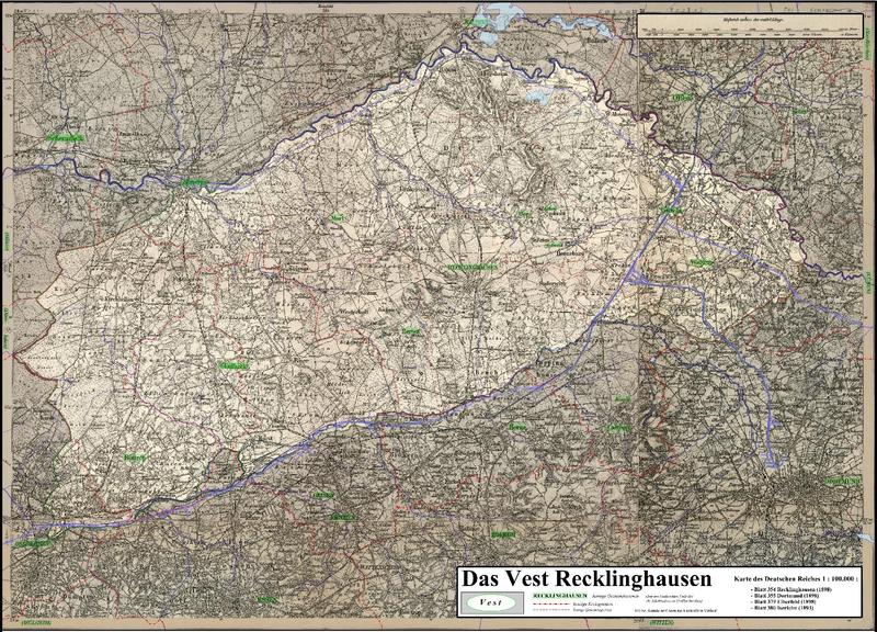
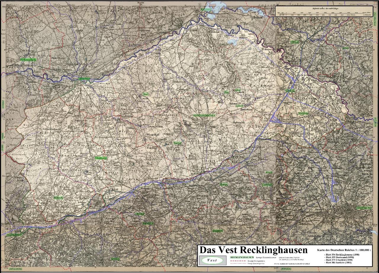
Size of this JPG preview of this PDF file: 800 × 576 pixels. Other resolutions: 320 × 230 pixels | 640 × 460 pixels | 1,024 × 737 pixels | 1,280 × 921 pixels | 1,754 × 1,262 pixels.
Original file (1,754 × 1,262 pixels, file size: 17.42 MB, MIME type: application/pdf)
Captions
Captions
Add a one-line explanation of what this file represents
Summary[edit]
| Description |
Deutsch: Karte des Vestes Recklinghausen (aufgehellt) auf Basis der Karte des Deutschen Reiches| 1 : 100.000; Verwaltungsgrenzen (rot), Kanäle, Flüsse und Seen entsprechen dem heutigen Stand/Verlauf; heutige Stadtnamen sind hellgrün hervorgehoben (damalige Stadtnamen in Großbuchstaben). |
| Date | |
| Source | Own work |
| Author |
|
| Other versions | Siehe Galerie |
Licensing[edit]
I, the copyright holder of this work, hereby publish it under the following license:
This file is licensed under the Creative Commons Attribution 3.0 Unported license.
- You are free:
- to share – to copy, distribute and transmit the work
- to remix – to adapt the work
- Under the following conditions:
- attribution – You must give appropriate credit, provide a link to the license, and indicate if changes were made. You may do so in any reasonable manner, but not in any way that suggests the licensor endorses you or your use.
File history
Click on a date/time to view the file as it appeared at that time.
| Date/Time | Thumbnail | Dimensions | User | Comment | |
|---|---|---|---|---|---|
| current | 20:29, 15 August 2013 |  | 1,754 × 1,262 (17.42 MB) | Elop (talk | contribs) | k |
| 16:41, 11 August 2013 | No thumbnail | 0 × 0 (17.46 MB) | Elop (talk | contribs) | {{Information |Description={{de|1=Karte des Vestes Recklinghausen (aufgehellt) auf Basis der Karte des Deutschen Reiches| 1 : 100.000;<br />Verwaltungsgrenzen (rot), Kanäle, Flüsse und S... |
You cannot overwrite this file.
File usage on Commons
The following page uses this file:
File usage on other wikis
The following other wikis use this file:
- Usage on de.wikipedia.org
- Usage on nds.wiktionary.org