File:Rooppur Nuclear Power Plant Landsat-8 January 2024.jpg
Jump to navigation
Jump to search

Size of this preview: 600 × 600 pixels. Other resolutions: 240 × 240 pixels | 480 × 480 pixels | 768 × 768 pixels | 1,024 × 1,024 pixels.
Original file (1,024 × 1,024 pixels, file size: 470 KB, MIME type: image/jpeg)
Captions
Captions
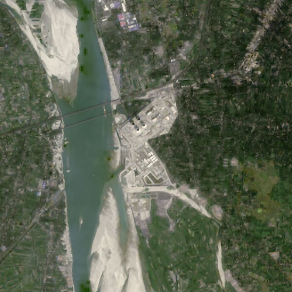
Landsat-8 image of the Rooppur Nuclear Power Plant in Bangladesh.
Summary[edit]
| Description | |
| Date | |
| Source | https://earthexplorer.usgs.gov/scene/metadata/full/5e83d14f2fc39685/LC81380432024028LGN00/ |
| Author | Landsat-8 image courtesy of the U.S. Geological Survey |
| Camera location | | View this and other nearby images on: OpenStreetMap |
|---|
Image created from the B2 (blue), B3 (green), and B4 (red) images. Color corrected and enlarged using Adobe Photoshop.
Licensing[edit]
This image is in the public domain in the United States because it only contains materials that originally came from the United States Geological Survey, an agency of the United States Department of the Interior. For more information, see the official USGS copyright policy.
|
File history
Click on a date/time to view the file as it appeared at that time.
| Date/Time | Thumbnail | Dimensions | User | Comment | |
|---|---|---|---|---|---|
| current | 02:31, 29 February 2024 | | 1,024 × 1,024 (470 KB) | Ahecht (talk | contribs) | Uploaded a work by Landsat-8 image courtesy of the U.S. Geological Survey from https://earthexplorer.usgs.gov/scene/metadata/full/5e83d14f2fc39685/LC81380432024028LGN00/ with UploadWizard |
You cannot overwrite this file.
File usage on Commons
The following page uses this file:
File usage on other wikis
The following other wikis use this file:
- Usage on bn.wikipedia.org
- Usage on en.wikipedia.org