File:Rur Urft map.svg
Jump to navigation
Jump to search

Size of this PNG preview of this SVG file: 645 × 599 pixels. Other resolutions: 258 × 240 pixels | 517 × 480 pixels | 827 × 768 pixels | 1,102 × 1,024 pixels | 2,204 × 2,048 pixels | 848 × 788 pixels.
Original file (SVG file, nominally 848 × 788 pixels, file size: 1.25 MB)
Captions
Captions
Add a one-line explanation of what this file represents
Summary[edit]
| Description |
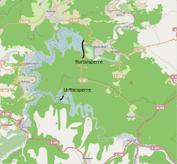
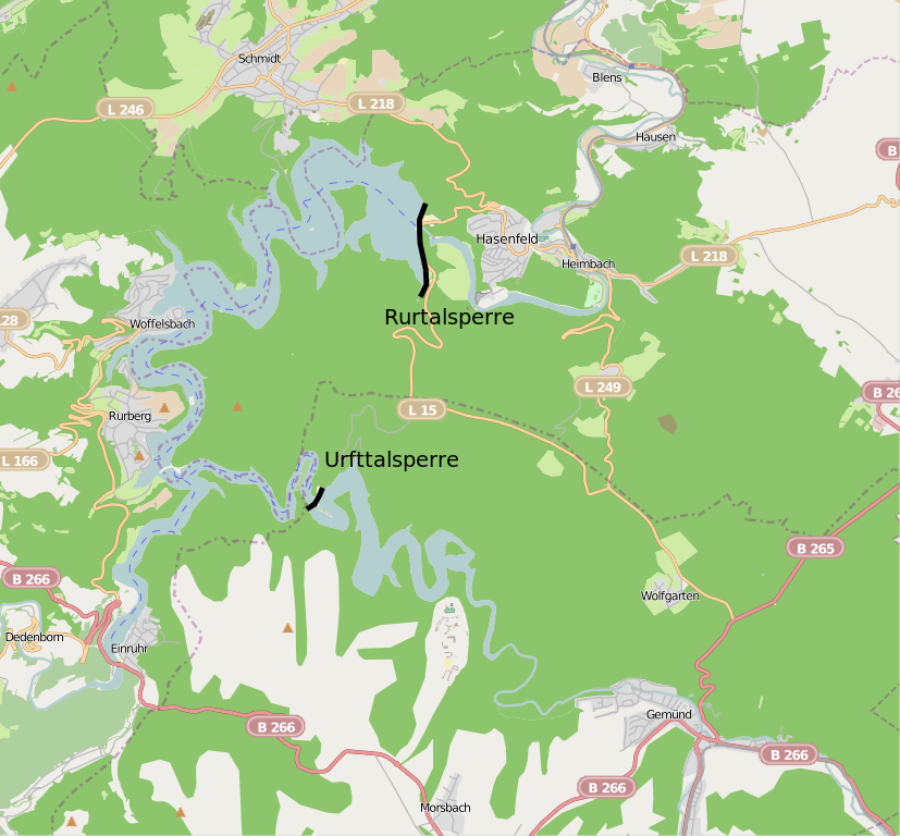
English: Location map for Rurtalsperre and Urfttalsperre, Germany
Nederlands: Lokatiekaart van de Roerdaldam en Urftdaldam, Duitsland
Deutsch: Lagekarte der Rurtalsperre und Urfttalsperre |
| Date | |
| Source | Own work |
| Author | Hans Erren |
| Other versions | Derivative works of this file: Rur Urft map.png |
Basemap from OpenStreetmap, with enhancement for the dams.
Licensing[edit]
The map has been created with the Generic Mapping Tools: https://www.generic-mapping-tools.org/ using one or more of these public-domain datasets for the relief:
|

|
Permission is granted to copy, distribute and/or modify this document under the terms of the GNU Free Documentation License, Version 1.2 or any later version published by the Free Software Foundation; with no Invariant Sections, no Front-Cover Texts, and no Back-Cover Texts. A copy of the license is included in the section entitled GNU Free Documentation License. |
| This file is licensed under the Creative Commons Attribution-Share Alike 3.0 Unported license. | ||
| ||
| This licensing tag was added to this file as part of the GFDL licensing update. |
File history
Click on a date/time to view the file as it appeared at that time.
| Date/Time | Thumbnail | Dimensions | User | Comment | |
|---|---|---|---|---|---|
| current | 15:28, 3 December 2010 | | 848 × 788 (1.25 MB) | Hans Erren (talk | contribs) | new try uploading hilshaded svg |
| 22:53, 2 December 2010 |  | 848 × 788 (1.25 MB) | Hans Erren (talk | contribs) | Reverted to version as of 19:36, 29 November 2010 | |
| 22:46, 2 December 2010 |  | 848 × 788 (1.25 MB) | Hans Erren (talk | contribs) | added srtm hillshade using GMT {{GFDL-GMT}} | |
| 19:36, 29 November 2010 |  | 848 × 788 (1.25 MB) | Hans Erren (talk | contribs) | {{Information |Description={{en|1=Location map for Rurtalsperre and Urfttalsperre, Germany}} {{nl|1=Lokatiekaart van de Roerdaldam en Urftdaldam, Duitsland}} {{de|1=Lagekarte der Rurtalsperre und Urfttalsperre}} |Source={{own}} |Author=[[User:Hans Erren|H |
You cannot overwrite this file.
File usage on Commons
The following page uses this file: