File:Schlabendorfer See 03.jpg
Original file (5,376 × 3,251 pixels, file size: 12.07 MB, MIME type: image/jpeg)
Captions
Summary[edit]
DescriptionSchlabendorfer See 03.jpg |
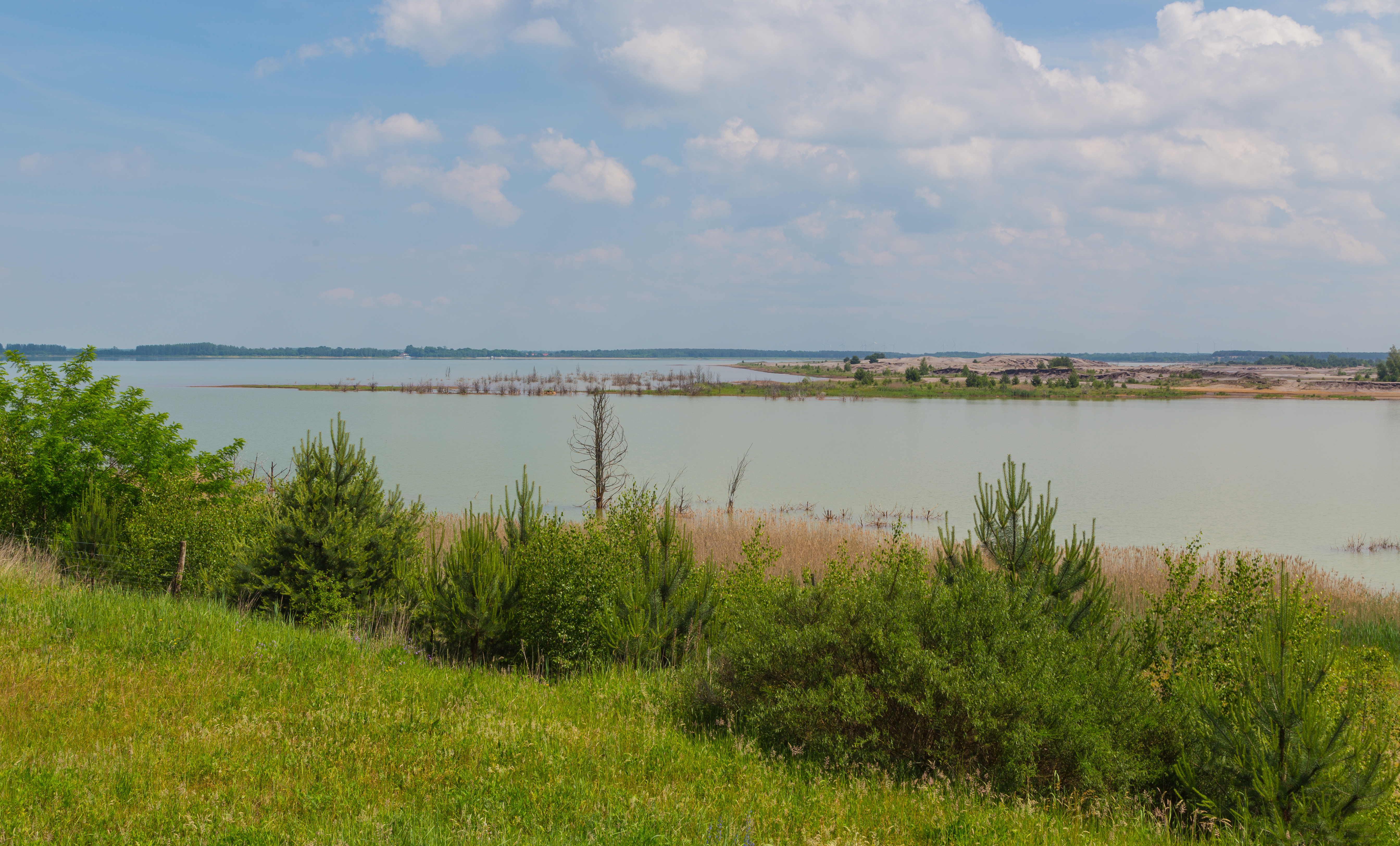
English: Lake Schlabendorf (Schlabendorfer See) near Görlsdorf, district of Luckau, Landkreis Dahme-Spreewald, Brandenburg, Germany. This part of the lake belongs to Sielmanns Naturlandschaft Wanninchen and also to Wanninchen Nature Reserve (Naturschutzgebiet Wanninchen).
Deutsch: Blick über den Schlabendorfer See bei Görlsdorf, Ortsteil der Gemeinde Luckau, Landkreis Dahme-Spreewald, Brandenburg, Deutschland. Dieser Teil des Sees ist Bestandteil von Sielmanns Naturlandschaft Wanninchen und gehört zugleich zum Naturschutzgebiet Wanninchen.
|
||
Date | |||
Source | Own work | ||
Author | J.-H. Janßen |
Camera location | 51° 47′ 20.9″ N, 13° 46′ 37.96″ E | View this and other nearby images on: OpenStreetMap | 51.789140; 13.777212 |
---|
This image was uploaded as part of Wiki Loves Earth 2018.
aragonés | العربية | asturianu | azərbaycanca | беларуская (тарашкевіца) | български | বাংলা | brezhoneg | català | čeština | Cymraeg | Deutsch | Ελληνικά | English | español | eesti | euskara | فارسی | français | galego | עברית | hrvatski | հայերեն | Bahasa Indonesia | italiano | 日本語 | ქართული | 한국어 | latviešu | македонски | മലയാളം | मराठी | Bahasa Melayu | norsk bokmål | नेपाली | Nederlands | norsk | polski | português | português do Brasil | русский | sicilianu | shqip | slovenščina | српски / srpski | svenska | ไทย | Türkçe | українська | اردو | 中文 | 中文(台灣) | +/− |
Licensing[edit]
- You are free:
- to share – to copy, distribute and transmit the work
- to remix – to adapt the work
- Under the following conditions:
- attribution – You must give appropriate credit, provide a link to the license, and indicate if changes were made. You may do so in any reasonable manner, but not in any way that suggests the licensor endorses you or your use.
- share alike – If you remix, transform, or build upon the material, you must distribute your contributions under the same or compatible license as the original.
File history
Click on a date/time to view the file as it appeared at that time.
Date/Time | Thumbnail | Dimensions | User | Comment | |
---|---|---|---|---|---|
current | 21:03, 2 May 2018 | 5,376 × 3,251 (12.07 MB) | J.-H. Janßen (talk | contribs) | {{Information |Description={{en|1=Lake Schlabendorf (''Schlabendorfer See'') near Schlabendorf am See, district of Luckau, Landkreis Dahme-Spreewald, Brandenburg, Germany. This part of the lake belongs to Wanninchen Nauture Reserve (''Naturschutzgebiet Wanninchen'').}} {{de|1=Blick über den Schlabendorfer See bei Schlabendorf am See, Ortsteil der Gemeinde [[... |
You cannot overwrite this file.
File usage on Commons
The following 2 pages use this file:
Metadata
This file contains additional information such as Exif metadata which may have been added by the digital camera, scanner, or software program used to create or digitize it. If the file has been modified from its original state, some details such as the timestamp may not fully reflect those of the original file. The timestamp is only as accurate as the clock in the camera, and it may be completely wrong.
Camera manufacturer | Canon |
---|---|
Camera model | Canon EOS 6D |
Author | Wikimedia User J.-H. Janssen |
Exposure time | 1/125 sec (0.008) |
F-number | f/11 |
ISO speed rating | 100 |
Date and time of data generation | 11:33, 6 June 2017 |
Lens focal length | 35 mm |
Latitude | 51° 47′ 20.9″ N |
Longitude | 13° 46′ 37.96″ E |
City shown | Luckau |
Horizontal resolution | 300 dpi |
Vertical resolution | 300 dpi |
Software used | Adobe Photoshop Lightroom 5.7.1 (Windows) |
File change date and time | 16:34, 29 April 2018 |
Exposure Program | Landscape mode (for landscape photos with the background in focus) |
Exif version | 2.3 |
Date and time of digitizing | 11:33, 6 June 2017 |
APEX shutter speed | 6.965784 |
APEX aperture | 6.918863 |
APEX exposure bias | 0 |
Maximum land aperture | 4 APEX (f/4) |
Metering mode | Pattern |
Flash | Flash did not fire, compulsory flash suppression |
DateTimeOriginal subseconds | 00 |
DateTimeDigitized subseconds | 00 |
Color space | sRGB |
Focal plane X resolution | 1,520 |
Focal plane Y resolution | 1,520 |
Focal plane resolution unit | 3 |
Custom image processing | Normal process |
Exposure mode | Auto exposure |
White balance | Auto white balance |
Scene capture type | Standard |
GPS time (atomic clock) | 10:33:9.999 |
Satellites used for measurement | 12 |
Receiver status | Measurement in progress |
Measurement mode | 2-dimensional measurement |
Measurement precision | Poor (5.1) |
Geodetic survey data used | WGS-84 |
GPS date | 6 June 2017 |
GPS tag version | 0.0.3.2 |
Serial number of camera | 033024001627 |
Lens used | EF24-105mm f/4L IS USM |
Date metadata was last modified | 18:34, 29 April 2018 |
Unique ID of original document | 2C71681C30D05E33B970C333686A39FA |
Province or state shown | Brandenburg |
Country shown | Deutschland |
Sublocation of city shown | Görlsdorf |
IIM version | 4 |
Structured data
Items portrayed in this file
depicts
6 June 2017
51°47'20.904"N, 13°46'37.963"E
0.008 second
11
35 millimetre
100
- Protected areas with known WDPA-ID
- Files with coordinates missing SDC location of creation
- Images from Wiki Loves Earth 2018
- Images from Wiki Loves Earth 2018 in Germany
- Images from Wiki Loves Earth missing SDC depicts
- Images from Wiki Loves Earth missing SDC location of creation
- Images from Wiki Loves Earth 2018, DE-BB
- Photographs by Jan-Herm Janßen/Luckau
- Photographs by J.-H. Janßen/Wiki Loves Earth
- Taken with Canon EOS 6D and Canon EF 24-105mm F4L IS USM
- CC-BY-SA-4.0
- Pages with maps