File:Scotland map-fr.jpg
Jump to navigation
Jump to search

Size of this preview: 417 × 599 pixels. Other resolutions: 167 × 240 pixels | 334 × 480 pixels | 534 × 768 pixels | 712 × 1,024 pixels | 2,400 × 3,450 pixels.
Original file (2,400 × 3,450 pixels, file size: 2.21 MB, MIME type: image/jpeg)
Captions
Captions
Add a one-line explanation of what this file represents
|

Summary[edit]
| Camera location | | View this and other nearby images on: OpenStreetMap |
|---|
| Description |
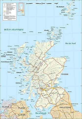
English: Map in French of Scotland
This is a lighter raster JPG format version of Image:Scotland_map-fr.svg which should be used in the article pages, the vector graphics version purpose being for modification and / or translation. Euskara: Eskoziako mapa frantsesez
Français : Carte en français de l'Écosse.
Ceci est une version bitmap au format JPG et de poids de fichier plus léger de Image:Scotland_map-fr.svg qui devrait être utilisée dans les pages d'articles, la version vectorisée SVG étant destinée à faciliter les modifications et / ou traductions. Português: Mapa (em Francês) da Escócia.
Polski: Mapa Szkocji (w języku francuskim).
Svenska: Karta över Skottland på franska.
Approximate scales of shaded relief and shore / lakes limits : 1:3,000,000 (accuracy : about 750 m) until 60.38° and 1:4,000,000 (accuracy : about 1,000 m) North of 60.38° |
||
| Date | |||
| Source |
Own work ;
|
||
| Author | Eric Gaba (Sting - fr:Sting) | ||
| Permission (Reusing this file) |
|
||
| Other versions |
[]
|


Licensing[edit]
I, the copyright holder of this work, hereby publish it under the following licenses:

|
Permission is granted to copy, distribute and/or modify this document under the terms of the GNU Free Documentation License, Version 1.2 or any later version published by the Free Software Foundation; with no Invariant Sections, no Front-Cover Texts, and no Back-Cover Texts. A copy of the license is included in the section entitled GNU Free Documentation License. |
This file is licensed under the Creative Commons Attribution-Share Alike 4.0 International, 3.0 Unported, 2.5 Generic, 2.0 Generic and 1.0 Generic license.
- You are free:
- to share – to copy, distribute and transmit the work
- to remix – to adapt the work
- Under the following conditions:
- attribution – You must give appropriate credit, provide a link to the license, and indicate if changes were made. You may do so in any reasonable manner, but not in any way that suggests the licensor endorses you or your use.
- share alike – If you remix, transform, or build upon the material, you must distribute your contributions under the same or compatible license as the original.
You may select the license of your choice.
File history
Click on a date/time to view the file as it appeared at that time.
| Date/Time | Thumbnail | Dimensions | User | Comment | |
|---|---|---|---|---|---|
| current | 21:33, 17 July 2010 | | 2,400 × 3,450 (2.21 MB) | Sting (talk | contribs) | Color profile |
| 02:40, 5 September 2008 |  | 2,400 × 3,450 (2.13 MB) | Sting (talk | contribs) | New standard colors | |
| 01:28, 14 December 2007 |  | 2,400 × 3,450 (2.23 MB) | Sting (talk | contribs) | Additional name | |
| 19:48, 13 December 2007 |  | 2,400 × 3,450 (2.23 MB) | Sting (talk | contribs) | {{Location|57|00|00|N|04|00|00|W|scale:4000000}} <br/> {{Information |Description=Map in French of Scotland<br/>This is a lighter raster JPG format version of Image:Scotland_map-fr.svg which should be used in the article pages, the v |
You cannot overwrite this file.
File usage on Commons
The following 37 pages use this file:
- User:Pfctdayelise/POTY07 categories/2007 list
- User:Sting/Gallery: Regional maps
- User talk:Ayack/Archives 1
- User talk:Sting/Archive 01
- Commons:Featured picture candidates/Image:Scotland map-fr.jpg
- Commons:Featured picture candidates/Log/December 2007
- Commons:Featured pictures/Non-photographic media/Maps
- Commons:Featured pictures/chronological/2007-B
- Commons:Picture of the Year/2007/Galleries/All
- Commons:Picture of the Year/2007/Galleries/Graphic art and maps
- Commons:Picture of the Year/2007/Results/Round 1/Gallery
- File:Moray Firth topo.png
- File:ScotlandTopo Base Map VHR.png
- File:Scotland map-de.svg
- File:Scotland map-en.jpg
- File:Scotland map-en.svg
- File:Scotland map-fr.jpg
- File:Scotland map-fr.svg
- File:Scotland topographic map-af.svg
- File:Scotland topographic map-de.svg
- File:Scotland topographic map-en.jpg
- File:Scotland topographic map-en.svg
- File:Scotland topographic map-es.svg
- File:Scotland topographic map-eu.svg
- File:Scotland topographic map-fr.jpg
- File:Scotland topographic map-fr.svg
- File:Scotland topographic map-mk.svg
- File:Scotland topographic map-nb.svg
- File:Scotland topographic map-nn.svg
- File:Scotland topographic map-ru.svg
- File:Scotland topographic map small-de.svg
- File:Scotland topographic map small-en.svg
- File:Scotland topographic map small-fr.svg
- File:Scotland topographic map small-mk.svg
- File:Scotland topographic map small-sco.svg
- Template:Other versions/Scotland topographic map
- Category:Blackwood, South Lanarkshire
File usage on other wikis
The following other wikis use this file:
- Usage on en.wikipedia.org
- Usage on es.wikipedia.org
- Usage on eu.wikipedia.org
- Usage on fr.wikipedia.org
- Usage on mg.wikipedia.org
- Usage on pcd.wikipedia.org
- Usage on pl.wikipedia.org
- Usage on uk.wikipedia.org
- Usage on www.wikidata.org