File:Sharondale Road in Sharonville.jpg
Jump to navigation
Jump to search

Size of this preview: 800 × 600 pixels. Other resolutions: 320 × 240 pixels | 640 × 480 pixels | 1,024 × 768 pixels | 1,280 × 960 pixels | 2,272 × 1,704 pixels.
Original file (2,272 × 1,704 pixels, file size: 2.22 MB, MIME type: image/jpeg)
Captions
Captions
Add a one-line explanation of what this file represents
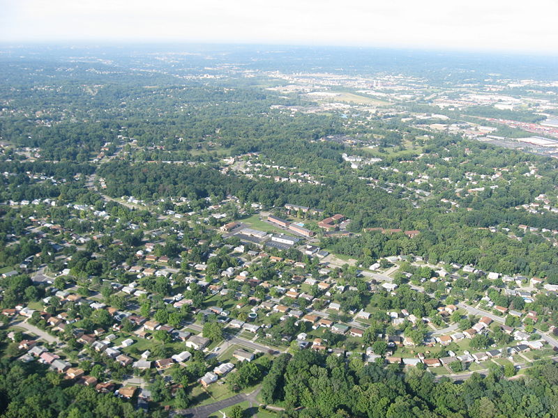
| Description | Aerial view of southern Sharonville, a city primarily in Hamilton County, Ohio, United States; although part of the city extends into Butler County, this picture is taken exclusively over Hamilton County. The church and parking lot in the center of the picture are located along Sharondale Road just north of its intersection with Elljay Drive. Picture taken from a Diamond Eclipse light airplane at an altitude of 1,740 feet MSL and a bearing of approximately 232º. | ||
| Date | Taken on 12 August 2008 | ||
| Source | Own work | ||
| Author | Nyttend | ||
| Permission (Reusing this file) |
|
File history
Click on a date/time to view the file as it appeared at that time.
| Date/Time | Thumbnail | Dimensions | User | Comment | |
|---|---|---|---|---|---|
| current | 14:30, 22 September 2008 | | 2,272 × 1,704 (2.22 MB) | Nyttend (talk | contribs) | {{Information |Description=Aerial view of southern {{w|Sharonville, Ohio|Sharonville}}, a city primarily in {{w|Hamilton County, Ohio|Hamilton County}}, {{w|Ohio}}, {{w|United States}}; although part of the city extends into {{w|Butler County, Ohio|Butler |
You cannot overwrite this file.
File usage on Commons
The following 2 pages use this file:
File usage on other wikis
The following other wikis use this file:
- Usage on ar.wikipedia.org
- Usage on arz.wikipedia.org
- Usage on bg.wikipedia.org
- Usage on ca.wikipedia.org
- Usage on ceb.wikipedia.org
- Usage on ce.wikipedia.org
- Usage on cy.wikipedia.org
- Usage on de.wikipedia.org
- Usage on en.wikivoyage.org
- Usage on es.wikipedia.org
- Usage on eu.wikipedia.org
- Usage on fa.wikipedia.org
- Usage on fr.wikipedia.org
- Usage on ht.wikipedia.org
- Usage on it.wikipedia.org
- Usage on it.wikivoyage.org
- Usage on ky.wikipedia.org
- Usage on lld.wikipedia.org
- Usage on pl.wikipedia.org
- Usage on pt.wikipedia.org
- Usage on sh.wikipedia.org
- Usage on sr.wikipedia.org
- Usage on sv.wikipedia.org
- Usage on tr.wikipedia.org
- Usage on tt.wikipedia.org
- Usage on uz.wikipedia.org
- Usage on vi.wikipedia.org
- Usage on vo.wikipedia.org
- Usage on www.wikidata.org
- Usage on zh-min-nan.wikipedia.org