File:Snow in the eastern Rocky Mountains and Great Plains (MODIS 2016-12-20).jpg

Original file (5,089 × 4,161 pixels, file size: 3.18 MB, MIME type: image/jpeg)
Captions
Captions
Summary[edit]
.jpg&action=edit§ion=1)
| Description |
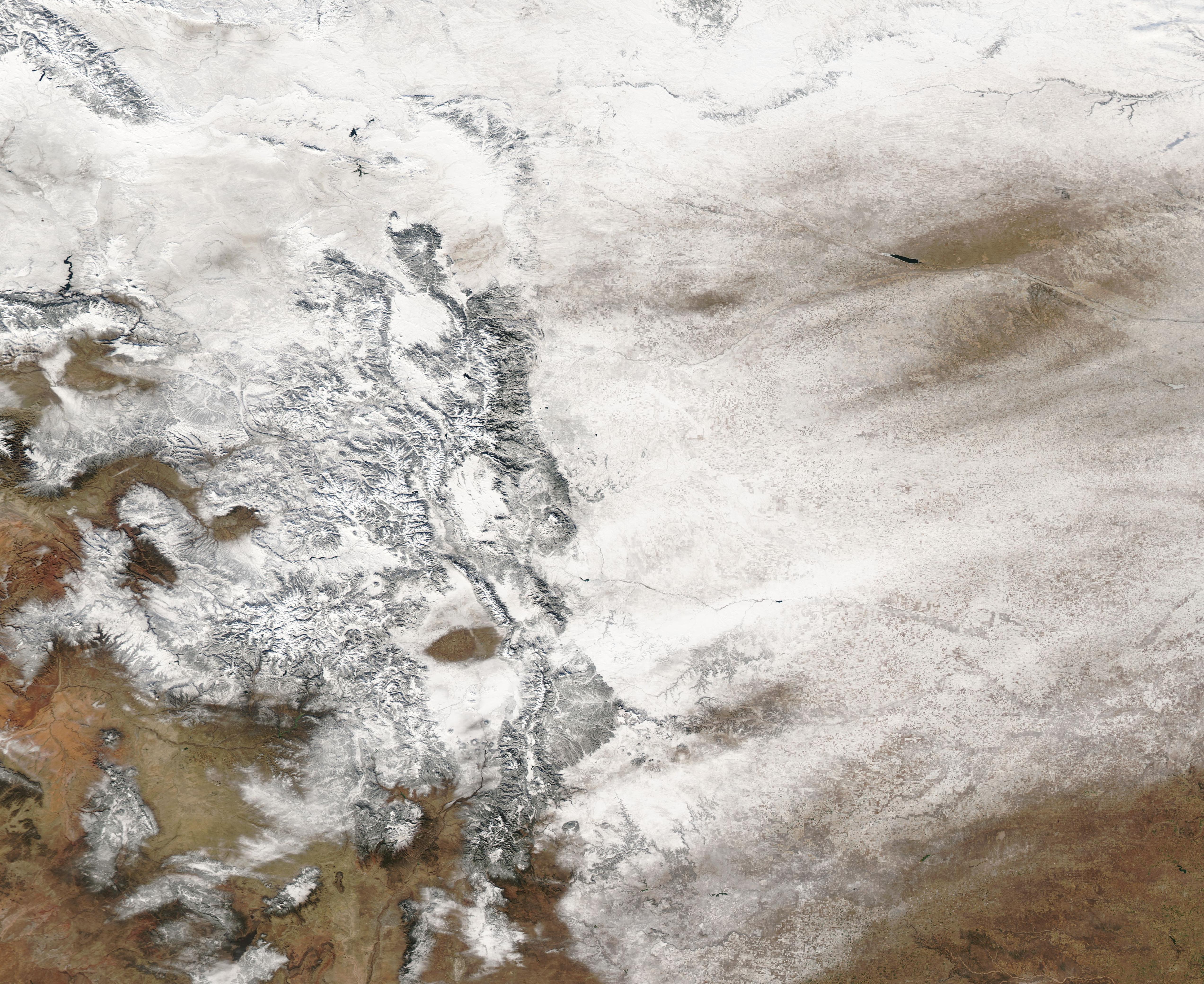
English: A strong winter storm brought snow and ice across the United States in the last days of autumn 2016. The storm, named Decima by the Weather Channel, slammed parts of the Northwest, the Rockies, the Great Plains, Midwest and the Eastern United States from December 14-18, dumping up to 33 inches of snow in parts of Colorado and Utah and spreading treacherous ice several states. Highest ice reports were 0.50 inches in Wakeman, Ohio and 0.40 inches in Hidden Valley, Pennsylvania.
The severe weather closed roads, caused hundreds of flight cancellations and delays, knocked out power, and made roadways treacherous. In Baltimore, Maryland, icy conditions caused a 67-car pileup as a tanker truck slid off an overpass, then exploding when it landed onto train tracks below. The accident left two dead and about two dozen more injured. Over thirty states reported snow and/or ice from the massive winter storm. They include: California, Colorado, Idaho, Montana, Nevada, New Mexico, Oregon, Utah, Washington, Wyoming, Illinois, Indiana, Iowa, Michigan, Minnesota, Missouri, Nebraska, Ohio, Oklahoma, South Dakota, Wisconsin, Connecticut, Maine, Massachusetts, New Hampshire, New Jersey, New York, Pennsylvania, Rhode Island, Vermont, West Virginia, Virginia, North Carolina and Maryland. Decima also brought squalls and rain as far south as southern Louisiana, southern Mississippi, and southern Alabama. On December 18, 2016, the Moderate Resolution Imaging Spectroradiometer aboard NASA’s Aqua satellite captured a true-color image of snow in the eastern Rockies of Colorado and Wyoming and the Great Plains of Kansas and Nebraska. |
||
| Date | Taken on 18 December 2016 | ||
| Source |
Snow in the eastern Rocky Mountains and Great Plains (direct link)
|
||
| Author | Jeff Schmaltz, MODIS Land Rapid Response Team, NASA GSFC |
| This media is a product of the Aqua mission Credit and attribution belongs to the mission team, if not already specified in the "author" row |
Licensing[edit]
.jpg&action=edit§ion=2)
| This file is in the public domain in the United States because it was solely created by NASA. NASA copyright policy states that "NASA material is not protected by copyright unless noted". (See Template:PD-USGov, NASA copyright policy page or JPL Image Use Policy.) | ||
 |
Warnings:
|
File history
Click on a date/time to view the file as it appeared at that time.
| Date/Time | Thumbnail | Dimensions | User | Comment | |
|---|---|---|---|---|---|
| current | 19:09, 15 February 2024 | | 5,089 × 4,161 (3.18 MB) | OptimusPrimeBot (talk | contribs) | #Spacemedia - Upload of http://modis.gsfc.nasa.gov/gallery/images/image12202016_250m.jpg via Commons:Spacemedia |
You cannot overwrite this file.
File usage on Commons
There are no pages that use this file.
.jpg&oldid=852063851)