File:Stanford Map, 1901, Outer London Map.jpg
Jump to navigation
Jump to search

Size of this preview: 799 × 600 pixels. Other resolutions: 320 × 240 pixels | 640 × 480 pixels | 1,024 × 768 pixels | 1,280 × 961 pixels | 2,560 × 1,921 pixels | 10,035 × 7,531 pixels.
Original file (10,035 × 7,531 pixels, file size: 84.03 MB, MIME type: image/jpeg)
Captions
Captions
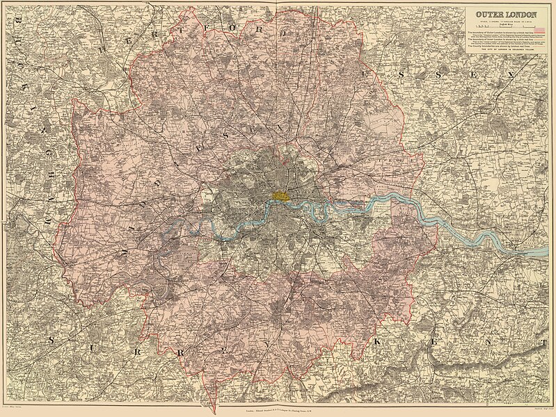
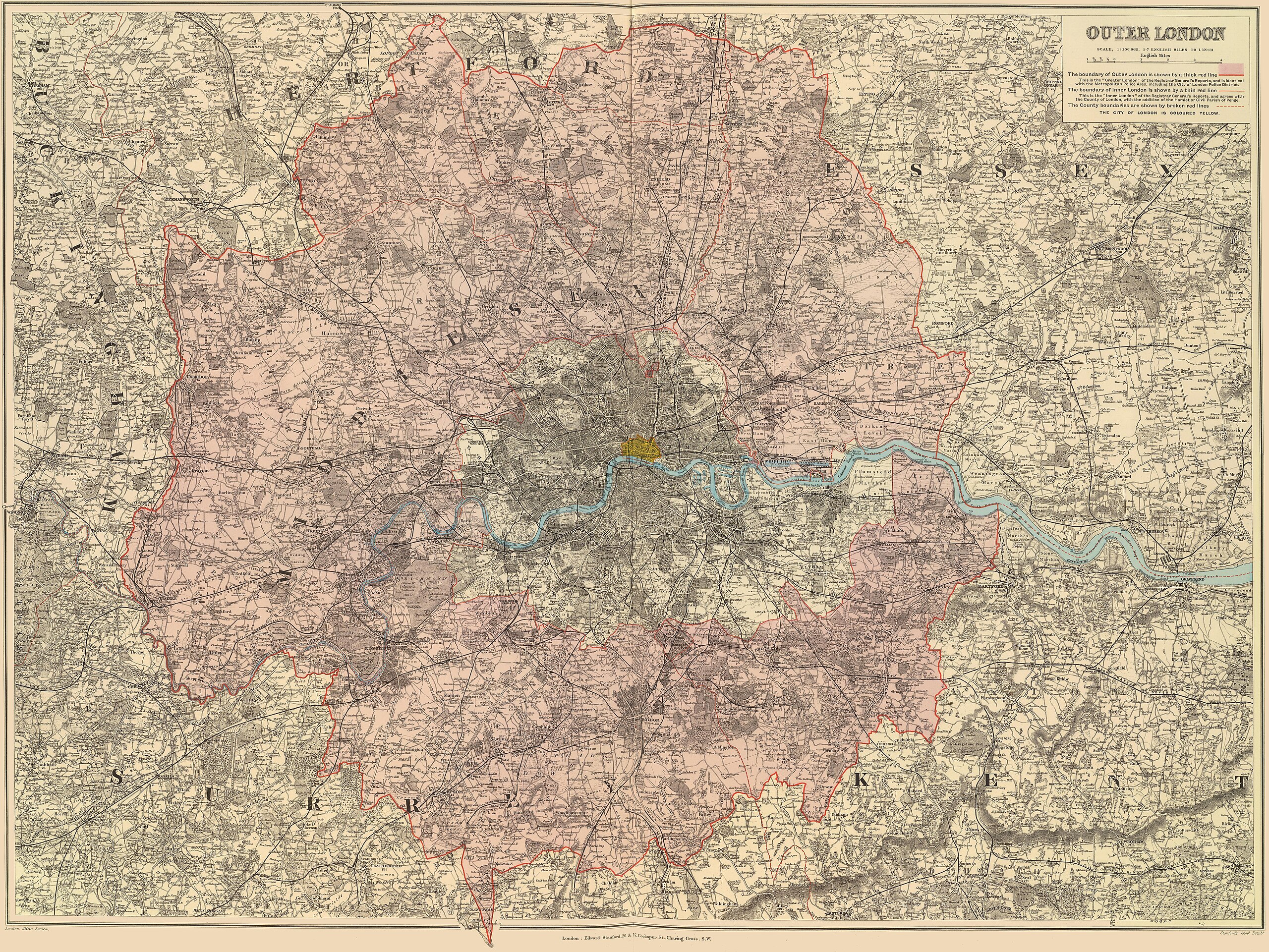
Outer London map from 1901 showing the area around London with the boundaries of the Metropolitan Police District, the County of London and the City of London highlighted
Summary[edit]
| Description | "Outer London" map showing the area around London with the boundaries of the Metropolitan Police District, the County of London and the City of London highlighted | |||||||||||||||||||
| Date | (Map shows County of London Boundary as it was in 1900: the three portions of South Hornsey Urban District in Middlesex to the south-east of Finsbury Park were merged with Vestry of Stoke Newington in the County of London to form the Metropolitan Borough of Stoke Newington) | |||||||||||||||||||
| Source | Stanford's London Atlas of Universal Geography Exhibiting the Physical and Political Divisions of the Various Countries of the World | |||||||||||||||||||
| Author |
|
|||||||||||||||||||
| Permission (Reusing this file) |
|
|||||||||||||||||||
File history
Click on a date/time to view the file as it appeared at that time.
| Date/Time | Thumbnail | Dimensions | User | Comment | |
|---|---|---|---|---|---|
| current | 19:57, 29 December 2019 | | 10,035 × 7,531 (84.03 MB) | DavidCane (talk | contribs) | == {{int:filedesc}} == {{Information |Description="Outer London" map showing the area around London with the boundaries of the Metropolitan Police District, the County of London and the City of London highlighted |Source=Stanford's London Atlas of Universal Geography Exhibiting the Physical and Political Divisions of the Various Countries of the World |Date=1901 |Author={{Creator:Edward Stanford}} |Permission={{PD... |
You cannot overwrite this file.
File usage on Commons
The following page uses this file:
- File:Stanford Map, 1901, Outer Lonodn Map.jpg (file redirect)
File usage on other wikis
The following other wikis use this file:
- Usage on en.wikipedia.org