File:Strait of Dover map mk.svg
Jump to navigation
Jump to search

Size of this PNG preview of this SVG file: 799 × 599 pixels. Other resolutions: 320 × 240 pixels | 640 × 480 pixels | 1,024 × 768 pixels | 1,280 × 960 pixels | 2,560 × 1,921 pixels | 857 × 643 pixels.
Original file (SVG file, nominally 857 × 643 pixels, file size: 487 KB)
Captions
Captions
Add a one-line explanation of what this file represents
Summary[edit]
| Description |
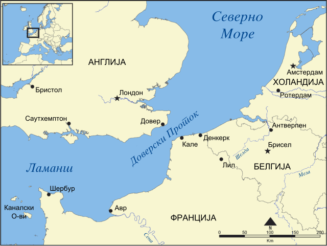
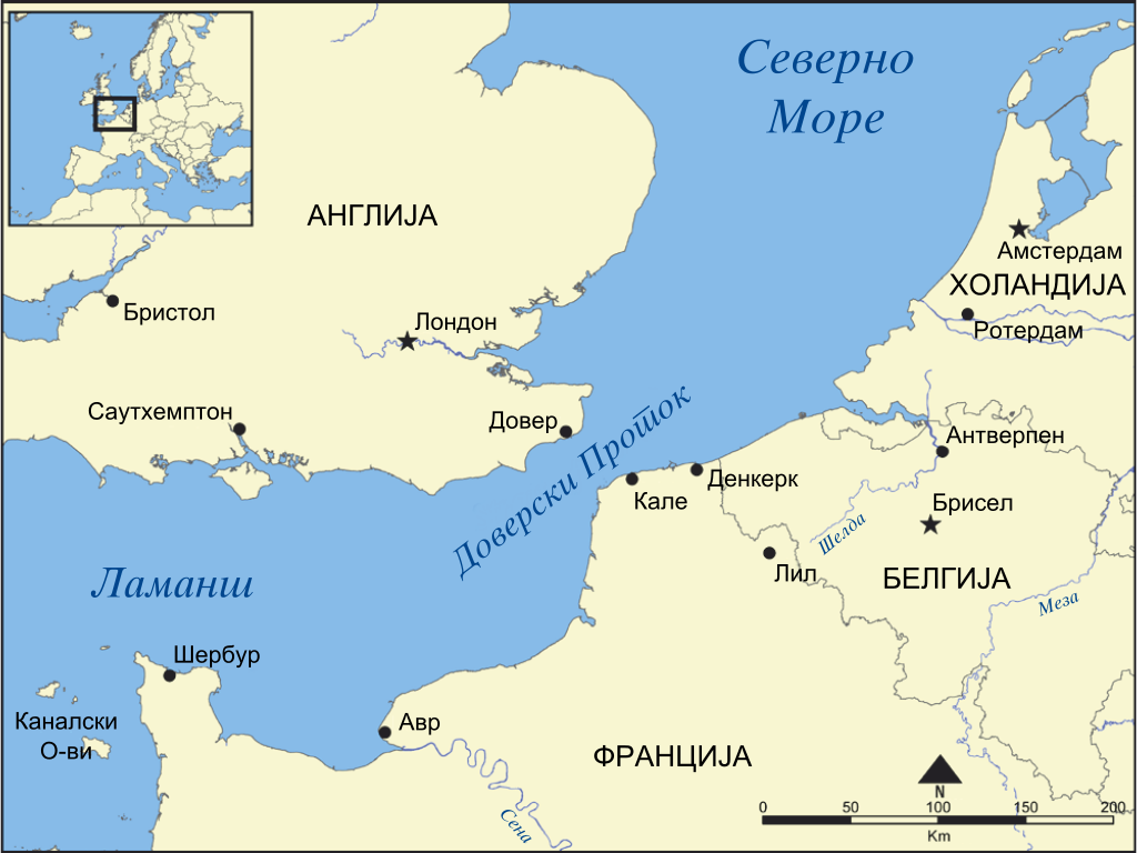
English: Map in Macedonian showing the locations of the Strait of Dover and the English Channel. |
| Date | (UTC) |
| Source |
This file was derived from: Strait of Dover map hr.svg: |
| Author |
|
| Other versions |
|


| This is a retouched picture, which means that it has been digitally altered from its original version. Modifications: Translated into Macedonian. The original can be viewed here: Strait of Dover map hr.svg:
|
Licensing[edit]
I, the copyright holder of this work, hereby publish it under the following licenses:
| This file is licensed under the Creative Commons Attribution-Share Alike 3.0 Unported license. | ||
| ||
| This licensing tag was added to this file as part of the GFDL licensing update. |

|
Permission is granted to copy, distribute and/or modify this document under the terms of the GNU Free Documentation License, Version 1.2 or any later version published by the Free Software Foundation; with no Invariant Sections, no Front-Cover Texts, and no Back-Cover Texts. A copy of the license is included in the section entitled GNU Free Documentation License. |
You may select the license of your choice.
Original upload log[edit]
This image is a derivative work of the following images:
- File:Strait_of_Dover_map_hr.svg licensed with Cc-by-sa-3.0-migrated, GFDL
- 2012-04-09T11:51:07Z MaGa 857x643 (471563 Bytes) {{Information |Description={{hr|La Manche i Doverski prolaz}} |Source=*[[:File:Strait of Dover map.png]] |Date=9. travnja 2012. |Author=*[[:File:Strait of Dover map.png|Strait of Dover map.png]]: [[User:NormanEinstein|NormanE
Uploaded with derivativeFX
File history
Click on a date/time to view the file as it appeared at that time.
| Date/Time | Thumbnail | Dimensions | User | Comment | |
|---|---|---|---|---|---|
| current | 03:35, 25 June 2012 | | 857 × 643 (487 KB) | Bjankuloski06en (talk | contribs) | == {{int:filedesc}} == {{Information |Description={{mk|Карта на Доверскиот Проток и каналот Ламанш.}} {{en|Map in Macedonian showing the locations of the St... |
You cannot overwrite this file.
File usage on Commons
The following 2 pages use this file:
File usage on other wikis
The following other wikis use this file:
- Usage on mk.wikipedia.org