File:Tertia Europe Tabula.jpg
Jump to navigation
Jump to search
Size of this preview: 800 × 528 pixels. Other resolutions: 320 × 211 pixels | 640 × 423 pixels | 1,024 × 676 pixels | 1,280 × 845 pixels | 2,560 × 1,690 pixels | 3,231 × 2,133 pixels.
Original file (3,231 × 2,133 pixels, file size: 1.13 MB, MIME type: image/jpeg)
Captions
Captions
Add a one-line explanation of what this file represents
Summary[edit]
| Description |
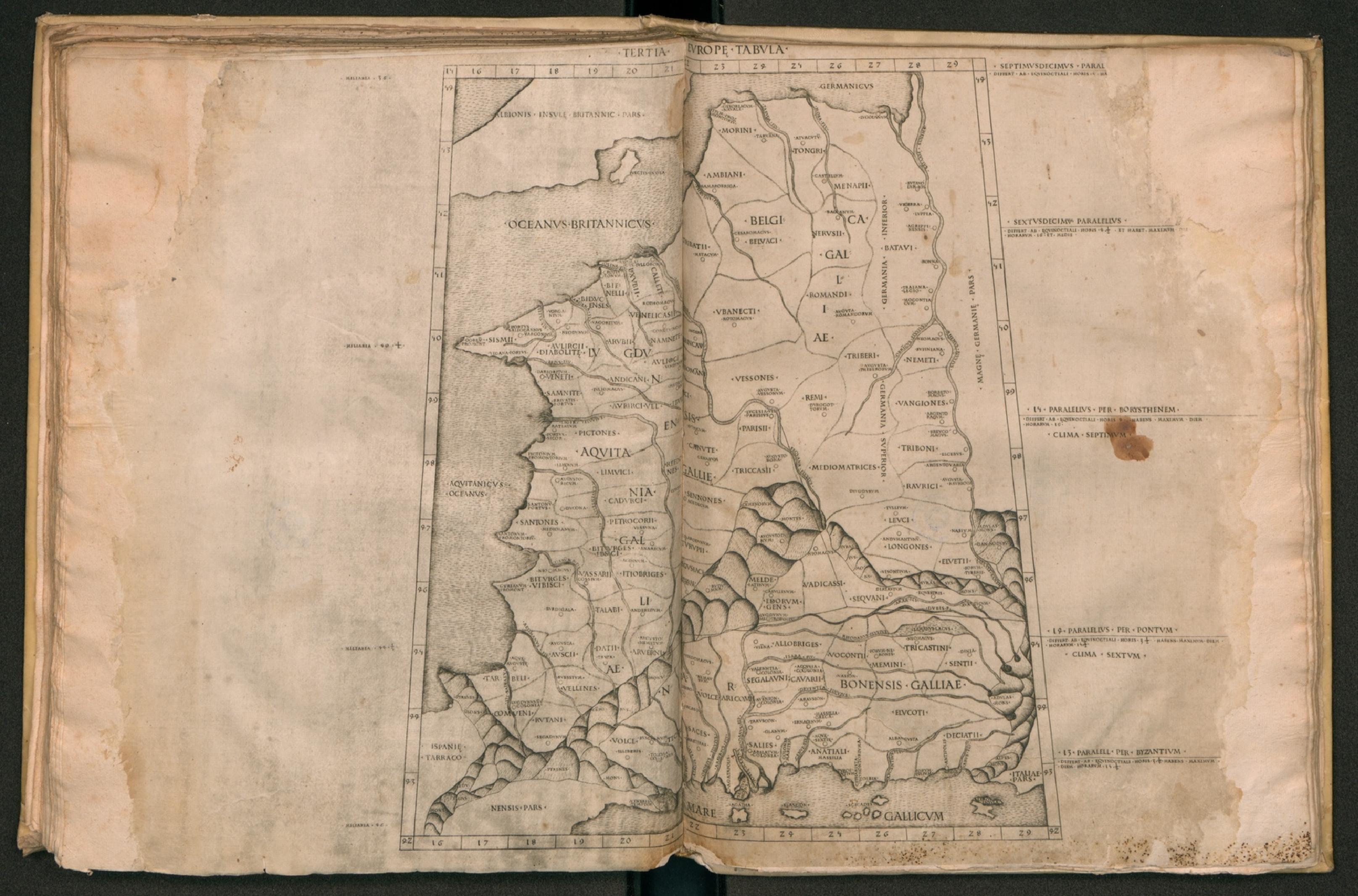
English: The Third Map of Europe (Tertia Europe Tabula), depicting Celtic and Belgic Gaul (Aquitania Galliae, Lugdunensis Gallię, Belgica Galliae, and Narbonensis Galliae), from the edition of Ptolemy's Geography (Cosmographia) printed at Rome. Latina: Tertia Europe Tabula: Gallia Aquitanica[,] Gallia Lugdunensis[,] Gallia Bellica[,] Gallia Narbonensis |
| Date | |
| Source | Rome Ptolemy |
| Author | Ptolemy |
Licensing[edit]
|
This work is in the public domain in its country of origin and other countries and areas where the copyright term is the author's life plus 70 years or fewer. This work is in the public domain in the United States because it was published (or registered with the U.S. Copyright Office) before January 1, 1929. | |
| This file has been identified as being free of known restrictions under copyright law, including all related and neighboring rights. | |
File history
Click on a date/time to view the file as it appeared at that time.
| Date/Time | Thumbnail | Dimensions | User | Comment | |
|---|---|---|---|---|---|
| current | 00:12, 8 September 2016 | | 3,231 × 2,133 (1.13 MB) | LlywelynII (talk | contribs) | User created page with UploadWizard |
You cannot overwrite this file.
File usage on Commons
There are no pages that use this file.