File:Thawing on Greenland's East Coast (MODIS).jpg

Original file (2,432 × 1,913 pixels, file size: 2.57 MB, MIME type: image/jpeg)
Captions
Captions
Summary[edit]
.jpg&action=edit§ion=1)
| Description |
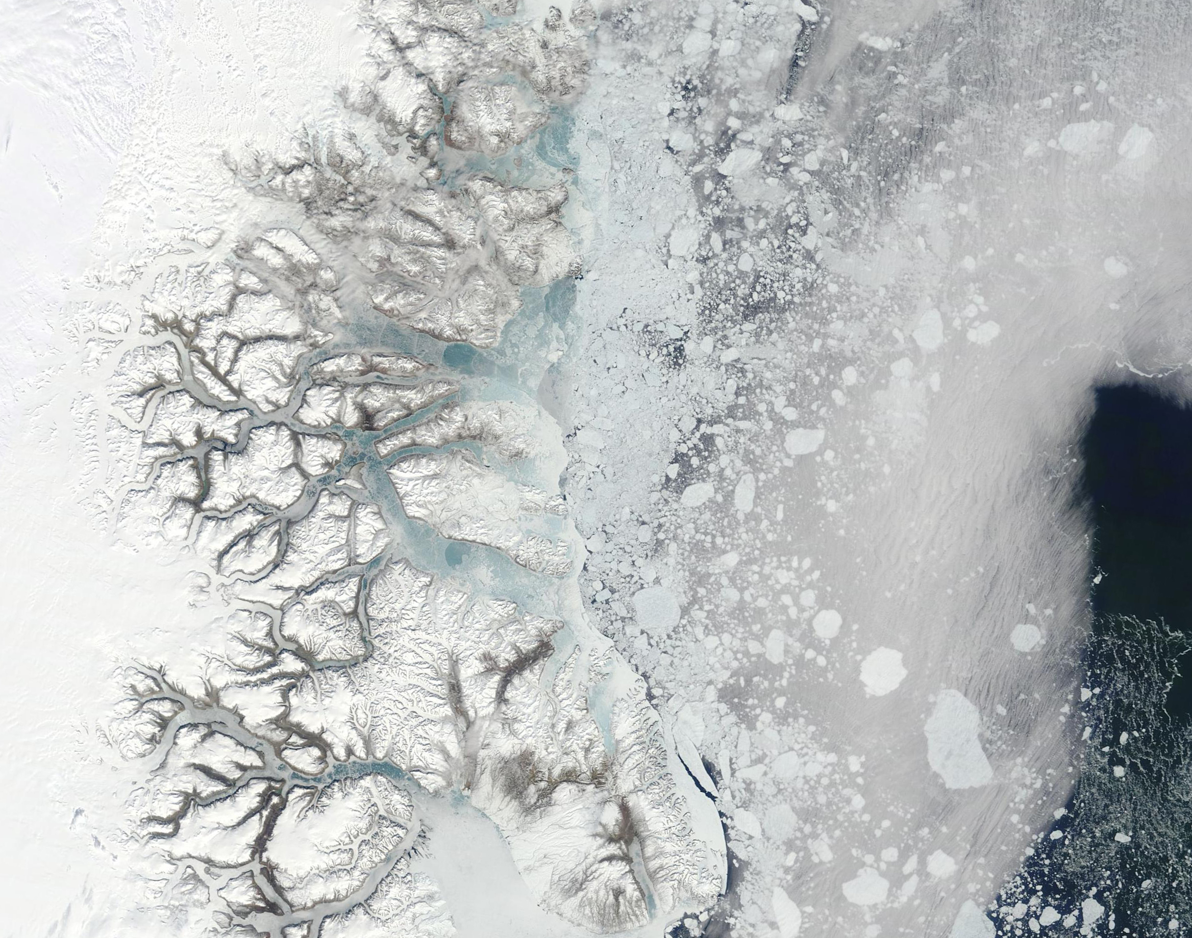
English: June 22, 2023 February 22, 2023
As the Earth’s largest island, Greenland dominates the North Atlantic Ocean, substantially filling the watery gap between North America and Europe. Stretching about 1,660 miles (2,670 m) from north to south, two-thirds of Greenland lies within the Arctic Circle. Bounded by the North Atlantic Ocean in the south and the Greenland Sea on the east, Greenland's northern coast reaches the Arctic Ocean. Given the high-north location, the climate is cold in summer and frigid in winter. About 80 percent of Greenland is covered by an ancient ice sheet year-round, while winter’s weather tops the island with snow as sea ice forms along the coastline. As daylight lengthens and temperatures rise in the spring, sea ice begins to break up and melt. Greenland’s melting season typically starts in May and ends in September. On June 23, 2023, the Moderate Resolution Imaging Spectroradiometer (MODIS) on NASA’s Terra satellite acquired a true-color image of summer melt well underway in Eastern Greenland. While thin ice still floats on most of the rivers and fjords along the coast, the thick fast ice that clung to the coastline and over the Greenland Sea during the winter has given way to bergy bits and growlers, with only a thin margin of fast ice remaining. Bergy bits are medium to large fragments of ice, while growlers are smaller—roughly the size of a truck or grand piano. The June 23 scene, which shows active melt in Eastern Greenland can be easily compared to an image of the same area acquired by the MODIS on Terra on February 22, 2023, by clicking on the dates under the image. The mid-winter scene shows smooth, thick fast ice covering all waterways, clinging to the coast, and reaching far into the Greenland Sea. In both images, a bank of cloud covers the Greenland Sea near the eastern edge of the image. |
||
| Date | Taken on 23 June 2023 | ||
| Source |
Thawing on Greenland's East Coast (direct link)
|
||
| Author | MODIS Land Rapid Response Team, NASA GSFC |
| This media is a product of the Terra mission Credit and attribution belongs to the mission team, if not already specified in the "author" row |
Licensing[edit]
.jpg&action=edit§ion=2)
| This file is in the public domain in the United States because it was solely created by NASA. NASA copyright policy states that "NASA material is not protected by copyright unless noted". (See Template:PD-USGov, NASA copyright policy page or JPL Image Use Policy.) | ||
 |
Warnings:
|
File history
Click on a date/time to view the file as it appeared at that time.
| Date/Time | Thumbnail | Dimensions | User | Comment | |
|---|---|---|---|---|---|
| current | 18:45, 31 July 2023 | | 2,432 × 1,913 (2.57 MB) | OptimusPrimeBot (talk | contribs) | #Spacemedia - Upload of http://modis.gsfc.nasa.gov/gallery/images/image06232023_250m.jpg via Commons:Spacemedia |
You cannot overwrite this file.
File usage on Commons
There are no pages that use this file.
.jpg&oldid=788765265)