File:Topographic map of Garonne and Adour.svg
Jump to navigation
Jump to search

Size of this PNG preview of this SVG file: 614 × 600 pixels. Other resolutions: 246 × 240 pixels | 491 × 480 pixels | 786 × 768 pixels | 1,049 × 1,024 pixels | 2,097 × 2,048 pixels | 642 × 627 pixels.
Original file (SVG file, nominally 642 × 627 pixels, file size: 2.9 MB)
Captions
Captions
Add a one-line explanation of what this file represents
| Description |
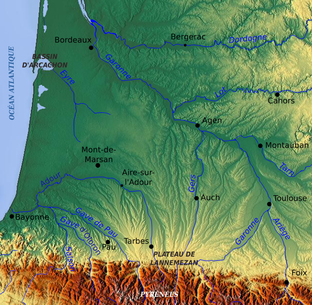
English: Topographic map of the South-West of France with main rivers and cities Français : Carte topographique du Sud-Ouest de la France avec rivières et villes principales |
| Date | |
| Source | Topographic map of South-West France with main rivers and cities.svg cropped (Pethrus work, based on a www.maps-for-free.com map (GFDL)) |
| Author | Pethrus, using www.maps-for-free.com maps |

|
Permission is granted to copy, distribute and/or modify this document under the terms of the GNU Free Documentation License, Version 1.2 or any later version published by the Free Software Foundation; with no Invariant Sections, no Front-Cover Texts, and no Back-Cover Texts. A copy of the license is included in the section entitled GNU Free Documentation License. |
This file is licensed under the Creative Commons Attribution-Share Alike 3.0 Unported license.
- You are free:
- to share – to copy, distribute and transmit the work
- to remix – to adapt the work
- Under the following conditions:
- attribution – You must give appropriate credit, provide a link to the license, and indicate if changes were made. You may do so in any reasonable manner, but not in any way that suggests the licensor endorses you or your use.
- share alike – If you remix, transform, or build upon the material, you must distribute your contributions under the same or compatible license as the original.
File history
Click on a date/time to view the file as it appeared at that time.
| Date/Time | Thumbnail | Dimensions | User | Comment | |
|---|---|---|---|---|---|
| current | 12:36, 13 March 2010 | | 642 × 627 (2.9 MB) | Pethrus (talk | contribs) | {{Information |Description={{en|Topographic map of the South-West of France with main rivers and cities}}{{fr|Carte topographique du Sud-Ouest de la France avec rivières et villes principales}} |Source=[[:Image:Topographic map of South-West France with m |
You cannot overwrite this file.
File usage on Commons
There are no pages that use this file.
File usage on other wikis
The following other wikis use this file:
- Usage on en.wikipedia.org
- Usage on es.wikipedia.org
- Usage on fr.wikipedia.org
- Gascogne
- Aquitaine protohistorique
- Utilisateur:Mandariine
- Inondations de 1977 en Gascogne
- Wikipédia:Atelier graphique/Cartes/Archives/mars 2010
- Discussion:Gustave Nadaud
- Pays de l'Adour
- Discussion:Gustave Nadaud/LSV 19651
- Wikipédia:Statistiques des anecdotes de la page d'accueil/Visibilité des anecdotes (2021)
- Utilisateur:GhosterBot/BacASable/Aide et accueil/Twitter/Tweets/archives/février 2021
- Wikipédia:Statistiques des anecdotes de la page d'accueil/Visibilité des anecdotes (2021)/2021 07
- Projet:Aide et accueil/Twitter/Tweets/archives/juillet 2021
- Wikipédia:Wikimag/2021/29
- Wikipédia:Le saviez-vous ?/Archives/2021
- Usage on it.wikipedia.org
- Usage on ja.wikipedia.org
- Usage on la.wikipedia.org
- Usage on oc.wikipedia.org
- Usage on sh.wikipedia.org