File:Typhoon Kalmaegi off the Philippines (MODIS 2019-11-19).jpg

Original file (7,614 × 6,282 pixels, file size: 12.16 MB, MIME type: image/jpeg)
Captions
Captions
Summary
[edit].jpg&action=edit§ion=1)
| Description |
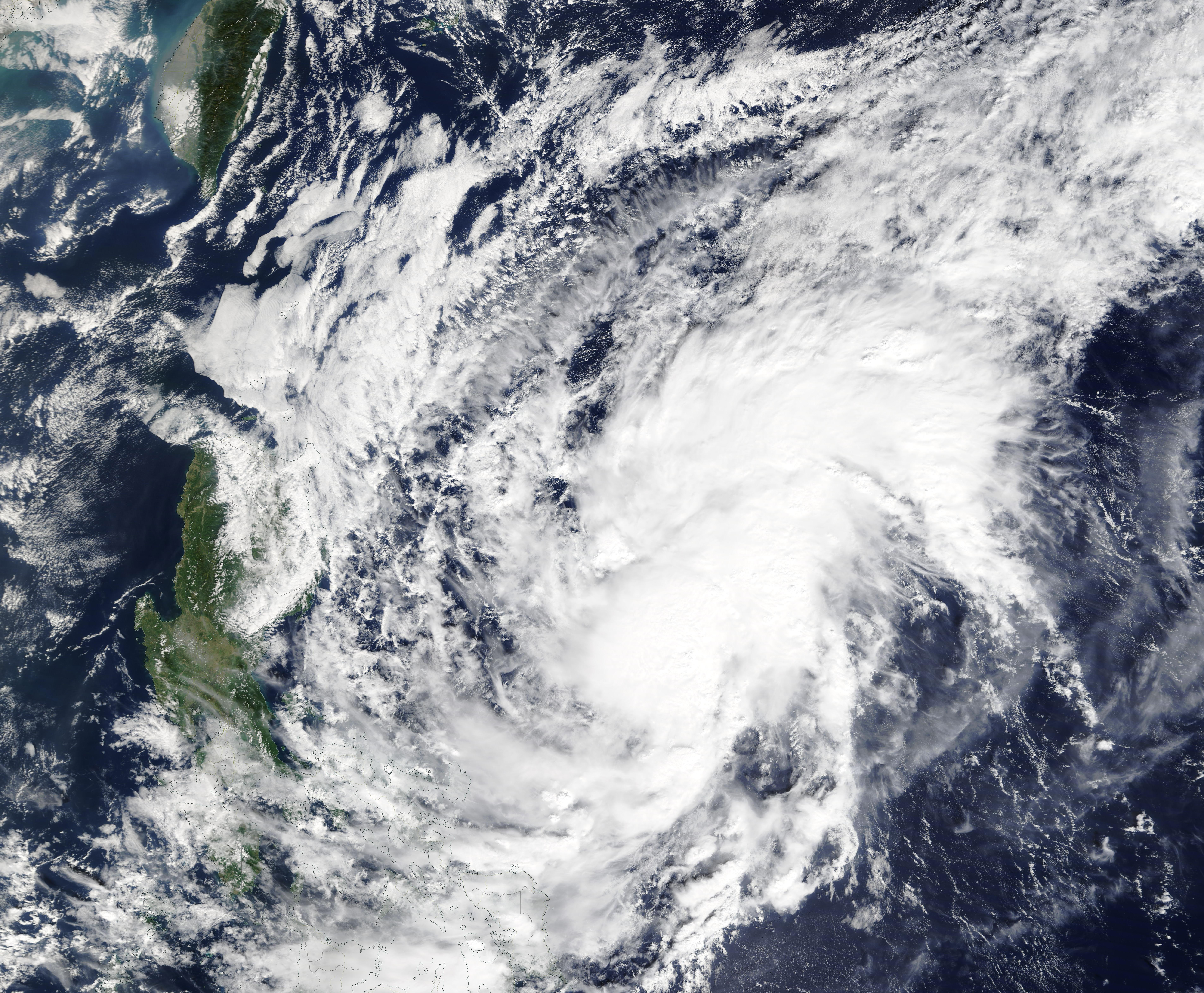
English: Typhoon Kalmaegi was spinning over the Philippine Sea and approaching the northern tip of the island of Luzon, Philippines, on November 18, 2019, triggering warnings for tropical-cyclone strength wind and heavy rain. At 2100 UTC (4:00 p.m. EST) on November 18, the Joint Typhoon Warning Center (JTWC) reported that Kalmaegi (known as Typhoon Ramon locally) was carrying maximum sustained winds of about 86 mph (138 km/h). The storm was located about 333 miles (536 km) north-northeast of Manilla, Philippines.
Typhoon Kalmaegi is expected to turn towards the west-southwest and clip the northwestern tip of the island of Luzon late on November 18 carrying maximum sustained winds of up to 75 mph (120 km/h). Category 1 on the Saffir-Simpson Hurricane Wind Scale begins at 75 mph (120 km/h). According to the Global Disaster Alert and Coordination System (GDACS), Kalmaegi has already brought heavy rain, flooding and landslides to parts of the Philippines, with several houses destroyed. Moderate to locally heavy rain is forecast for northern Luzon from November 18-19 before the storm dissipates to the west of Luzon in the next several days. The Moderate Resolution Imaging Spectroradiometer (MODIS) on board NASA’s Terra satellite acquired a true-color image of Typhoon Kalmaegi over the Philippine Sea as it intensified on November 16, 2019. At that time, the system appeared elongated with rain bands curving into a cloud-filled center. |
||
| Date | Taken on 16 October 2019 | ||
| Source |
Typhoon Kalmaegi off the Philippines (direct link)
|
||
| Author | MODIS Land Rapid Response Team, NASA GSFC |
| This media is a product of the Terra mission Credit and attribution belongs to the mission team, if not already specified in the "author" row |
Licensing
[edit].jpg&action=edit§ion=2)
| This file is in the public domain in the United States because it was solely created by NASA. NASA copyright policy states that "NASA material is not protected by copyright unless noted". (See Template:PD-USGov, NASA copyright policy page or JPL Image Use Policy.) | ||
 |
Warnings:
|
File history
Click on a date/time to view the file as it appeared at that time.
| Date/Time | Thumbnail | Dimensions | User | Comment | |
|---|---|---|---|---|---|
| current | 02:51, 17 February 2024 | | 7,614 × 6,282 (12.16 MB) | OptimusPrimeBot (talk | contribs) | #Spacemedia - Upload of http://modis.gsfc.nasa.gov/gallery/images/image11192019_250m.jpg via Commons:Spacemedia |
You cannot overwrite this file.
File usage on Commons
There are no pages that use this file.
.jpg&oldid=852935468)