File:U.S. territorial acquisitions-fr.png
Jump to navigation
Jump to search
Size of this preview: 800 × 542 pixels. Other resolutions: 320 × 217 pixels | 640 × 434 pixels | 1,029 × 697 pixels.
Original file (1,029 × 697 pixels, file size: 183 KB, MIME type: image/png)
Captions
Captions
Add a one-line explanation of what this file represents
Summary[edit]
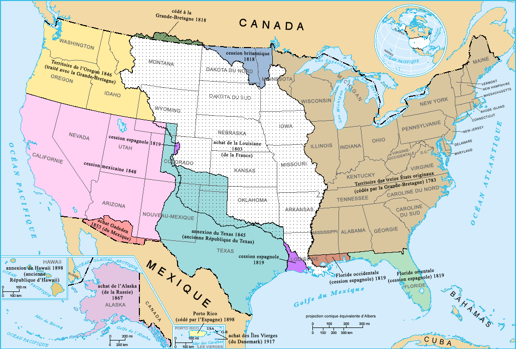
French-version map of the territorial acquisitions of the United States.
For the English version, see : Image:USA_territorial_acquisitions.png.
- Sujet : Carte des acquisitions territoriales des États-Unis d'Amérique
- Réalisée par : US Department of Interior
- Source : National Atlas of the United States : http://nationalatlas.gov
- Traduction : par fr:Utilisateur:Sting
Licensing[edit]
This map was obtained from an edition of the National Atlas of the United States. Like almost all works of the U.S. federal government, works from the National Atlas are in the public domain in the United States.
Online access: NationalAtlas.gov | 1970 print edition: Library of Congress, Perry-Castañeda Library
|
File history
Click on a date/time to view the file as it appeared at that time.
| Date/Time | Thumbnail | Dimensions | User | Comment | |
|---|---|---|---|---|---|
| current | 17:15, 3 February 2006 | | 1,029 × 697 (183 KB) | Sting (talk | contribs) | French-version map of the territorial acquisitions of the United States. For the English version, see : Image:USA_territorial_acquisitions.png. * '''Sujet :''' Carte des acquisitions territoriales des États-Unis d'Amérique * '''Réalisée pa |
You cannot overwrite this file.
File usage on Commons
The following 4 pages use this file:
File usage on other wikis
The following other wikis use this file:
- Usage on fr.wikipedia.org
- Usage on la.wikipedia.org