File:USAF RC-130A of the 1st Aerial Cartographic and Geodetic Squadron at Tuy Hoa AB.jpg
Jump to navigation
Jump to search

Size of this preview: 758 × 600 pixels. Other resolutions: 304 × 240 pixels | 607 × 480 pixels | 971 × 768 pixels | 1,280 × 1,013 pixels | 2,560 × 2,025 pixels | 2,943 × 2,328 pixels.
Original file (2,943 × 2,328 pixels, file size: 841 KB, MIME type: image/jpeg)
Captions
Captions
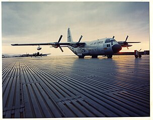
USAF RC-130A of the 1st Aerial Cartographic and Geodetic Squadron at Tuy Hoa AB
Summary[edit]
| Description |
English: USAF RC-130A of the 1st Aerial Cartographic and Geodetic Squadron at Tuy Hoa AB
NARA photo 342-B-VN-009-1-KKE-31782 |
| Date | |
| Source | https://catalog.archives.gov/id/148728104 |
| Author | Sgt John D. Larson |
Licensing[edit]
This image or file is a work of a U.S. Air Force Airman or employee, taken or made as part of that person's official duties. As a work of the U.S. federal government, the image or file is in the public domain in the United States.
|
 |
File history
Click on a date/time to view the file as it appeared at that time.
| Date/Time | Thumbnail | Dimensions | User | Comment | |
|---|---|---|---|---|---|
| current | 11:59, 15 January 2024 | | 2,943 × 2,328 (841 KB) | Mztourist (talk | contribs) | Uploaded a work by Sgt John D. Larson from https://catalog.archives.gov/id/148728104 with UploadWizard |
You cannot overwrite this file.
File usage on Commons
There are no pages that use this file.