File:USGS Kīlauea MultimediaFile-2422 (2018-07-13).jpg
Jump to navigation
Jump to search

Size of this preview: 800 × 450 pixels. Other resolutions: 320 × 180 pixels | 640 × 360 pixels | 1,024 × 576 pixels | 1,280 × 720 pixels | 2,560 × 1,440 pixels | 4,032 × 2,268 pixels.
Original file (4,032 × 2,268 pixels, file size: 2.09 MB, MIME type: image/jpeg)
Captions
Captions
Add a one-line explanation of what this file represents
Summary
[edit].jpg&action=edit§ion=1)
| Description |
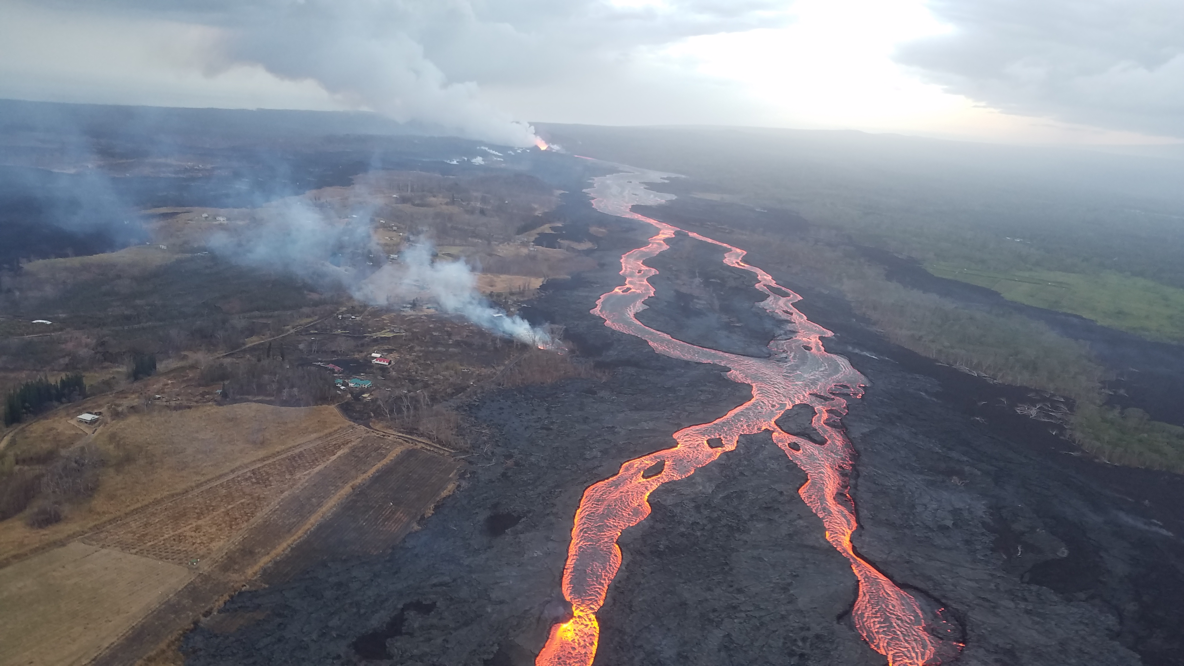
Kīlauea's 2018 lower Puna eruption. A tiny new island of lava has formed on the northernmost part of the ocean entry. During this morning's overflight, HVO's field crew noticed the island was oozing lava similar to the lava oozing from the broad flow front along the coastline. |
| Date | |
| Source |
https://volcanoes.usgs.gov/volcanoes/kilauea/multimedia_chronology.html https://volcanoes.usgs.gov/observatories/hvo/multimedia_uploads/multimediaFile-2422.jpg |
| Author | United States Geological Survey |
| Camera location | | View this and other nearby images on: OpenStreetMap |
|---|
.jpg¶ms=019.520513_N_-154.877602_E_globe:Earth_type:camera_alt:0_source:exif_&language=en)
Licensing
[edit].jpg&action=edit§ion=2)
This image is in the public domain in the United States because it only contains materials that originally came from the United States Geological Survey, an agency of the United States Department of the Interior. For more information, see the official USGS copyright policy.
|
File history
Click on a date/time to view the file as it appeared at that time.
| Date/Time | Thumbnail | Dimensions | User | Comment | |
|---|---|---|---|---|---|
| current | 13:36, 13 November 2018 | | 4,032 × 2,268 (2.09 MB) | Batholith (talk | contribs) | == {{int:filedesc}} == {{Information |description={{en|A tiny new island of lava has formed on the northernmost part of the ocean entry. During this morning's overflight, HVO's field crew noticed the island was oozing lava similar to the lava oozing from the broad flow front along the coastline.}} |date=2018-07-13 |source=https://volcanoes.usgs.gov/volcanoes/kilauea/multimedia_chronology.html<br/>https://volcanoes.usgs.gov/observatories/hvo/multimedia_uploads/multimediaFile-2422.jpg |author=[... |
You cannot overwrite this file.
File usage on Commons
The following page uses this file:
.jpg&oldid=520943284)