File:USGS Kīlauea multimediaFile-2175(2018-06-05).jpg
Jump to navigation
Jump to search

Size of this preview: 800 × 530 pixels. Other resolutions: 320 × 212 pixels | 640 × 424 pixels | 1,024 × 678 pixels | 1,280 × 848 pixels | 2,320 × 1,537 pixels.
Original file (2,320 × 1,537 pixels, file size: 2.33 MB, MIME type: image/jpeg)
Captions
Captions
Add a one-line explanation of what this file represents
Summary
[edit].jpg&action=edit§ion=1)
| Description |
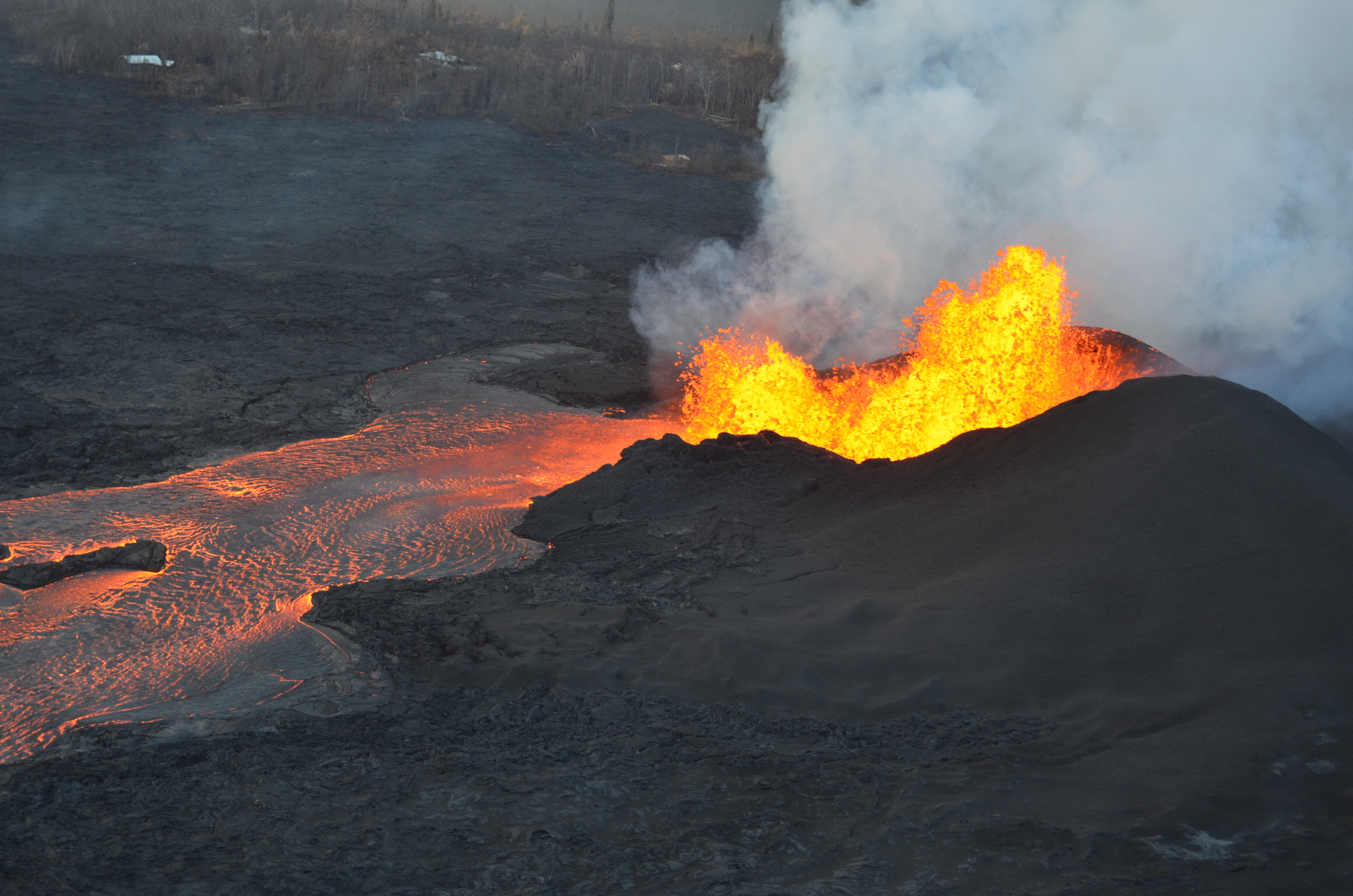
Kīlauea's 2018 lower Puna eruption. Lava fountains continue at fissure 8, although overnight USGS field crews reported reduced fountain heights. The lava fountain has built a 35 m (115 ft) high spatter cone, as wells as an actively-growing spatter rampart on its eastern side. The lava channel leading from the cone was filled to the top of its levees at the time of this photo. |
| Date | |
| Source |
https://volcanoes.usgs.gov/volcanoes/kilauea/multimedia_chronology.html https://volcanoes.usgs.gov/observatories/hvo/multimedia_uploads/multimediaFile-2175.jpg |
| Author | United States Geological Survey |
Licensing
[edit].jpg&action=edit§ion=2)
This image is in the public domain in the United States because it only contains materials that originally came from the United States Geological Survey, an agency of the United States Department of the Interior. For more information, see the official USGS copyright policy.
|
File history
Click on a date/time to view the file as it appeared at that time.
| Date/Time | Thumbnail | Dimensions | User | Comment | |
|---|---|---|---|---|---|
| current | 14:53, 14 November 2018 | | 2,320 × 1,537 (2.33 MB) | Batholith (talk | contribs) | == {{int:filedesc}} == {{Information |description= {{en|Fissure 8 of the Kīlauea 2018 eruptions.}} {{cquote| Lava fountains continue at fissure 8, although overnight USGS field crews reported reduced fountain heights. The lava fountain has built a 35 m (115 ft) high spatter cone, as wells as an actively-growing spatter rampart on its eastern side. The lava channel leading from the cone was filled to the top of its levees at the time of this photo.|author=USGS}} |date=2018-06... |
You cannot overwrite this file.
File usage on Commons
The following page uses this file:
File usage on other wikis
The following other wikis use this file:
- Usage on ja.wikipedia.org
Metadata
.jpg&oldid=835225091)
Categories:
- Volcanic damage at Kīlauea
- East Rift Zone of Kīlauea
- Kilauea 2018 eruptions (June 5)
- Leilani Estates, Hawaii
- Lava fountains connected to 2018 eruption series of Kilauea
- Active lava flows in Hawaii in 2018
- Fissure 8 at Kilauea's East Rift Zone (in 2018)
- Fissure fountains of Kilauea
- Kīlauea's 2018 lower Puna eruption