File:USGS Kīlauea multimediaFile-2469 (2018-07-21).jpg

Original file (4,032 × 3,024 pixels, file size: 5.75 MB, MIME type: image/jpeg)
Captions
Captions
Summary
[edit].jpg&action=edit§ion=1)
| Description |
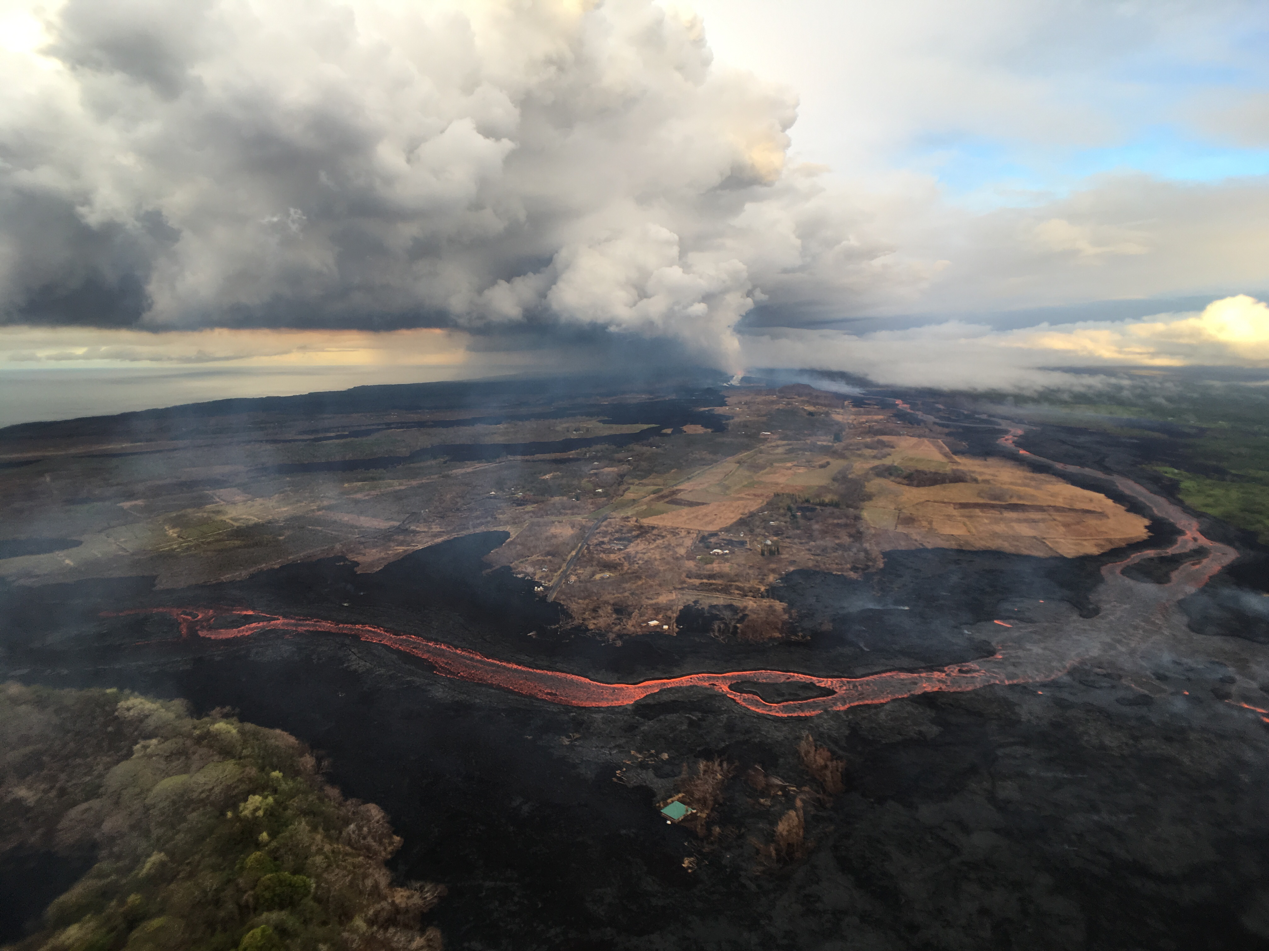
Kīlauea's 2018 lower Puna eruption. Fissure 8, source of the white gas plume in the distance, continues to erupt lava into the channel heading northeastward from the vent. Near Kapoho Crater (lower left), the channel turns south, sending lava toward the coast, where it enters the ocean in the Ahalanui area (shown in adjacent photo). Channel overflows are visible in the lower right. Right: This aerial view, looking to the southwest, shows the most vigorous ocean entry of the fissure 8 flow, which is located a few hundred meters (yards) northeast of the southern flow margin. |
| Date | |
| Source |
https://volcanoes.usgs.gov/volcanoes/kilauea/multimedia_chronology.html https://volcanoes.usgs.gov/observatories/hvo/multimedia_uploads/multimediaFile-2469.jpg |
| Author | United States Geological Survey |
| Object location | | View this and other nearby images on: OpenStreetMap |
|---|
.jpg¶ms=019.497170_N_-154.854453_E_globe:Earth_class:object_type:object_region:US_&language=en)
Licensing
[edit].jpg&action=edit§ion=2)
This image is in the public domain in the United States because it only contains materials that originally came from the United States Geological Survey, an agency of the United States Department of the Interior. For more information, see the official USGS copyright policy.
|
File history
Click on a date/time to view the file as it appeared at that time.
| Date/Time | Thumbnail | Dimensions | User | Comment | |
|---|---|---|---|---|---|
| current | 12:13, 14 November 2018 | | 4,032 × 3,024 (5.75 MB) | Batholith (talk | contribs) | == {{int:filedesc}} == {{Information |description= {{en|Lava channel from Fissure 8 Kīlauea in 2018 eruptions. {{cquote|Fissure 8, source of the white gas plume in the distance, continues to erupt lava into the channel heading northeastward from the vent. Near Kapoho Crater (lower left), the channel turns south, sending lava toward the coast, where it enters the ocean in the Ahalanui area (shown in adjacent photo). Channel overflows are visible in the lower right. Right: This... |
You cannot overwrite this file.
File usage on Commons
The following page uses this file:
.jpg&oldid=546356430)