File:Velim test track.png
Jump to navigation
Jump to search
Size of this preview: 565 × 600 pixels. Other resolutions: 226 × 240 pixels | 452 × 480 pixels | 831 × 882 pixels.
Original file (831 × 882 pixels, file size: 343 KB, MIME type: image/png)
Captions
Captions
Add a one-line explanation of what this file represents
Summary
[edit]
| Description |
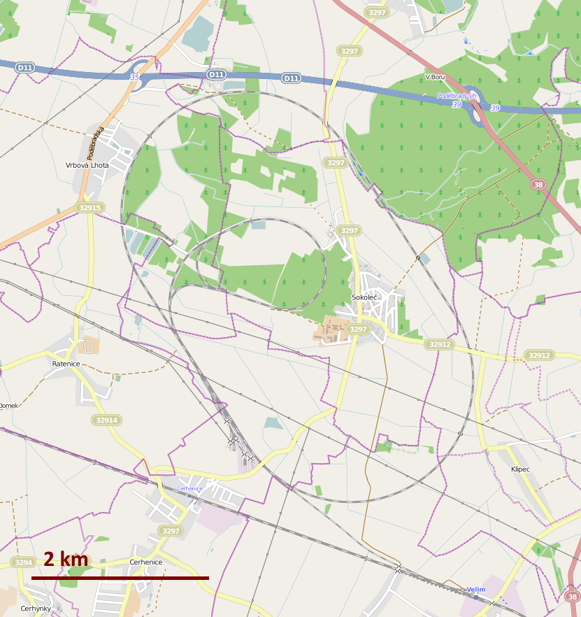
Čeština: Mapa železničního zkušebního okruhu Cerhenice
English: Overview map of the railway test circuit Cerhenice (near Velim, the Czech Republic) |
| Date | |
| Source | OpenStreetMap (original render link) |
| Author |
|
| Description |
This map was created from OpenStreetMap project data, collected by the community. This map may be incomplete, and may contain errors. Don't rely solely on it for navigation. |
|||||||||
| Date | ||||||||||
| Source | openstreetmap.org | |||||||||
| Creator |
OpenStreetMap contributors |
|||||||||
| Permission (Reusing this file) |
OpenStreetMap data is available under the Open Database License (details). Map tiles are licensed under the Creative Commons Attribution-ShareAlike 2.0 license (CC-BY-SA 2.0).
This file is licensed under the Creative Commons Attribution-Share Alike 2.0 Generic license.
|
|||||||||
| Geotemporal data | ||||||||||
| Bounding box |
|
|||||||||
| Georeferencing | If inappropriate please set warp_status = skip to hide. | |||||||||

|
This transport map image could be re-created using vector graphics as an SVG file. This has several advantages; see Commons:Media for cleanup for more information. If an SVG form of this image is available, please upload it and afterwards replace this template with
{{vector version available|new image name}}.
It is recommended to name the SVG file “Velim test track.svg”—then the template Vector version available (or Vva) does not need the new image name parameter. |
File history
Click on a date/time to view the file as it appeared at that time.
| Date/Time | Thumbnail | Dimensions | User | Comment | |
|---|---|---|---|---|---|
| current | 17:02, 21 July 2014 | | 831 × 882 (343 KB) | Mormegil (talk | contribs) | +scale indicator |
| 17:01, 21 July 2014 |  | 831 × 882 (355 KB) | Mormegil (talk | contribs) | updated | |
| 19:51, 26 February 2009 |  | 590 × 617 (252 KB) | Classical geographer (talk | contribs) | {{Information |Description={{en|1=Overview of the Velim test track.}} |Source=Open Street Map |Author=Classical Geographer (just added the scale bar, nothing fancy) |Date=2009-02-26 |Permission= |other_versions= }} {[OpenStreetMap}}] <!--{{Image |
You cannot overwrite this file.
File usage on Commons
The following 2 pages use this file:
File usage on other wikis
The following other wikis use this file:
- Usage on cs.wikipedia.org
- Usage on de.wikipedia.org
- Usage on en.wikipedia.org
- Usage on fr.wikipedia.org
- Usage on hu.wikipedia.org
- Usage on it.wikipedia.org
- Usage on ja.wikipedia.org
- Usage on nl.wikipedia.org
- Usage on ru.wikipedia.org
- Usage on sk.wikipedia.org
- Usage on www.wikidata.org