File:Venus - Computer Simulated Global View Centered at 180 Degrees East Longitude, Magellan.tif
Jump to navigation
Jump to search

Size of this JPG preview of this TIF file: 600 × 600 pixels. Other resolutions: 240 × 240 pixels | 480 × 480 pixels | 768 × 768 pixels | 1,024 × 1,024 pixels | 2,048 × 2,048 pixels | 4,096 × 4,096 pixels.
Original file (4,096 × 4,096 pixels, file size: 7.79 MB, MIME type: image/tiff)
Captions
Captions
Add a one-line explanation of what this file represents
Summary[edit]
| Description |
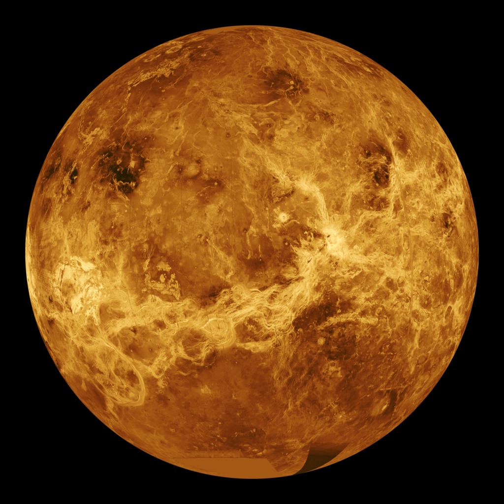
English: This global view of the surface of Venus is centered at 180 degrees east longitude. Magellan synthetic aperture radar mosaics from the first cycle of Magellan mapping are mapped onto a computer-simulated globe to create this image. Data gaps are filled with Pioneer Venus Orbiter data, or a constant mid-range value. Simulated color is used to enhance small-scale structure. The simulated hues are based on color images recorded by the Soviet Venera 13 and 14 spacecraft. The image was produced by the Solar System Visualization project and the Magellan science team at the JPL Multimission Image Processing Laboratory and is a single frame from a video released at the October 29, 1991, JPL news conference. |
| Date | |
| Source | http://photojournal.jpl.nasa.gov/catalog/PIA00104 |
| Author | NASA/JPL |
| Other versions |
|

Licensing[edit]
| This file is in the public domain in the United States because it was solely created by NASA. NASA copyright policy states that "NASA material is not protected by copyright unless noted". (See Template:PD-USGov, NASA copyright policy page or JPL Image Use Policy.) | ||
 |
Warnings:
|
File history
Click on a date/time to view the file as it appeared at that time.
| Date/Time | Thumbnail | Dimensions | User | Comment | |
|---|---|---|---|---|---|
| current | 12:25, 15 July 2015 |  | 4,096 × 4,096 (7.79 MB) | The Obento Musubi (talk | contribs) | User created page with UploadWizard |
You cannot overwrite this file.
File usage on Commons
The following 2 pages use this file:
File usage on other wikis
The following other wikis use this file:
- Usage on oc.wikipedia.org
- Usage on oc.wiktionary.org