File:Virginia topographic edit.jpg
Jump to navigation
Jump to search

Size of this preview: 800 × 358 pixels. Other resolutions: 320 × 143 pixels | 903 × 404 pixels.
Original file (903 × 404 pixels, file size: 304 KB, MIME type: image/jpeg)
Captions
Captions
Add a one-line explanation of what this file represents
Summary[edit]
| Description |
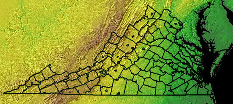
English: Virginia - topographic map |
| Date | |
| Source |
Derivative of Image:Virginia topographic.jpg |
| Author | NOAA's National Geophysical Data Center (NGDC) |
| Other versions | Image:Virginia topographic.jpg |
Licensing[edit]
This image is in the public domain because it contains materials that originally came from the U.S. National Oceanic and Atmospheric Administration, taken or made as part of an employee's official duties.
|

|
This map image could be re-created using vector graphics as an SVG file. This has several advantages; see Commons:Media for cleanup for more information. If an SVG form of this image is available, please upload it and afterwards replace this template with
{{vector version available|new image name}}.
It is recommended to name the SVG file “Virginia topographic edit.svg”—then the template Vector version available (or Vva) does not need the new image name parameter. |


File history
Click on a date/time to view the file as it appeared at that time.
| Date/Time | Thumbnail | Dimensions | User | Comment | |
|---|---|---|---|---|---|
| current | 20:57, 1 February 2008 | | 903 × 404 (304 KB) | Patrickneil (talk | contribs) |
You cannot overwrite this file.
File usage on Commons
There are no pages that use this file.
File usage on other wikis
The following other wikis use this file:
- Usage on es.wikipedia.org
- Usage on ro.wikipedia.org
- Categorie:Guvernatori ai statului Virginia
- Categorie:Virginia
- Categorie:Oameni din Virginia
- Virginia
- Richmond, Virginia
- Comitatul Albemarle, Virginia
- Langley, Virginia
- Categorie:Liste Virginia
- Categorie:Comitatul Arlington, Virginia
- Commonwealth (Statele Unite)
- Categorie:Guvernul statului Virginia
- Categorie:Comitatul Albemarle, Virginia
- Listă de comitate din statul Virginia
- Categorie:Comitatul Accomack, Virginia
- Categorie:Comitatul York, Virginia
- Categorie:Comitatul Alleghany, Virginia
- Categorie:Comitatul Amelia, Virginia
- Categorie:Comitatul Amherst, Virginia
- Categorie:Comitatul Appomattox, Virginia
- Categorie:Comitatul Augusta, Virginia
- Categorie:Comitatul Bath, Virginia
- Categorie:Comitatul Bland, Virginia
- Listă de orașe din statul Virginia
- Categorie:Zone micropolitane din Virginia
- Categorie:Comitatul Wythe, Virginia
- Categorie:Comitatul Wise, Virginia
- Categorie:Zone metropolitane din Virginia
- Alexandria, Virginia
- Categorie:Localități din Virginia
- Categorie:Orașe din Virginia
- Categorie:Forme de relief din Virginia
- Categorie:Comitatul Westmoreland, Virginia
- Categorie:Politicieni din statul Virginia
- Categorie:Membri ai legislaturii statului Virginia
- Categorie:Absolvenți din Virginia după instituția de învățământ superior
- Prefix telefonic 202 (Statele Unite ale Americii)
- Categorie:Târguri din statul Virginia
- Categorie:Municipalități din statul Virginia
- Categorie:Localități costale din Virginia
- Categorie:Insule ale statului Virginia
- Format:Sediile comitatelor din Virginia
- Categorie:Sate din statul Virginia
- Categorie:Locuri desemnate pentru recensământ din statul Virginia
- Gore, Virginia
- Categorie:Subdiviziunile statului Virginia
- Categorie:Istoria naturală a statului Virginia
- Categorie:Dezastre naturale din statul Virginia
- Categorie:Dezastre din statul Virginia
- Categorie:Regiuni ale statului Virginia
View more global usage of this file.