File:WestBengalDistricts numbered (old) bn.svg
Jump to navigation
Jump to search

Size of this PNG preview of this SVG file: 480 × 599 pixels. Other resolutions: 192 × 240 pixels | 385 × 480 pixels | 615 × 768 pixels | 820 × 1,024 pixels | 1,641 × 2,048 pixels | 1,589 × 1,983 pixels.
Original file (SVG file, nominally 1,589 × 1,983 pixels, file size: 495 KB)
Captions
Captions
Add a one-line explanation of what this file represents
Summary[edit]
| Description |
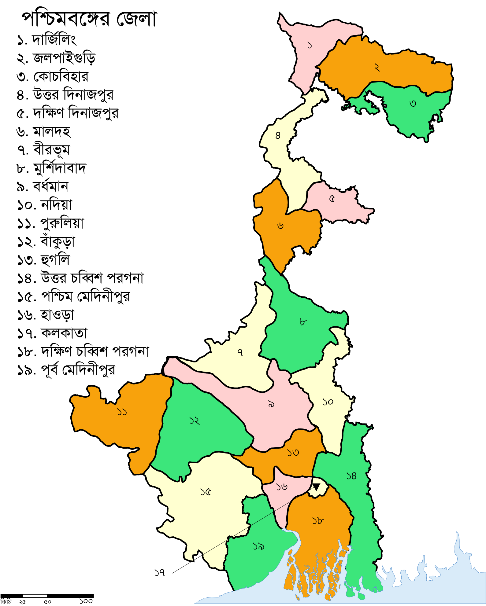
English: Map of WestBengal with Districts_numbered_in Bengali language |
| Date | |
| Source | Own work |
| Author | Jayantanth |
| Other versions |
[]
|
| SVG development |


_bn.svg)


_bn.svg&action=edit§ion=1)
Licensing[edit]
_bn.svg&action=edit§ion=2)
| I, the copyright holder of this work, release this work into the public domain. This applies worldwide. In some countries this may not be legally possible; if so: I grant anyone the right to use this work for any purpose, without any conditions, unless such conditions are required by law. |
File history
Click on a date/time to view the file as it appeared at that time.
| Date/Time | Thumbnail | Dimensions | User | Comment | |
|---|---|---|---|---|---|
| current | 08:09, 13 March 2010 | | 1,589 × 1,983 (495 KB) | Jayantanth (talk | contribs) | {{Information |Description={{en|1=Map of WestBengal with Districts_numbered_in Bengali language}} |Source={{own}} |Author=Jayantanth |Date=March 13, 2010 |Permission= |other_versions= }} Category:Maps of West Bengal |
You cannot overwrite this file.
File usage on Commons
The following 14 pages use this file:
- File:WestBengalDistricts.svg
- File:WestBengalDistricts numbered-gu.svg
- File:WestBengalDistricts numbered-hi.svg
- File:WestBengalDistricts numbered-kn.svg
- File:WestBengalDistricts numbered-or.svg
- File:WestBengalDistricts numbered-sat.svg
- File:WestBengalDistricts numbered-te.svg
- File:WestBengalDistricts numbered.svg
- File:WestBengalDistricts numbered (old) bn.svg
- File:WestBengalDistricts numbered as.svg
- File:WestBengalDistricts numbered bn.svg
- File:WestBengalDistricts numbered bpy.svg
- File:WestBengalDistricts numbered de.svg
- Template:Other versions/WestBengalDistricts
_bn.svg&oldid=469858149)