File:Wide Bay Glacier, Hanging Glacier Icefalls, August 24, 1960 (GLACIERS 856).jpg
Jump to navigation
Jump to search

Size of this preview: 600 × 600 pixels. Other resolutions: 240 × 240 pixels | 480 × 480 pixels | 768 × 768 pixels | 1,024 × 1,024 pixels | 2,048 × 2,048 pixels | 3,840 × 3,840 pixels.
Original file (3,840 × 3,840 pixels, file size: 1.16 MB, MIME type: image/jpeg)
Captions
Captions
Icy Peak

|
The categories of this image need checking. You can do so here.
|
.jpg&action=edit&withJS=MediaWiki:Catcheck.js)
Summary[edit]
.jpg&action=edit§ion=1)
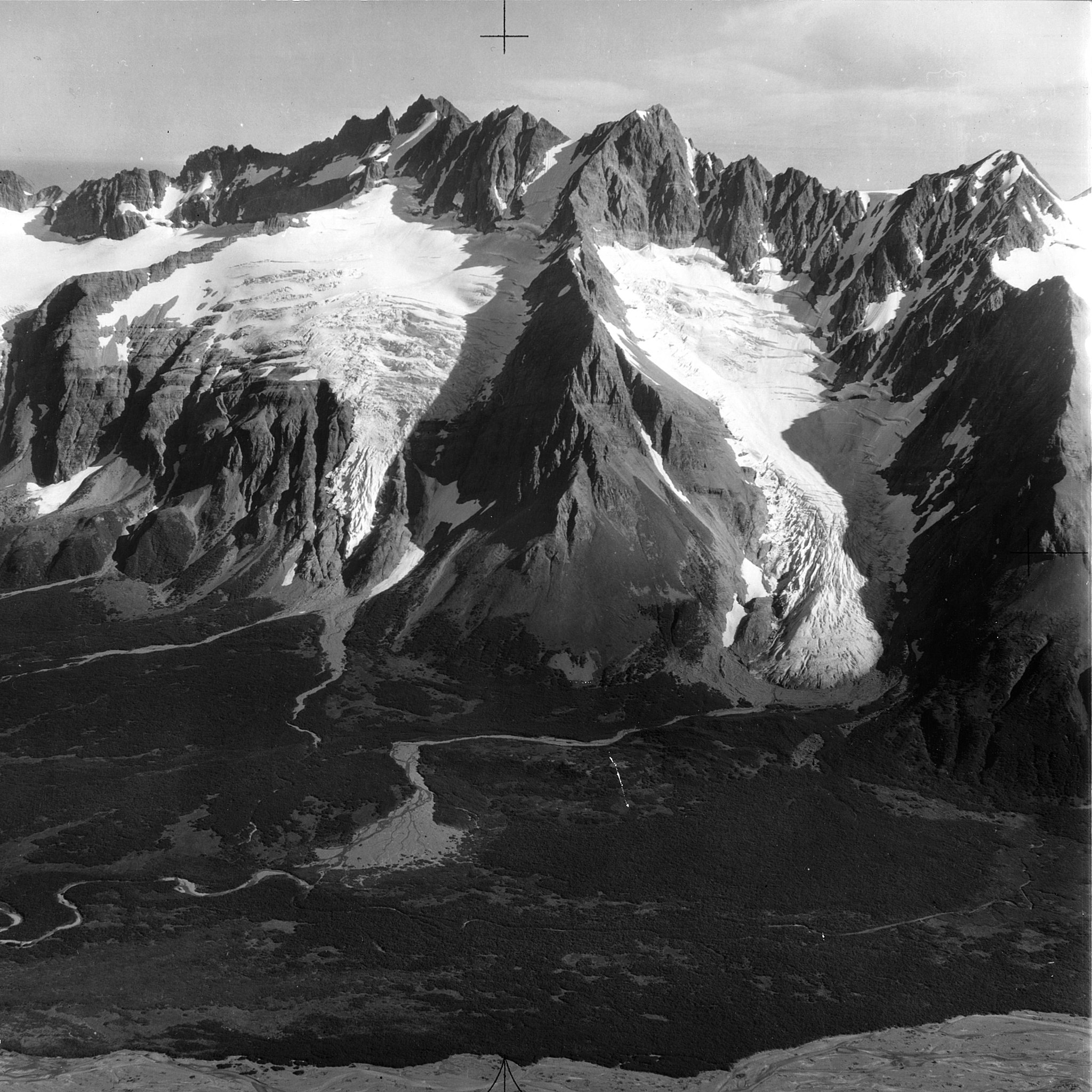
| English: Wide Bay Glacier, Hanging Glacier Icefalls, August 24, 1960
( |
||||||||||||||||||||||||
|---|---|---|---|---|---|---|---|---|---|---|---|---|---|---|---|---|---|---|---|---|---|---|---|---|
| Photographer |
|
|||||||||||||||||||||||
| Title |
English: Wide Bay Glacier, Hanging Glacier Icefalls, August 24, 1960 |
|||||||||||||||||||||||
| Description |
English: Wide Bay Glacier, Hanging Glacier Icefalls, August 24, 1960
|
|||||||||||||||||||||||
| Depicted place | Aleutian Range | |||||||||||||||||||||||
| Date | Taken on 24 August 1960 | |||||||||||||||||||||||
| Dimensions | height: 9 in (22.8 cm); width: 9 in (22.8 cm) | |||||||||||||||||||||||
| Collection |
|
|||||||||||||||||||||||
| Current location | ||||||||||||||||||||||||
| Accession number | ||||||||||||||||||||||||
| Source | ||||||||||||||||||||||||
| Permission (Reusing this file) |
|
|||||||||||||||||||||||
| Order Number | EAS0002 | |||||||||||||||||||||||
| Reference Number on Photograph | PH734.AA2 | |||||||||||||||||||||||
| Judicial District | Aleutians West Census Area | |||||||||||||||||||||||
| Mountain Range | Aleutian Range | |||||||||||||||||||||||
| Object location | | View this and other nearby images on: OpenStreetMap |
|---|
.jpg¶ms=053.949444_N_-166.615833_E_globe:Earth_class:object_type:object__&language=en)
| Annotations | This image is annotated: View the annotations at Commons |
.jpg)
File history
Click on a date/time to view the file as it appeared at that time.
| Date/Time | Thumbnail | Dimensions | User | Comment | |
|---|---|---|---|---|---|
| current | 06:55, 8 June 2019 | | 3,840 × 3,840 (1.16 MB) | BMacZeroBot (talk | contribs) | Batch upload (Commons:Batch uploading/University of Washington Digital Collections) |
You cannot overwrite this file.
File usage on Commons
The following 3 pages use this file:
.jpg)
.jpg&oldid=830132789)