File:World geographic expeditions from the United States.jpg
Jump to navigation
Jump to search

Size of this preview: 800 × 545 pixels. Other resolutions: 320 × 218 pixels | 640 × 436 pixels | 1,024 × 697 pixels | 1,280 × 871 pixels | 2,560 × 1,743 pixels | 4,158 × 2,831 pixels.
Original file (4,158 × 2,831 pixels, file size: 2.32 MB, MIME type: image/jpeg)
Captions
Captions
Add a one-line explanation of what this file represents
Summary[edit]
| Description |
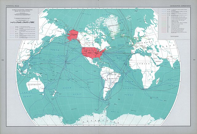
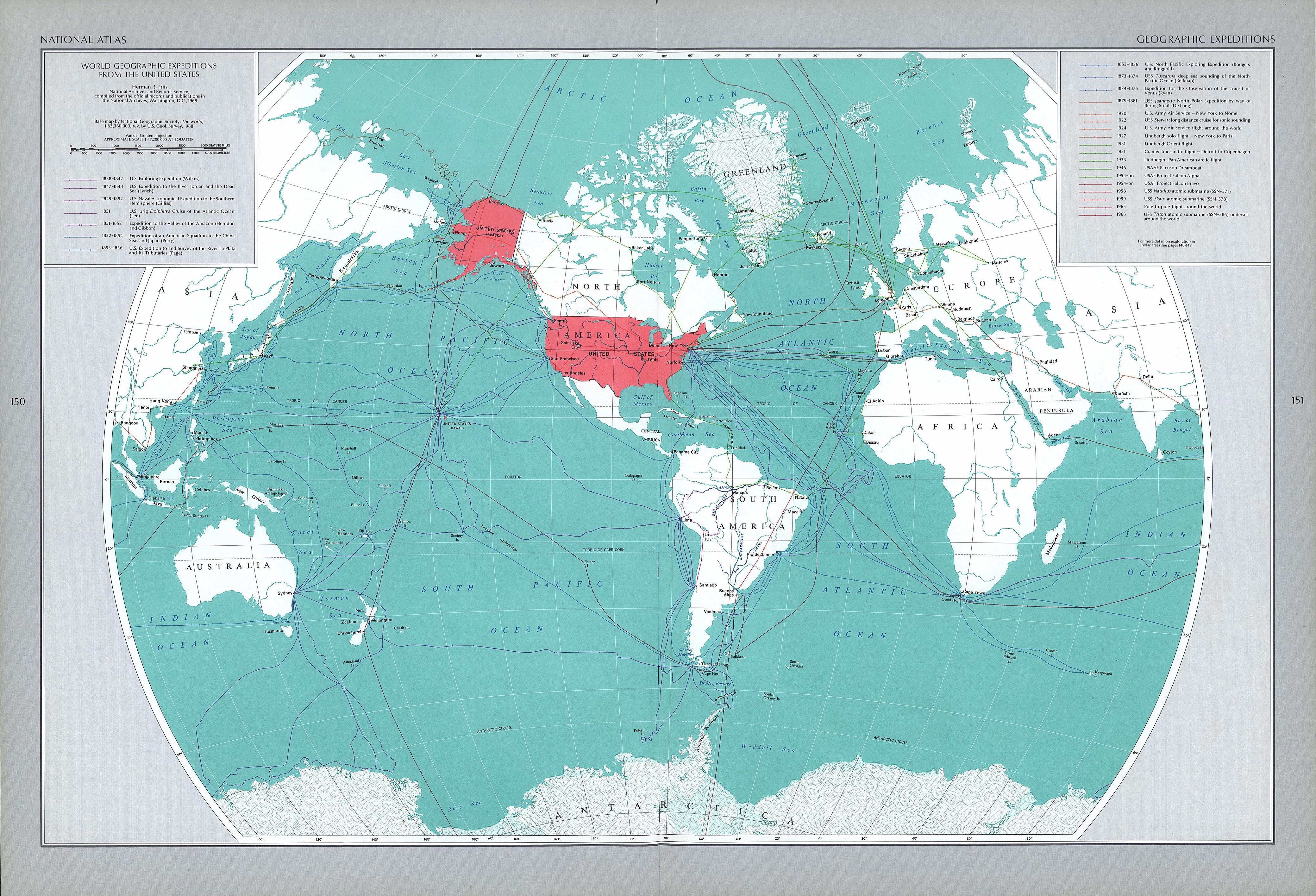
English: Map that shows the routes of American geographic expeditions outside the USA and polar zones |
| Date | |
| Source | University of Texas at Austin - Perry-Castañeda Library Map Collection |
| Author | United States Geological Survey |
Licensing[edit]
This map was obtained from an edition of the National Atlas of the United States. Like almost all works of the U.S. federal government, works from the National Atlas are in the public domain in the United States.
Online access: NationalAtlas.gov | 1970 print edition: Library of Congress, Perry-Castañeda Library
|
File history
Click on a date/time to view the file as it appeared at that time.
| Date/Time | Thumbnail | Dimensions | User | Comment | |
|---|---|---|---|---|---|
| current | 19:26, 9 November 2023 | | 4,158 × 2,831 (2.32 MB) | Universalis (talk | contribs) | Uploaded a work by United States Geological Survey from University of Texas at Austin - Perry-Castañeda Library Map Collection with UploadWizard |
You cannot overwrite this file.
File usage on Commons
The following page uses this file: