Ice sheets
Jump to navigation
Jump to search
Deutsch: Als de:'''Eisschild''' oder '''Inlandseis''' bezeichnet man einen ausgedehnten, festes Land bedeckenden Gletscher mit einer Fläche von mehr als 50.000 km². Der Eisschild begräbt das vorhandene Relief nahezu vollständig unter sich. Die Bewegung des Eises wird auch nur unwesentlich von diesem beeinflusst.
English: An Ice sheet is a mass of glacier ice that covers surrounding terrain and is greater than 50,000 km2 (19,000 sq mi), thus also known as continental glacier. The only current ice sheets are in Antarctica and Greenland; during the last glacial period at Last Glacial Maximum (LGM) the Laurentide ice sheet covered much of North America, the Weichselian ice sheet covered northern Europe and the Patagonian Ice Sheet covered southern South America.
Français : Inlandsis
Greenland Ice Sheet[edit]
Maps[edit]
-
 Map of the Greenland Ice sheet
 -
 The ice sheet
 -
 Thinning rate
 -
 Thinning of the ice sheet


Impressions of the Greenland Ice Sheet[edit]
-

-
 Calving front
 -
 The Greenland Ice Sheet, seen from the air

.jpg)

Ice flow, englacial drainage system and receding glacier[edit]
-
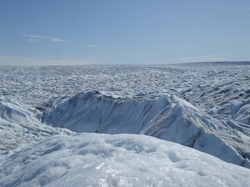
 Glacial flow in an outlet glacier
 -
 Meltwater streams
 -
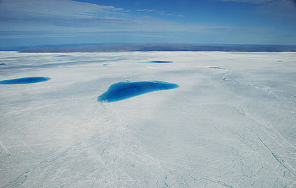 Supraglacial lakes
 -
 Crevasses
 -
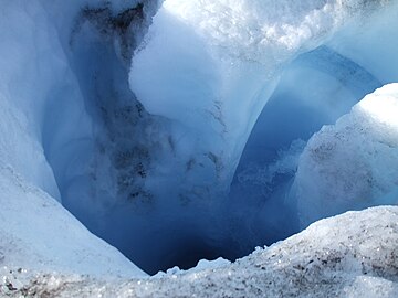 Moulin
 -
 Supraglacial river
 -
 Holes in the ice
 -
 A small nunatak
 -
 Glacier edge with erratic

.jpg)
.jpg)


Antarctica[edit]
Maps[edit]
-
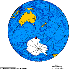 Location of Antarctica
 -
 Topographic map
 -
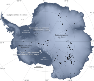 Subglacial lakes of Antarctica
 -
 Surface slopes


Impressions of Antarctica[edit]
-

-
 Distant pinguin colony
 -
 Mountains on Alexander Land
 -
 Shelf ice calving front


.jpg)

Glaciological diagrams of Antarctica[edit]


Englacial drainage systems of Greenland and Antarctica (videos)[edit]
-
Greenland's mega-canyon
-
Ice flow under Antarctica