File:Assateague Island aerial view.jpg
Aller à la navigation
Aller à la recherche

Taille de cet aperçu : 800 × 534 pixels. Autres résolutions : 320 × 214 pixels | 640 × 427 pixels | 1 024 × 683 pixels | 1 500 × 1 001 pixels.
Fichier d’origine (1 500 × 1 001 pixels, taille du fichier : 593 kio, type MIME : image/jpeg)
Légendes
Légendes
Ajoutez en une ligne la description de ce que représente ce fichier
| Description |
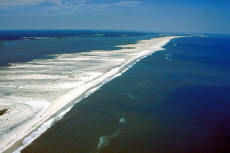
English: Aerial view of Assateague Island on the Atlantic Ocean in Maryland, USA.
|
|||
| Date | ||||
| Source |
U.S. Army Corps of Engineers Digital Visual Library Image page Image description page Digital Visual Library home page |
|||
| Auteur | Susanne Bledsoe, U.S. Army Corps of Engineers | |||
| Autorisation (Réutilisation de ce fichier) |
|
|||
| Lieu | Assateague Island, Worcester County, Maryland, USA |
| Lieu de la prise de vue | | Voir cet endroit et d’autres images sur : OpenStreetMap |
|---|
Historique du fichier
Cliquer sur une date et heure pour voir le fichier tel qu'il était à ce moment-là.
| Date et heure | Vignette | Dimensions | Utilisateur | Commentaire | |
|---|---|---|---|---|---|
| actuel | 8 avril 2007 à 01:02 | | 1 500 × 1 001 (593 kio) | DanMS (d | contributions) | {{Information | Description = {{en|Aerial view of Assateague Island on the Atlantic Ocean in Maryland, USA. The photograph shows the erosion to the beaches due to Atlantic storms. In the far distance at the top right is Ocean City, Maryland.}} | |
Vous ne pouvez pas remplacer ce fichier.
Utilisations locales du fichier
Aucune page n’utilise ce fichier.
Utilisations du fichier sur d’autres wikis
Les autres wikis suivants utilisent ce fichier :
- Utilisation sur de.wikipedia.org
- Utilisation sur en.wikipedia.org
- Utilisation sur es.wikipedia.org
- Utilisation sur fa.wikipedia.org
- Utilisation sur fr.wikipedia.org
- Utilisation sur gl.wikipedia.org
- Utilisation sur ko.wikipedia.org
- Utilisation sur tr.wikipedia.org
- Utilisation sur uk.wikipedia.org