File:Map Banaba Island 1936-fr.svg

Original file (SVG file, nominally 512 × 358 pixels, file size: 252 KB)
Captions
Captions
Summary
[edit]| Description |
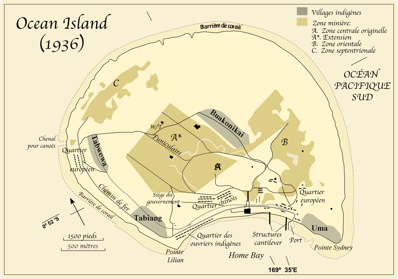
English: Banaba Island, Kiribati Español: Mapa de Banaba. Français : Banaba Island, Kiribati in 1936 Македонски: Остров Банаба, Кирибати. Русский: Остров Банаба. |
||
| Date | |||
| Source | Indolences, utexas.edu | ||
| Author | Kimdime69 translation and little modifications of a map Vectorization: Indolences | ||
| Permission (Reusing this file) |
|
||
| Other versions |
[]
|
||
| SVG development | This map was created with Adobe Illustrator. |


http://www.lib.utexas.edu/maps/historical/pacific_islands_1943_1945.html
http://www.lib.utexas.edu/usage_statement.html?maps=yes: "Most of the maps scanned by the University of Texas Libraries and served from this web site are in the public domain. No permissions are needed to copy them. You may download them and use them as you wish. A few maps are copyrighted, and are clearly marked as such."
This file is in the public domain because it has been taken from a collection of public domain maps at the University of Texas Library
|
File history
Click on a date/time to view the file as it appeared at that time.
| Date/Time | Thumbnail | Dimensions | User | Comment | |
|---|---|---|---|---|---|
| current | 20:21, 12 August 2018 | | 512 × 358 (252 KB) | JoKalliauer (talk | contribs) | Resized image and added viewBox |
| 10:52, 12 August 2018 |  | 1,052 × 744 (252 KB) | JoKalliauer (talk | contribs) | made file valid (had 766 errors) | |
| 23:47, 10 November 2008 |  | 1,052 × 744 (569 KB) | Kimdime (talk | contribs) | ||
| 20:32, 10 November 2008 |  | 1,052 × 744 (569 KB) | Kimdime (talk | contribs) | ||
| 20:21, 10 November 2008 |  | 744 × 1,052 (525 KB) | Kimdime (talk | contribs) | ||
| 00:58, 20 February 2007 | No thumbnail | (897 KB) | Kimdime (talk | contribs) | {{Information |Description= Banaba Island, Kiribati in 1936 |Source=User:Indolences, utexas.edu |Date=2007 |Author=User:Kimdime69 translation and little modifications of a map drawn by User:Indolences |Permission= {{PD-self}} |other_versions= | |
| 00:51, 20 February 2007 | No thumbnail | (1.93 MB) | Kimdime (talk | contribs) | {{Information |Description= Banaba Island, Kiribati in 1936 |Source=User:Indolences, utexas.edu |Date=2007 |Author=User:Kimdime69 translation and little modifications of a map drawn by User:Indolences |Permission= {{PD-self}} |other_versions= |
You cannot overwrite this file.
File usage on Commons
The following 8 pages use this file:
File usage on other wikis
The following other wikis use this file:
- Usage on fr.wikipedia.org