File:IranChaharMahaalBakhtiari.png
Jump to navigation
Jump to search

Size of this preview: 648 × 599 pixels. Other resolutions: 260 × 240 pixels | 519 × 480 pixels | 879 × 813 pixels.
Original file (879 × 813 pixels, file size: 25 KB, MIME type: image/png)
Captions
Captions
Add a one-line explanation of what this file represents
Summary[edit]

|
This file has been superseded by IranChaharMahaalBakhtiari-SVG.svg. It is recommended to use the other file. Please note that deleting superseded images requires consent.
|

|
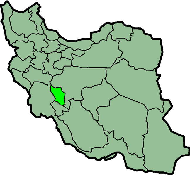
Province of Chahar-Mahal and Bakhtiyari, Iran Created by Morwen
Licensing[edit]
| This file is licensed under the Creative Commons Attribution-Share Alike 3.0 Unported license. Subject to disclaimers. | ||
| ||
| This licensing tag was added to this file as part of the GFDL licensing update. |

|
Permission is granted to copy, distribute and/or modify this document under the terms of the GNU Free Documentation License, Version 1.2 or any later version published by the Free Software Foundation; with no Invariant Sections, no Front-Cover Texts, and no Back-Cover Texts. A copy of the license is included in the section entitled GNU Free Documentation License. Subject to disclaimers. |
| Description |
Province of Chahar Mahal and Bakhtiyari, Iran Deutsch: Lage der Provinz Chahar Mahaal und Bakhtiari im Iran
Nederlands: Locatie van Chahar Mahaal en Bakhtiari |
| Date | (UTC) |
| Source | http://en.wikipedia.org/wiki/Image:IranChaharMahaalBakhtiari.png |
| Author | Morven |
| Permission (Reusing this file) |
GFDL |
File history
Click on a date/time to view the file as it appeared at that time.
| Date/Time | Thumbnail | Dimensions | User | Comment | |
|---|---|---|---|---|---|
| current | 23:42, 23 June 2013 | | 879 × 813 (25 KB) | BasilLeaf (talk | contribs) | بروزرسانی مرز بین استانهای یزد و خراسان جنوبی، تهران و البرز، فارس و یزد و اصفهان |
| 11:41, 12 November 2010 |  | 879 × 813 (41 KB) | M samadi (talk | contribs) | Border of some provinces updated. | |
| 12:56, 13 October 2010 |  | 697 × 614 (108 KB) | Amin19850 (talk | contribs) | Tehran & Alborz Province is divided | |
| 23:03, 9 March 2007 |  | 697 × 614 (95 KB) | KureCewlik81 (talk | contribs) | ||
| 21:10, 8 November 2006 |  | 200 × 185 (10 KB) | Raymond (talk | contribs) | transparent background, improved color palette | |
| 21:53, 15 September 2005 |  | 200 × 185 (20 KB) | Kotoito (talk | contribs) | Province of Chahar-Mahal and Bakhtiyari, Iran Created by Morwen |
You cannot overwrite this file.
File usage on Commons
There are no pages that use this file.
File usage on other wikis
The following other wikis use this file:
- Usage on ar.wikipedia.org
- Usage on arz.wikipedia.org
- Usage on az.wikipedia.org
- Usage on bn.wikipedia.org
- Usage on ca.wikipedia.org
- Usage on ceb.wikipedia.org
- Usage on ckb.wikipedia.org
- Usage on da.wikipedia.org
- Usage on el.wikipedia.org
- Usage on en.wikipedia.org
- Kian
- Zard-Kuh
- Lordegan
- Farsan
- Farrokh Shahr
- Ben, Iran
- Gandoman
- Ardal
- Lepir
- Borujen County
- Lordegan County
- Ardal County
- Kuhrang County
- Chelgerd
- Shahrekord Shahid Estaki International Airport
- Gahru
- Template:ChaharmahalBakhtiari-geo-stub
- Saman, Chaharmahal and Bakhtiari
- Mahrik
- Hardan, Chaharmahal and Bakhtiari
- User:AlexNebraska/Images of Iran
- Buger
- Faradonbeh
- Kiar County
- Aluni
- Babaheydar
- Boldaji
- Sefiddasht
- Sudjan
- Sureshjan
- Shalamzar
- Taqanak
- Mal-e Khalifeh
- Naghan
- Nafech
- Naqneh
- Sharmak
- Pahna
- Gandoman District
View more global usage of this file.