File:New Orleans 17th Street Canal filling.JPG
Original file (1,600 × 1,200 pixels, file size: 819 KB, MIME type: image/jpeg)
Captions
Captions
Summary[edit]
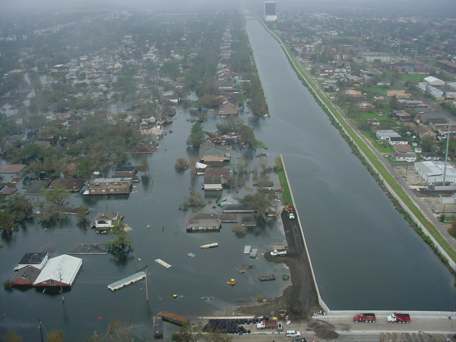
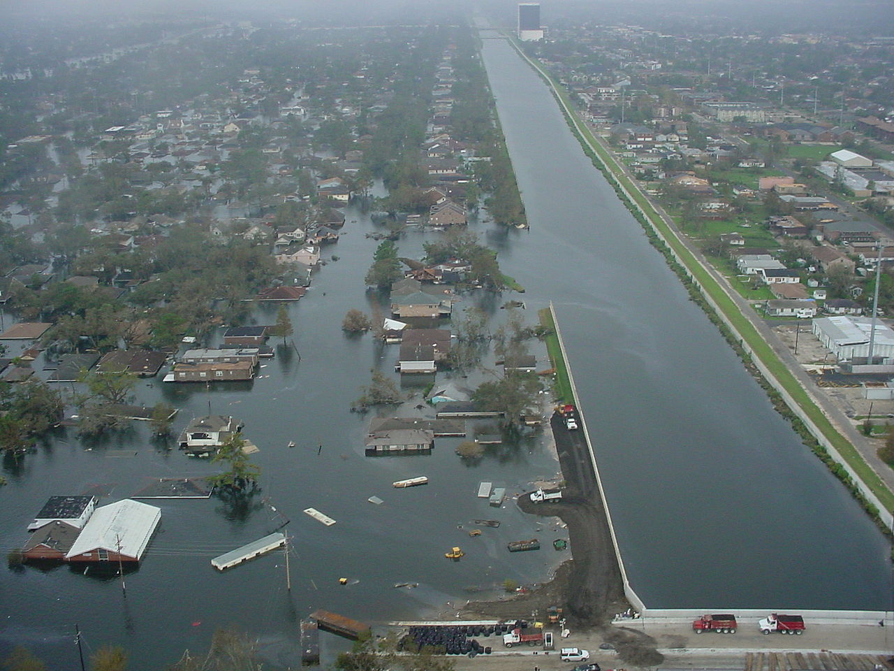
Building roadway toward the New Orleans 17th Street Canal breach.
Looking towards the River.
Metarie, Louisiana on right side, West End/Lakeview neighborhoods of New Orleans on left. The Old Hammond Highway Bridge is at front center; in the background the Metarie Road bridge over the canal can be seen.
This is clearly the famous breach in the Canal after Hurricane Katrina in September of 2005. (Camera's datestamp of January 3 2002 is obviously wrong.)
http://www.mvd.usace.army.mil/hurricane/KatrinaImages/Misc/DSC00033.JPG
Licensing[edit]
This file is a work of a U.S. Army soldier or employee, taken or made as part of that person's official duties. As a work of the U.S. federal government, it is in the public domain in the United States.
|
 |
File history
Click on a date/time to view the file as it appeared at that time.
| Date/Time | Thumbnail | Dimensions | User | Comment | |
|---|---|---|---|---|---|
| current | 17:06, 16 September 2005 | | 1,600 × 1,200 (819 KB) | SEWilco (talk | contribs) | Building roadway toward the New Orleans 17th Street Canal breach. http://www.mvd.usace.army.mil/hurricane/KatrinaImages/Misc/DSC00033.JPG Category:Hurricane Katrina |
You cannot overwrite this file.
File usage on Commons
The following 2 pages use this file:
File usage on other wikis
The following other wikis use this file:
- Usage on en.wikipedia.org
- Usage on es.wikipedia.org