File:River Rouge Dearborn.jpg
Aller à la navigation
Aller à la recherche

Taille de cet aperçu : 800 × 561 pixels. Autres résolutions : 320 × 224 pixels | 640 × 448 pixels | 1 024 × 717 pixels | 1 280 × 897 pixels | 1 500 × 1 051 pixels.
Fichier d’origine (1 500 × 1 051 pixels, taille du fichier : 506 kio, type MIME : image/jpeg)
Légendes
Légendes
Ajoutez en une ligne la description de ce que représente ce fichier
| Description |
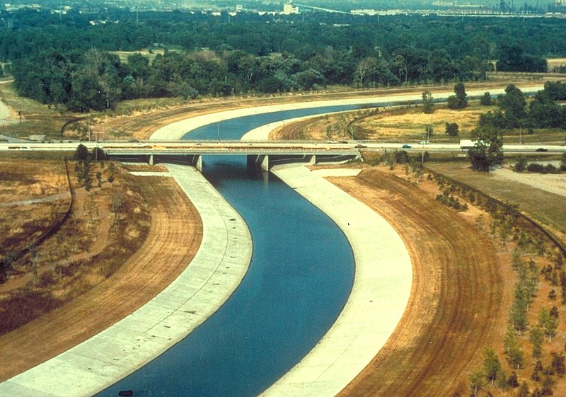
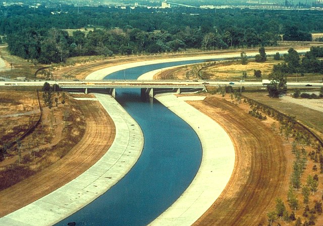
English: River Rouge in Dearborn, Michigan, USA. The U.S. Army Corps of Engineers has channelized the river as a flood control project. The view in the picture appears to be looking west across the Southfield Freeway, M-39. |
|||
| Date | not specified or unknown | |||
| Source |
U.S. Army Corps of Engineers Digital Visual Library Image page Image description page Digital Visual Library home page |
|||
| Auteur | U.S. Army Corps of Engineers, photographer not specified or unknown | |||
| Autorisation (Réutilisation de ce fichier) |
|
|||
| Lieu | Dearborn, Michigan, USA |
| Lieu de la prise de vue | | Voir cet endroit et d’autres images sur : OpenStreetMap |
|---|
Historique du fichier
Cliquer sur une date et heure pour voir le fichier tel qu'il était à ce moment-là.
| Date et heure | Vignette | Dimensions | Utilisateur | Commentaire | |
|---|---|---|---|---|---|
| actuel | 29 mars 2007 à 03:58 | | 1 500 × 1 051 (506 kio) | DanMS (d | contributions) | {{Information | Description = {{en|River Rouge in Dearborn, Michigan, USA. The U.S. Army Corps of Engineers has channelized the river as a flood control project. The view in the picture appears to be looking west across the Smithfield Freeway, Michigan |
Vous ne pouvez pas remplacer ce fichier.
Utilisations locales du fichier
La page suivante utilise ce fichier :
Utilisations du fichier sur d’autres wikis
Les autres wikis suivants utilisent ce fichier :
- Utilisation sur de.wikipedia.org
- Utilisation sur en.wikipedia.org
- River Rouge (Michigan)
- M-39 (Michigan highway)
- Michigan State Trunkline Highway System
- File talk:River Rouge Dearborn.jpg
- Portal:Michigan highways
- Portal:Michigan highways/Pictures
- Portal:Michigan highways/Selected picture/September 2011
- Portal:Michigan highways/Did you know
- Portal:Michigan highways/Did you know/August 2012
- Portal:Michigan highways/Did you know/April 2014
- Portal:Michigan highways/Did you know/May 2016
- Portal:Michigan highways/Did you know/January 2018
- Portal:Michigan highways/Did you know/April 2020
- Utilisation sur fr.wikipedia.org
- Utilisation sur ja.wikipedia.org
- Utilisation sur mk.wikipedia.org
Métadonnées
Catégories :
- Dearborn, Michigan
- M-39 (Michigan highway)
- River Rouge
- Bridges over rivers in Michigan
- Road bridges in Michigan
- Girder bridges in Michigan
- 1960s bridges in Michigan
- Built in Michigan in 1963
- Bridges in the United States completed in 1963
- Steel bridges in the United States
- 0.1-kilometer bridges in the United States