File:Seraing Liège Belgium Map.png
Jump to navigation
Jump to search
No higher resolution available.
Seraing_Liège_Belgium_Map.png (290 × 220 pixels, file size: 5 KB, MIME type: image/png)
Captions
Captions
Add a one-line explanation of what this file represents

|
File:Seraing Liège Belgium Map.svg is a vector version of this file. It should be used in place of this PNG file when not inferior.
File:Seraing Liège Belgium Map.png → File:Seraing Liège Belgium Map.svg
For more information, see Help:SVG. |
 |
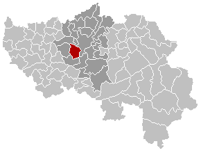
Français : localisation de la commune de Seraing dans la province de Liège
Walon : Mape des comenes del province di Lidje, avou Serè e rodje
English: Position of Seraing commune in the Liege province
| This work has been released into the public domain by its author, LennartBolks. This applies worldwide. In some countries this may not be legally possible; if so: |
File history
Click on a date/time to view the file as it appeared at that time.
| Date/Time | Thumbnail | Dimensions | User | Comment | |
|---|---|---|---|---|---|
| current | 18:18, 6 September 2008 | | 290 × 220 (5 KB) | Ludger1961 (talk | contribs) | arrondissement sans Olne et sans Herve |
| 22:57, 24 December 2005 |  | 290 × 220 (7 KB) | Wester (talk | contribs) | ||
| 22:08, 21 March 2005 |  | 290 × 220 (5 KB) | Srtxg (talk | contribs) |
You cannot overwrite this file.
File usage on Commons
The following page uses this file:
File usage on other wikis
The following other wikis use this file:
- Usage on fr.wikipedia.org
- Usage on fr.wikinews.org