File:USACE Claiborne Lock and Dam.jpg
Aller à la navigation
Aller à la recherche

Taille de cet aperçu : 800 × 523 pixels. Autres résolutions : 320 × 209 pixels | 640 × 419 pixels | 1 024 × 670 pixels | 1 280 × 837 pixels | 1 685 × 1 102 pixels.
Fichier d’origine (1 685 × 1 102 pixels, taille du fichier : 428 kio, type MIME : image/jpeg)
Légendes
Légendes
Ajoutez en une ligne la description de ce que représente ce fichier
| Description |
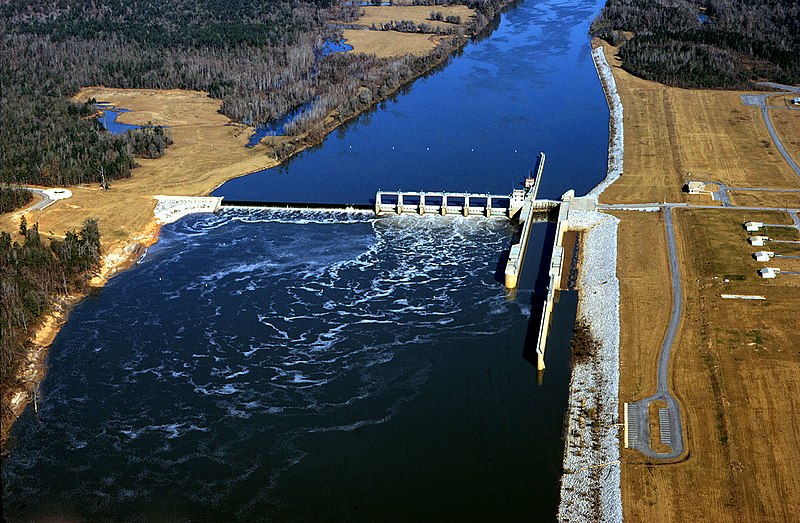
English: Aerial view of Claiborne Lock and Dam on the Alabama River in Monroe County, Alabama, USA. The dam is located approximately 5 miles (8 km) upriver from Claiborne, Alabama. The U.S. Army Corps of Engineers maintains the lock and dam for barge navigation on the river. View is upriver to the north.
Coordinates: 31°36′53.92″N 87°33′2.8″W / 31.6149778°N 87.550778°W |
|||
| Lieu | Monroe County, Alabama, USA | |||
| Date | ||||
| Source |
U.S. Army Corps of Engineers Digital Visual Library Image page Image description page Digital Visual Library home page |
|||
| Auteur | Adrien Lamarre, U.S. Army Corps of Engineers | |||
| Autorisation (Réutilisation de ce fichier) |
|
Historique du fichier
Cliquer sur une date et heure pour voir le fichier tel qu'il était à ce moment-là.
| Date et heure | Vignette | Dimensions | Utilisateur | Commentaire | |
|---|---|---|---|---|---|
| actuel | 28 avril 2007 à 20:19 | | 1 685 × 1 102 (428 kio) | DanMS (d | contributions) | {{Information | Description = {{en|Aerial view of Claiborne Lock and Dam on the Alabama River in Monroe County, Alabama, USA. The dam is located approximately 5 miles (8 km) upriver from Claiborne, Alabama. The U.S. Army Corps of Engineers maintains th |
Vous ne pouvez pas remplacer ce fichier.
Utilisations locales du fichier
Aucune page n’utilise ce fichier.
Utilisations du fichier sur d’autres wikis
Les autres wikis suivants utilisent ce fichier :
- Utilisation sur ar.wikipedia.org
- Utilisation sur de.wikipedia.org
- Utilisation sur en.wikipedia.org
- Utilisation sur fr.wikipedia.org
- Utilisation sur fy.wikipedia.org
- Utilisation sur ja.wikipedia.org
- Utilisation sur jv.wikipedia.org
- Utilisation sur xmf.wikipedia.org