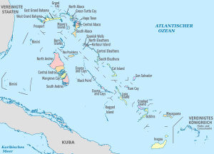
Template:Bahamas imagemap (location map scheme)
From Wikimedia Commons, the free media repository
(Redirected from Template:The Bahamas imagemap (location map scheme))

|
This page contains raw data imagemaps. This is not for direct use and must be adjusted (e.g. fixing links, translating, ...) before being transferred to other templates. Use Image map editor for editing the data set. |
de[edit]


