User:Ebyabe/central
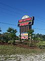
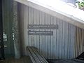
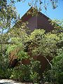
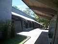
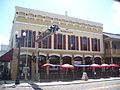
Altoona[edit]
-
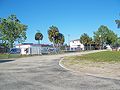
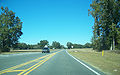
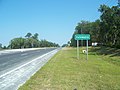
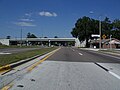
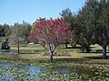
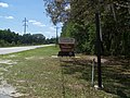
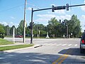
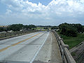
 Southern part of town, looking north along US 19 towards the intersection with County Road 42
 -
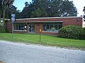
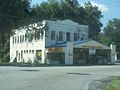
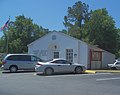
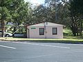
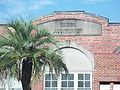
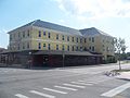
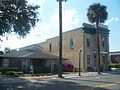
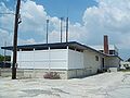
 Post office
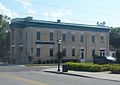
 -

-

-

-


Anthony[edit]
-
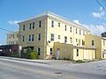
 Post office.
 -
 Entrance to Jumbolair, a gated aviation community in the area. One of the more famous residents is John Travolta. Panorama view.
 -
 Entrance to Jumbolair, a gated aviation community in the area. One of the more famous residents is John Travolta. Panorama view.
 -
 Entrance to Jumbolair, a gated aviation community in the area. One of the more famous residents is John Travolta. Panorama view.
 -
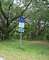
 Sign outside Jumbolair, a gated aviation community in the area. One of the more famous residents is John Travolta.


Apopka[edit]
-
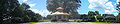
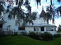
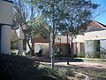
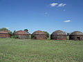
 One of the plantation buildings.
 -
 One of the plantation buildings.
 -
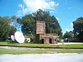
 A brick thing on the property. Possibly a well or water basin.
 -
 Live oak. Probably one of those transplanted from the original plantation.
 -
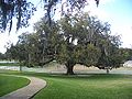 Live oak. Probably one of those transplanted from the original plantation.
 -
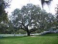 Live oak. Probably one of those transplanted from the original plantation.
 -
 Sign on the old plantation's smithy.
 -
 The old plantation's smithy.
 -

-

-

-
-

-

-

-


Archer[edit]
-
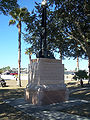
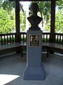
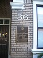
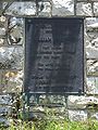
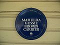 Great Floridians plaque for Mahulda Gussie Brown Carrier
 -
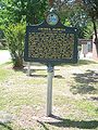
 Historical marker
 -
 Historical marker
 -
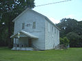
 Maddox Foundry & Machine Works, opened in 1905. Current buildings are from the 1940s.
 -
 Maddox Foundry & Machine Works, opened in 1905. Current buildings are from the 1940s.
 -
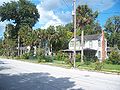
 Main street, looking west
 -
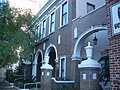
 Masonic Lodge, built in the 1890s
 -
 Masonic Lodge, built in the 1890s
 -
 Neal-Wood House, built in the 1890s
 -
 Neal-Wood House, built in the 1890s
 -
 Neal-Wood House, built in the 1890s
 -
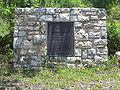
 Historical marker
 -
 Historical marker
 -
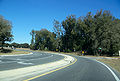
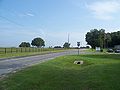
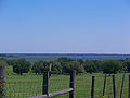
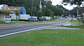
 Looking west along SR 24 towards US 27/41
 -
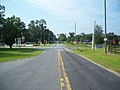
 Looking west along SR 24
 -
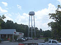 Water tower


Astor[edit]
-
 Astor, Florida: Post office

Barberville[edit]
-
 Barberville, Florida: Post office
 -
 Barberville, Florida: Post office
 -

-

-

-

-
-


Belleview[edit]
-
 The old Belleview Library, completed in 1908.
 -
 The old Belleview Library, completed in 1908.


State Road 35[edit]
-
 English: The intersection of Florida State Road 35, Florida State Road 25 and Marion County Road 25, looking north.
 -
 English: The intersection of Florida State Road 35, Florida State Road 25 and Marion County Road 25.
 -
 English: The intersection of Florida State Road 35, Florida State Road 25 and Marion County Road 25, looking north.
 -
 English: The southern terminus of Florida State Road 35 on the right, looking north along U.S. Route 441.
 -
 English: Near the southern terminus of Florida State Road 35 next to U.S. Route 441, looking northeast.
 -


Don Garlits Museum of Drag Racing[edit]
-
 Panorama view of Antique Car Museum building.
 -
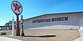 Panorama view of Antique Car Museum building.
 -
 Antique Car Museum building.
 -
 Billboard for the museum.
 -
 Entrance to the museum, off CR 475A, near I-75.
 -
 Entrance to the museum, off CR 475A, near I-75.
 -
 Entrance to the museum, off CR 475A, near I-75.
 -
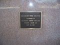 Plaque at the base of the Hall of Fame monument, describing construction material.
 -
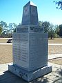
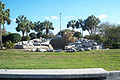
 International Drag Racing Hall of Fame monument.
 -
 International Drag Racing Hall of Fame monument.
 -
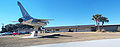 Panorama view. Includes Museum of Drag Racing building on right, and Vought A7A Corsair II BuNo 152650 on left.
 -
 Panorama of museum buildings, from near monuments.
 -
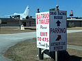 Signs guiding visitors in museum parking lot.
 -
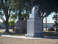 Southeastern Drag Racing Hall of Fame monument, with International Drag Racing Hall of Fame monument in background.
 -
 Southeastern Drag Racing Hall of Fame monument.


Branchborough[edit]


Brooksville[edit]


Bushnell[edit]
-
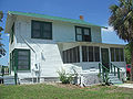
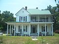
 House across from the Thomas R. Pierce House.

[edit]
-
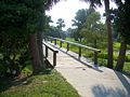
 Boardwalk to beach
 -
 Boardwalk from beach
 -
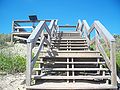 Stairs to boardwalk from beach
 -
 Entrance sign
 -
 Entrance
 -

-
-
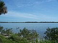
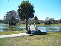
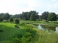
 Intracoastal Waterway near the Moulton-Wells House.
 -
 Looking north
 -
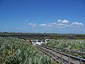
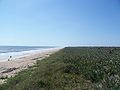
 Apollo Beach, which is the northern part of the Seashore open to the public. Looking generally north, towards New Smyrna Beach. The Atlantic Ocean is on the right.
 -
 Path near the Moulton-Wells House.
 -
 CR A1A, looking north
 -
 Side road, off CR A1A
 -
 Looking south
 -
 Oak Hill area


Center Hill[edit]


Chiefland[edit]
Old depot[edit]


Old Hardeetown Hotel[edit]


Citra[edit]
-
 Post office.

Clermont[edit]
-
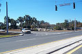
 US 27, looking north from in front of the Citrus Tower
 -
 US 27, looking south from in front of the Citrus Tower


Coleman[edit]
-
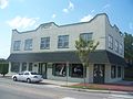
 House on US 301.
 -
 House on US 301.
 -
 House on US 301.


Cross Creek[edit]
-
 Intersection of County Road 325 and US 301
 -
 County Road 325 sign, next to US 301
 -
 County Road 325, next to US 301


Dade City[edit]


-
 LeHeup Hill
 -
 LeHeup Hill
 -
 LeHeup Hill
 -
 LeHeup Hill


Dallas[edit]
-
 Intersection of US 301 and the Marion County section of State Road 42.

Davenport[edit]


Daytona Beach[edit]
-
 Art League
 -
 Art League
 -
 Art League
 -
 The University Center


Beach


Pier


DeBary[edit]


DeLand[edit]
-
 Panorama view in the DeLand Airport area. Couldn't find a specific sign, this is from a parking lot across from the DeLand Naval Air Station Museum
 -
 Sign outside city hall.
 -
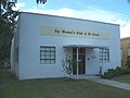
 Deland, Florida: Woman's club
 -
 Lim Gong memorial
 -
 Lim Gong memorial
 -
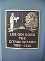 Lim Gong memorial
 -
-


-
 Edmunds Center sign
 -
 Edmunds Center


Dunnellon[edit]
Old ACL depot


East Lake Weir[edit]
-
 Marion County Road 25, looking north. This was part of the original alignment of US 441 when it was first laid out in the 1920s.
 -
 Marion County Road 25, looking south. This was part of the original alignment of US 441 when it was first laid out in the 1920s.
 -
 Post office, with James Riley Josselyn House in the background.
 -
 Post office.
 -
 Post office.


Emeralda Marsh[edit]
-
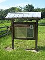 Info sign at the Wood Duck Wildlife Trail entrance.
 -
 Info sign at the Wood Duck Wildlife Trail entrance.
 -
 Sign near the Wood Duck trail entrance.
 -
 Wood Duck Wildlife Trail entrance.
 -
 Wood Duck Wildlife Trail entrance.
 -
 Wood Duck Wildlife Trail entrance.
 -
 Looking east from Emeralda Island Road.
 -
 Looking east from Emeralda Island Road.
 -
 Looking west from Emeralda Island Road.
 -
 Looking west from Emeralda Island Road.
 -
 Emeralda Island Road, looking south.
 -

-
-
 Emeralda Island Road, looking north.


Eustis[edit]


Evinston[edit]
-
 Wood's Packinghouse, built in the early 1900s
 -
 Two buildings, the Wood and Swink post office in the background
 -
 Looking south on CR 225, with Wood and Swink post office on the right
 -
 Looking north on CR 225


Fairfield[edit]


Fellowship[edit]
-
 Looking west along US 27 from the southern end of Fellowship
 -
 Looking north along County Road 464, towards US 27


Fort Lonesome[edit]


Fort White[edit]
-
 Historical plaque.

Freedtown[edit]

Frostproof[edit]


Scenic Highway 17, south of Lake Moody


Georgianna[edit]

Hawthorne[edit]
-
 Brick building. Maybe railroad related, considering it's next to the rail tracks.
 -
 Houses on Johnson Street/221st Street.
 -
 Intersection of Johnson Street/221st Street and County Road 2082.
 -
 Railroad tracks, looking south.
 -
 Railroad tracks, looking north.
 -
 Historical marker
 -
 Historical marker
 -
 US 301
 -
 US 301
 -
 US 301


Gainesville-Hawthorne Trail[edit]


High Springs[edit]

Old Bellamy Road[edit]


Homosassa Springs[edit]
-
 U.S. Route 98, looking north from in front of Homosassa Springs Wildlife State Park
 -
 U.S. Route 98, looking south from in front of Homosassa Springs Wildlife State Park


Holopaw[edit]
-
 Looking east
 -
 Looking east
 -
 Looking north
 -
 Looking southeast
 -
 Looking south
 -
 Looking west


Interlachen[edit]
Old Brush Store[edit]


Community School[edit]


Inverness[edit]


Jonesville[edit]
-
 Fire station
 -
 Looking south towards SR 26
 -
 Shopping mall on SR 26


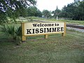
Kissimmee[edit]
-
 Sign at the Amtrak station
 -
 Welcome sign next to the Amtrak station
 -
 Amtrak station
 -
 Amtrak station
 -
 Amtrak station
 -
 Monument of States


Lady Lake[edit]
-
 Sign outside the local Chamber of Commerce building, on US 441.
 -
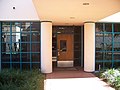
 Local Chamber of Commerce building.
 -
 Local Chamber of Commerce building.
 -
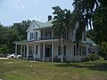
 House in the area.
 -
 House in the area.
 -
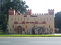 Building made to look like a castle. It's a tile place now, but I think it sold gaming miniatures when it first opened. The building's been there at least 20 years.
 -
 Building made to look like a castle. It's a tile place now, but I think it sold gaming miniatures when it first opened. The building's been there at least 20 years.


Lake City[edit]


Lakeland[edit]


Lake Wales[edit]
Heckscher monument[edit]


Spook Hill[edit]


Lecanto[edit]


Leesburg[edit]
Lifestream Building[edit]


Old opera house[edit]


Venetian Gardens[edit]
-
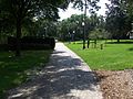
 Looking at the park from a neighboring park to the west.
 -
 Looking at the park from a neighboring park to the west.
 -

-

-

-
 The Martin Luther King, Jr. Memorial Walkway.
 -
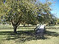
 One of the bridges connecting two of the small islands in the park.
 -

-

-
-

-

-

-
-
 A monument in the park commemorating the black pioneers of Leesburg.
 -

-
-

-

-

-
-

-

-

-


Levy County[edit]


Lisbon[edit]
-
 Intersection of Emeralda Avenue and Emeralda Island Road/Goose Prairie Road.
 -
 On Emeralda Avenue, looking north into it.
 -
 On Emeralda Island Road, looking east into it.
 -
On Emeralda Island Road, looking east into it.
-
 Sign says "Lisbon A Distinctive Lake County Community". Many of the small towns in the county have these signs.


Lowell[edit]
-
 County Road 25A, going through the town.
 -
 County Road 25A, going through the town.
 -
 County Road 25A, going through the town.
 -
 Intersection of County Road 25A and County Road 329.
 -
 Intersection of County Road 25A and County Road 329.
 -
 Local post office.
 -
 Local post office.


Luraville[edit]
-
 Country store

Maitland[edit]
Holocaust Center[edit]


Old brick Dixie Highway[edit]
-
 Historical marker about the old brick Dixie Highway around Lake Lily
 -
 Part of the old brick Dixie Highway around Lake Lily
 -
 Part of the old brick Dixie Highway around Lake Lily
 -
 Part of the old brick Dixie Highway around Lake Lily
 -
 Part of the old brick Dixie Highway around Lake Lily
 -
 Part of the old brick Dixie Highway around Lake Lily


Marion Oaks[edit]
-
 Community Center
 -
 Community Center
 -
 Community Center
 -
 Library
 -
 Entrance
 -
 Entrance
 -
-


Martin[edit]
-
 County Road 25A, going through the town.
 -
 County Road 25A, going through the town.


Mayo[edit]
-
 Building next to old courthouse

-
 Historical marker outside the Lafayette County Courthouse.
 -
 Historical marker outside the Lafayette County Courthouse.


-
 Brick building on US 27 across from the Lafayette County Courthouse.

House of Seven Gables[edit]


Melbourne[edit]
-
 Carter House
 -
 Building built by Gleason family. Former masonic temple and bank
 -
 Building built by Gleason family. Former masonic temple and bank
 -
 Sign about buildings at Highland Avenue and Law Street intersection
 -
 Lee House
 -
 Lee House
 -
 Lee House
 -
 Lee House
 -
 Shave House
 -
 US 192 bridge
 -
 US 192 bridge


Melrose[edit]
Cemetery


Merritt Island[edit]


Micanopy[edit]
-
 Plaque on the local fire station.
 -
 Fire station
 -
 Plaque on the town hall.
 -
 Sign in front of the town hall.
 -
 Town hall.
 -
 Town hall.
 -
 Town hall.
 -
 Town hall.


Morriston[edit]
-
 Morriston: St. James Missionary Baptist Church

Mount Dora[edit]
-
 Mount Dora Center for the Arts.
 -
 Mount Dora Center for the Arts.
 -
 Mount Dora Center for the Arts.
 -
 Mount Dora Center for the Arts. Rear of building.


New Smyrna Beach[edit]

-
 Monument in park on Sams Avenue, honoring the original settlers of the New Smyrna colony
 -
-

-

-


-
 Bell Administration Building sign
 -
 Panorama view of amphitheatre and visitor center
 -
 Amphitheater
 -
 Entrance
 -
 Leeper Studio Complex
 -
 Leeper Studio Complex
 -
 Leeper Studio Complex
 -
 Pabst Visitor Center and Gallery
 -
 Pabst Visitor Center and Gallery
 -
 Pabst Visitor Center and Gallery on the left, amphitheater on the right


AHEPA memorial


Veterans memorial


Oak Hill[edit]


Ocala National Forest[edit]
-
 Ocala National Forest: Clearwater Lake Recreation Site sign on CR 42
 -
 Ocala National Forest: Clearwater Lake Recreation Site


State Road 19 and 40 intersection[edit]


Ocklawaha[edit]
-
 A local convenience store.
 -
 The old Oklawaha Inn, now a pool and spa supplies store.
 -
 Post office.
 -
 Sheriff's office. A new one is nearly finished about a half-mile south.


Orange Bend[edit]
-
 Orange Bend, Florida: On Lake County Road 44, looking south into it.
 -
 Orange Bend, Florida: On Lake County Road 44, looking north into it.


Orange Home[edit]


Orange Lake[edit]
-
 Post office
 -
 Post office
 -
 South of the intersection of US 441 and County Road 318, looking north
 -
 Intersection of US 441 and County Road 318, looking north
 -
 Intersection of US 441 and County Road 318, looking south
 -

-


Orlando[edit]


Downtown[edit]
-
 History center
 -
 History center
 -
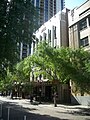
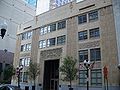 Old 1st National Bank building
 -
 Old 1st National Bank building
 -
 Old 1st National Bank building
 -
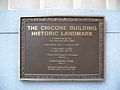 Marker on old 1st National Bank building
 -
 Marker on old 1st National Bank building
 -
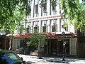
 Elijah Hand Building
 -
 Elijah Hand Building
 -
 Elijah Hand Building
 -
 Old S.H. Kress building
 -
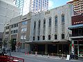 Old S.H. Kress building
 -
-
-

-
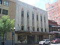 Old S.H. Kress store
 -
 Bumby Block
 -
 Bumby Block
 -
 Bumby Block
 -
 Bumby Block
 -
 Bumby Block
 -
 Carey Funeral Home
 -
 Carey Funeral Home


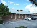
Old Seaboard Coastline Station (Amtrak station)[edit]


Ormond Beach[edit]


Owensboro[edit]


Oxford[edit]
-
 Local post office.
 -
 Local post office.
 -
 Tree-lined street, parallel and to the west of US 301.


Palatka[edit]


Palm Coast[edit]


Paisley[edit]
-
 Building in the town, think it's a B&B
 -
 Post office
 -
 Welcome to Paisley sign


Pittman[edit]
-
 Panorama view of Pittman Work Center
 -
 Plaque near entrance of Pittman Work Center. It reads:
Memorial Plantation
Dedicated to
William H. Croke
First Ranger of
the Seminole Ranger District
who died March 27, 1958
Bill loved the Ocala
The Ocala loved Bill
Ocala National Forest
Forest Service
U. S. Dept. of Agriculture -
 Plaque near entrance of Pittman Work Center. It reads:
Memorial Plantation
Dedicated to
William H. Croke
First Ranger of
the Seminole Ranger District
who died March 27, 1958
Bill loved the Ocala
The Ocala loved Bill
Ocala National Forest
Forest Service
U. S. Dept. of Agriculture -
 Pittman Work Center sign
 -


Plant City[edit]

Ponce Inlet[edit]


Port Orange[edit]

Rainbow Lakes Estates[edit]
-
 Building, maybe community center?
 -
 District office
 -
 Library
 -
 Entrance
 -
 Entrance
 -
 Entrance
 -
 Lake Bonable


Reddick[edit]
-
 Panoramic view of Reddick Auditorium, part of the old Reddick High School. At least part of it is being used as an Interfaith thrift store.
 -
 Panoramic view of old Reddick Auditorium, part of the old Reddick High School. At least part of it is being used as an Interfaith thrift store.
 -
 Old Reddick Auditorium, name carved on building, part of the old Reddick High School. At least part of it is being used as an Interfaith thrift store.
 -
 Old Reddick Auditorium, part of the old Reddick High School. At least part of it is being used as an Interfaith thrift store.
 -
 Local post office.


Rochelle[edit]
</gallery> File:Rochelle FL marker01a.jpg| File:Rochelle FL marker01b.jpg| File:Rochelle FL Prairie Creek Preserve01.jpg| File:Madison Starke Perry marker01.jpg|
-
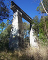
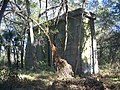
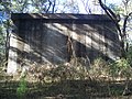
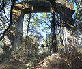
 Round brick buildings on US 41, south of the intersection of US 41 and County Road 328, near Romeo. There are a total of 8 of them in a row. Maybe 10 feet tall, not too much bigger than that in diameter

San Antonio[edit]


Sanford[edit]


Santos[edit]
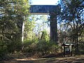
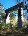
Supports for the bridge over the where the Cross Florida Barge Canal was going to be. The bridge was never completed, since the building of the canal was stopped. They are in a grassy median on US 441 in Santos, behind the County Sheriff's station.
-
-
-

-
-
-
-

-

-

-

-
-
 Start of historic ship canal trail.
 -
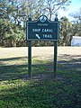 Sign to indicate start of historic ship canal trail.


-
 County sheriff's office, on 441.
 -
 Looking north along 441, from parking lot of county sheriff's office.


Shady[edit]
-
 Shady, Florida: Intersection of Marion County Roads 475A and 312

Sparr[edit]
-
 Intersection of County Road 200A (Jacksonville Road) and County Road 329.
 -
 Post office.


St. catherine[edit]


St. Cloud[edit]
-
 Old Atlantic Coast Line train station, now a VFW meeting place
 -
 Old Atlantic Coast Line train station, now a VFW meeting place
 -
 Old Atlantic Coast Line train station, now a VFW meeting place
 -
 Old Atlantic Coast Line train station, now a VFW meeting place


-
 Old St. Cloud Hotel
 -
 St. Cloud Hotel
 -
 St. Cloud Hotel
 -
 St. Cloud Hotel


-
 Woman's club
 -
 Woman's club
 -
 Woman's club


-
 First National Bank Building-Golden Age Club, now Chamber of Commerce: Plaque
 -
 First National Bank Building-Golden Age Club, now Chamber of Commerce: Plaque
 -
 First National Bank Building-Golden Age Club, now Chamber of Commerce
 -
 First National Bank Building-Golden Age Club, now Chamber of Commerce
 -
 First National Bank Building-Golden Age Club, now Chamber of Commerce
 -
 First National Bank Building-Golden Age Club, now Chamber of Commerce
 -
 First National Bank Building-Golden Age Club, now Chamber of Commerce
 -
 First National Bank Building-Golden Age Club, now Chamber of Commerce
 -
 Hunter Arms
 -
 Hunter Arms
 -
 Sam Lupfer-Davidson House: Plaque
 -
 Sam Lupfer-Davidson House
 -
 Sam Lupfer-Davidson House
 -
 Sam Lupfer-Davidson House
 -
 Old People's Bank building
 -
 Old People's Bank building
 -
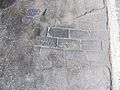 Old bricks showing through asphalt
 -
 GAR memorial


St. Leo[edit]


Summerfield[edit]
-
 Panoramic view of local post office.
 -
 Local post office.
 -
 Local post office.
 -
 Old Summerfield School, opened in 1925, now closed and used as a storage facility.
 -
 Old Summerfield School, opened in 1925, now closed and used as a storage facility.
 -
 Old Summerfield School, opened in 1925, now closed and used as a storage facility.
 -
 Old Summerfield School, opened in 1925, now closed and used as a storage facility.


Trilby[edit]

Umatilla[edit]
-
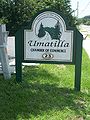 Sign outside Chamber of Commerce.
 -
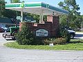
 Chamber of Commerce. It looks like it might have been a small railroad depot back in the day.


-
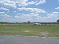 Umatilla Municipal Airport: Plane at the airport
 -
 Umatilla Municipal Airport: Plane at the airport
 -

-

-
 Informational plaque about Fort Mason
 -
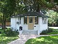
 House in the city
 -
 House in the city
 -
 Umatilla, Florida: Seminole Ranger Station sign for the Ocala National Forest
 -
 Umatilla, Florida: Seminole Ranger Station for the Ocala National Forest
 -
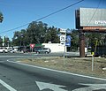
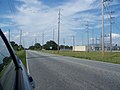
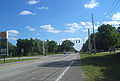
 U.S. 19, looking north, near the southern city limits
 -
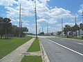 U.S. 19, looking south, near the southern city limits


The Villages[edit]
-
 Cherry Lake.
 -
 Canal Street, looking south.
 -
 Canal Street, looking north.
 -
 Golf cart bridge
 -
 Golf cart bridge
 -
 Golf cart bridge
 -
 Golf cart bridge
 -
 Golf cart bridge
 -
 Golf cart bridge
 -
 Golf cart bridge


Waldo[edit]


Webster[edit]
-
 Fussell House
 -
 Fussell House
 -
 Fussell House
 -
 old State Bank
 -
 old State Bank
 -
 old State Bank
 -
 old State Bank
 -
 Rowell Library
 -
 Rowell Library


Weirsdale[edit]


Welaka[edit]
-
 Observation tower at the Welaka National Fish Hatchery.

Wildwood[edit]
-
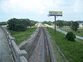
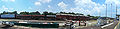 Panorama view of tracks and railcars behind the former Amtrak station. Now a CSX station and maintenance area.
 -
 Panorama view of former Amtrak station. Now a CSX station and maintenance area.
 -
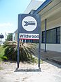 Sign outside the former Amtrak station. Now a CSX station and maintenance area.
 -
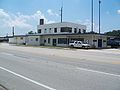 Former Amtrak station. Now a CSX station and maintenance area.
 -
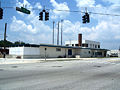 Former Amtrak station. Now a CSX station and maintenance area.
 -
 Former Amtrak station. Now a CSX station and maintenance area.
 -
Former Amtrak station. Now a CSX station and maintenance area.
-
 Former Amtrak station. Now a CSX station and maintenance area.
 -
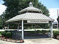 Gazebo.
 -
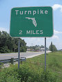 Sign for Florida's Turnpike.
 -
 US 301 bridge, looking north.
 -
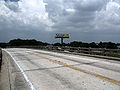 US 301 bridge, looking north.
 -
 US 301 bridge, looking north.
 -
 US 301 bridge, looking south.
 -
US 301 bridge, looking south.
-

-
 Rail tracks, looking north from the US 301 bridge.
 -
 Rail tracks, looking north from the US 301 bridge.
 -
 Rail tracks and railcars, looking south from the US 301 bridge.
 -
 Rail tracks and railcars.
 -
 Sign for Florida's Turnpike and railroad tracks, looking south from the US 301 bridge.
 -

-


Williston[edit]
-
 Old railroad depot
 -
 Old railroad depot
 -
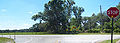
 Intersection of County Road 121, US 27 and US 41


L. C. Hester house


House across from the L. C. Hester house


Winter Haven[edit]

Winter Park[edit]
Amtrak station[edit]


Rollins College[edit]
-
 Plaque

Welcome center[edit]


Zuber[edit]
-
 County Road 25A, going through the town.

Intersections[edit]
Alachua County[edit]
-
 Alachua County, Florida: Interstate 75 overpass near Micanopy

Lake County[edit]
-
 Road sign for the intersection of Lake County Roads 33 and 48. This is on CR 48, heading east.
 -
 Road sign at the intersection of Lake County Roads 33 and 48. A left turn heads north to Leesburg, a right turn leads to Mascotte.


Levy County[edit]
-
 Levy County, Florida: Intersection of County Road 320 and State Road 121
Marion County[edit]
-
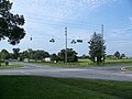
 Intersection of State Road 200 and County Road 484
 -
 Intersection of County Roads 329 and 320
 -
 Intersection of County Roads 329 and 320
 -
 Intersection of State Road 40 and US 41
 -
 Intersection of US 41 and County Road 328, near Romeo


US 301[edit]
-
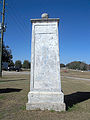 Concrete post next to U.S. Route 301. Says "Welcome to Sumter County" on the north side. Very likely this was the original path of the road back in the day.
 -
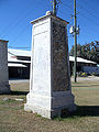 Concrete post next to U.S. Route 301. Says "Welcome to Sumter County" on the north side. Very likely this was the original path of the road back in the day.
 -
 Concrete post next to U.S. Route 301. Says "Welcome to Sumter County" on the north side. Very likely this was the original path of the road back in the day.
 -
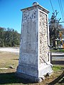 Concrete post next to U.S. Route 301. Says "Welcome to Sumter County" on the north side. Very likely this was the original path of the road back in the day.
 -
 Concrete posts next to U.S. Route 301. Says "Welcome to Sumter County" on the north side. Very likely this was the original path of the road back in the day.
 -
 Concrete posts next to U.S. Route 301. Says "Welcome to Sumter County" on the north side. Very likely this was the original path of the road back in the day.


-
 U.S. Route 301: Looking north into Marion County.
 -
 U.S. Route 301: Looking south into Sumter County.


-
 Fort Dade plaque
 -
 Looking from Hernando into Pasco County
 -
 Looking from Pasco County into Polk County


