User:Frettiebot/Galleries/ŠJů/2015/1
Načtené fotografie uživatele ŠJů za 1/2015
2[edit]
-
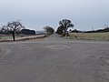
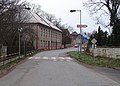
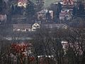
 Čeština: Vysoký Újezd-Kuchař a Mořina-Trněný Üjezd, okres Beroun. Silnice III/10122 od Kuchaře, křižovatka se silnicí III/1057.English: Vysoký Újezd-Kuchař and Mořina-Trněný Újezd, Beroun District, Central Bohemian Region, Czech Republic.
Camera location 

View all coordinates using: OpenStreetMap 
-
 Čeština: Vysoký Újezd-Kuchař a Mořina-Trněný Üjezd, okres Beroun. Silnice III/10122 od Kuchaře, křižovatka se silnicí III/1057.English: Vysoký Újezd-Kuchař and Mořina-Trněný Újezd, Beroun District, Central Bohemian Region, Czech Republic.
Camera location View all coordinates using: OpenStreetMap -
 Čeština: Vysoký Újezd-Kuchař a Mořina-Trněný Üjezd, okres Beroun. Silnice III/1157 od Roblína do Trněného Újezdu, křižovatka se silnicí III/10122.English: Vysoký Újezd-Kuchař and Mořina-Trněný Újezd, Beroun District, Central Bohemian Region, Czech Republic.
Camera location 
View all coordinates using: OpenStreetMap -
 Čeština: Vysoký Újezd-Kuchař a Mořina-Trněný Üjezd, okres Beroun. Silnice III/1157 od Roblína do Trněného Újezda, přístřešek bývalé zastávky.English: Vysoký Újezd-Kuchař and Mořina-Trněný Újezd, Beroun District, Central Bohemian Region, Czech Republic.
Camera location 
View all coordinates using: OpenStreetMap -
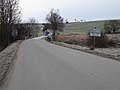
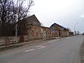
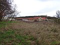
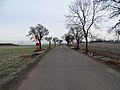 Čeština: Mořina-Trněný Üjezd, okres Beroun. Silnice III/1157 od Trněného Újezda do Roblína, autobusové zastávky.English: Mořina-Trněný Újezd, Beroun District, Central Bohemian Region, Czech Republic. A road III/1157 to Roblín, bus stops.
Camera location 
View all coordinates using: OpenStreetMap -
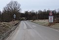
 Čeština: Mořina-Trněný Üjezd, okres Beroun. Silnice III/10122 od Kuchaře do Mořiny, značka zakazující používat vysílače v blízkosti lomu.English: Mořina-Trněný Újezd, Beroun District, Central Bohemian Region, Czech Republic. A road III/10122 to Mořina.
Camera location 
View all coordinates using: OpenStreetMap -
 English: Mořina-Trněný Újezd, Beroun District, Central Bohemian Region, Czech Republic. A road III/10122 to Mořina.
Camera location 
View all coordinates using: OpenStreetMap -
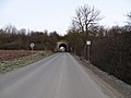
 Čeština: Mořina-Trněný Üjezd, okres Beroun. Silnice III/10122 od Kuchaře do Mořiny, most bývalé vlečky.English: Mořina-Trněný Újezd, Beroun District, Central Bohemian Region, Czech Republic. A road III/10122 to Mořina, a bridge of the former railway siding.
Camera location 
View all coordinates using: OpenStreetMap -
 Čeština: Mořina-Trněný Üjezd, okres Beroun. Silnice III/10122 od Kuchaře do Mořiny, most bývalé vlečky.English: Mořina-Trněný Újezd, Beroun District, Central Bohemian Region, Czech Republic. A road III/10122 to Mořina, a bridge of the former railway siding.
Camera location View all coordinates using: OpenStreetMap -
 Čeština: Mořina-Trněný Üjezd, okres Beroun. Silnice III/10122 z Mořiny do Kuchaře, most bývalé vlečky.English: Mořina-Trněný Újezd, Beroun District, Central Bohemian Region, Czech Republic. A road III/10122 from Mořina to Kuchař, a bridge of the former railway siding.
Camera location 
View all coordinates using: OpenStreetMap -
 Čeština: Mořina-Trněný Üjezd, okres Beroun. Silnice III/10122 z Mořiny do Kuchaře, most bývalé vlečky.English: Mořina-Trněný Újezd, Beroun District, Central Bohemian Region, Czech Republic. A road III/10122 from Mořina to Kuchař, a bridge of the former railway siding.
Camera location View all coordinates using: OpenStreetMap -
 Čeština: Mořina-Trněný Üjezd, okres Beroun. Silnice III/10122 z Mořiny do Kuchaře, most bývalé vlečky.English: Mořina-Trněný Újezd, Beroun District, Central Bohemian Region, Czech Republic. A road III/10122 from Mořina to Kuchař, a bridge of the former railway siding.
Camera location View all coordinates using: OpenStreetMap -
 Čeština: Mořina-Trněný Üjezd, okres Beroun. Silnice III/10122 z Kuchaře do Mořiny, vyústění silnice III/11610.English: Mořina-Trněný Újezd, Beroun District, Central Bohemian Region, Czech Republic. A road III/10122 from Kuchař to Mořina, intersection of the road III/11610.
Camera location View all coordinates using: OpenStreetMap -
 Čeština: Mořina-Trněný Üjezd, okres Beroun. Silnice III/11610 od Trněného Újezda, vyústění do silnice III/10122 a komunikace do lomu.English: Mořina-Trněný Újezd, Beroun District, Central Bohemian Region, Czech Republic. A road III/11610 from Trněný Újezd and intersection of the road III/10122.
Camera location 
View all coordinates using: OpenStreetMap -
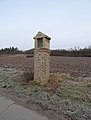
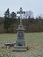
 Čeština: Mořina-Trněný Üjezd, okres Beroun. Silnice III/11610 od silnice III/10122 do Trněného Újezda, boží muka z roku 1911.English: Mořina-Trněný Újezd, Beroun District, Central Bohemian Region, Czech Republic. A road III/11610 from Trněný Újezd.
Camera location 
View all coordinates using: OpenStreetMap -
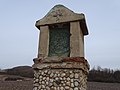
 Čeština: Mořina-Trněný Üjezd, okres Beroun. Silnice III/11610 od silnice III/10122 do Trněného Újezda, boží muka z roku 1911.English: Mořina-Trněný Újezd, Beroun District, Central Bohemian Region, Czech Republic. A road III/11610 from Trněný Újezd, a wayside shrine.
Camera location 
View all coordinates using: OpenStreetMap -
 English: Mořina-Trněný Újezd, Beroun District, Central Bohemian Region, Czech Republic. Information about Bohemian Carst Protected Landscape Area.
Camera location 
View all coordinates using: OpenStreetMap -
 English: Mořina-Trněný Újezd, Beroun District, Central Bohemian Region, Czech Republic. Road III/10122, bridge over the Karlík Creek.
Camera location View all coordinates using: OpenStreetMap -
 English: Mořina-Trněný Újezd, Beroun District, Central Bohemian Region, Czech Republic. Road III/10122, bridge over the Karlík Creek.
Camera location 
View all coordinates using: OpenStreetMap -
 Čeština: Mořina-Trněný Üjezd, okres Beroun. Silnice III/11515 do Karlického údolí, ze silnice III/10122.English: Mořina-Trněný Újezd, Beroun District, Central Bohemian Region, Czech Republic. Road III/11515, sen from the road III/10122.
Camera location View all coordinates using: OpenStreetMap -
 Čeština: Mořina a Trněný Üjezd, okres Beroun. Silnice III/10122, přes údolí Karlického potoka, odbočka III/11515 do Karlického údolí.English: Mořina and Trněný Újezd, Beroun District, Central Bohemian Region, Czech Republic. Road III/10122, valley of Karlík Creek.
Camera location View all coordinates using: OpenStreetMap -
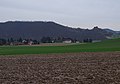
 Čeština: Mořina-Trněný Üjezd, okres Beroun. Lom, pohled ze silnice III/10122 přes údolí Karlického potoka.English: Mořina-Trněný Újezd, Beroun District, Central Bohemian Region, Czech Republic. A quarry, seen from the road III/10122 across the valley of Karlík Creek.
Camera location 
View all coordinates using: OpenStreetMap -
 English: Mořina, Beroun District, Central Bohemian Region, Czech Republic. Road III/10122. Hradec–Řeporyje (V412) and Řeporyje-Prosenice (V413) 400 kV power lines, combined on one pylon.
Camera location 
View all coordinates using: OpenStreetMap -
 English: Mořina, Beroun District, Central Bohemian Region, Czech Republic. Road III/10122. Hradec–Řeporyje (V412) and Řeporyje-Prosenice (V413) 400 kV power lines, combined on one pylon.
Camera location View all coordinates using: OpenStreetMap -

Camera location View all coordinates using: OpenStreetMap -

Camera location View all coordinates using: OpenStreetMap -
 English: Mořina, Beroun District, Central Bohemian Region, Czech Republic. Road III/10122, III/11613.
Camera location View all coordinates using: OpenStreetMap -
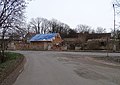
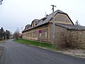
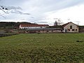
 English: Mořina, Beroun District, Central Bohemian Region, Czech Republic. Mořina 174, a restaurant.
Camera location 
View all coordinates using: OpenStreetMap -
 English: Mořina, Beroun District, Central Bohemian Region, Czech Republic. Mořina 174, a restaurant.
Camera location 
View all coordinates using: OpenStreetMap -
 English: Mořina, Beroun District, Central Bohemian Region, Czech Republic. Mořina 174, a restaurant.
Camera location 
View all coordinates using: OpenStreetMap

.jpg)


.jpg)
.jpg)
.jpg)
.jpg)
.jpg)


.jpg)

.jpg)


.jpg)
.jpg)
3[edit]
-
Camera location View all coordinates using: OpenStreetMap

4[edit]
-
 English: Mořina, Beroun District, Central Bohemian Region, Czech Republic. Mořina 167, 178, a column shrine.
Camera location View all coordinates using: OpenStreetMap -
 English: Mořina, Beroun District, Central Bohemian Region, Czech Republic. Mořina 210, 167, a column shrine.
Camera location View all coordinates using: OpenStreetMap -
 English: Mořina, Beroun District, Central Bohemian Region, Czech Republic. Road III/10122, a bus in the bus stop "Mořina, U Pěchotů".
Camera location View all coordinates using: OpenStreetMap -
 English: Mořina, Beroun District, Central Bohemian Region, Czech Republic. Road III/10122, a bus in the bus stop "Mořina, U Pěchotů".
Camera location 
View all coordinates using: OpenStreetMap -
 English: Mořina, Beroun District, Central Bohemian Region, Czech Republic. Road III/10122, bus stop "Mořina, U Pěchotů".
Camera location 
View all coordinates using: OpenStreetMap -
 English: Mořina, Beroun District, Central Bohemian Region, Czech Republic. Road III/10122, bus stop "Mořina, U Pěchotů".
Camera location 
View all coordinates using: OpenStreetMap -
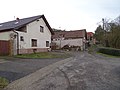
 English: Mořina, Beroun District, Central Bohemian Region, Czech Republic. Road III/10122, bus stop "Mořina, U Pěchotů", house no. 201 and 25.
Camera location View all coordinates using: OpenStreetMap -
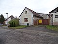
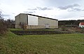
 English: Mořina, Beroun District, Central Bohemian Region, Czech Republic. Road III/10122, house no. 57, elementary school.
Camera location View all coordinates using: OpenStreetMap -
 English: Mořina, Beroun District, Central Bohemian Region, Czech Republic. Road III/11620, III/10122, house no. 57, elementary school.
Camera location View all coordinates using: OpenStreetMap -
 English: Mořina, Beroun District, Central Bohemian Region, Czech Republic. Road III/10122, house no. 57, elementary school.
Camera location 
View all coordinates using: OpenStreetMap -
 Čeština: Mořina, okres Beroun. Silnice III/11620, III/10122, čp. 57, základní škola, zmrzlinové auto Eismann.English: Mořina, Beroun District, Central Bohemian Region, Czech Republic. Road III/11620, III/10122, house no. 57, elementary school, Eismann ice cream van.
Camera location 
View all coordinates using: OpenStreetMap -
 English: Mořina, Beroun District, Central Bohemian Region, Czech Republic. Road III/10122, house no. 26.
Camera location View all coordinates using: OpenStreetMap -
 English: Mořina, Beroun District, Central Bohemian Region, Czech Republic. Road III/11619 a III/10122, house no. 26, 126.
Camera location View all coordinates using: OpenStreetMap -
 English: Mořina, Beroun District, Central Bohemian Region, Czech Republic. Road III/10122, house no. 26, 126 and school no. 57.
Camera location View all coordinates using: OpenStreetMap -
 Čeština: Mořina, okres Beroun. Silnice III/11621, směrovky na Karlštejn po silnici III/10122, čp. 125.English: Mořina, Beroun District, Central Bohemian Region, Czech Republic. Road III/11621, directional road signs to Karlštejn for the road III/10122, house no. 125.
Camera location View all coordinates using: OpenStreetMap -
 English: Mořina, Beroun District, Central Bohemian Region, Czech Republic. Road III/11619, a direct road to Karlštejn, closed for public.
Camera location 
View all coordinates using: OpenStreetMap -
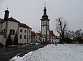
 English: Mořina, Beroun District, Central Bohemian Region, Czech Republic. Church of Saint Stanislaus.
 This is a photo of a cultural monument of the Czech Republic,
number:46660/2-354.
Památkový katalog · MIS · hledat obrázky · hledat seznamy · WikidataCamera location View all coordinates using: OpenStreetMap -
 English: Mořina, Beroun District, Central Bohemian Region, Czech Republic. Church of Saint Stanislaus.This is a photo of a cultural monument of the Czech Republic,
number:46660/2-354.
Památkový katalog · MIS · hledat obrázky · hledat seznamy · WikidataCamera location 
View all coordinates using: OpenStreetMap -
 English: Mořina, Beroun District, Central Bohemian Region, Czech Republic. Church of Saint Stanislaus.This is a photo of a cultural monument of the Czech Republic,
number:46660/2-354.
Památkový katalog · MIS · hledat obrázky · hledat seznamy · WikidataCamera location View all coordinates using: OpenStreetMap -
 English: Mořina, Beroun District, Central Bohemian Region, Czech Republic. Church of Saint Stanislaus.This is a photo of a cultural monument of the Czech Republic,
number:46660/2-354.
Památkový katalog · MIS · hledat obrázky · hledat seznamy · WikidataCamera location 
View all coordinates using: OpenStreetMap -
Camera location View all coordinates using: OpenStreetMap -
Camera location 
View all coordinates using: OpenStreetMap -
 English: Mořina, Beroun District, Central Bohemian Region, Czech Republic. A stream, houses no. 140, 166.
Camera location View all coordinates using: OpenStreetMap -
 English: Mořina, Beroun District, Central Bohemian Region, Czech Republic. A stream near the church.
Camera location View all coordinates using: OpenStreetMap -
 English: Mořina, Beroun District, Central Bohemian Region, Czech Republic. A niche shrine near house no. 140.
Camera location View all coordinates using: OpenStreetMap -
 English: Mořina, Beroun District, Central Bohemian Region, Czech Republic. A niche shrine near house no. 140.
Camera location View all coordinates using: OpenStreetMap -
 English: Mořina, Beroun District, Central Bohemian Region, Czech Republic. Road III/11620, houses no. 27, 137, 28.
Camera location View all coordinates using: OpenStreetMap -
 English: Mořina, Beroun District, Central Bohemian Region, Czech Republic. Road III/11620, houses no. 136, 28.This is a photo of a cultural monument of the Czech Republic,
number:37433/2-3357.
Památkový katalog · MIS · hledat obrázky · hledat seznamy · WikidataCamera location View all coordinates using: OpenStreetMap -
 English: Mořina, Beroun District, Central Bohemian Region, Czech Republic. Road III/11620, houses no. 28, 84, 29.This is a photo of a cultural monument of the Czech Republic,
number:37433/2-3357.
Památkový katalog · MIS · hledat obrázky · hledat seznamy · WikidataCamera location View all coordinates using: OpenStreetMap -
Camera location View all coordinates using: OpenStreetMap -
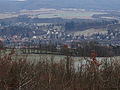
 English: Mořina, Beroun District, Central Bohemian Region, Czech Republic. South-eastern part, seen from the road III/10122.
Camera location View all coordinates using: OpenStreetMap -
 English: Mořina, Beroun District, Central Bohemian Region, Czech Republic. South-eastern part, seen from the road III/10122.
Camera location View all coordinates using: OpenStreetMap -

Camera location View all coordinates using: OpenStreetMap -
 English: Mořina, Beroun District, Central Bohemian Region, Czech Republic. A field and a hill, seen from the road III/10122.
Camera location View all coordinates using: OpenStreetMap -
 English: Mořina, Beroun District, Central Bohemian Region, Czech Republic. Seen from the road III/10122.
Camera location View all coordinates using: OpenStreetMap -
 English: Mořina and Mořinka, Beroun District, Central Bohemian Region, Czech Republic. Road III/10122.
Camera location View all coordinates using: OpenStreetMap -
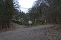
 English: Mořinka, Beroun District, Central Bohemian Region, Czech Republic. A board of the educational trail, Haknovec and Haknová hills.
Camera location View all coordinates using: OpenStreetMap -
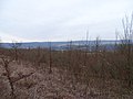
 English: Mořina, Beroun District, Central Bohemian Region, Czech Republic. A field near Haknovec hill.
Camera location View all coordinates using: OpenStreetMap -
 English: Karlštejn-Budňany, Beroun District, Central Bohemian Region, Czech Republic. A forest road at Haknová hill.
Camera location View all coordinates using: OpenStreetMap -
 English: Karlštejn-Budňany, Beroun District, Central Bohemian Region, Czech Republic. A forest road and houses under Haknová hill.
Camera location View all coordinates using: OpenStreetMap -
 English: Hlásná Třebaň and Karlštejn-Budňany, Beroun District, Central Bohemian Region, Czech Republic. A forest road and houses under Haknová hill.
Camera location View all coordinates using: OpenStreetMap -
 English: Karlštejn-Budňany, Beroun District, Central Bohemian Region, Czech Republic. A guide post under Plešivec and Haknová hills.
Camera location 
View all coordinates using: OpenStreetMap -
 Čeština: Karlštejn-Budňany, okres Beroun. Směrovka u chat mezi kopci Plešivec a Haknová, dům čp. 150.English: Karlštejn-Budňany, Beroun District, Central Bohemian Region, Czech Republic. A guidepost under Plešivec and Haknová hills, house no. 150.
Camera location 
View all coordinates using: OpenStreetMap -
 Čeština: Karlštejn-Budňany, okres Beroun. Rozcestí u chat mezi kopci Plešivec a Haknová, dům čp. 150.English: Karlštejn-Budňany, Beroun District, Central Bohemian Region, Czech Republic. A crossroad under Plešivec and Haknová hills, house no. 150.
Camera location View all coordinates using: OpenStreetMap -
 English: Karlštejn-Budňany, Beroun District, Central Bohemian Region, Czech Republic. A forest road under Plešivec hill.
Camera location View all coordinates using: OpenStreetMap -
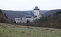
 Čeština: Karlštejn-Budňany, okres Beroun. Výhled na hrad Karlštejn ze sedla mezi Plešivcem a Haknovou.English: Karlštejn-Budňany, Beroun District, Central Bohemian Region, Czech Republic. A view of Karlštejn Castle from the saddle between Plešivec and Haknová hills.
Camera location View all coordinates using: OpenStreetMap -
 English: Karlštejn-Budňany, Beroun District, Central Bohemian Region, Czech Republic. A cross in the saddle between Plešivec and Haknová hills.
Camera location View all coordinates using: OpenStreetMap -
 English: Hlásná Třebaň, Beroun District, Central Bohemian Region, Czech Republic. A view of Hřebeny across Berounka valley.
Camera location View all coordinates using: OpenStreetMap -
 Čeština: Hlásná Třebaň, okres Beroun. Pohled z NPR Karlštejn přes údolí Berounky na Voškov a Hřebeny.English: Hlásná Třebaň, Beroun District, Central Bohemian Region, Czech Republic. A view of Hřebeny and Voškov across Berounka valley.
Camera location View all coordinates using: OpenStreetMap -
Camera location View all coordinates using: OpenStreetMap -

Camera location View all coordinates using: OpenStreetMap -
Camera location View all coordinates using: OpenStreetMap -

Camera location View all coordinates using: OpenStreetMap -
 English: Hlásná Třebaň, Beroun District, Central Bohemian Region, Czech Republic. A memorable tree with a chapel.
Camera location View all coordinates using: OpenStreetMap -
 English: Hlásná Třebaň, Beroun District, Central Bohemian Region, Czech Republic. A memorable tree with a chapel.
Camera location View all coordinates using: OpenStreetMap -
 English: Hlásná Třebaň, Beroun District, Central Bohemian Region, Czech Republic. A memorable tree with a chapel.
Camera location View all coordinates using: OpenStreetMap -
 English: Hlásná Třebaň, Beroun District, Central Bohemian Region, Czech Republic. A memorable tree with a chapel.
Camera location View all coordinates using: OpenStreetMap -
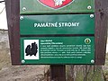
 Čeština: Hlásná Třebaň, okres Beroun. Památná lípa s kapličkou. Tabule naučné stezky Památné stromy Karlštejnska, zastavení 13.English: Hlásná Třebaň, Beroun District, Central Bohemian Region, Czech Republic. A memorable tree with a chapel.
Camera location View all coordinates using: OpenStreetMap -
 Čeština: Hlásná Třebaň, okres Beroun. V popředí dům Na Klouzavce čp. 348, 347, v pozadí za řekou kopec Voškov a na obzoru Hřebeny.English: Hlásná Třebaň, Beroun District, Central Bohemian Region, Czech Republic. Na Klouzavce 348, 347, Voškov hill, Hřebeny Mountains.
Camera location View all coordinates using: OpenStreetMap -
 English: Hlásná Třebaň, Beroun District, Central Bohemian Region, Czech Republic. K Zámku, Voškov hill.
Camera location View all coordinates using: OpenStreetMap -
 English: Hlásná Třebaň, Beroun District, Central Bohemian Region, Czech Republic. Mořinská street, a way from the north.
Camera location View all coordinates using: OpenStreetMap -
 English: Hlásná Třebaň, Beroun District, Central Bohemian Region, Czech Republic. Mořinská street, road III/10122.
Camera location View all coordinates using: OpenStreetMap -
 English: Hlásná Třebaň, Beroun District, Central Bohemian Region, Czech Republic. Mořinská street, road III/10122, a bridge near V Rokli street.
Camera location View all coordinates using: OpenStreetMap -
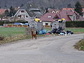 English: Hlásná Třebaň, Beroun District, Central Bohemian Region, Czech Republic. Pod Svahem street, seen from Mořinská to Ječná street, trash bins and a dog.
Camera location View all coordinates using: OpenStreetMap -
 English: Hlásná Třebaň, Beroun District, Central Bohemian Region, Czech Republic. Mořinská street, road III/10122.
Camera location View all coordinates using: OpenStreetMap -
 English: Hlásná Třebaň, Beroun District, Central Bohemian Region, Czech Republic. Mořinská street, road III/10122, V Rokli street.
Camera location View all coordinates using: OpenStreetMap -
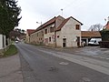
 English: Hlásná Třebaň, Beroun District, Central Bohemian Region, Czech Republic. Mořinská street, road III/10122, house no. 28.
Camera location View all coordinates using: OpenStreetMap -
 English: Hlásná Třebaň, Beroun District, Central Bohemian Region, Czech Republic. Mořinská street, road III/10122, house no. 27.
Camera location View all coordinates using: OpenStreetMap -
 English: Hlásná Třebaň, Beroun District, Central Bohemian Region, Czech Republic. Mořinská street, road III/10122, house no. 29, 27, 28.
Camera location View all coordinates using: OpenStreetMap -
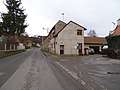
 English: Hlásná Třebaň, Beroun District, Central Bohemian Region, Czech Republic. Karlštejnská 57, Mořinská street, Česká hospoda.
Camera location View all coordinates using: OpenStreetMap -
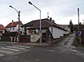
 Čeština: Hlásná Třebaň, okres Beroun. U Kapličky, Karlštejnská, silnice II/116, domy čp. 26, 25, 24, 23.English: Hlásná Třebaň, Beroun District, Central Bohemian Region, Czech Republic. U Kapličky and Karlštejnská street.
Camera location View all coordinates using: OpenStreetMap -

Camera location View all coordinates using: OpenStreetMap -
 English: Hlásná Třebaň, Beroun District, Central Bohemian Region, Czech Republic. U Kapličky 32, 68.
Camera location 
View all coordinates using: OpenStreetMap -

Camera location View all coordinates using: OpenStreetMap -
 English: Hlásná Třebaň, Beroun District, Central Bohemian Region, Czech Republic. U Kapličky 68, 32.
Camera location View all coordinates using: OpenStreetMap -

Camera location View all coordinates using: OpenStreetMap -
 English: Hlásná Třebaň, Beroun District, Central Bohemian Region, Czech Republic. U Kapličky street.
Camera location View all coordinates using: OpenStreetMap -
 English: Hlásná Třebaň, Beroun District, Central Bohemian Region, Czech Republic. U Kapličky street, a chapel, houses no. 23, 32.This is a photo of a cultural monument of the Czech Republic,
number:14681/2-3341.
Památkový katalog · MIS · hledat obrázky · hledat seznamy · WikidataCamera location View all coordinates using: OpenStreetMap -
 English: Hlásná Třebaň, Beroun District, Central Bohemian Region, Czech Republic. U Kapličky street, a chapel.This is a photo of a cultural monument of the Czech Republic,
number:14681/2-3341.
Památkový katalog · MIS · hledat obrázky · hledat seznamy · WikidataCamera location View all coordinates using: OpenStreetMap -
 English: Hlásná Třebaň, Beroun District, Central Bohemian Region, Czech Republic. U Kapličky street, a fingerpost in front of the chapel.
Camera location View all coordinates using: OpenStreetMap -
 English: Hlásná Třebaň, Beroun District, Central Bohemian Region, Czech Republic. U Kapličky street, houses no. 34, 1, 58.
Camera location View all coordinates using: OpenStreetMap -
 English: Hlásná Třebaň, Beroun District, Central Bohemian Region, Czech Republic. U Kapličky street, houses no. 18, 115, 65, 70.
Camera location View all coordinates using: OpenStreetMap -

Camera location View all coordinates using: OpenStreetMap -
 English: Hlásná Třebaň, Beroun District, Central Bohemian Region, Czech Republic. U Kapličky 63, 1, 58.
Camera location View all coordinates using: OpenStreetMap -

Camera location View all coordinates using: OpenStreetMap -
 English: Hlásná Třebaň and Zadní Třebaň, Beroun District, Central Bohemian Region, Czech Republic. A footbridge over the Berounka river.
Camera location View all coordinates using: OpenStreetMap -
 English: Hlásná Třebaň and Zadní Třebaň, Beroun District, Central Bohemian Region, Czech Republic. A footbridge over the Berounka river.
Camera location View all coordinates using: OpenStreetMap -
 English: Hlásná Třebaň and Zadní Třebaň, Beroun District, Central Bohemian Region, Czech Republic. A footbridge over the Berounka river.
Camera location View all coordinates using: OpenStreetMap -
 English: Zadní Třebaň and Hlásná Třebaň, Beroun District, Central Bohemian Region, Czech Republic. A footbridge over the Berounka river.
Camera location View all coordinates using: OpenStreetMap -
 Čeština: Zadní Třebaň a Hlásná Třebaň-Rovina, okres Beroun. Pohled z lávky přes Brounku po proudu směr jez, ostrov a Rovina.English: Zadní Třebaň and Hlásná Třebaň-Rovina, Beroun District, Central Bohemian Region, Czech Republic. Berounka river.
Camera location View all coordinates using: OpenStreetMap -
 English: Zadní Třebaň, Beroun District, Central Bohemian Region, Czech Republic. Train station Zadní Třebaň.
Camera location View all coordinates using: OpenStreetMap -
 English: Zadní Třebaň, Beroun District, Central Bohemian Region, Czech Republic. Train station Zadní Třebaň.
Camera location 
View all coordinates using: OpenStreetMap -
 English: Zadní Třebaň, Beroun District, Central Bohemian Region, Czech Republic. Train station Zadní Třebaň.
Camera location View all coordinates using: OpenStreetMap -
 English: Prague-New Town, Czech Republic. Hlavní nádraží station, public transport information office.
Camera location View all coordinates using: OpenStreetMap -
 English: Prague-New Town, Czech Republic. Hlavní nádraží station, public transport information office.
Camera location View all coordinates using: OpenStreetMap -

Camera location View all coordinates using: OpenStreetMap -
 This is a photo of a cultural monument of the Czech Republic,
number:105432.
Památkový katalog · MIS · hledat obrázky · hledat seznamy · WikidataCamera location View all coordinates using: OpenStreetMap -
 This is a photo of a cultural monument of the Czech Republic,
number:105432.
Památkový katalog · MIS · hledat obrázky · hledat seznamy · WikidataCamera location View all coordinates using: OpenStreetMap -
 This is a photo of a cultural monument of the Czech Republic,
number:105432.
Památkový katalog · MIS · hledat obrázky · hledat seznamy · WikidataCamera location View all coordinates using: OpenStreetMap -
 This is a photo of a cultural monument of the Czech Republic,
number:105432.
Památkový katalog · MIS · hledat obrázky · hledat seznamy · WikidataCamera location View all coordinates using: OpenStreetMap -

Camera location View all coordinates using: OpenStreetMap -
 This is a photo of a cultural monument of the Czech Republic,
number:41150/1-1915.
Památkový katalog · MIS · hledat obrázky · hledat seznamy · WikidataCamera location View all coordinates using: OpenStreetMap -
 This is a photo of a cultural monument of the Czech Republic,
number:41150/1-1915.
Památkový katalog · MIS · hledat obrázky · hledat seznamy · WikidataCamera location View all coordinates using: OpenStreetMap -
 This is a photo of a cultural monument of the Czech Republic,
number:41150/1-1915.
Památkový katalog · MIS · hledat obrázky · hledat seznamy · WikidataCamera location View all coordinates using: OpenStreetMap -
 This is a photo of a cultural monument of the Czech Republic,
number:41150/1-1915.
Památkový katalog · MIS · hledat obrázky · hledat seznamy · WikidataCamera location View all coordinates using: OpenStreetMap


.jpg)


.jpg)


.jpg)


.jpg)


.jpg)
.jpg)


.jpg)
.jpg)


.jpg)


.jpg)


.jpg)


.jpg)
.jpg)

.jpg)
.jpg)
.jpg)

.jpg)


5[edit]
-
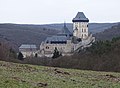
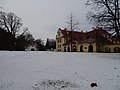
 English: Prague-Zbraslav, Czech Republic. Zbraslav Monastery, the castle tower, church of Saint James the Greater on the left.This is a photo of a cultural monument of the Czech Republic,
number:41150/1-1915.
Památkový katalog · MIS · hledat obrázky · hledat seznamy · WikidataCamera location View all coordinates using: OpenStreetMap -
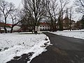
 English: Prague-Zbraslav, Czech Republic. Zbraslav Monastery, an alley between the convent and the church of Saint James the Greater on the left.This is a photo of a cultural monument of the Czech Republic,
number:41150/1-1915.
Památkový katalog · MIS · hledat obrázky · hledat seznamy · WikidataCamera location View all coordinates using: OpenStreetMap -
 This is a photo of a cultural monument of the Czech Republic,
number:41150/1-1915.
Památkový katalog · MIS · hledat obrázky · hledat seznamy · WikidataCamera location View all coordinates using: OpenStreetMap -
 This is a photo of a cultural monument of the Czech Republic,
number:41150/1-1915.
Památkový katalog · MIS · hledat obrázky · hledat seznamy · WikidataCamera location View all coordinates using: OpenStreetMap -
 This is a photo of a cultural monument of the Czech Republic,
number:41150/1-1915.
Památkový katalog · MIS · hledat obrázky · hledat seznamy · WikidataCamera location View all coordinates using: OpenStreetMap -
 This is a photo of a cultural monument of the Czech Republic,
number:41150/1-1915.
Památkový katalog · MIS · hledat obrázky · hledat seznamy · WikidataCamera location View all coordinates using: OpenStreetMap -
 This is a photo of a cultural monument of the Czech Republic,
number:41150/1-1915.
Památkový katalog · MIS · hledat obrázky · hledat seznamy · WikidataCamera location View all coordinates using: OpenStreetMap -
 This is a photo of a cultural monument of the Czech Republic,
number:41150/1-1915.
Památkový katalog · MIS · hledat obrázky · hledat seznamy · WikidataThis is a photo of a cultural monument of the Czech Republic,
number:41163/1-1925.
Památkový katalog · MIS · hledat obrázky · hledat seznamy · WikidataCamera location View all coordinates using: OpenStreetMap -
 This is a photo of a cultural monument of the Czech Republic,
number:41163/1-1925.
Památkový katalog · MIS · hledat obrázky · hledat seznamy · WikidataCamera location View all coordinates using: OpenStreetMap -
 This is a photo of a cultural monument of the Czech Republic,
number:41150/1-1915.
Památkový katalog · MIS · hledat obrázky · hledat seznamy · WikidataCamera location View all coordinates using: OpenStreetMap -
 This is a photo of a cultural monument of the Czech Republic,
number:41150/1-1915.
Památkový katalog · MIS · hledat obrázky · hledat seznamy · WikidataCamera location View all coordinates using: OpenStreetMap -
 This is a photo of a cultural monument of the Czech Republic,
number:41150/1-1915.
Památkový katalog · MIS · hledat obrázky · hledat seznamy · WikidataCamera location View all coordinates using: OpenStreetMap -
 This is a photo of a cultural monument of the Czech Republic,
number:41150/1-1915.
Památkový katalog · MIS · hledat obrázky · hledat seznamy · WikidataCamera location View all coordinates using: OpenStreetMap -
 This is a photo of a cultural monument of the Czech Republic,
number:41150/1-1915.
Památkový katalog · MIS · hledat obrázky · hledat seznamy · WikidataCamera location View all coordinates using: OpenStreetMap -
 English: Velké Přílepy, Prague-West District, Central Bohemian Region, Czech Republic. Pražská 129, a cultural centre.
Camera location View all coordinates using: OpenStreetMap -
 English: Velké Přílepy, Prague-West District, Central Bohemian Region, Czech Republic. Pražská 129, a cultural centre.
Camera location View all coordinates using: OpenStreetMap -
 English: Velké Přílepy, Prague-West District, Central Bohemian Region, Czech Republic. Pražská 45, a restaurant.
Camera location View all coordinates using: OpenStreetMap -

Camera location View all coordinates using: OpenStreetMap -
 English: Velké Přílepy, Prague-West District, Central Bohemian Region, Czech Republic. Kladenská, Pražská and Roztocká street.
Camera location View all coordinates using: OpenStreetMap -
 English: Velké Přílepy, Prague-West District, Central Bohemian Region, Czech Republic. Kladenská street, bus stop Velké Přílepy.
Camera location View all coordinates using: OpenStreetMap -
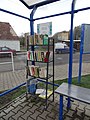 Čeština: Velké Přílepy, okres Praha-západ. Kladenská, autobusová zastávka Velké Přílepy, knihovnička.English: Velké Přílepy, Prague-West District, Central Bohemian Region, Czech Republic. Kladenská street, bus stop Velké Přílepy, a library.
Camera location View all coordinates using: OpenStreetMap -
 English: Velké Přílepy, Prague-West District, Central Bohemian Region, Czech Republic. Kladenská street, bus stop Velké Přílepy.
Camera location View all coordinates using: OpenStreetMap -
 English: Velké Přílepy, Prague-West District, Central Bohemian Region, Czech Republic. Kladenská street.
Camera location View all coordinates using: OpenStreetMap -
 English: Velké Přílepy, Prague-West District, Central Bohemian Region, Czech Republic. Kladenská 215, a shop.
Camera location View all coordinates using: OpenStreetMap -
 English: Velké Přílepy, Prague-West District, Central Bohemian Region, Czech Republic. Kladenská 215, a shop.
Camera location View all coordinates using: OpenStreetMap -
 English: Velké Přílepy, Prague-West District, Central Bohemian Region, Czech Republic. Kladenská 256, Příčná.
Camera location View all coordinates using: OpenStreetMap -
 English: Velké Přílepy, Prague-West District, Central Bohemian Region, Czech Republic. Kladenská 18, a barn.
Camera location View all coordinates using: OpenStreetMap -
 English: Velké Přílepy, Prague-West District, Central Bohemian Region, Czech Republic. Kladenská 18.
Camera location View all coordinates using: OpenStreetMap -
 Čeština: Velké Přílepy, okres Praha-západ. Kladenská, restaurace Špejchar, bývalý špejchar usedlosti čp. 18.English: Velké Přílepy, Prague-West District, Central Bohemian Region, Czech Republic. Kladenská, Restaurant Špejchar, former granary of the house no. 18.This is a photo of a cultural monument of the Czech Republic,
number:23099/2-2338.
Památkový katalog · MIS · hledat obrázky · hledat seznamy · WikidataCamera location View all coordinates using: OpenStreetMap -
 Čeština: Velké Přílepy, okres Praha-západ. Kladenská, restaurace Špejchar, bývalý špejchar usedlosti čp. 18, z Polní ulice.English: Velké Přílepy, Prague-West District, Central Bohemian Region, Czech Republic. Kladenská, Restaurant Špejchar, former granary of the house no. 18.This is a photo of a cultural monument of the Czech Republic,
number:23099/2-2338.
Památkový katalog · MIS · hledat obrázky · hledat seznamy · WikidataCamera location View all coordinates using: OpenStreetMap -
 English: Velké Přílepy, Prague-West District, Central Bohemian Region, Czech Republic. Kladenská 20.
Camera location View all coordinates using: OpenStreetMap -
 English: Velké Přílepy, Prague-West District, Central Bohemian Region, Czech Republic. Kladenská 20.
Camera location View all coordinates using: OpenStreetMap -
 Čeština: Velké Přílepy, okres Praha-západ. Kladenská, informační tabule mikroregionu o obci Velké Přílepy, umístěná u Špejcharu.English: Velké Přílepy, Prague-West District, Central Bohemian Region, Czech Republic. Kladenská, an infoboard.
Camera location View all coordinates using: OpenStreetMap -
 English: Velké Přílepy, Prague-West District, Central Bohemian Region, Czech Republic. Kladenská 23, Polní.
Camera location View all coordinates using: OpenStreetMap -
 English: Velké Přílepy, Prague-West District, Central Bohemian Region, Czech Republic. Kladenská 292.
Camera location View all coordinates using: OpenStreetMap -
 English: Velké Přílepy, Prague-West District, Central Bohemian Region, Czech Republic. Kladenská 292.
Camera location View all coordinates using: OpenStreetMap -
 English: Velké Přílepy, Prague-West District, Central Bohemian Region, Czech Republic. Kladenská 23, from Polní street.
Camera location View all coordinates using: OpenStreetMap -
 English: Velké Přílepy, Prague-West District, Central Bohemian Region, Czech Republic. Polní street, from Kladenská street.
Camera location View all coordinates using: OpenStreetMap -
 English: Velké Přílepy, Prague-West District, Central Bohemian Region, Czech Republic. Kladenská street.
Camera location View all coordinates using: OpenStreetMap -
Camera location View all coordinates using: OpenStreetMap -
 English: Velké Přílepy, Prague-West District, Central Bohemian Region, Czech Republic. Kladenská 17.
Camera location View all coordinates using: OpenStreetMap -
 English: Velké Přílepy, Prague-West District, Central Bohemian Region, Czech Republic. Kladenská 17, 292.
Camera location View all coordinates using: OpenStreetMap -
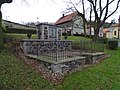 English: Velké Přílepy, Prague-West District, Central Bohemian Region, Czech Republic. Kladenská, WWI memorial.
Camera location View all coordinates using: OpenStreetMap -
 English: Velké Přílepy, Prague-West District, Central Bohemian Region, Czech Republic. Kladenská, WWII memorial.
Camera location View all coordinates using: OpenStreetMap -
 English: Velké Přílepy, Prague-West District, Central Bohemian Region, Czech Republic. Kladenská, WWII memorial.
Camera location View all coordinates using: OpenStreetMap -
 English: Velké Přílepy, Prague-West District, Central Bohemian Region, Czech Republic. Kladenská street, under the chapel.
Camera location View all coordinates using: OpenStreetMap -
 English: Velké Přílepy, Prague-West District, Central Bohemian Region, Czech Republic. Kladenská street, a bus.
Camera location View all coordinates using: OpenStreetMap -
 English: Velké Přílepy, Prague-West District, Central Bohemian Region, Czech Republic. Kladenská street, chapel of Saint Godehard.This is a photo of a cultural monument of the Czech Republic,
number:103639.
Památkový katalog · MIS · hledat obrázky · hledat seznamy · WikidataCamera location View all coordinates using: OpenStreetMap -
 Čeština: Velké Přílepy, okres Praha-západ. Kladenská, Ke Křížku, kaple svatého Gotharda, dům čp. 28.English: Velké Přílepy, Prague-West District, Central Bohemian Region, Czech Republic. Kladenská street, chapel of Saint Godehard, house no. 28.This is a photo of a cultural monument of the Czech Republic,
number:103639.
Památkový katalog · MIS · hledat obrázky · hledat seznamy · WikidataCamera location View all coordinates using: OpenStreetMap -
 English: Velké Přílepy, Prague-West District, Central Bohemian Region, Czech Republic. Kladenská 51, 6, 8, 9.
Camera location View all coordinates using: OpenStreetMap -
 English: Velké Přílepy, Prague-West District, Central Bohemian Region, Czech Republic. Kladenská 40, 5, 51, 6.
Camera location View all coordinates using: OpenStreetMap -
 English: Velké Přílepy, Prague-West District, Central Bohemian Region, Czech Republic. Kladenská 8, 9.
Camera location View all coordinates using: OpenStreetMap -
 English: Velké Přílepy, Prague-West District, Central Bohemian Region, Czech Republic. Kladenská 10.
Camera location View all coordinates using: OpenStreetMap -
 English: Velké Přílepy, Prague-West District, Central Bohemian Region, Czech Republic. Kladenská 12, 9.
Camera location View all coordinates using: OpenStreetMap -
 English: Velké Přílepy, Prague-West District, Central Bohemian Region, Czech Republic. Kladenská 11, 10, 9.
Camera location View all coordinates using: OpenStreetMap -
 English: Velké Přílepy, Prague-West District, Central Bohemian Region, Czech Republic. Kladenská 11, 10, 9, 33.
Camera location View all coordinates using: OpenStreetMap -
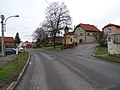
 Čeština: Velké Přílepy, okres Praha-západ. Silnice III/2406 do Noutonic, křižovatka s ulicemi Boženy Němcové a Halasova.English: Velké Přílepy, Prague-West District, Central Bohemian Region, Czech Republic. Road III/2406 to Noutonice, intersection of Boženy Němcové and Halasova street.
Camera location View all coordinates using: OpenStreetMap -

Camera location View all coordinates using: OpenStreetMap -
 Čeština: Velké Přílepy, okres Praha-západ. Pohled ze silnice III/00710 přes silnici III/2406 na Noutonice, Na Vršcích, vlevo kostel Narození sv. Jana Křtitele.English: A view of Noutonice from Velké Přílepy, Prague-West District, Central Bohemian Region, Czech Republic.
Camera location View all coordinates using: OpenStreetMap -
 Čeština: Noutonice, okres Praha-západ. Pohled ze silnice III/00710 (Velké Přílepy) přes silnici III/2406 na kostel Narození sv. Jana Křtitele.English: A view of the church of the Nativity of Saint John the Baptist in Noutonice from Velké Přílepy, Prague-West District, Central Bohemian Region, Czech Republic.
Camera location View all coordinates using: OpenStreetMap -
 English: Velké Přílepy, Prague-West District, Central Bohemian Region, Czech Republic. Statenická street, buildings.
Camera location View all coordinates using: OpenStreetMap -
 English: Velké Přílepy, Prague-West District, Central Bohemian Region, Czech Republic. Statenická street, buildings.
Camera location View all coordinates using: OpenStreetMap -
 English: Velké Přílepy, Prague-West District, Central Bohemian Region, Czech Republic. Statenická street, buildings.
Camera location View all coordinates using: OpenStreetMap -
 English: Velké Přílepy, Prague-West District, Central Bohemian Region, Czech Republic. Statenická street, buildings.
Camera location View all coordinates using: OpenStreetMap


.jpg)


.jpg)


.jpg)


.jpg)

.jpg)


.jpg)


.jpg)


.jpg)


.jpg)


.jpg)
.jpg)


.jpg)

.jpg)
6[edit]
-
 English: Velké Přílepy, Prague-West District, Central Bohemian Region, Czech Republic. Statenická 733, buildings.
Camera location View all coordinates using: OpenStreetMap -
 English: Velké Přílepy, Prague-West District, Central Bohemian Region, Czech Republic. Statenická 770.
Camera location View all coordinates using: OpenStreetMap -
 English: Velké Přílepy, Prague-West District, Central Bohemian Region, Czech Republic. Statenická street, buildings.
Camera location View all coordinates using: OpenStreetMap -
 English: Velké Přílepy, Prague-West District, Central Bohemian Region, Czech Republic. A path to the cross.
Camera location View all coordinates using: OpenStreetMap -
 English: Velké Přílepy, Prague-West District, Central Bohemian Region, Czech Republic. A path to the cross.
Camera location View all coordinates using: OpenStreetMap -
 English: Velké Přílepy, Prague-West District, Central Bohemian Region, Czech Republic. A path to the cross.
Camera location View all coordinates using: OpenStreetMap -
 English: Velké Přílepy, Prague-West District, Central Bohemian Region, Czech Republic. A path to the cross.
Camera location View all coordinates using: OpenStreetMap -
 English: Velké Přílepy, Prague-West District, Central Bohemian Region, Czech Republic. A path to the cross, an infoboard.
Camera location View all coordinates using: OpenStreetMap -
 English: Velké Přílepy, Prague-West District, Central Bohemian Region, Czech Republic. A path to the cross, at the foothill.
Camera location View all coordinates using: OpenStreetMap -
 English: Velké Přílepy, Prague-West District, Central Bohemian Region, Czech Republic. A path to the cross, near the summit.
Camera location View all coordinates using: OpenStreetMap -
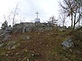 English: Velké Přílepy, Prague-West District, Central Bohemian Region, Czech Republic. U Křížku, a summit cross.
Camera location View all coordinates using: OpenStreetMap -
 English: Velké Přílepy, Prague-West District, Central Bohemian Region, Czech Republic. U Křížku, a summit cross.
Camera location View all coordinates using: OpenStreetMap -
 English: Velké Přílepy, Prague-West District, Central Bohemian Region, Czech Republic. Ke Křížku 32, 26.
Camera location View all coordinates using: OpenStreetMap -
 English: Velké Přílepy, Prague-West District, Central Bohemian Region, Czech Republic. Ke Křížku 32, 26.
Camera location View all coordinates using: OpenStreetMap -
 English: Velké Přílepy, Prague-West District, Central Bohemian Region, Czech Republic. Ke Křížku 32, a view of the village.
Camera location View all coordinates using: OpenStreetMap -
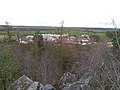 English: Velké Přílepy, Prague-West District, Central Bohemian Region, Czech Republic. A view from the cross hill, buildings in Statenická street.
Camera location View all coordinates using: OpenStreetMap -
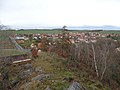 English: Velké Přílepy, Prague-West District, Central Bohemian Region, Czech Republic. A view from the cross hill.
Camera location View all coordinates using: OpenStreetMap -

-
 Čeština: Noutonice, výhled z kopce U Křížku, Velké Přílepy, okres Praha-západ. Kostel Narození sv. Jana Křtitele.English: Noutonice, seen from the cross hill in Velké Přílepy, Prague-West District, Central Bohemian Region, Czech Republic. Church of the Nativity of Saint John the Baptist.
Camera location View all coordinates using: OpenStreetMap -
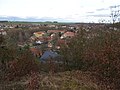 English: Velké Přílepy, Prague-West District, Central Bohemian Region, Czech Republic. A view from the cross hill.
Camera location View all coordinates using: OpenStreetMap -
 English: Velké Přílepy, Prague-West District, Central Bohemian Region, Czech Republic. A view from the cross hill.
Camera location View all coordinates using: OpenStreetMap -
 English: Velké Přílepy, Prague-West District, Central Bohemian Region, Czech Republic. A view from the cross hill, a quarry.
Camera location View all coordinates using: OpenStreetMap -
 English: Velké Přílepy, Prague-West District, Central Bohemian Region, Czech Republic. A view from the cross hill.
Camera location View all coordinates using: OpenStreetMap -
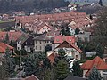 English: Velké Přílepy, Prague-West District, Central Bohemian Region, Czech Republic. A view from the cross hill.
Camera location View all coordinates using: OpenStreetMap -
 English: Velké Přílepy, Prague-West District, Central Bohemian Region, Czech Republic. A view from the cross hill.
Camera location View all coordinates using: OpenStreetMap -
 English: Velké Přílepy, Prague-West District, Central Bohemian Region, Czech Republic. A view from the cross hill.
Camera location View all coordinates using: OpenStreetMap -
 English: Velké Přílepy, Prague-West District, Central Bohemian Region, Czech Republic. A view from the cross hill.
Camera location View all coordinates using: OpenStreetMap -
 English: Velké Přílepy, Prague-West District, Central Bohemian Region, Czech Republic. A view from the cross hill.
Camera location View all coordinates using: OpenStreetMap -
 English: Velké Přílepy, Prague-West District, Central Bohemian Region, Czech Republic. u Křížku, the north summit.
Camera location View all coordinates using: OpenStreetMap -
 English: Velké Přílepy, Prague-West District, Central Bohemian Region, Czech Republic. A view from the cross hill.
Camera location View all coordinates using: OpenStreetMap -
 English: Velké Přílepy, Prague-West District, Central Bohemian Region, Czech Republic. A view from the cross hill.
Camera location View all coordinates using: OpenStreetMap -
 English: Velké Přílepy, Prague-West District, Central Bohemian Region, Czech Republic. A view from the cross hill to Svrkyně.
Camera location View all coordinates using: OpenStreetMap -
 English: Velké Přílepy, Prague-West District, Central Bohemian Region, Czech Republic. A view from the cross hill.
Camera location View all coordinates using: OpenStreetMap -
 Čeština: Výhled z kopce U Křížku, Velké Přílepy, okres Praha-západ. Směr Řež, objekty na snímku neidentifikovány.English: A view from the cross hill in Velké Přílepy, Prague-West District, Central Bohemian Region, Czech Republic. Direction to Řež - unidentified buildings.
Camera location View all coordinates using: OpenStreetMap -
 Čeština: Výhled z kopce U Křížku, Velké Přílepy, okres Praha-západ. Komín teplárny Praha-Třeboradice. Vesnice v popředí neidentifikována, asi Brnky.English: A view from the cross hill in Velké Přílepy, Prague-West District, Central Bohemian Region, Czech Republic. Praha-Třeboradice heating plant chimney. The village unidentified.
Camera location View all coordinates using: OpenStreetMap -
 English: A view from the cross hill in Velké Přílepy, Prague-West District, Central Bohemian Region, Czech Republic. Noutonice.
Camera location View all coordinates using: OpenStreetMap -
 English: A view from the cross hill in Velké Přílepy, Prague-West District, Central Bohemian Region, Czech Republic. Noutonice, store buildings at the train station.
Camera location View all coordinates using: OpenStreetMap -
 English: A view from the cross hill in Velké Přílepy, Prague-West District, Central Bohemian Region, Czech Republic. Noutonice, store buildings at the train station.
Camera location View all coordinates using: OpenStreetMap -
 Čeština: Výhled z kopce U Křížku, Velké Přílepy, okres Praha-západ. Elektrárna Kladno, vzdálenost 12,5 km, v popředí sklad u Noutonického nádraží.English: A view from the cross hill in Velké Přílepy, Prague-West District, Central Bohemian Region, Czech Republic. Kladno Power Plant.
Camera location View all coordinates using: OpenStreetMap -
 Čeština: Výhled z kopce U Křížku, Velké Přílepy, okres Praha-západ. Elektrárna Kladno, vzdálenost 12,5 km.English: A view from the cross hill in Velké Přílepy, Prague-West District, Central Bohemian Region, Czech Republic. Kladno Power Plant.
Camera location View all coordinates using: OpenStreetMap -
 Čeština: Výhled z kopce U Křížku, Velké Přílepy, okres Praha-západ. Větrné turbíny u Pcher, vzdálenost 13 km, pohled přes Noutonice a Dřetovice.English: A view from the cross hill in Velké Přílepy, Prague-West District, Central Bohemian Region, Czech Republic. Wind turbines near Pchery, seen across Noutonice and Dřetovice village.
Camera location View all coordinates using: OpenStreetMap -
 Čeština: Výhled z kopce U Křížku, Velké Přílepy, okres Praha-západ. Větrné turbíny u Pcher, vzdálenost 13 km, pohled přes Dřetovice.English: A view from the cross hill in Velké Přílepy, Prague-West District, Central Bohemian Region, Czech Republic. Wind turbines near Pchery, seen across Dřetovice village.
Camera location View all coordinates using: OpenStreetMap


.jpg)

.jpg)

.jpg)


.jpg)

.jpg)


.jpg)


.jpg)


.jpg)


.jpg)


7[edit]
-
 English: Velké Přílepy, Prague-West District, Central Bohemian Region, Czech Republic. Ke Křížku 42.
Camera location View all coordinates using: OpenStreetMap -
 English: Velké Přílepy, Prague-West District, Central Bohemian Region, Czech Republic. Ke Křížku street.
Camera location View all coordinates using: OpenStreetMap -
 English: Velké Přílepy, Prague-West District, Central Bohemian Region, Czech Republic. Krátká street, from Ke Křížku street.
Camera location View all coordinates using: OpenStreetMap -
 English: Velké Přílepy, Prague-West District, Central Bohemian Region, Czech Republic. Ke Křížku street, chapel of Saint Godehard.
Camera location View all coordinates using: OpenStreetMap -
 English: Velké Přílepy, Prague-West District, Central Bohemian Region, Czech Republic. Ke Křížku street, chapel of Saint Godehard.
Camera location View all coordinates using: OpenStreetMap -
 English: Velké Přílepy, Prague-West District, Central Bohemian Region, Czech Republic. Ke Křížku 26.
Camera location View all coordinates using: OpenStreetMap -
 English: Velké Přílepy, Prague-West District, Central Bohemian Region, Czech Republic. Ke Křížku 43.
Camera location View all coordinates using: OpenStreetMap -
 English: Velké Přílepy, Prague-West District, Central Bohemian Region, Czech Republic. Ke Křížku 93.
Camera location View all coordinates using: OpenStreetMap -
 English: Velké Přílepy, Prague-West District, Central Bohemian Region, Czech Republic. Pod Hajnicí street, from Polní street.
Camera location View all coordinates using: OpenStreetMap -
 English: Velké Přílepy, Prague-West District, Central Bohemian Region, Czech Republic. Polní 22, from Krátká street to Kladenská street.
Camera location View all coordinates using: OpenStreetMap -
 English: Velké Přílepy, Prague-West District, Central Bohemian Region, Czech Republic. Polní street, intersection of Krátká and Pod Hajnicí street.
Camera location View all coordinates using: OpenStreetMap -
 English: Velké Přílepy, Prague-West District, Central Bohemian Region, Czech Republic. Pod Hajnicí street, an excavator.
Camera location View all coordinates using: OpenStreetMap -
 English: Velké Přílepy, Prague-West District, Central Bohemian Region, Czech Republic. Pod Hajnicí street.
Camera location View all coordinates using: OpenStreetMap -
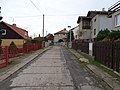 English: Velké Přílepy, Prague-West District, Central Bohemian Region, Czech Republic. Pod Hajnicí street.
Camera location View all coordinates using: OpenStreetMap -
 English: Velké Přílepy, Prague-West District, Central Bohemian Region, Czech Republic. Pod Hajnicí street.
Camera location View all coordinates using: OpenStreetMap -
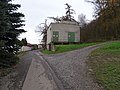 English: Velké Přílepy, Prague-West District, Central Bohemian Region, Czech Republic. Pod Lesem, an electrical station.
Camera location View all coordinates using: OpenStreetMap -
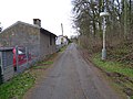 English: Velké Přílepy, Prague-West District, Central Bohemian Region, Czech Republic. Pod Lesem street.
Camera location View all coordinates using: OpenStreetMap -
 English: Velké Přílepy, Prague-West District, Central Bohemian Region, Czech Republic. Pod Lesem street.
Camera location View all coordinates using: OpenStreetMap -
 English: Velké Přílepy, Prague-West District, Central Bohemian Region, Czech Republic. Pod Lesem 299, 60.
Camera location View all coordinates using: OpenStreetMap -
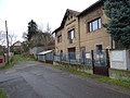 English: Velké Přílepy, Prague-West District, Central Bohemian Region, Czech Republic. Pod Lesem 60.
Camera location View all coordinates using: OpenStreetMap -
 English: Velké Přílepy, Prague-West District, Central Bohemian Region, Czech Republic. Pražská 55, 53.
Camera location View all coordinates using: OpenStreetMap -
 English: Velké Přílepy, Prague-West District, Central Bohemian Region, Czech Republic. Pražská street, Nová street.
Camera location View all coordinates using: OpenStreetMap -
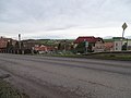 English: Velké Přílepy, Prague-West District, Central Bohemian Region, Czech Republic. Pražská street, a view to Svahová street.
Camera location View all coordinates using: OpenStreetMap -
 English: Velké Přílepy, Prague-West District, Central Bohemian Region, Czech Republic. Pražská street, bus stop Velké Přílepy, Pražská.
Camera location View all coordinates using: OpenStreetMap -
 English: Velké Přílepy, Prague-West District, Central Bohemian Region, Czech Republic. Pražská street, bus stop Velké Přílepy, Pražská.
Camera location View all coordinates using: OpenStreetMap -
 English: Velké Přílepy, Prague-West District, Central Bohemian Region, Czech Republic. Pražská street, bus stop Velké Přílepy, Pražská.
Camera location View all coordinates using: OpenStreetMap -
 English: Velké Přílepy, Prague-West District, Central Bohemian Region, Czech Republic. Pražská street.
Camera location View all coordinates using: OpenStreetMap -
 English: Velké Přílepy, Prague-West District, Central Bohemian Region, Czech Republic. Pražská street.
Camera location View all coordinates using: OpenStreetMap -
 English: Velké Přílepy, Prague-West District, Central Bohemian Region, Czech Republic. Pražská street.
Camera location View all coordinates using: OpenStreetMap


.jpg)


.jpg)


.jpg)
8[edit]
-

Camera location View all coordinates using: OpenStreetMap -

Camera location View all coordinates using: OpenStreetMap -
 English: Velké Přílepy, Prague-West District, Central Bohemian Region, Czech Republic. Svahová 152, 148.
Camera location View all coordinates using: OpenStreetMap -
 English: Velké Přílepy, Prague-West District, Central Bohemian Region, Czech Republic. Svahová 152, 148.
Camera location View all coordinates using: OpenStreetMap -
 English: Velké Přílepy, Prague-West District, Central Bohemian Region, Czech Republic. Svahová 152, a sundial.
Camera location View all coordinates using: OpenStreetMap -
 English: Velké Přílepy, Prague-West District, Central Bohemian Region, Czech Republic. Svahová 152, a sundial.
Camera location View all coordinates using: OpenStreetMap -

Camera location View all coordinates using: OpenStreetMap -

Camera location View all coordinates using: OpenStreetMap -

Camera location View all coordinates using: OpenStreetMap -

Camera location View all coordinates using: OpenStreetMap -
 English: Velké Přílepy, Prague-West District, Central Bohemian Region, Czech Republic. Roztocká 138, 121.
Camera location View all coordinates using: OpenStreetMap -
 English: Velké Přílepy, Prague-West District, Central Bohemian Region, Czech Republic. Roztocká 138, 121.
Camera location View all coordinates using: OpenStreetMap -
 English: Velké Přílepy, Prague-West District, Central Bohemian Region, Czech Republic. Roztocká street, houses in Hógerova and Peškova street.
Camera location View all coordinates using: OpenStreetMap -
 English: Velké Přílepy, Prague-West District, Central Bohemian Region, Czech Republic. Peškova street, from Roztocká street.
Camera location View all coordinates using: OpenStreetMap -
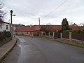 English: Velké Přílepy, Prague-West District, Central Bohemian Region, Czech Republic. Roztocká 163, 137, 138.
Camera location View all coordinates using: OpenStreetMap -
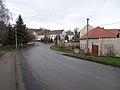 English: Velké Přílepy, Prague-West District, Central Bohemian Region, Czech Republic. Roztocká 138, 121.
Camera location View all coordinates using: OpenStreetMap -
 English: Velké Přílepy, Prague-West District, Central Bohemian Region, Czech Republic. Roztocká 121.
Camera location View all coordinates using: OpenStreetMap -
 English: Velké Přílepy, Prague-West District, Central Bohemian Region, Czech Republic. Roztocká 134.
Camera location View all coordinates using: OpenStreetMap -
 English: Velké Přílepy, Prague-West District, Central Bohemian Region, Czech Republic. Roztocká 133 and a water work.
Camera location View all coordinates using: OpenStreetMap -
 English: Velké Přílepy, Prague-West District, Central Bohemian Region, Czech Republic. Roztocká 133.
Camera location View all coordinates using: OpenStreetMap -
 English: Velké Přílepy, Prague-West District, Central Bohemian Region, Czech Republic. Roztocká 134, 133, a water well and water works.
Camera location View all coordinates using: OpenStreetMap -
 English: Velké Přílepy, Prague-West District, Central Bohemian Region, Czech Republic. Roztocká 138, 134.
Camera location View all coordinates using: OpenStreetMap -
 English: Velké Přílepy, Prague-West District, Central Bohemian Region, Czech Republic. Roztocká street, a little pond.
Camera location View all coordinates using: OpenStreetMap -
 English: Velké Přílepy, Prague-West District, Central Bohemian Region, Czech Republic. Roztocká 47, 120, a chapel.
Camera location View all coordinates using: OpenStreetMap -
 English: Velké Přílepy, Prague-West District, Central Bohemian Region, Czech Republic. Roztocká street, a chapel.
Camera location View all coordinates using: OpenStreetMap -
 English: Velké Přílepy, Prague-West District, Central Bohemian Region, Czech Republic. Roztocká street, a chapel.
Camera location View all coordinates using: OpenStreetMap -
 English: Velké Přílepy, Prague-West District, Central Bohemian Region, Czech Republic. Roztocká 121.
Camera location View all coordinates using: OpenStreetMap -
 English: Velké Přílepy, Prague-West District, Central Bohemian Region, Czech Republic. Roztocká street, from the chapel to no. 134.
Camera location View all coordinates using: OpenStreetMap -
 Čeština: Velké Přílepy, okres Praha-západ. Roztocká, park na návsi, čp. 133, směr Pražská a les Hajnice.English: Velké Přílepy, Prague-West District, Central Bohemian Region, Czech Republic. Roztocká street, a park, house no. 133, a view to Pražská street.
Camera location View all coordinates using: OpenStreetMap -
 English: Velké Přílepy, Prague-West District, Central Bohemian Region, Czech Republic. Roztocká 122, 157, 129.
Camera location View all coordinates using: OpenStreetMap -
 English: Velké Přílepy, Prague-West District, Central Bohemian Region, Czech Republic. Roztocká 121, Podmoráňská.
Camera location View all coordinates using: OpenStreetMap -
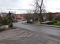 English: Velké Přílepy, Prague-West District, Central Bohemian Region, Czech Republic. Roztocká street, from Podmoráňská street.
Camera location View all coordinates using: OpenStreetMap -
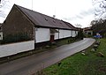 English: Velké Přílepy, Prague-West District, Central Bohemian Region, Czech Republic. Podmoráňská street, Roztocká 121.
Camera location View all coordinates using: OpenStreetMap -
 English: Velké Přílepy, Prague-West District, Central Bohemian Region, Czech Republic. Roztocká 153, 123, 157, 122.
Camera location View all coordinates using: OpenStreetMap -

Camera location View all coordinates using: OpenStreetMap -
 English: Velké Přílepy, Prague-West District, Central Bohemian Region, Czech Republic. Pražská street.
Camera location View all coordinates using: OpenStreetMap -
 English: Velké Přílepy, Prague-West District, Central Bohemian Region, Czech Republic. Pražská street.
Camera location View all coordinates using: OpenStreetMap -
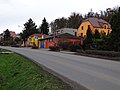 English: Velké Přílepy, Prague-West District, Central Bohemian Region, Czech Republic. Pražská street.
Camera location View all coordinates using: OpenStreetMap -
 English: Velké Přílepy, Prague-West District, Central Bohemian Region, Czech Republic. Pražská street.
Camera location View all coordinates using: OpenStreetMap -
 English: Velké Přílepy, Prague-West District, Central Bohemian Region, Czech Republic. Pražská 45, 129.
Camera location View all coordinates using: OpenStreetMap -
 English: Velké Přílepy, Prague-West District, Central Bohemian Region, Czech Republic. Pražská 45, 129.
Camera location View all coordinates using: OpenStreetMap -
 English: Velké Přílepy, Prague-West District, Central Bohemian Region, Czech Republic. Pražská street, Podmoráň Creek.
Camera location View all coordinates using: OpenStreetMap -
 Čeština: Velké Přílepy, okres Praha-západ. Roztocká, paneláky čp. 217, 218 a 219, domky čp. 153, 123, 127, Skalka.English: Velké Přílepy, Prague-West District, Central Bohemian Region, Czech Republic. Roztocká 217, 218, 219, 153, 123, 127, Skalka hill.
Camera location View all coordinates using: OpenStreetMap -
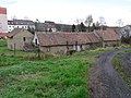 English: Velké Přílepy, Prague-West District, Central Bohemian Region, Czech Republic. Roztocká 133, from Pražská street.
Camera location View all coordinates using: OpenStreetMap -
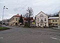 English: Velké Přílepy, Prague-West District, Central Bohemian Region, Czech Republic. Pražská 41, 162, 130, Na Skalce 149.
Camera location View all coordinates using: OpenStreetMap -
 English: Velké Přílepy, Prague-West District, Central Bohemian Region, Czech Republic. Pražská 41, 162, 130, Na Skalce 149.
Camera location View all coordinates using: OpenStreetMap -
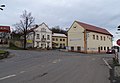 English: Velké Přílepy, Prague-West District, Central Bohemian Region, Czech Republic. Pražská 41, 162, 129.
Camera location View all coordinates using: OpenStreetMap -
 English: Velké Přílepy, Prague-West District, Central Bohemian Region, Czech Republic. Pražská 41, 162, 129.
Camera location View all coordinates using: OpenStreetMap -
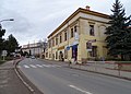
Camera location View all coordinates using: OpenStreetMap -

Camera location View all coordinates using: OpenStreetMap -
 English: Velké Přílepy, Prague-West District, Central Bohemian Region, Czech Republic. Pražská street, a road sign.
Camera location View all coordinates using: OpenStreetMap -
 English: Velké Přílepy, Prague-West District, Central Bohemian Region, Czech Republic. Pražská and Na Skalce street.
Camera location View all coordinates using: OpenStreetMap -
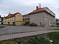 English: Velké Přílepy, Prague-West District, Central Bohemian Region, Czech Republic. Pražská 48, 38.
Camera location View all coordinates using: OpenStreetMap -
 English: Velké Přílepy, Prague-West District, Central Bohemian Region, Czech Republic. Pražská 82, from Svrkyňská street.
Camera location View all coordinates using: OpenStreetMap -
 English: Velké Přílepy, Prague-West District, Central Bohemian Region, Czech Republic. Na Parcelách street, from Svrkyňská street.
Camera location View all coordinates using: OpenStreetMap -
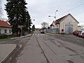 English: Velké Přílepy, Prague-West District, Central Bohemian Region, Czech Republic. Svrkyňská street, from Pražská street.
Camera location View all coordinates using: OpenStreetMap -

-
-

Camera location View all coordinates using: OpenStreetMap -
 Čeština: Velké Přílepy, okres Praha-západ. Svrkyňská čp. 63, bývalá ubytovna a stravovna, nyní pošta, od Pražské.English: Velké Přílepy, Prague-West District, Central Bohemian Region, Czech Republic. Svrkyňská 63.
Camera location View all coordinates using: OpenStreetMap -
 Čeština: Velké Přílepy, okres Praha-západ. Pražská, zatáčka u Svrkyňské, trafo a dům Na Parcelách čp. 267.English: Velké Přílepy, Prague-West District, Central Bohemian Region, Czech Republic. Pražská street.
Camera location View all coordinates using: OpenStreetMap -
 English: Velké Přílepy, Prague-West District, Central Bohemian Region, Czech Republic. Pražská 38, elementary school.
Camera location View all coordinates using: OpenStreetMap -
 English: Velké Přílepy, Prague-West District, Central Bohemian Region, Czech Republic. Pražská 52, 38.
Camera location View all coordinates using: OpenStreetMap -
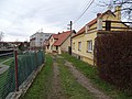 Čeština: Velké Přílepy, okres Praha-západ. Na Skalce čp. 139, 164, v pozadí základní škola Pražská čp. 38.English: Velké Přílepy, Prague-West District, Central Bohemian Region, Czech Republic. Na Skalce 139, 164, Pražská 138.
Camera location View all coordinates using: OpenStreetMap -
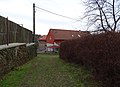 English: Velké Přílepy, Prague-West District, Central Bohemian Region, Czech Republic. Na Skalce 149.
Camera location View all coordinates using: OpenStreetMap -
 English: Velké Přílepy, Prague-West District, Central Bohemian Region, Czech Republic. U Rybníčku 274, a prison.
Camera location View all coordinates using: OpenStreetMap -
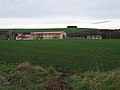 English: Velké Přílepy, Prague-West District, Central Bohemian Region, Czech Republic. U Rybníčku 274, a prison.
Camera location View all coordinates using: OpenStreetMap -
 English: Velké Přílepy, Prague-West District, Central Bohemian Region, Czech Republic. A view from Skalka hill to Podmoráňská street, Slavíčkova street, H-system clony and Úholičky village.
Camera location View all coordinates using: OpenStreetMap -
 Čeština: Velké Přílepy, okres Praha-západ. Pohled od Skalky, v popředí Podmoráňská ulice a hala čp. 799, v pozadí kolonie H-System.English: Velké Přílepy, Prague-West District, Central Bohemian Region, Czech Republic. Podmoráňská street, hall no. 799 and H-System colony.
Camera location View all coordinates using: OpenStreetMap -
 English: Velké Přílepy, Prague-West District, Central Bohemian Region, Czech Republic. Sportovní street.
Camera location View all coordinates using: OpenStreetMap -
 Čeština: Velké Přílepy, okres Praha-západ. Pohled ze Skalky, Podmoráňská, statek čp. 121, centrum starých Přílep a nová výstavba.English: Velké Přílepy, Prague-West District, Central Bohemian Region, Czech Republic. A view from Skalka.
Camera location View all coordinates using: OpenStreetMap -
 Čeština: Velké Přílepy, okres Praha-západ. Pohled ze Skalky, bývalá náves u Roztocké ulice a les Hajnice.English: Velké Přílepy, Prague-West District, Central Bohemian Region, Czech Republic. A view from Skalka.
Camera location View all coordinates using: OpenStreetMap


.jpg)


.jpg)


.jpg)
.jpg)

.jpg)


.jpg)

.jpg)
.jpg)
.jpg)


.jpg)


.jpg)


9[edit]
-
 Čeština: Velké Přílepy, okres Praha-západ. Pohled ze Skalky, statek čp. 121, Roztocká ulice a nová výstavba.English: Velké Přílepy, Prague-West District, Central Bohemian Region, Czech Republic. A view from Skalka.
Camera location View all coordinates using: OpenStreetMap -

Camera location View all coordinates using: OpenStreetMap -
 English: Velké Přílepy, Prague-West District, Central Bohemian Region, Czech Republic. A view from Skalka.
Camera location View all coordinates using: OpenStreetMap -
 English: Velké Přílepy, Prague-West District, Central Bohemian Region, Czech Republic. A view from Skalka, Roztocká 133.
Camera location View all coordinates using: OpenStreetMap -
 English: Velké Přílepy, Prague-West District, Central Bohemian Region, Czech Republic. A view from Skalka, Roztocká street.
Camera location View all coordinates using: OpenStreetMap -
 English: Velké Přílepy, Prague-West District, Central Bohemian Region, Czech Republic. A view from Skalka, Roztocká street.
Camera location View all coordinates using: OpenStreetMap -
 Čeština: Velké Přílepy, okres Praha-západ. Pohled ze Skalky, statek Roztocká čp. 134, Svahová a Nová ulice atd..English: Velké Přílepy, Prague-West District, Central Bohemian Region, Czech Republic. A view from Skalka, farm no. 134, Svahová and Nová street etc.
Camera location View all coordinates using: OpenStreetMap -
 English: Velké Přílepy, Prague-West District, Central Bohemian Region, Czech Republic. A view from Skalka, Kamýk.
Camera location View all coordinates using: OpenStreetMap -
 English: Velké Přílepy, Prague-West District, Central Bohemian Region, Czech Republic. A view from Skalka, Kamýk.
Camera location View all coordinates using: OpenStreetMap


.jpg)


11[edit]
-

Camera location View all coordinates using: OpenStreetMap -

Camera location View all coordinates using: OpenStreetMap -

Camera location View all coordinates using: OpenStreetMap -

Camera location View all coordinates using: OpenStreetMap -
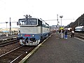 Čeština: Beroun, okres Beroun. Nádraží Beroun, posunující postrk zvláštního spěšného vlaku Křivoklátský expres.English: Beroun, Beroun District, Central Bohemian Region, Czech Republic. Train station Beroun, a locomotive of Křivoklát Expres.
Camera location View all coordinates using: OpenStreetMap -
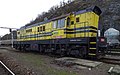 English: Beroun, Beroun District, Central Bohemian Region, Czech Republic. Train station Beroun, a locomotive of KDS company.
Camera location View all coordinates using: OpenStreetMap -
 Čeština: Beroun, okres Beroun. Nádraží Beroun, posunující postrk zvláštního spěšného vlaku Křivoklátský expres.English: Beroun, Beroun District, Central Bohemian Region, Czech Republic. Train station Beroun, a locomotive of Křivoklát Expres.
Camera location View all coordinates using: OpenStreetMap -
 English: Beroun, Beroun District, Central Bohemian Region, Czech Republic. Train station Beroun, Křivoklát Expres.
Camera location View all coordinates using: OpenStreetMap -
 English: Beroun, Beroun District, Central Bohemian Region, Czech Republic. Train station Beroun, Křivoklát Expres.
Camera location View all coordinates using: OpenStreetMap -
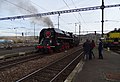 English: Beroun, Beroun District, Central Bohemian Region, Czech Republic. Train station Beroun, Křivoklát Expres.
Camera location View all coordinates using: OpenStreetMap -
 English: Beroun, Beroun District, Central Bohemian Region, Czech Republic. Train station Beroun, Křivoklát Expres.
Camera location View all coordinates using: OpenStreetMap -
 English: Beroun, Beroun District, Central Bohemian Region, Czech Republic. Train station Beroun, Křivoklát Expres.
Camera location View all coordinates using: OpenStreetMap -
 English: Beroun, Beroun District, Central Bohemian Region, Czech Republic. Train station Beroun, Křivoklát Expres.
Camera location View all coordinates using: OpenStreetMap -
 English: Beroun, Beroun District, Central Bohemian Region, Czech Republic. Train station Beroun, Křivoklát Expres.
Camera location View all coordinates using: OpenStreetMap -
 English: Beroun, Beroun District, Central Bohemian Region, Czech Republic. Train station Beroun, Křivoklát Expres.
Camera location View all coordinates using: OpenStreetMap -
 English: Beroun, Beroun District, Central Bohemian Region, Czech Republic. Train station Beroun, Křivoklát Expres.
Camera location View all coordinates using: OpenStreetMap -
 English: Beroun, Beroun District, Central Bohemian Region, Czech Republic. Train station Beroun, Křivoklát Expres.
Camera location View all coordinates using: OpenStreetMap -
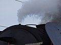 English: Beroun, Beroun District, Central Bohemian Region, Czech Republic. Train station Beroun, Křivoklát Expres.
Camera location View all coordinates using: OpenStreetMap -
 English: Beroun, Beroun District, Central Bohemian Region, Czech Republic. Train station Beroun, Křivoklát Expres.
Camera location View all coordinates using: OpenStreetMap -
 English: Beroun, Beroun District, Central Bohemian Region, Czech Republic. Train station Beroun, Křivoklát Expres.
Camera location View all coordinates using: OpenStreetMap -
 English: Beroun, Beroun District, Central Bohemian Region, Czech Republic. Train station Beroun, Křivoklát Expres.
Camera location View all coordinates using: OpenStreetMap -
 English: Beroun, Beroun District, Central Bohemian Region, Czech Republic. Train station Beroun, Křivoklát Expres.
Camera location View all coordinates using: OpenStreetMap -
 English: Beroun, Beroun District, Central Bohemian Region, Czech Republic. Train station Beroun, Křivoklát Expres.
Camera location View all coordinates using: OpenStreetMap -
 English: Beroun, Beroun District, Central Bohemian Region, Czech Republic. Train station Beroun, Křivoklát Expres.
Camera location View all coordinates using: OpenStreetMap -
 Čeština: Beroun, okres Beroun. Nádraží Beroun, zvláštní spěšný vlak Křivoklátský expres. Cedule Doprovodný vůz na dveřích vozu WLAB (80 54 89 - 00 237 - 0).English: Beroun, Beroun District, Central Bohemian Region, Czech Republic. Train station Beroun, Křivoklát Expres.
Camera location View all coordinates using: OpenStreetMap -
 Čeština: Beroun, okres Beroun. Nádraží Beroun, zvláštní spěšný vlak Křivoklátský expres. Tabulky u dveří vozu WLAB (80 54 89 - 00 237 - 0).English: Beroun, Beroun District, Central Bohemian Region, Czech Republic. Train station Beroun, Křivoklát Expres.
Camera location View all coordinates using: OpenStreetMap -
 Čeština: Beroun, okres Beroun. Nádraží Beroun, zvláštní spěšný vlak Křivoklátský expres. Vůz WLAB (80 54 89 - 00 237 - 0).English: Beroun, Beroun District, Central Bohemian Region, Czech Republic. Train station Beroun, Křivoklát Expres.
Camera location View all coordinates using: OpenStreetMap -
 Čeština: Beroun, okres Beroun. Nádraží Beroun, zvláštní spěšný vlak Křivoklátský expres. Vůz Ae1-4729.English: Beroun, Beroun District, Central Bohemian Region, Czech Republic. Train station Beroun, Křivoklát Expres.
Camera location View all coordinates using: OpenStreetMap -
 Čeština: Beroun, okres Beroun. Nádraží Beroun, zvláštní spěšný vlak Křivoklátský expres. Vůz Ae1-4729.English: Beroun, Beroun District, Central Bohemian Region, Czech Republic. Train station Beroun, Křivoklát Expres.
Camera location View all coordinates using: OpenStreetMap -

-
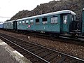 Čeština: Beroun, okres Beroun. Nádraží Beroun, zvláštní spěšný vlak Křivoklátský expres. Vůz č. 1, Be3-5337.English: Beroun, Beroun District, Central Bohemian Region, Czech Republic. Train station Beroun, Křivoklát Expres.
Camera location View all coordinates using: OpenStreetMap -

-
 Čeština: Beroun, okres Beroun. Nádraží Beroun, zvláštní spěšný vlak Křivoklátský expres. Vůz č. 2, Be3-3979.English: Beroun, Beroun District, Central Bohemian Region, Czech Republic. Train station Beroun, Křivoklát Expres.
Camera location View all coordinates using: OpenStreetMap -
 Čeština: Beroun, okres Beroun. Nádraží Beroun, zvláštní spěšný vlak Křivoklátský expres. Vůz č. 3, Ce3-3231.English: Beroun, Beroun District, Central Bohemian Region, Czech Republic. Train station Beroun, Křivoklát Expres.
Camera location View all coordinates using: OpenStreetMap -
 Čeština: Beroun, okres Beroun. Nádraží Beroun, zvláštní spěšný vlak Křivoklátský expres. Vůz č. 3, Ce3-3231.English: Beroun, Beroun District, Central Bohemian Region, Czech Republic. Train station Beroun, Křivoklát Expres.
Camera location View all coordinates using: OpenStreetMap -
 Čeština: Beroun, okres Beroun. Nádraží Beroun, zvláštní spěšný vlak Křivoklátský expres. Vůz č. 4, Ce3-3479.English: Beroun, Beroun District, Central Bohemian Region, Czech Republic. Train station Beroun, Křivoklát Expres.
Camera location View all coordinates using: OpenStreetMap -
 Čeština: Beroun, okres Beroun. Nádraží Beroun, zvláštní spěšný vlak Křivoklátský expres. Vůz č. 5, Ce3-3766.English: Beroun, Beroun District, Central Bohemian Region, Czech Republic. Train station Beroun, Křivoklát Expres.
Camera location View all coordinates using: OpenStreetMap -

-
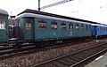 Čeština: Beroun, okres Beroun. Nádraží Beroun, zvláštní spěšný vlak Křivoklátský expres. Nečíslovaný vůz za vozem č. 6, Ce3-3606.English: Beroun, Beroun District, Central Bohemian Region, Czech Republic. Train station Beroun, Křivoklát Expres.
Camera location View all coordinates using: OpenStreetMap -
 Čeština: Beroun, okres Beroun. Nádraží Beroun, zvláštní spěšný vlak Křivoklátský expres. Vůz BUFET mezi vozy č. 6 a 7, Baak.English: Beroun, Beroun District, Central Bohemian Region, Czech Republic. Train station Beroun, Křivoklát Expres.
Camera location View all coordinates using: OpenStreetMap -
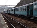 Čeština: Beroun, okres Beroun. Nádraží Beroun, zvláštní spěšný vlak Křivoklátský expres. Vozy č. 6 – 1.English: Beroun, Beroun District, Central Bohemian Region, Czech Republic. Train station Beroun, Křivoklát Expres.
Camera location View all coordinates using: OpenStreetMap -
 Čeština: Beroun, okres Beroun. Nádraží Beroun, zvláštní spěšný vlak Křivoklátský expres. Vůz č. 7, Bai 4-3819.English: Beroun, Beroun District, Central Bohemian Region, Czech Republic. Train station Beroun, Křivoklát Expres.
Camera location View all coordinates using: OpenStreetMap -
 Čeština: Beroun, okres Beroun. Nádraží Beroun, zvláštní spěšný vlak Křivoklátský expres. Vůz č. 8, Bai 4-3838.English: Beroun, Beroun District, Central Bohemian Region, Czech Republic. Train station Beroun, Křivoklát Expres.
Camera location View all coordinates using: OpenStreetMap -
Čeština: Beroun, okres Beroun. Nádraží Beroun, zvláštní spěšný vlak Křivoklátský expres. Vůz č. 7, Bai 4-3819.English: Beroun, Beroun District, Central Bohemian Region, Czech Republic. Train station Beroun, Křivoklát Expres.
Camera location View all coordinates using: OpenStreetMap -
 Čeština: Beroun, okres Beroun. Nádraží Beroun, zvláštní spěšný vlak Křivoklátský expres. Nečíslovaný vůz za bufetovým vozem, před vozem č. 7, Bai 4-3239.English: Beroun, Beroun District, Central Bohemian Region, Czech Republic. Train station Beroun, Křivoklát Expres.
Camera location View all coordinates using: OpenStreetMap -
 English: Beroun, Beroun District, Central Bohemian Region, Czech Republic. Train station Beroun, Křivoklát Expres.
Camera location View all coordinates using: OpenStreetMap -
 Čeština: Beroun, okres Beroun. Nádraží Beroun, zvláštní spěšný vlak Křivoklátský expres. Vůz č. 9, Bai 4-3129.English: Beroun, Beroun District, Central Bohemian Region, Czech Republic. Train station Beroun, Křivoklát Expres.
Camera location View all coordinates using: OpenStreetMap -
 Čeština: Beroun, okres Beroun. Nádraží Beroun, zvláštní spěšný vlak Křivoklátský expres. Vůz č. 9, Bai 4-3129, označení vlaku.English: Beroun, Beroun District, Central Bohemian Region, Czech Republic. Train station Beroun, Křivoklát Expres.
Camera location View all coordinates using: OpenStreetMap -
 Čeština: Beroun, okres Beroun. Nádraží Beroun, zvláštní spěšný vlak Křivoklátský expres. Vůz č. 10, Bai 4-3708.English: Beroun, Beroun District, Central Bohemian Region, Czech Republic. Train station Beroun, Křivoklát Expres.
Camera location View all coordinates using: OpenStreetMap -
 Čeština: Beroun, okres Beroun. Nádraží Beroun, zvláštní spěšný vlak Křivoklátský expres. Vůz č. 10, Bai 4-3708.English: Beroun, Beroun District, Central Bohemian Region, Czech Republic. Train station Beroun, Křivoklát Expres.
Camera location View all coordinates using: OpenStreetMap -
 Čeština: Beroun, okres Beroun. Nádraží Beroun, zvláštní spěšný vlak Křivoklátský expres. Konec vlaku s postrkem.English: Beroun, Beroun District, Central Bohemian Region, Czech Republic. Train station Beroun, Křivoklát Expres.
Camera location View all coordinates using: OpenStreetMap -
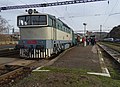 Čeština: Beroun, okres Beroun. Nádraží Beroun, zvláštní spěšný vlak Křivoklátský expres. Konec vlaku s postrkem.English: Beroun, Beroun District, Central Bohemian Region, Czech Republic. Train station Beroun, Křivoklát Expres.
Camera location View all coordinates using: OpenStreetMap -
 Čeština: Beroun, okres Beroun. Nádraží Beroun, zvláštní spěšný vlak Křivoklátský expres. Dveře vozu Bai (pravděpodobně vůz č. 8, Bai 4-3838).English: Beroun, Beroun District, Central Bohemian Region, Czech Republic. Train station Beroun, Křivoklát Expres.
Camera location View all coordinates using: OpenStreetMap -
 Čeština: Beroun, okres Beroun. Nádraží Beroun, zvláštní spěšný vlak Křivoklátský expres. Dveře vozů Bai.English: Beroun, Beroun District, Central Bohemian Region, Czech Republic. Train station Beroun, Křivoklát Expres.
Camera location View all coordinates using: OpenStreetMap -
 Čeština: Beroun, okres Beroun. Nádraží Beroun, zvláštní spěšný vlak Křivoklátský expres. Dveře vozů Baak a Ce3.English: Beroun, Beroun District, Central Bohemian Region, Czech Republic. Train station Beroun, Křivoklát Expres.
Camera location View all coordinates using: OpenStreetMap -
 Čeština: Beroun, okres Beroun. Nádraží Beroun, zvláštní spěšný vlak Křivoklátský expres. Dveře vozů Ce3 (vozy č. 6 a 5).English: Beroun, Beroun District, Central Bohemian Region, Czech Republic. Train station Beroun, Křivoklát Expres.
Camera location View all coordinates using: OpenStreetMap -
 Čeština: Beroun, okres Beroun. Nádraží Beroun, zvláštní spěšný vlak Křivoklátský expres. Tabule na voze č. 6.English: Beroun, Beroun District, Central Bohemian Region, Czech Republic. Train station Beroun, Křivoklát Expres.
Camera location View all coordinates using: OpenStreetMap -
 Čeština: Beroun, okres Beroun. Zvláštní spěšný vlak Křivoklátský expres vyjíždí z nádraží Beroun na most přes Berounku.
Camera location View all coordinates using: OpenStreetMap -
 Čeština: Beroun, okres Beroun. Berounka, pohled z železničního mostu na dálniční most, ostrov a ústí Litavky.English: Beroun, Beroun District, Central Bohemian Region, Czech Republic. Berounka river, seen from the railway bridge.
Camera location View all coordinates using: OpenStreetMap
.jpg)


,_posunuj%C3%ADc%C3%AD_postrk.jpg)
,_posunuj%C3%ADc%C3%AD_postrk_(01).jpg)

,_posunuj%C3%ADc%C3%AD_postrk_(02).jpg)
,_posunuj%C3%ADc%C3%AD_postrk_(03).jpg)
,_konec_vlaku.jpg)
,_posunuj%C3%ADc%C3%AD_lokomotiva_(01).jpg)
,_posunuj%C3%ADc%C3%AD_lokomotiva_(02).jpg)
,_posunuj%C3%ADc%C3%AD_lokomotiva_(03).jpg)
,_vozy.jpg)
,_p%C5%99ipojov%C3%A1n%C3%AD_lokomotivy_(01).jpg)
,_p%C5%99ipojov%C3%A1n%C3%AD_lokomotivy_(02).jpg)
,_p%C5%99ipojov%C3%A1n%C3%AD_lokomotivy_(03).jpg)
,_lokomotiva.jpg)
,_lokomotiva_a_lid%C3%A9.jpg)
,_kou%C5%99_z_lokomotivy.jpg)
,_kou%C5%99_z_lokomotivy_(01).jpg)
,_tendrem_nap%C5%99ed_(01).jpg)
,_tendrem_nap%C5%99ed_(02).jpg)
,_lokomotiva_(01).jpg)
,_lokomotiva_(02).jpg)
,_lokomotiva_(03).jpg)
,_cedulka_Doprovodn%C3%BD_v%C5%AFz_na_vozu_WLAB.jpg)
,_tabulky_na_vozu_WLAB.jpg)
,_v%C5%AFz_WLAB.jpg)
,_v%C5%AFz_Ae1-4729.jpg)
,_v%C5%AFz_Ae1-4729,_k_lokomotiv%C4%9B.jpg)
,_v%C5%AFz_1_-_Be3-5337.jpg)
,_v%C5%AFz_1_-_Be3-5337_(01).jpg)
,_v%C5%AFz_2_-_Be3-3979.jpg)
,_v%C5%AFz_2_-_Be3-3979_(01).jpg)
,_v%C5%AFz_3_-_Ce3-3231.jpg)
,_v%C5%AFz_3_-_Ce3-3231,_ozna%C4%8Den%C3%AD.jpg)
,_v%C5%AFz_4_-_Ce3-3479.jpg)
,_v%C5%AFz_5_-_Ce3-3766.jpg)
,_v%C5%AFz_6_-_Ce3-3577.jpg)
,_v%C5%AFz_Ce3-3606.jpg)
,_v%C5%AFz_Bufet,_Baak.jpg)
,_vozy_6_-_1.jpg)
,_v%C5%AFz_7_-_Bai_4-3819.jpg)
,_v%C5%AFz_8_-_Bai_4-3838.jpg)
,_v%C5%AFz_Bai_4-3239.jpg)
,_vozy_7_-_1.jpg)
,_v%C5%AFz_9_-_Bai_4-3129.jpg)

,_v%C5%AFz_10_-_Bai_4-3708.jpg)
,_vozy_10_-_7.jpg)
,_konec_vlaku_s_postrkem.jpg)
,_konec_vlaku_s_postrkem_(01).jpg)
,_v%C5%AFz_8_-_Bai_4-3838,_dve%C5%99e.jpg)
,_vozy_Bai,_dve%C5%99e.jpg)
,_vozy_Baak_a_Ce3.jpg)
,_vozy_Ce3_(6_a_5).jpg)

,_v%C3%BDjezd_z_n%C3%A1dra%C5%BE%C3%AD_sm%C4%9Br_K%C5%99ivokl%C3%A1t.jpg)

12[edit]
-
 Čeština: Beroun-Závodí, okres Beroun. Zvláštní spěšný vlak Křivoklátský expres, železniční most přes Hostímskou ulici, dálniční most přes trať.
Camera location View all coordinates using: OpenStreetMap -
 Čeština: Beroun-Závodí, okres Beroun. Zvláštní spěšný vlak Křivoklátský expres, nádraží Beroun-Závodí a silo.
Camera location View all coordinates using: OpenStreetMap -
 Čeština: Beroun-Závodí, okres Beroun. Zvláštní spěšný vlak Křivoklátský expres, nádraží Beroun-Závodí a silo.English: Beroun-Závodí, Beroun District, Central Bohemian Region, Czech Republic. Seen from the Křivoklát Expres.
Camera location View all coordinates using: OpenStreetMap -
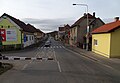
-
 Čeština: Beroun-Závodí a Hýskov, okres Beroun. Berounka a silnice II/116 (ul. Lidická, Na Krétě), z vlaku.English: Beroun-Závodí and Hýskov, Beroun District, Central Bohemian Region, Czech Republic. Berounka river and road II/116, seen from the Křivoklát Expres.
Camera location View all coordinates using: OpenStreetMap -
 English: Hýskov, Beroun District, Central Bohemian Region, Czech Republic. Road II/116, seen from the Křivoklát Expres.
Camera location View all coordinates using: OpenStreetMap -
 Čeština: Hýskov, okres Beroun. Domy v ulici Na Krétě, čp. 179, 189, 181, 185, 182, 184, 183, z vlaku.English: Hýskov, Beroun District, Central Bohemian Region, Czech Republic. Houses in Na Krétě street, seen from the Křivoklát Expres.
Camera location View all coordinates using: OpenStreetMap -
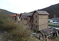 English: Hýskov, Beroun District, Central Bohemian Region, Czech Republic. Houses in Na Krétě street, seen from the Křivoklát Expres.
Camera location View all coordinates using: OpenStreetMap -
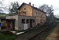 English: Hýskov, Beroun District, Central Bohemian Region, Czech Republic. Train station Hýskov, seen from the Křivoklát Expres.
Camera location View all coordinates using: OpenStreetMap -
 English: Hýskov, Beroun District, Central Bohemian Region, Czech Republic. Train station Hýskov, seen from the Křivoklát Expres.
Camera location View all coordinates using: OpenStreetMap -
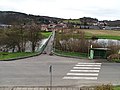 Čeština: Nižbor-Stradonice, okres Beroun. Lávka přes Berounku, z vlaku, autobusová zastávka na silnici 116.English: Nižbor-Stradonice, Beroun District, Central Bohemian Region, Czech Republic. A footbridge over the Berounka, seen from the Křivoklát Expres.
Camera location View all coordinates using: OpenStreetMap -
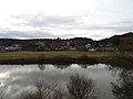 English: Nižbor-Stradonice, Beroun District, Central Bohemian Region, Czech Republic. A view across the Berounka, seen from the Křivoklát Expres.
Camera location View all coordinates using: OpenStreetMap -
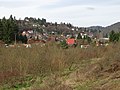 English: Nižbor-Žloukovice, Beroun District, Central Bohemian Region, Czech Republic. A view from the Křivoklát Expres.
Camera location View all coordinates using: OpenStreetMap -
 English: Nižbor-Žloukovice, Beroun District, Central Bohemian Region, Czech Republic. A view from the Křivoklát Expres.
Camera location View all coordinates using: OpenStreetMap -
 English: Nižbor-Žloukovice, Beroun District, Central Bohemian Region, Czech Republic. A view across the Berounka from the Křivoklát Expres.
Camera location View all coordinates using: OpenStreetMap -
 English: Nižbor-Žloukovice, Beroun District, Central Bohemian Region, Czech Republic. Way maintenance along the railway to Račice, seen from the Křivoklát Expres.
Camera location View all coordinates using: OpenStreetMap -
 English: Nižbor-Žloukovice, Beroun District, Central Bohemian Region, Czech Republic. Way maintenance along the railway to Račice, seen from the Křivoklát Expres.
Camera location View all coordinates using: OpenStreetMap -
 English: Křivoklát, Rakovník District, Central Bohemian Region, Czech Republic. People going from the nostalgic steam-powered train.
Camera location View all coordinates using: OpenStreetMap -
 English: Křivoklát, Rakovník District, Central Bohemian Region, Czech Republic. People going from the nostalgic steam-powered train.
Camera location View all coordinates using: OpenStreetMap -
 English: Křivoklát, Rakovník District, Central Bohemian Region, Czech Republic. A footbridge over the Rakovník Creek.
Camera location View all coordinates using: OpenStreetMap -
 Čeština: Praha-Vršovice. Nádraží Praha-Vršovice, zvláštní spěšný vlak Křivoklátský expres vedený parní lokomotivou 475.179.
Camera location View all coordinates using: OpenStreetMap -
 Čeština: Praha-Vršovice. Nádraží Praha-Vršovice, zvláštní spěšný vlak Křivoklátský expres vedený parní lokomotivou 475.179.
Camera location View all coordinates using: OpenStreetMap -
 Čeština: Praha-Vršovice. Nádraží Praha-Vršovice, zvláštní spěšný vlak Křivoklátský expres vedený parní lokomotivou 475.179.
Camera location View all coordinates using: OpenStreetMap -
 Čeština: Praha-Vršovice. Nádraží Praha-Vršovice, zvláštní spěšný vlak Křivoklátský expres vedený parní lokomotivou 475.179.
Camera location View all coordinates using: OpenStreetMap -
 Čeština: Praha-Vršovice. Nádraží Praha-Vršovice, zvláštní spěšný vlak Křivoklátský expres vedený parní lokomotivou 475.179.
Camera location View all coordinates using: OpenStreetMap -
Čeština: Praha-Vršovice. Nádraží Praha-Vršovice, zvláštní spěšný vlak Křivoklátský expres vedený parní lokomotivou 475.179 s postrkem T478.3001.
Camera location View all coordinates using: OpenStreetMap -
 English: Křivoklát, Rakovník District, Central Bohemian Region, Czech Republic. House no. 85, Hotel Sýkora.
Camera location View all coordinates using: OpenStreetMap -
 English: Křivoklát, Rakovník District, Central Bohemian Region, Czech Republic. House no. 53, U Jelena restaurant, Budy.
Camera location View all coordinates using: OpenStreetMap -
 English: Křivoklát, Rakovník District, Central Bohemian Region, Czech Republic. House no. 53, U Jelena restaurant, Budy.
Camera location View all coordinates using: OpenStreetMap -

Camera location View all coordinates using: OpenStreetMap -

Camera location View all coordinates using: OpenStreetMap -

Camera location View all coordinates using: OpenStreetMap -
 Čeština: Křivoklát, okres Rakovník. Hrad Křivoklát, pohled od pomníku Karla Egona II. z Fürstenberku.English: Křivoklát, Rakovník District, Central Bohemian Region, Czech Republic. Křivoklát Castle, seen from the viewpoint nearby the Karl Egon II monument.
Camera location View all coordinates using: OpenStreetMap -
 Čeština: Křivoklát, okres Rakovník. Hrad Křivoklát, přístupová cesta, pohled od pomníku Karla Egona II. z Fürstenberku.English: Křivoklát, Rakovník District, Central Bohemian Region, Czech Republic. Křivoklát Castle, seen from the viewpoint nearby the Karl Egon II monument.
Camera location View all coordinates using: OpenStreetMap -
 Čeština: Křivoklát, okres Rakovník. Hrad Křivoklát, hodiny na věži, pohled od pomníku Karla Egona II. z Fürstenberku.English: Křivoklát, Rakovník District, Central Bohemian Region, Czech Republic. Křivoklát Castle, tower clock, seen from the viewpoint nearby the Karl Egon II monument.
Camera location View all coordinates using: OpenStreetMap -
 Čeština: Křivoklát, okres Rakovník. Most silnice II/201 přes Rakovnický potok, pohled od pomníku Karla Egona II. z Fürstenberku.English: Křivoklát, Rakovník District, Central Bohemian Region, Czech Republic. A bridge of road II/201 over the Rakovník Creek, seen from the viewpoint nearby the Karl Egon II monument.
Camera location View all coordinates using: OpenStreetMap -
 English: Křivoklát, Rakovník District, Central Bohemian Region, Czech Republic. A monument to Karl Egon II. zu Fürstenberg.
Camera location View all coordinates using: OpenStreetMap -
 English: Křivoklát, Rakovník District, Central Bohemian Region, Czech Republic. A monument to Karl Egon II. zu Fürstenberg.
Camera location View all coordinates using: OpenStreetMap -
 English: Křivoklát, Rakovník District, Central Bohemian Region, Czech Republic. A monument to Karl Egon II. zu Fürstenberg, Latin inscription.
Camera location View all coordinates using: OpenStreetMap -
 English: Křivoklát, Rakovník District, Central Bohemian Region, Czech Republic. A monument to Karl Egon II. zu Fürstenberg, German inscription.
Camera location View all coordinates using: OpenStreetMap -
 English: Křivoklát, Rakovník District, Central Bohemian Region, Czech Republic. A monument to Karl Egon II. zu Fürstenberg.
Camera location View all coordinates using: OpenStreetMap -
 English: Křivoklát, Rakovník District, Central Bohemian Region, Czech Republic. A monument to Karl Egon II. zu Fürstenberg.
Camera location View all coordinates using: OpenStreetMap -
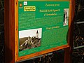 Čeština: Křivoklát, okres Rakovník. Naučná stezka Paraplíčko, Pomník Karla Egona II. z Fürstenberku.English: Křivoklát, Rakovník District, Central Bohemian Region, Czech Republic. A board of the educational trail, a monument to Karl Egon II. zu Fürstenberg.
Camera location View all coordinates using: OpenStreetMap -

Camera location View all coordinates using: OpenStreetMap -

Camera location View all coordinates using: OpenStreetMap -

Camera location View all coordinates using: OpenStreetMap -

Camera location View all coordinates using: OpenStreetMap -

Camera location View all coordinates using: OpenStreetMap -
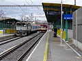
Camera location View all coordinates using: OpenStreetMap -

Camera location View all coordinates using: OpenStreetMap -
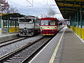
Camera location View all coordinates using: OpenStreetMap -

Camera location View all coordinates using: OpenStreetMap -

Camera location View all coordinates using: OpenStreetMap -

Camera location View all coordinates using: OpenStreetMap -
Camera location View all coordinates using: OpenStreetMap -

Camera location View all coordinates using: OpenStreetMap -
Camera location View all coordinates using: OpenStreetMap -
 Čeština: Praha-Bubeneč. Železniční zastávka Praha-Podbaba. Nehodová jeřábová jednotka EDK 750 nakládá stavební buňky po výstavbě železniční zastávky Praha-Podbaba.
Camera location View all coordinates using: OpenStreetMap -
 Čeština: Praha-Bubeneč. Železniční zastávka Praha-Podbaba. Nehodová jeřábová jednotka EDK 750 nakládá stavební buňky po výstavbě železniční zastávky Praha-Podbaba.
Camera location View all coordinates using: OpenStreetMap -
 Čeština: Praha-Bubeneč. Železniční zastávka Praha-Podbaba. Nehodová jeřábová jednotka EDK 750 nakládá stavební buňky po výstavbě železniční zastávky Praha-Podbaba.
Camera location View all coordinates using: OpenStreetMap -
Čeština: Praha-Bubeneč. Železniční zastávka Praha-Podbaba. Nehodová jeřábová jednotka EDK 750 nakládá stavební buňky po výstavbě železniční zastávky Praha-Podbaba.
Camera location View all coordinates using: OpenStreetMap -
 Čeština: Praha-Bubeneč. Železniční zastávka Praha-Podbaba. Nehodová jeřábová jednotka EDK 750 nakládá stavební buňky po výstavbě železniční zastávky Praha-Podbaba.
Camera location View all coordinates using: OpenStreetMap -
 Čeština: Praha-Bubeneč. Železniční zastávka Praha-Podbaba. Nehodová jeřábová jednotka EDK 750 nakládá stavební buňky po výstavbě železniční zastávky Praha-Podbaba.
Camera location View all coordinates using: OpenStreetMap -

Camera location View all coordinates using: OpenStreetMap -

Camera location View all coordinates using: OpenStreetMap -

Camera location View all coordinates using: OpenStreetMap -
 Čeština: Praha-Bubeneč. Železniční zastávka Praha-Podbaba. Vlak do Kralup přijíždějící po levé koleji.
Camera location View all coordinates using: OpenStreetMap -
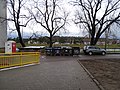
Camera location View all coordinates using: OpenStreetMap -

Camera location View all coordinates using: OpenStreetMap -
 Čeština: Praha-Sedlec. Železniční zastávka Praha-Sedlec, pohled z vlaku. V pozadí domy Roztocká 57/31, 52/33.
Camera location View all coordinates using: OpenStreetMap


,_p%C5%99es_Berounku_z_vlaku.jpg)


.jpg)


.jpg)
.jpg)
.jpg)


.jpg)

.jpg)


.jpg)
.jpg)


.jpg)
.jpg)


.jpg)
.jpg)
.jpg)
.jpg)
.jpg)


13[edit]
-
Čeština: Praha-Bubeneč. Železniční zastávka Praha-Podbaba. Nehodová jeřábová jednotka EDK 750 nakládá stavební buňky po výstavbě železniční zastávky Praha-Podbaba.
Camera location View all coordinates using: OpenStreetMap -

-

-
-


14[edit]


.jpg)


.jpg)


.jpg)


.jpg)


.jpg)


.jpg)


.jpg)


15[edit]


.jpg)


.jpg)


.jpg)
.jpg)

.jpg)

.jpg)


.jpg)


.jpg)


.jpg)


.jpg)
.jpg)
.jpg)


.jpg)

.jpg)
.jpg)


16[edit]

.jpg)


.jpg)


.jpg)


.jpg)


.jpg)


.jpg)


.jpg)


.jpg)
.jpg)

.jpg)

.jpg)
.jpg)
.jpg)


.jpg)

.jpg)
.jpg)


.jpg)

.jpg)
.jpg)
.jpg)
.jpg)
.jpg)
.jpg)
.jpg)

.jpg)

.jpg)
.jpg)
.jpg)


.jpg)
17[edit]
-

-

-

-
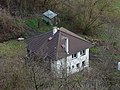
-

-

Camera location View all coordinates using: OpenStreetMap -

Camera location View all coordinates using: OpenStreetMap -

Camera location View all coordinates using: OpenStreetMap -

Camera location View all coordinates using: OpenStreetMap -

Camera location View all coordinates using: OpenStreetMap -
Camera location View all coordinates using: OpenStreetMap -
Camera location View all coordinates using: OpenStreetMap -

Camera location View all coordinates using: OpenStreetMap -

Camera location View all coordinates using: OpenStreetMap -
 English: Prague-Čimice, Czech Republic. Čimická street, chapel of Saint John of Nepomuk and Draháň shopping centre.
Camera location View all coordinates using: OpenStreetMap -
 English: Prague-Čimice, Czech Republic. Čimická street, chapel of Saint John of Nepomuk and Draháň shopping centre.
Camera location View all coordinates using: OpenStreetMap -

Camera location View all coordinates using: OpenStreetMap -
Camera location View all coordinates using: OpenStreetMap -

Camera location View all coordinates using: OpenStreetMap -
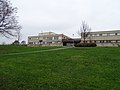
Camera location View all coordinates using: OpenStreetMap -

Camera location View all coordinates using: OpenStreetMap -
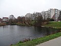
Camera location View all coordinates using: OpenStreetMap -

Camera location View all coordinates using: OpenStreetMap -

Camera location View all coordinates using: OpenStreetMap -
Camera location View all coordinates using: OpenStreetMap -

Camera location View all coordinates using: OpenStreetMap -

Camera location View all coordinates using: OpenStreetMap -

Camera location View all coordinates using: OpenStreetMap -

Camera location View all coordinates using: OpenStreetMap -

Camera location View all coordinates using: OpenStreetMap -
Camera location View all coordinates using: OpenStreetMap -
Camera location View all coordinates using: OpenStreetMap -

Camera location View all coordinates using: OpenStreetMap -

Camera location View all coordinates using: OpenStreetMap -
Camera location View all coordinates using: OpenStreetMap -

Camera location View all coordinates using: OpenStreetMap -
Camera location View all coordinates using: OpenStreetMap -

Camera location View all coordinates using: OpenStreetMap -

Camera location View all coordinates using: OpenStreetMap -

Camera location View all coordinates using: OpenStreetMap -

Camera location View all coordinates using: OpenStreetMap -

Camera location View all coordinates using: OpenStreetMap -

Camera location View all coordinates using: OpenStreetMap -

Camera location View all coordinates using: OpenStreetMap -
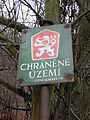 English: Prague-Čimice, Czech Republic. Čimice Valley natural monument, an old sign of protected area.
Camera location View all coordinates using: OpenStreetMap -
 English: Prague-Čimice, Czech Republic. Čimice Valley natural monument, an old sign of protected area.
Camera location View all coordinates using: OpenStreetMap -

Camera location View all coordinates using: OpenStreetMap -

Camera location View all coordinates using: OpenStreetMap -

Camera location View all coordinates using: OpenStreetMap -

Camera location View all coordinates using: OpenStreetMap -

Camera location View all coordinates using: OpenStreetMap -

Camera location View all coordinates using: OpenStreetMap -

Camera location View all coordinates using: OpenStreetMap


.jpg)


.jpg)


.jpg)


.jpg)


.jpg)

.jpg)


.jpg)

.jpg)


.jpg)


.jpg)


18[edit]
-
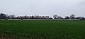
Camera location View all coordinates using: OpenStreetMap -

Camera location View all coordinates using: OpenStreetMap -

Camera location View all coordinates using: OpenStreetMap -

Camera location View all coordinates using: OpenStreetMap -

-

-

-

-

-

-

-

-

-

-

-
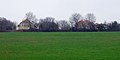
-

-
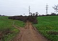
-
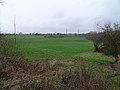
-

-

-

-

-
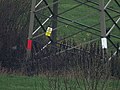
-

-
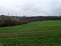
-

-

-
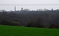

.jpg)
.jpg)


.jpg)


.jpg)
.jpg)

.jpg)

.jpg)


.jpg)
.jpg)
.jpg)
.jpg)
.jpg)

.jpg)

.jpg)
20[edit]

21[edit]


.jpg)

.jpg)
.jpg)
.jpg)


.jpg)
.jpg)
.jpg)

.jpg)


.jpg)
.jpg)
,_Vltava_a_City_Elefant,_od_dynamitky.jpg)
,_Vltava_a_vlak,_od_dynamitky.jpg)
,_Vltava_a_vlak,_od_dynamitky_(01).jpg)


.jpg)
.jpg)


.jpg)
.jpg)

.jpg)
.jpg)


.jpg)

.jpg)


.jpg)


.jpg)


.jpg)
.jpg)


.jpg)
.jpg)

.jpg)
.jpg)

.jpg)

..jpg)
22[edit]


.jpg)


.jpg)


.jpg)
.jpg)


.jpg)


.jpg)


.jpg)


.jpg)
.jpg)
.jpg)
.jpg)
.jpg)
23[edit]


.jpg)
.jpg)
.jpg)


.jpg)
.jpg)
.jpg)
.jpg)
.jpg)

.jpg)


.jpg)

.jpg)


.jpg)


.jpg)
.jpg)
25[edit]


.jpg)


26[edit]


.jpg)
.jpg)


.jpg)


.jpg)
.jpg)
.jpg)
.jpg)
.jpg)

.jpg)


.jpg)


.jpg)


.jpg)
.jpg)


.jpg)


.jpg)
.jpg)
.jpg)
.jpg)
.jpg)
.jpg)

.jpg)

.jpg)


.jpg)

27[edit]

.jpg)
.jpg)


.jpg)


.jpg)


,_58,_59.jpg)


.jpg)


29[edit]
Unstrip size limit exceeded (5,000,000)
30[edit]
Unstrip size limit exceeded (5,000,000)
31[edit]
Unstrip size limit exceeded (5,000,000)