User:Tysto/aerial
I have begun a kind of personal project documenting cities and towns from the air during my regular travels. I'm using this page to keep track of them as I upload them, categorize them, and link to them from Wikipedia articles.
I only fly over US cities, and mostly Indiana right now. But I would encourage anyone to take aerial photos of any cities listed in Wikipedia. My view is that having any photos of towns and cities improves the articles, with ground photos of landmarks being best (see my home town of Bremen, Indiana) but I can take pictures of dozens of cities from the air that I'll never actually visit.
Please leave a message on my talk page if you have an opinion about whether this project is valuable or a waste of time, given that good satellite photos are readily available, especially for the US. Ironically, Google Maps added detailed coverage of all of Indiana in June 2005, making my task of identifying the cities much easier... and less valuable.
Indiana counties
[edit]-
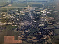
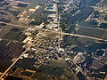
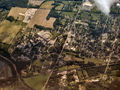
 Hartford City from the west
 -
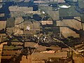
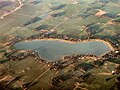
 Shamrock Lakes from the west


-
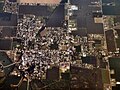
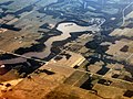
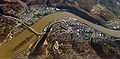
 Aurora from the southwest.
 -
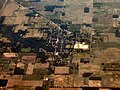
 West Harrison (at top) from the east.
 -
 West Harrison (at bottom) from the west.
 -
 Lawrenceburg from the southwest.


-
 Greensburg from the south.
 -
 Milford from the southwest.
 -
 New Point from the southwest.
 -
 St. Paul from the southwest.


-
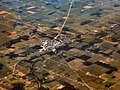 Albany from the west
 -
 Daleville from the northeast
 -
 Eaton from the west
 -
 Gaston from the northwest
 -
 Muncie downtown from the west
 -
 Muncie from the northwest
 -
 Selma from the northwest
 -
 Yorktown from the west


-
 Connersville from the southwest

-
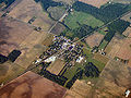
 Batesville from the northeast
 -
 Brookville from the northeast
 -
 Oldenburg from the west


-
 Akron from the east


-
 Fairmount from the northeast
 -
 Fowlerton from the northeast
 -
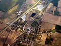
 Gas City from the northeast
 -
 Matthews from the west
 -
-
 Van Buren from the northeast


-
 Cadiz from the west
 -
 Dunreith from the west
 -
 Greensboro from the west
 -
 Kennard from the northeast
 -
 Knightstown, Indiana from the northeast
 -
 Middletown from the east
 -
 New Castle from the west
 -
 Spiceland from the west
 -
 Springport from the southwest
 -
 Sulphur Springs from the southwest


-
 Andrews from the southwest
 -
 Huntington from the west
 -
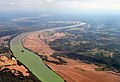
 Salamonie Reservoir with Huntington in the distance
 -
 Mount Etna from the west
 -
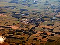
 Warren from the southwest


-
 Burket from the southwest
 -
 Claypool from the west
 -
 Etna Green from the southwest
 -

-
 Mentone from the northeast
 -
 Silver Lake from the southwest
 -
 Warsaw from the west


-
 Anderson from the east
 -
 Chesterfield from the northeast
 -
 Markleville from the east


-
 Beech Grove from the southwest
 -
 Downtown Indianapolis from the southwest
 -
 Speedway from above


-
 Bremen from the east
 -
 Lake of the Woods, southwest of Bremen from the west
 -
 Bremen from the west, with Nappanee in the distance
 -
 Bourbon from the east
 -
 La Paz from the northwest
 -
 Plymouth from above


-
 Rising Sun from the east

-
 Losantville from the southwest
 -
 Modoc from the southwest
 -
 Parker City from the southwest


-
 Fairland from the southwest
 -
 Shelbyville from the southwest


-
 Lakeville from the west
 -
 Roseland from the south
 -
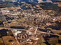
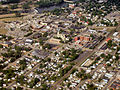
 South Bend downtown from the south
 -

-

-

-
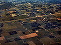
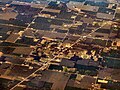
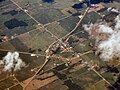
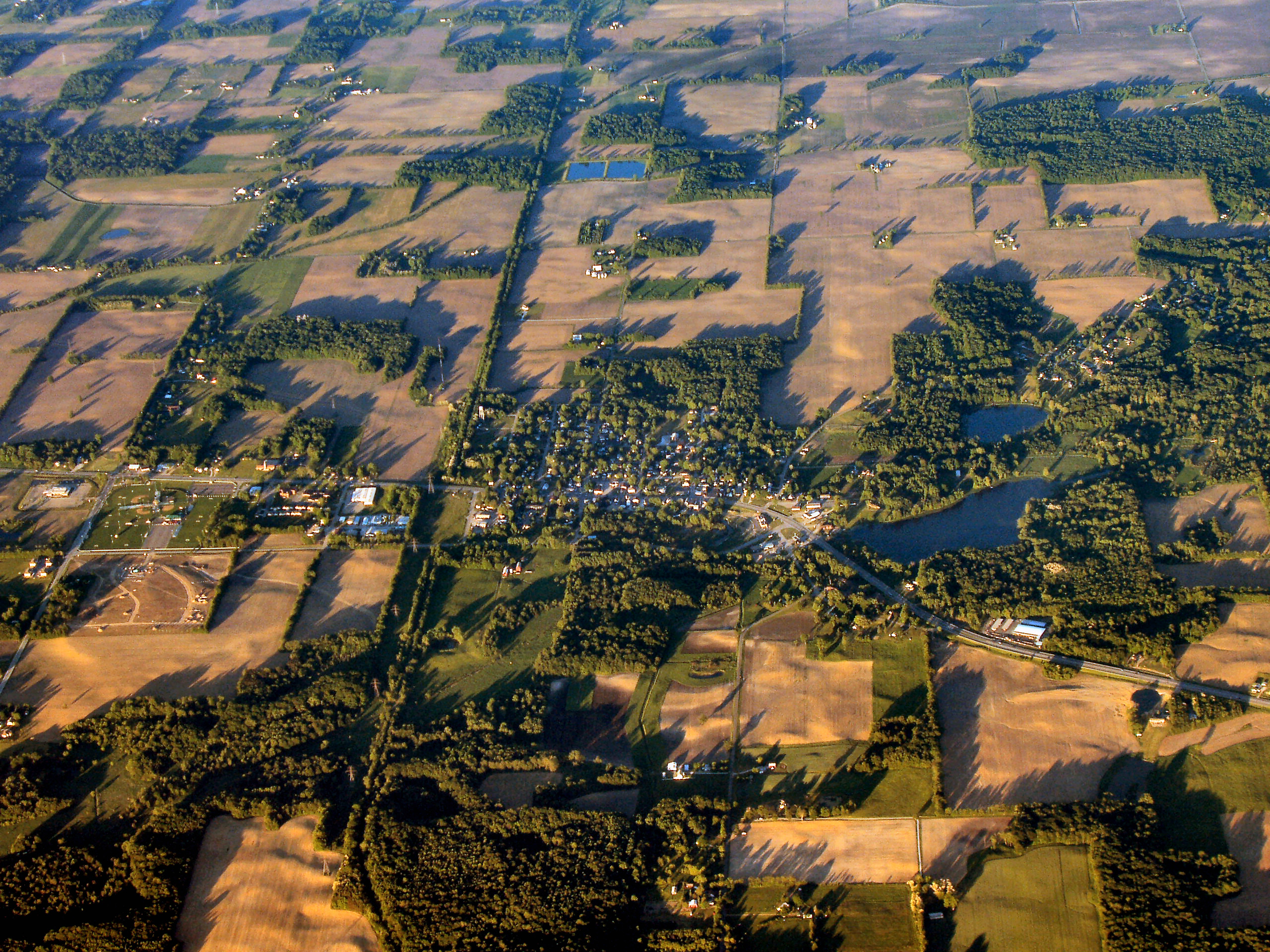
 Wyatt, Indiana from above, a good example of a small town
 -
 Mishawaka, Indiana from above, looking east
 -
 Indian Ridge plaza, north of Mishawaka, Indiana from above, looking northeast


-
 Liberty from the east
 -
 West College Corner from the southwest


-
 La Fontaine from the east
 -
 Lagro from above
 -
 North Manchester from the southwest
 -
 North Manchester from the southwest
 -
 Roann from the east
 -
 Wabash from the east


-
 Centerville from the west
 -
 Hagerstown from the southwest
 -
 Richmond from the southwest


Kentucky counties
[edit]-
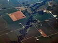
 Burlington from the south

Michigan counties
[edit]-
 Stony Point from the northeast

Ohio counties
[edit]-
College Corner from the west
-
 Wellsville from the north
 -
 East Liverpool from the north
 -
 Salineville from the north


-
 Kelleys Island from the east


-
 Put-in-Bay on South Bass Island

How they're done
[edit]
I take photographs from the window of commercial airplanes I fly on each week in my business travels. Because I fly out of little South Bend Regional Airport in South Bend, these are mostly CRJs, which typically fly at about 25,000 feet, somewhat lower than than the jumbos. I try to take frequent photos of both towns and lakes along the route to help me identify the locations (lakes are much easier to recognize on satellite photos). I use Google Maps and Terraserver to do the indentification.

When the weather is clear in daylight, you can see the ground even at 25,000 feet, altho pictures taken from there have a strong blue haze over them. Results are best when shooting down almost under the plane; worst when shooting out toward the horizon, since the haze gets heavier toward the top of the picture instead of remaining even.
I take 5 megapixel digital photos and transfer them to my laptop for processing. I use Corel Paint Shop Pro (mostly because I've been using various versions for about 15 years), but Adobe Photoshop Elements is also a good choice (if you don't want to fork over the cabbage for Adobe Photoshop). Generally, I start by using the One Step Photo Fix, which automatically adjusts color, contrast, clarity, saturation, and some other settings to improve your photo. Then I manually adjust those same settings to further improve the image, trying to draw out natural color and contrast without burning the darker parts or oversaturating. It takes some trial-and-error, and it sometimes helps to create multiple adjustment layers so you can tweak adjustments separately rather than sequentially.
Getting even moderately comfortable adjusting these settings will help you improve all your photos, even everyday pictures of friends and family that seem fine when you initially shot them. You'll soon find that you prefer a bit more contrast or saturation than your camera produces naturally, and you'll discover that photography is as much about making great photos as it is about taking great photos.
Leave a message on my Talk page or e-mail me at 'derek...tysto.dot.com' if you have questions or if you would like help processing photos you have taken from the air.