User:Yug/Locator maps (location map based)
This page provides conventions for the creation of locator maps (location maps based).
Usage: Locator maps are used to locate geographically the polyshape of an encyclopedic topic over a geographic map.
Creation: Locator maps are conveniently derivate from country or wider area Location maps. According to available data, the map maker add the red enlightening area. If need, specific glowings, circles, and zoom may also be needed and added. Locator maps are very basic, and should not have, or have very few labels. Usually displayed in articles as miniatures, their aim is to show the geographical occupation in a wider context, not to explain this occupation.
Convention[edit]

| Subject | Colorimetry (RGB/hex) |
|---|---|
| Area (main of A) | 992210
R:153 V:34 B:16 A:1 #A52512ff
R:165 V:37 B:18 A:1 B00000ff
R:176 V:00 B:00 A:1 C00000ff
R:192 V:00 B:00 A:1 #C12838ff
R:193 V:40 B:56 A:1 |
| De facto controlled by A. (opacity 0.5 !) | #C128387F
R:193 V:40 B:56 A:.5 |
| Claimed by A, controlled by X/others : STRIPPED ▨ | #C12838ff
R:193 V:40 B:56 A:1 |
| Glowing effect (opacity 0.2 !) | #C1283833
R:193 V:40 B:56 A:.2 |
| Borders (for markers ◯ and Area of A on topography) | #C12838ff
R:193 V:40 B:56 A:1 |
| Frame: area (to enlarge) | #C12838ff
R:193 V:40 B:56 A:1 |
| Zoom transfer-shadow (opacity 0.2 !) | #C1283833
R:193 V:40 B:56 A:.2 |
| Frame: area (enlarged) | #646464
R:100 V:100 B:100 A:1 |
|
Naming (upload):
| |
Rational[edit]
- Background
The locator maps are based upon location maps for their background, they thus use location maps' colors as well as the "commonly recognized international borders". Alternative versions with alternative borderlines can still be done depending on the consensus on each wikipedia.
- Enlightening large areas
Then come our current subject : enlighten one semantic object, let's say a country. But it may also be other quite monolitic items such as a single species' geographic range, a nation, etc. However, there is various degrees of presence. For conveniency, the current page provide the following 3 level scheme:
- The core area is in full red. It's there area for which where there is a massive, undoubted agreement of the topic's presence.
- The unsecure / de facto area in half red (opacity 50%). is where the topic's presence is, indeed, but this presence doesn't make concensus (wide, open disagreement).
- The claimed area in stripped red. Is where some claim verbally the topic's presence without de facto material presence.
While this scheme is clearly inspired by geopolitical situations (Marocco, Taiwan, Kashmir), it is flexible enough to apply to others simple sequential issues from fields suchs as biology, ethnology, history. The addition of a legend may, however be needed. For more complex cases, please refer to the complex map recommendations.
| IMPORTANT: | Locator map show simple objects from A's point of view, i.e. from one country's point of view VS all others. It is not suitable for complex multi-players (>2) geopollitical disputes. The visual localization should make concensus but also be fact-based for de facto / claimed presence. |
|---|
- Enlightening small areas
A, Glowing & Circles :
B. Zooms :
- National waters (?)
About this recommendation[edit]
- History
The style is of course widely derived from the Location maps style. It's key additions take in source in the former unformal wikipedia's locator maps style based on white oceans, grey lands, and full green (mostly) or full red (less but also frequent) areas. The rise of the Location maps and Relief maps styles where blue, green, and brown-yellow are widely used strengthened the need for red-based locator maps. The red color also got the favor of the various cartographers and cartographic workshops for years, believing the red color to be more suitable to enlighten areas, small or big. On the other side, the precision upgrades made by Location maps on the borderlines generated further needs for internationally disputed areas and their cartographic depiction. In 2012, several requests were made relatively to these disputed areas, users expressingly asking for a more suitable and consensual cartographic symbology for these issues. Based on location maps and most seen practice, User:TUBS (de), a very active cartographer from the German cartographic workshop built a comprehensive set of recommendations. This recommendations have since been adopted by the German and French cartographer teams as well as by independant cartographers.
- Innovations
(2012) Based on the expressed needs for a clear scheme depicting areas with various degree of control/presences, a new toolkit have been produce, including 3 degrees of presence as well as symbology's tools (zoom, marker, glowing). The definition of sovereign state in cartographic context have been clarified. Naming convention have been suggested.
|
Sovereign state - Are considered as sovereign or independent states all entities fulfilling the
following conditions:[1] |
- Leading place
Here, TUBS and Yug for the next week !
Gallery of examples[edit]
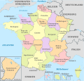
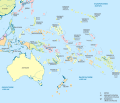
New style (location maps based)[edit]
- Edit Template:SVG locator maps (location map scheme)/design for changes.


