Category:Aighton, Bailey and Chaigley
Jump to navigation
Jump to search

English: Aighton, Bailey and Chaigley is a civil parish in the Ribble Valley district of Lancashire, England, just west of Clitheroe. The main settlements in the parish are Hurst Green and Walker Fold. Other places are Aighton, Bailey and Chaigley, originally three hamlets forming a township.

civil parish in Ribble Valley, Lancashire, UK  | |||||
| Upload media | |||||
| Instance of | |||||
|---|---|---|---|---|---|
| Location | Ribble Valley, Lancashire, North West England, England | ||||
| Population |
| ||||
 | |||||
Subcategories
This category has the following 9 subcategories, out of 9 total.
G
- Greengore (3 F)
H
L
- Longridge Fell (31 F)
N
- New Lower Hodder Bridge (5 F)
O
- Old Lower Hodder Bridge (20 F)
P
- Punch Bowl Inn, Lancashire (5 F)
S
W
- Walker Fold, Lancashire (5 F)
Media in category "Aighton, Bailey and Chaigley"
The following 200 files are in this category, out of 546 total.
(previous page) (next page)-
 'No Entry' Gateway to Stonyhurst - geograph.org.uk - 1976543.jpg 1,600 × 1,169; 567 KB
-
-
 A distant windfarm - geograph.org.uk - 4137037.jpg 4,592 × 3,056; 7.49 MB
-
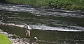 A fisherman on the River Hodder - geograph.org.uk - 4006161.jpg 3,867 × 2,064; 6.2 MB
-
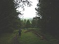
 A footbridge and steps on the Ribble Way - geograph.org.uk - 3617878.jpg 3,056 × 4,592; 7.65 MB
-
 A glimpse of Crawshaw Lodge (reservoir) - geograph.org.uk - 4513300.jpg 4,592 × 3,056; 7.65 MB
-
 A less muddy path ahead - geograph.org.uk - 4513643.jpg 4,577 × 3,046; 7.79 MB
-
 A seat with a view - geograph.org.uk - 3619496.jpg 4,171 × 2,726; 6.92 MB
-
 A stile and a choice of routes - geograph.org.uk - 3617891.jpg 4,592 × 3,056; 7.8 MB
-
 A View Eastwards towards Pendle Hill - geograph.org.uk - 5705564.jpg 5,184 × 3,456; 6.64 MB
-
 A view of a diminished Pendle Hill - geograph.org.uk - 4136056.jpg 4,592 × 3,056; 7.56 MB
-
 A View Westwards towards Pendle Hill - geograph.org.uk - 5849491.jpg 5,184 × 3,456; 6.76 MB
-
 A weir on the River Ribble - geograph.org.uk - 3618099.jpg 4,016 × 2,769; 7.87 MB
-
 Access Lane leading to Trough House - geograph.org.uk - 5849926.jpg 5,184 × 3,456; 4.59 MB
-
 Access Lane to Intack - geograph.org.uk - 5704634.jpg 5,184 × 3,456; 5.62 MB
-
 Access to the riverbank - geograph.org.uk - 5905832.jpg 4,000 × 3,000; 4.65 MB
-
 Access Track heading for the Clitheroe-Chipping Road - geograph.org.uk - 4655184.jpg 1,600 × 1,067; 822 KB
-
 Aighton, Bailey and Chaigley, UK - panoramio.jpg 3,264 × 2,448; 2.24 MB
-
 Almost a natural footbridge over Dean Brook - geograph.org.uk - 4513662.jpg 4,592 × 3,056; 7.08 MB
-
 An aqueduct over the River Ribble - geograph.org.uk - 3617917.jpg 4,592 × 3,056; 7.91 MB
-
 An Englishman's home^ - geograph.org.uk - 3619532.jpg 3,074 × 2,727; 4.08 MB
-
 Approaching Greengore - geograph.org.uk - 5703084.jpg 5,184 × 3,456; 6.13 MB
-
 Approaching High Beacon on Longridge Fell - geograph.org.uk - 5705549.jpg 5,184 × 3,456; 6.93 MB
-
 Approaching Parker's Wood - geograph.org.uk - 4655172.jpg 1,600 × 1,067; 607 KB
-
 Approaching Planetree Cottage - geograph.org.uk - 4653664.jpg 1,600 × 1,067; 364 KB
-
 Approaching Winckley Hall Farm - geograph.org.uk - 3551836.jpg 1,600 × 1,200; 574 KB
-
 Approaching Winckley Hall Farm - geograph.org.uk - 5905837.jpg 4,000 × 3,000; 5.16 MB
-
 Aqueduct across the River Ribble - geograph.org.uk - 5904705.jpg 4,000 × 3,000; 4.85 MB
-
 Aqueduct over the River Ribble - geograph.org.uk - 1050090.jpg 640 × 480; 91 KB
-
 Aqueduct over the River Ribble - geograph.org.uk - 2283657.jpg 1,600 × 1,198; 511 KB
-
 Aqueduct over the River Ribble - geograph.org.uk - 2393011.jpg 4,000 × 3,000; 5.87 MB
-
 Aqueduct over the River Ribble - geograph.org.uk - 3551827.jpg 1,600 × 1,200; 568 KB
-
 Aqueduct Over The River Ribble - geograph.org.uk - 3953673.jpg 2,560 × 1,679; 2.47 MB
-
 Aqueduct over the River Ribble - geograph.org.uk - 5904700.jpg 4,000 × 3,000; 4.65 MB
-
 Art ^ disused quarry wall, Longridge Fell - geograph.org.uk - 2802642.jpg 1,024 × 683; 256 KB
-
 At Higher Hodder Bridge - geograph.org.uk - 4023362.jpg 4,000 × 3,000; 5.11 MB
-
 Ave Maria - geograph.org.uk - 2421978.jpg 683 × 1,024; 306 KB
-
 B6243 at Starling Bridge - geograph.org.uk - 5475928.jpg 640 × 480; 87 KB
-
 B6243 at the closed Punch Bowl - geograph.org.uk - 5475929.jpg 640 × 480; 60 KB
-
 B6243 west of Lower Hodder Bridge - geograph.org.uk - 5475933.jpg 640 × 480; 46 KB
-
 B6243 Whalley Road looking east - geograph.org.uk - 5475931.jpg 640 × 481; 41 KB
-

-

-
 Bailey Bank at Chaigley Court - geograph.org.uk - 4502182.jpg 2,000 × 1,508; 503 KB
-
 Bailey Green Cottages - geograph.org.uk - 5139218.jpg 640 × 480; 87 KB
-
 Barn at Woodfields - geograph.org.uk - 2577627.jpg 4,000 × 3,000; 4.25 MB
-
 Barn, Cherry Tree House - geograph.org.uk - 2401266.jpg 1,024 × 721; 92 KB
-
 Barracks - geograph.org.uk - 4460454.jpg 3,376 × 3,788; 1.83 MB
-
 Bayley Arms, Hurst Green - geograph.org.uk - 5848540.jpg 5,184 × 3,456; 7.15 MB
-
 Being duly busy - geograph.org.uk - 4516906.jpg 3,376 × 2,400; 7.4 MB
-
 Benchmark on a barn at Winckley Hall Farm - geograph.org.uk - 3551839.jpg 1,600 × 1,200; 890 KB
-
 Beside Woodtop Wood - geograph.org.uk - 4655729.jpg 1,600 × 1,067; 597 KB
-
 Beware of the - cats - geograph.org.uk - 5904604.jpg 4,000 × 3,000; 5.02 MB
-
 Big Daddy - geograph.org.uk - 4023371.jpg 3,000 × 4,000; 6.68 MB
-
 Birdy Brow - geograph.org.uk - 4006577.jpg 4,528 × 2,848; 7.77 MB
-
 Birdy Brow - geograph.org.uk - 4463935.jpg 4,392 × 3,180; 1.57 MB
-
 Boer War memorial at Hurst Green - geograph.org.uk - 3734322.jpg 3,872 × 2,592; 3.54 MB
-
 Boer War Memorial, Hurst Green - geograph.org.uk - 5139250.jpg 480 × 640; 88 KB
-
 Bradhurst Barn - geograph.org.uk - 5139340.jpg 640 × 480; 58 KB
-
 Bridge in Over Hacking Wood - geograph.org.uk - 1933012.jpg 640 × 425; 231 KB
-
 Bridge in Over Hacking Wood - geograph.org.uk - 1933013.jpg 640 × 425; 255 KB
-
 Bridge Over Stream - geograph.org.uk - 3573797.jpg 2,560 × 1,920; 3.07 MB
-
 Bridleway above Dean Brook - geograph.org.uk - 3771970.jpg 800 × 600; 214 KB
-
 Bridleway along the Southern Boundary of Deer House Wood - geograph.org.uk - 5703388.jpg 5,184 × 3,456; 6.65 MB
-
 Bridleway ascending the Southern Flanks of Longridge Fell - geograph.org.uk - 5705561.jpg 5,184 × 3,456; 7.02 MB
-
 Bridleway descending to Chilsey Green - geograph.org.uk - 5705559.jpg 5,184 × 3,456; 7.18 MB
-
 Bridleway in Hudd Lee Wood - geograph.org.uk - 5703391.jpg 5,184 × 3,456; 3.92 MB
-
 Bridleway near Hurst Green - geograph.org.uk - 3882767.jpg 1,024 × 768; 938 KB
-
 Bridleway off Longridge Road - geograph.org.uk - 1119882.jpg 640 × 480; 121 KB
-
 Bridleway West of Greengore - geograph.org.uk - 1117060.jpg 640 × 480; 118 KB
-
 Brook on the edge of Over Hacking Wood - geograph.org.uk - 4306384.jpg 5,400 × 3,600; 7.14 MB
-
 Brownslow from Intack - geograph.org.uk - 4464470.jpg 1,024 × 797; 874 KB
-
 Building beside River Ribble - geograph.org.uk - 2699227.jpg 640 × 480; 130 KB
-
 Buildings at New Spring - geograph.org.uk - 3927170.jpg 3,474 × 2,644; 3.7 MB
-
 Buildings at Winckley Hall Farm - geograph.org.uk - 3552136.jpg 1,600 × 1,200; 618 KB
-
 Bulbous oak tree near Winckley Hall Farm - geograph.org.uk - 3772857.jpg 640 × 480; 129 KB
-

-
 Bus Stop - geograph.org.uk - 2422002.jpg 1,024 × 683; 249 KB
-

-
 Calder Foot Pool, River Ribble - geograph.org.uk - 895319.jpg 640 × 480; 89 KB
-
 Camping Barn at Greengore - geograph.org.uk - 5703383.jpg 4,943 × 3,428; 7.29 MB
-
 Cascades on Dean Brook - geograph.org.uk - 3771957.jpg 480 × 640; 159 KB
-
 Cemetery chapel at Hurst Green - geograph.org.uk - 2923213.jpg 4,000 × 3,000; 5.59 MB
-
 Chaigley Hall - geograph.org.uk - 1090243.jpg 640 × 480; 74 KB
-
 Chaigley Hall - geograph.org.uk - 2465381.jpg 1,600 × 1,200; 630 KB
-
 Chapel House near Walker Ford - geograph.org.uk - 4502193.jpg 2,000 × 1,263; 461 KB
-
 Cherry Tree House - geograph.org.uk - 1976191.jpg 2,592 × 1,944; 1.59 MB
-
 Cherry Tree House - geograph.org.uk - 4459851.jpg 4,678 × 3,017; 1.7 MB
-
 Cherry Tree House - geograph.org.uk - 4655209.jpg 1,600 × 1,067; 627 KB
-
 Chilsey Green Farm - geograph.org.uk - 3567568.jpg 2,387 × 1,445; 1.38 MB
-
 Climbing Birdy Brow in Early Morning Mist - geograph.org.uk - 4652899.jpg 1,600 × 1,067; 639 KB
-
 Clitheroe Old Road - geograph.org.uk - 5767858.jpg 1,280 × 915; 855 KB
-
 Close up, Elizabeth II postbox on Longridge Road - geograph.org.uk - 5141519.jpg 1,030 × 1,667; 345 KB
-
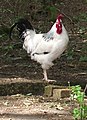 Cock of the walk - geograph.org.uk - 2394535.jpg 1,229 × 1,695; 1.06 MB
-
 Confluence of the Calder and Ribble - geograph.org.uk - 3772366.jpg 640 × 480; 75 KB
-
 Confluence of the Hodder and Ribble - geograph.org.uk - 3772845.jpg 480 × 640; 119 KB
-

-
 Confluence of the Rivers Calder and Ribble - geograph.org.uk - 5905808.jpg 4,000 × 3,000; 4.8 MB
-

-
 Cottage beside the Ribble Way - geograph.org.uk - 2283635.jpg 1,600 × 1,198; 341 KB
-
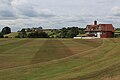 Cricket Pavilion and Pitch, Stonyhurst College - geograph.org.uk - 5849436.jpg 5,184 × 3,456; 6.35 MB
-
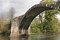
 Cromwell's Bridge from Lower Hodder Bridge - geograph.org.uk - 5905881.jpg 4,000 × 3,000; 4.54 MB
-
 Cromwell's Bridge from Lower Hodder Bridge - geograph.org.uk - 5906045.jpg 4,000 × 3,000; 4.9 MB
-

-
 Cromwell's Bridge, River Hodder - geograph.org.uk - 5367963.jpg 640 × 427; 125 KB
-
 Cromwell's Bridge, River Hodder - geograph.org.uk - 5367965.jpg 640 × 427; 99 KB
-
 Cromwell's Bridge, River Hodder - geograph.org.uk - 5367969.jpg 640 × 427; 95 KB
-
 Cromwell's Bridge, River Hodder - geograph.org.uk - 5367975.jpg 461 × 640; 111 KB
-

-
 Cross at Cross Gills - geograph.org.uk - 2393895.jpg 4,000 × 3,000; 6.84 MB
-
 Cross In Over Hacking Wood - geograph.org.uk - 3573897.jpg 2,560 × 1,920; 3.02 MB
-

-
 Cut down the trees and you get the view - geograph.org.uk - 4137069.jpg 4,592 × 2,180; 7.73 MB
-
 Dead Tree by track, near Plantation Farm - geograph.org.uk - 3803544.jpg 683 × 1,024; 128 KB
-

-
 Dean Brook in Deer House Wood - geograph.org.uk - 5703078.jpg 5,184 × 3,456; 4.61 MB
-
 Dean Brook upstream from the footbridge - geograph.org.uk - 4516869.jpg 4,592 × 3,056; 7.83 MB
-
 Dilworth House - geograph.org.uk - 5139262.jpg 640 × 480; 66 KB
-
 Dinckley foot bridge near Hurst Green - geograph.org.uk - 5039363.jpg 1,280 × 1,069; 1.39 MB
-
 Dinckley Footbridge - geograph.org.uk - 3617865.jpg 3,974 × 2,736; 7.88 MB
-
 Dinckley footbridge - geograph.org.uk - 6366070.jpg 2,592 × 1,944; 1.59 MB
-
 Dinkley Footbridge - geograph.org.uk - 75041.jpg 640 × 480; 214 KB
-
 Disused quarry - geograph.org.uk - 4023375.jpg 4,000 × 3,000; 5.65 MB
-
 Disused quarry near Intack Farm - geograph.org.uk - 4023309.jpg 4,000 × 3,000; 5.57 MB
-
 Doe Hill - geograph.org.uk - 4477686.jpg 4,304 × 2,485; 7.89 MB
-
 Doe Hill Trig - geograph.org.uk - 3277665.jpg 2,560 × 1,920; 3.61 MB
-
 Doeford Bridge - geograph.org.uk - 1285106.jpg 640 × 427; 135 KB
-
 Doeford Bridge - geograph.org.uk - 4522837.jpg 4,592 × 2,351; 6.8 MB
-
 Doeford Bridge - geograph.org.uk - 5480302.jpg 5,184 × 3,456; 5.94 MB
-
 Doeford Bridge over River Hoddle - geograph.org.uk - 4130974.jpg 4,000 × 3,000; 3.85 MB
-
 Doeford Bridge over the River Hodder - geograph.org.uk - 4504233.jpg 2,000 × 1,500; 837 KB
-
 Driveway leading to Chadswell House - geograph.org.uk - 119080.jpg 640 × 426; 210 KB
-

-
 Dry Stone Wall Near Longridge Fell - geograph.org.uk - 3353364.jpg 2,560 × 1,920; 2.56 MB
-
 Elizabeth II postbox on Longridge Road - geograph.org.uk - 5141517.jpg 2,848 × 2,136; 1.51 MB
-
 Entrance to Chadswell - geograph.org.uk - 2034287.jpg 640 × 480; 145 KB
-
 Entrance to Chadswell - geograph.org.uk - 2034288.jpg 640 × 480; 134 KB
-
 Entrance to Chaigley Hall - geograph.org.uk - 2034289.jpg 640 × 480; 142 KB
-
 Entrance to St. Mary's Hall - geograph.org.uk - 3517703.jpg 1,024 × 678; 468 KB
-
 Fair Field on the Stonyhurst Estate - geograph.org.uk - 5906993.jpg 4,000 × 3,000; 5.07 MB
-
 Fair Oak Fell - geograph.org.uk - 4459862.jpg 5,184 × 3,456; 1.84 MB
-
 Farmland by the River Hodder - geograph.org.uk - 4306373.jpg 5,400 × 3,600; 6.1 MB
-
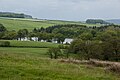
 Farmland in Hurst Green - geograph.org.uk - 3882765.jpg 1,024 × 767; 539 KB
-
 Felled Trees on Longridge Fell - geograph.org.uk - 5705556.jpg 5,184 × 3,456; 6.55 MB
-
 Fence and wall on Longridge Fell - geograph.org.uk - 1090204.jpg 640 × 480; 77 KB
-
 Field North of Stonyhurst Park - geograph.org.uk - 5849473.jpg 5,184 × 3,456; 7.13 MB
-
 Fishing Hut - geograph.org.uk - 2698632.jpg 640 × 480; 154 KB
-
 Fishing in the River Ribble - geograph.org.uk - 5905800.jpg 4,000 × 3,000; 4.58 MB
-
 Flow Measurement Building - geograph.org.uk - 2922438.jpg 640 × 480; 57 KB
-
 Flowering Hawthorn and Gorse - geograph.org.uk - 4516875.jpg 4,259 × 2,285; 7.89 MB
-
 Following the Ridge on Longridge Fell - geograph.org.uk - 5705552.jpg 5,184 × 3,456; 5.83 MB
-

-
 Footbridge 2 - geograph.org.uk - 1307483.jpg 640 × 427; 139 KB
-
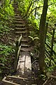
 Footbridge and steps at Raid Deep Wood - geograph.org.uk - 3551785.jpg 1,200 × 1,600; 973 KB
-
-
 Footbridge by the Hodder - geograph.org.uk - 4306355.jpg 5,400 × 3,600; 3.31 MB
-
 Footbridge in Park Wood - geograph.org.uk - 3772004.jpg 640 × 480; 155 KB
-
 Footbridge over an unnamed stream - geograph.org.uk - 4023353.jpg 3,000 × 4,000; 4.1 MB
-
 Footbridge over Dean Brook - geograph.org.uk - 3771994.jpg 640 × 480; 177 KB
-
 Footbridge over Dean Brook - geograph.org.uk - 4510897.jpg 4,592 × 3,056; 7.57 MB
-
 Footbridge Over Ribble Tributary On The Ribble Way - geograph.org.uk - 2113583.jpg 3,456 × 2,304; 5.9 MB
-
 Footbridge over the Ribble - geograph.org.uk - 2394013.jpg 4,000 × 3,000; 5.16 MB
-
 Footbridge over unnamed stream, Lodge Wood - geograph.org.uk - 3803538.jpg 1,024 × 683; 287 KB
-
 Footbridge, Over Hacking Wood - geograph.org.uk - 4448914.jpg 3,072 × 2,304; 2.84 MB
-
 Footpath along the Hodder - geograph.org.uk - 3927114.jpg 3,648 × 2,736; 4.07 MB
-
 Footpath at Stonyhurst College - geograph.org.uk - 5039349.jpg 1,280 × 1,117; 954 KB
-
 Footpath by the Hodder - geograph.org.uk - 4306362.jpg 5,400 × 3,600; 2.91 MB
-
-

-
 Footpath Following Ruined Wall - geograph.org.uk - 3353374.jpg 2,560 × 1,920; 3.32 MB
-
 Footpath heading away from Birdy Brow - geograph.org.uk - 4652907.jpg 1,600 × 1,067; 388 KB
-
 Footpath heading North East towards Longridge Road - geograph.org.uk - 5852616.jpg 5,184 × 3,456; 7.67 MB
-
 Footpath in Mill Wood - geograph.org.uk - 3882774.jpg 1,024 × 768; 928 KB
-
 Footpath in Mill Wood - geograph.org.uk - 3882777.jpg 1,024 × 768; 775 KB
-
 Footpath into the Vale of Chipping - geograph.org.uk - 3733954.jpg 3,661 × 2,441; 3.32 MB
-
 Footpath junction on Longridge Fell - geograph.org.uk - 1868877.jpg 640 × 426; 209 KB
-
 Footpath near Hill Farm - geograph.org.uk - 3882773.jpg 1,024 × 768; 427 KB
-
 Footpath on the Eastern Flanks of Longridge Fell - geograph.org.uk - 4652919.jpg 1,600 × 1,067; 717 KB
-
 Footpath outside Turner Fold - geograph.org.uk - 4652913.jpg 1,600 × 1,067; 765 KB
-
 Footpath through Raid Deep Wood - geograph.org.uk - 5904641.jpg 4,000 × 3,000; 5.27 MB
-
 Footpath through the fields - geograph.org.uk - 2392977.jpg 4,000 × 3,000; 5.38 MB
-
 Footpath through the fields - geograph.org.uk - 3517656.jpg 1,024 × 828; 618 KB
-

-
 Footpath To Diseased Larch - geograph.org.uk - 3567556.jpg 2,560 × 1,920; 3.11 MB
-
 Footpath to Kemple End - geograph.org.uk - 2302513.jpg 640 × 426; 447 KB
-
 Footpath to Over Hacking - geograph.org.uk - 3517713.jpg 1,024 × 768; 557 KB
-
 Footpath to Stonyhurst College - geograph.org.uk - 5906986.jpg 4,000 × 3,000; 4.75 MB
-
 Footpath towards Cherry Tree House - geograph.org.uk - 4124989.jpg 640 × 480; 71 KB
-
 Footpath Towards Dinkley Footbridge - geograph.org.uk - 3953656.jpg 2,548 × 1,906; 3.61 MB
-
 Forest Track on Longridge Fell - geograph.org.uk - 5705547.jpg 5,184 × 3,456; 6.52 MB
-
 Forestry Track on Longridge Fell - geograph.org.uk - 5705550.jpg 5,184 × 3,456; 6.51 MB
-
 Former Craven Heifer - geograph.org.uk - 2771175.jpg 640 × 480; 115 KB
-
 Former Craven Heifer Pub - geograph.org.uk - 2401215.jpg 1,024 × 737; 94 KB
-
 Former public house - geograph.org.uk - 4521591.jpg 4,259 × 2,428; 7.13 MB
-
 Frozen confluence... - geograph.org.uk - 6368175.jpg 2,592 × 1,944; 1.57 MB
-
 Frozen pond at Winckley Hall Farm - geograph.org.uk - 6377850.jpg 4,032 × 3,024; 4.18 MB
-
 Frozen river - geograph.org.uk - 6368170.jpg 2,592 × 1,944; 1.48 MB
-
 Gate and Driveway at Chadswell - geograph.org.uk - 3927159.jpg 3,648 × 2,736; 4.74 MB
-
 Gate on Ribble Way - geograph.org.uk - 2283651.jpg 1,600 × 1,198; 645 KB
-
 Gates to the cricket field - geograph.org.uk - 3517686.jpg 1,024 × 768; 372 KB


_-_geograph.org.uk_-_4513300.jpg)


_-_geograph.org.uk_-_5139331.jpg)


