Category:Maps of the world showing history
Jump to navigation
Jump to search

Maps of the world made less than seventy (70) years ago that show history.
- For old maps of the world, see Category:Old maps of the world.
- For old maps in general, see Category:Old maps
| Maps of world history | |
| BC | |
|
| |
| AD |
1 · 50 · 100 · 200 · 250 · 300 · 400 · 500 · 700 · 750 · 820 · 900 · 1200 · 1500 · 1556 · 1648 · 1700 · 1750 · 1815 · 1859 · 1871 · 1914 · 1935 · 1954 · 1989 · 2000 · |
|
Maps of colonization history | |
|
see also: Eastern Hemisphere only maps template (1300BC-1500AD) | |
| (this template: · view · discuss ) | |
Subcategories
This category has the following 17 subcategories, out of 17 total.
Pages in category "Maps of the world showing history"
The following 10 pages are in this category, out of 10 total.
Media in category "Maps of the world showing history"
The following 156 files are in this category, out of 156 total.
-
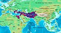 Alexander-Empire 323bc.jpg 2,321 × 1,288; 933 KB
-
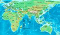
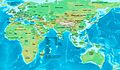
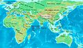
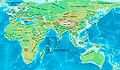
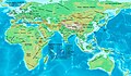
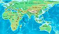
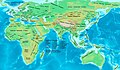
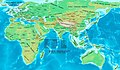
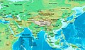 Asia 500ad.jpg 2,196 × 1,305; 435 KB
-
 East-Hem 001ad.jpg 3,240 × 1,903; 709 KB
-
 East-Hem 050ad.jpg 3,240 × 1,903; 722 KB
-
 East-Hem 050bc.jpg 3,240 × 1,903; 722 KB
-
 East-Hem 1000bc.jpg 3,240 × 1,903; 1.43 MB
-
 East-Hem 100ad.jpg 3,240 × 1,903; 726 KB
-
 East-Hem 100bc.jpg 3,240 × 1,903; 737 KB
-
 East-Hem 1025ad.jpg 3,240 × 1,903; 3.16 MB
-
 East-Hem 1100ad.jpg 3,240 × 1,903; 3.16 MB
-
 East-Hem 1200ad.jpg 3,240 × 1,903; 2.01 MB
-
 East-Hem 1300bc.jpg 3,240 × 1,903; 1.42 MB
-
 East-Hem 200ad.jpg 3,240 × 1,903; 734 KB
-
 East-Hem 200bc.jpg 3,240 × 1,903; 2.23 MB
-
 East-Hem 300ad (cropped).jpg 968 × 602; 107 KB
-
 East-Hem 300ad.jpg 3,240 × 1,903; 739 KB
-
 East-Hem 323bc.jpg 3,240 × 1,903; 712 KB
-
 East-Hem 400ad (cropped).jpg 1,079 × 574; 117 KB
-
 East-Hem 400ad.jpg 3,240 × 1,903; 749 KB
-
 East-Hem 400bc.jpg 3,240 × 1,903; 725 KB
-
 East-Hem 475ad.jpg 3,240 × 1,903; 753 KB
-
 East-Hem 476ad (cropped).jpg 1,042 × 685; 167 KB
-
 East-Hem 476ad.jpg 3,240 × 1,903; 754 KB
-
 East-Hem 477ad.jpg 3,240 × 1,903; 760 KB
-
 East-Hem 500ad.jpg 3,240 × 1,903; 774 KB
-
 East-Hem 500bc.jpg 3,240 × 1,903; 1.41 MB
-
 East-Hem 565ad.jpg 3,240 × 1,903; 773 KB
-
 East-Hem 600ad.jpg 3,240 × 1,903; 3.8 MB
-
 East-Hem 600bc.jpg 3,240 × 1,903; 731 KB
-
 East-Hem 700ad.jpg 3,240 × 1,903; 924 KB
-
 East-Hem 800ad.jpg 3,240 × 1,903; 3.51 MB
-
 East-Hem 900ad.jpg 3,240 × 1,903; 1.71 MB
-
 Hittites 1300bc.jpg 1,285 × 1,008; 520 KB
-
 India in 477 CE.png 749 × 946; 1.03 MB
-
 Indo-Greeks 100bc.jpg 880 × 659; 696 KB
-
 Kushano-Hephthalites 600ad.jpg 758 × 670; 575 KB
-
 Kushanshas-Hepthalites 565ad.jpg 816 × 853; 131 KB
-
 NE 600ad.jpg 1,439 × 1,086; 502 KB
-
 NE 800ad.jpg 1,533 × 1,264; 552 KB
-
 Odoacer 480ad.jpg 900 × 545; 701 KB
-
 Parthia 001ad.jpg 793 × 652; 741 KB
-
 Persia 600ad.jpg 1,098 × 623; 644 KB
-
 Ptolemaic-Empire 200bc.jpg 1,164 × 636; 1.02 MB
-
 Roman-Empire 200bc.jpg 1,164 × 636; 887 KB
-
 Roman-Empire 477ad.jpg 1,405 × 954; 372 KB
-
 Roman-Empire 565ad.jpg 1,287 × 875; 1.23 MB
-
 Rome-Seleucia-Parthia 200bc.jpg 1,205 × 567; 767 KB
-
 Saffarids 900ad.jpg 1,076 × 769; 1.04 MB
-
 Seleucid-Empire 200bc.jpg 1,244 × 716; 748 KB
-
 Sindh 700ad.jpg 720 × 473; 432 KB
-
 Map14century.png 1,438 × 712; 548 KB
-
 1555-56 CE World Map.PNG 4,500 × 2,234; 302 KB
-
 Age of Ancient Empires.png 7,016 × 4,681; 846 KB
-
 Ancientcultures.gif 1,427 × 628; 76 KB
-

-
 C.C.Fernberger.png 2,000 × 1,015; 202 KB
-
 Cavindasch.png 1,425 × 625; 48 KB
-
 Centres of origin and spread of agriculture v2.svg 940 × 415; 1.49 MB
-
 Colonisation 1492.png 3,600 × 1,578; 1.09 MB
-
 Colonisation 1600.png 8,550 × 3,750; 3.41 MB
-
Colonisation territorial changes from 15th to 20th century.ogv 1 min 34 s, 800 × 351; 3.32 MB
-
 Conceptions Colomb map-en.svg 1,022 × 635; 857 KB
-
 Conceptions Colomb map-fr.svg 1,022 × 635; 1.01 MB
-
 Connaissances geographiques.jpg 5,965 × 3,835; 3.53 MB
-
 Descobrimentos e explorações portuguesesV2.png 1,357 × 628; 211 KB
-
 Enrique melaka.png 1,425 × 625; 46 KB
-
 Europa60AD.jpeg 750 × 469; 72 KB
-
 Europe in search of new routes to India and China, 1486-1616 A.D..jpg 4,667 × 2,708; 7.78 MB
-
 Francesco Carletti.png 1,425 × 625; 45 KB
-
 French Empire on World 1812.png 1,357 × 628; 15 KB
-
 French-British colonial twilight.png 3,056 × 1,730; 226 KB
-
 GDP of the world in 1800.png 1,202 × 571; 176 KB
-
 Geographie de l'antiquité.jpg 5,965 × 3,835; 4.08 MB
-
 Geopolitica guerra fria-Cold war geopolitics.png 3,057 × 1,784; 310 KB
-
 German campaign on world 1813.png 1,357 × 628; 33 KB
-
 German colonial.PNG 1,425 × 625; 41 KB
-
 Grass to meat.png 1,425 × 625; 50 KB
-
 Holocene-crop-domestication-de.svg 1,576 × 743; 252 KB
-
 Holocene-crop-domestication-en.svg 1,613 × 743; 252 KB
-
 Human spreading over history.png 1,425 × 625; 159 KB
-
 Karte Hochkulturen.png 1,871 × 991; 161 KB
-
 Karte Portugiesisch-Spanischer Verträge.png 1,500 × 775; 180 KB
-
 Las Indias.png 1,334 × 613; 46 KB
-
 Linie Inter Caetera und Tordesillas.jpg 1,200 × 1,254; 103 KB
-
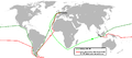
 Magellan's Voyage HR.PNG 2,000 × 1,108; 391 KB
-
 Magellan-Harita-Tr.jpg 1,884 × 892; 193 KB
-
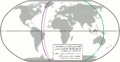
 Magellan-Map-En.png 1,357 × 643; 112 KB
-
 Magellan-Map-No.png 1,357 × 643; 74 KB
-
 Mongolempire.png 1,357 × 628; 49 KB
-
 Mundo post-Guerra Fria.png 3,050 × 1,938; 297 KB
-
 Old World 820.png 643 × 408; 31 KB
-
 Orbe China 1450.png 1,439 × 945; 81 KB
-
 Orbe Europa.png 1,250 × 769; 73 KB
-
 Orbe Islam 1500.png 1,442 × 962; 82 KB
-
 Osmanlı haritası 3.murad 1592.jpg 4,476 × 2,763; 7.57 MB
-
 Planche VI - Principales religions de l'ancien monde - liv3-ch09.png 4,224 × 2,848; 5.82 MB
-
 Portugal XVIII.png 1,427 × 628; 48 KB
-
 Portugal-1500.png 1,357 × 628; 72 KB
-
 Portuguese discoveries and explorationsV2en.png 1,357 × 628; 213 KB
-
 Post-Cold War World.png 3,048 × 1,937; 296 KB
-
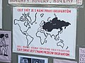 Praha, Nové Město, plakát z 21. srpna 1968.jpg 2,848 × 2,136; 1.44 MB
-
 Roman-Empire 477ad-es.svg 512 × 287; 36 KB
-
 Roman-Empire 477ad-pt.svg 512 × 287; 28 KB
-
 Rutas Jaime Duque.jpg 2,560 × 1,440; 885 KB
-
 Schouten,Spielbergen.png 1,425 × 625; 47 KB
-
 Second French Empire.png 1,425 × 625; 35 KB
-
 Spain and Portugal-ar.png 1,500 × 771; 225 KB
-
 Spain and Portugal-fr.png 1,500 × 771; 188 KB
-
 Spain and Portugal.png 1,500 × 771; 92 KB
-
 Spread of Manicheanism.png 3,269 × 1,624; 4.33 MB
-
 Spread-of-printing.gif 1,400 × 725; 744 KB
-
 UK Surveying Activities Overseas 1961.jpg 4,836 × 3,936; 2.09 MB
-
 Weltumsegelung von Ferdinand Magellan und Juan Sebastian Elcano.png 1,500 × 885; 350 KB
-
 Weltumsegelung von Magellan und Juan Sebastian Elcano.png 1,500 × 885; 297 KB
-
 World 2000 BC EL.svg 4,500 × 2,234; 824 KB
-
 World 2000 BC.png 4,500 × 2,234; 868 KB
-
 World 2000 BCE NearEast and Mediterranean.jpg 734 × 462; 73 KB
-
 World 2000 BCE.png 4,000 × 1,986; 1 MB
-
 World 2000BC.jpeg 319 × 158; 9 KB
-
 World History mid res v2.2.jpg 5,577 × 5,577; 4.14 MB
-
 World in 1 CE.png 4,000 × 2,036; 1.73 MB
-
 World in 100 BCE.PNG 4,000 × 2,036; 1.74 MB
-
 World in 100 CE.PNG 4,000 × 2,036; 1.67 MB
-
 World in 1000 BCE.png 4,500 × 2,234; 401 KB
-
 World in 200 CE.PNG 4,000 × 2,036; 1.71 MB
-
 World in 2000 BC.svg 4,500 × 2,234; 847 KB
-
 World in 250 CE.png 4,000 × 2,036; 1.7 MB
-
 World in 300 BCE.PNG 4,500 × 2,291; 1.92 MB
-
 World in 300 CE.PNG 4,000 × 2,036; 1.69 MB
-
 World in 323 BCE.png 4,500 × 2,234; 467 KB
-
 World in 400 BCE.png 4,700 × 2,392; 2.03 MB
-
 World in 400 CE.png 4,000 × 2,036; 1.71 MB
-
 World in 50 BCE.PNG 4,000 × 2,036; 1.73 MB
-
 World in 50 CE.PNG 4,000 × 2,036; 1.67 MB
-
 World in 500 BCE.png 4,000 × 1,986; 974 KB
-
 World in 500 CE.png 4,000 × 2,036; 1.72 MB
-
 World in 5000 BCE.png 4,700 × 2,392; 2.13 MB
-
 World in 700 CE.png 4,000 × 2,036; 1.74 MB
-
 World in 750 CE.png 4,000 × 2,036; 1.51 MB
-
 World in 800.png 1,357 × 617; 37 KB
-
 World in 820.png 1,200 × 600; 42 KB
-
 World in 900 CE.png 4,000 × 2,036; 1.76 MB
-
 World map 1200.jpg 5,000 × 2,605; 826 KB
-
 World map 1500.png 4,074 × 1,863; 269 KB
-
 World map 1648.png 2,476 × 1,391; 248 KB
-
 World map 1750.png 2,920 × 1,379; 266 KB
-
 World map 1871.jpg 5,000 × 2,605; 819 KB
-
 World map 1914.jpg 5,000 × 2,605; 829 KB
-
 World map 1935.png 3,058 × 1,245; 349 KB
-
 World map 1954.png 3,005 × 1,247; 331 KB
-
 World map at 2002.png 4,500 × 2,234; 204 KB
-
 World map at 2006.png 4,500 × 2,234; 204 KB
-
 World map at 2007.png 4,500 × 2,234; 204 KB
-
 World map between 2003 and 2005.png 4,500 × 2,234; 204 KB
-
 WorldsOldestCitiesContinuouslyInhabitedThroughPresentDay.svg 2,745 × 2,133; 1.68 MB
-
 מפת חוזה סרגוסה.svg 1,219 × 627; 643 KB


.jpg)


.jpg)


.jpg)


.jpg)
._LOC_2001620596.jpg)