File:SchuylkillSkylinePhyladelphia.jpg
Jump to navigation
Jump to search
Size of this preview: 799 × 205 pixels. Other resolutions: 320 × 82 pixels | 640 × 164 pixels | 1,024 × 263 pixels | 1,280 × 329 pixels | 2,560 × 657 pixels | 8,000 × 2,054 pixels.
Original file (8,000 × 2,054 pixels, file size: 10 MB, MIME type: image/jpeg)
Captions
Captions
Add a one-line explanation of what this file represents
Summary[edit]
| Description |
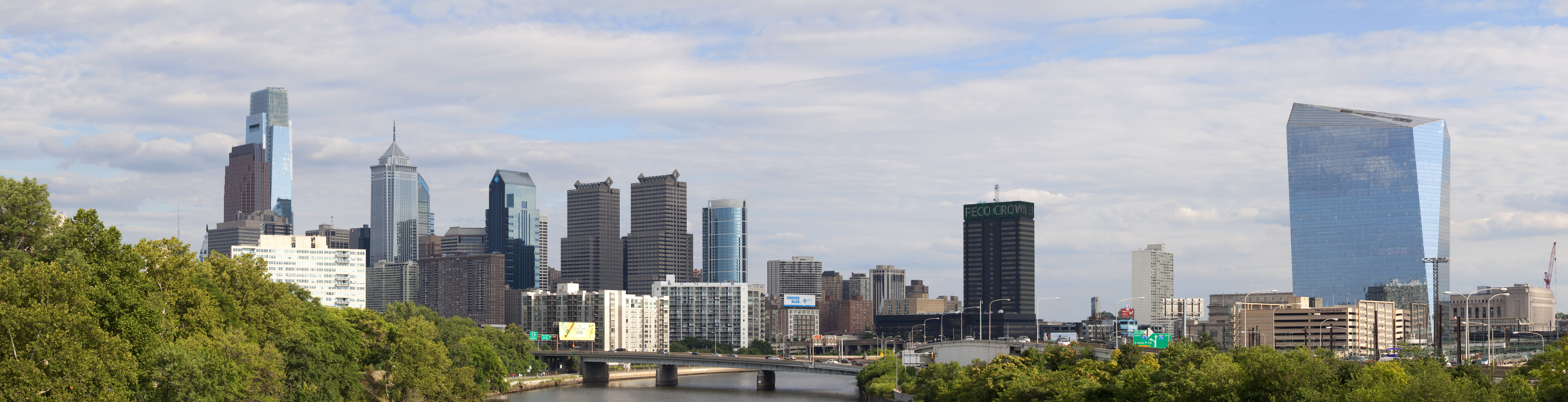
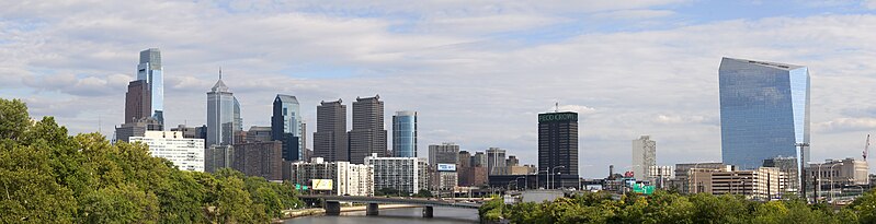
English: The skyline of Pennsylvania's largest city Philadelphia. Visible are Center City with the Comcast Center on the left bank of the Schuylkill River and the 30th Street Station with the Cira Centre on the right. The resolution of the original photograph is 14000*3594.
Nederlands: De skyline van de grootste stad in de staat Pennsylvania Philadelphia. Zichtbaar zijn Center City met het Comcast Center op de linker oever van de Schuylkill Rivier en het 30th Street Station met het Cira Centre op de rechter oever. De resolutie van de oorspronkelijke foto is 14000*3594. |
| Date | |
| Source | Own work |
| Author | Massimo Catarinella |
| Permission (Reusing this file) |
See license, attribution required - contact me to discuss less restrictive commercial licensing terms by email Special:EmailUser/Massimo Catarinella or leave a message on my talk page |
| Other versions |
 |
| Camera location | | View this and other nearby images on: OpenStreetMap |
|---|
Licensing[edit]
I, the copyright holder of this work, hereby publish it under the following license:
This file is licensed under the Creative Commons Attribution 3.0 Unported license.
- You are free:
- to share – to copy, distribute and transmit the work
- to remix – to adapt the work
- Under the following conditions:
- attribution – You must give appropriate credit, provide a link to the license, and indicate if changes were made. You may do so in any reasonable manner, but not in any way that suggests the licensor endorses you or your use.
File history
Click on a date/time to view the file as it appeared at that time.
| Date/Time | Thumbnail | Dimensions | User | Comment | |
|---|---|---|---|---|---|
| current | 21:50, 17 July 2009 | 8,000 × 2,054 (10 MB) | Massimo Catarinella (talk | contribs) | Increased the saturation | |
| 18:32, 17 July 2009 | 8,000 × 2,054 (9.62 MB) | Massimo Catarinella (talk | contribs) | More contrast | ||
| 17:26, 16 July 2009 | 8,000 × 2,023 (8.84 MB) | Massimo Catarinella (talk | contribs) | {{Information |Description=The skyline of Pennsylvania's largest city Philadelphia. Visible are Center City with the Comcast Center on the left bank of the Schuykill River and the 30th Street Station with the Cira Centre on the right. The resolution of th |
You cannot overwrite this file.
File usage on Commons
The following 2 pages use this file:
File usage on other wikis
The following other wikis use this file:
- Usage on en.wikipedia.org
- Usage on tl.wikipedia.org