Þingvellir
See also: Þingvellir/History
Pronunciation of the place name of Þingvellir
[modifier]Location of Þingvellir
[modifier]Þingvellir is located in the southwest of Iceland at about 45 km from Reykjavík and 35 km from w:Mosfellsbær. To get there, it is possible to take Road No. 1 in direction of Borgarnes and from Mosfellsbær Road No. 36 over Mosfellsheiði, or take Road No. 1 south in direction of Selfoss, then Road 35 and Road No. 36 from Þrastalundur (restaurant).


History of Þingvellir
[modifier]During the Middle Ages, one of the oldest parliaments in the world met here in the summer time. (See also: Þingvellir/History )
-
 Lögberg, the place of the parliament meetings from 930 AD on.
 -
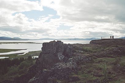
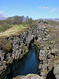
 The chasm of Almannagjá, important center of summer activity during the meetings
 -
 Lögberg
 -
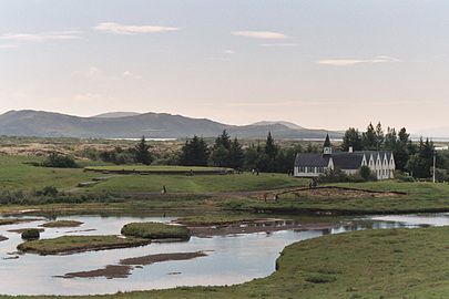 Church and manorhouse at Þingvellir


Nature of Þingvellir
[modifier]Not only is Þingvellir one of the key places re. the history of Iceland, but it is also very important in relation to the nature of the country, the homonymous Þingvellir Graben being part of the active rift and volcanic zone and as such of the w:Midatlantic Ridge, the region sprouting many species of plants and animals, typical for subarctic regions like Iceland, eg. the Arctic Char or the Polar fox.
-
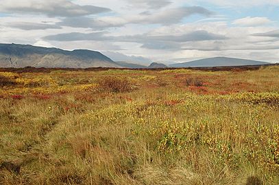 Þingvellir in autumn, with typical vegetation dominated by birch and willows, w:shield volcano Skjaldbreiður in the background
 -
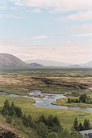
 Þingvellir in autumn 2004 with the lake Þingvallavatn and the volcanic system of w:Hengill
 -
 The Þingvellir Graben, a tectonic rift
 -
 Arctic char
 -
 Polar fox


Þingvellir National Park
[modifier]Because of the importance for Iceland's history as well as for its riches of nature, there was founded in 1928 a national park (Thingvellir National Park) which comprises mostly the northeastern and eastern parts of the lake shores.
-
 National park of Þingvellir, river Öxará in the foreground
 -
 Faults in Þingvellir
 -
 Overview from Almannagjá: Church and graben at Þingvellir
.jpeg)

