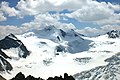
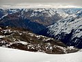
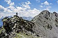
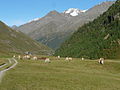
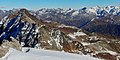
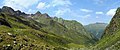
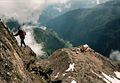
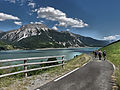
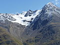
Category:Ötztal Alps
Vai alla navigazione
Vai alla ricerca

mountain range in the Central Eastern Alps   | |||||
| Carica un file multimediale | |||||
| Istanza di | |||||
|---|---|---|---|---|---|
| Materiale usato | |||||
| Luogo |
| ||||
| Catena montuosa |
| ||||
| Punto più alto | |||||
| Altezza sul mare |
| ||||
 | |||||
Deutsch: Ötztaler Alpen
Italiano: Alpi Venoste
Sottocategorie
Questa categoria contiene le 53 sottocategorie indicate di seguito, su un totale di 53.
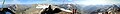
- Panoramics of Ötztal Alps (13 F)
*
- Maps of Ötztal Alps (14 F)
+
C
- Cyprian-Granbichler-Weg (36 F)
D
- Danzebell (2 F)
E
F
G
- Gaisbergbach (4 F)
- Gepatschspeicher (13 F)
- Gurgler Eissee (6 F)
H
- Hochjochbach (15 F)
K
L
M
N
- Niederjochbach (6 F)
O
- Ötztaler Urkund (4 F)
P
- Petznerbach (13 F)
- Piburger See (36 F)
- Pitztaler Urkund (2 F)
- Pollestal (4 F)
R
- Ramoljoch (9 F)
- Rheinland-Pfalz-Biwak (6 F)
S
- Schwarzsee (Ötztaler Alpen) (3 F)
- Seebertal (11 F)
- Stiller Bach (Inn) (7 F)
T
- Timmelsbach (3 F)
V
- Vernagtbach (22 F)
Ä
- Äußeres Hochebenkar (1 F)
Ö
File nella categoria "Ötztal Alps"
Questa categoria contiene 200 file, indicati di seguito, su un totale di 245.
(pagina precedente) (pagina successiva)-
 2015 0729 Gaislachkogel and Rettenbachferner panorama.jpg 8 054 × 1 279; 5,95 MB
-
 2015 0731 Mountains surrounding Sölden.jpg 18 543 × 2 298; 34,13 MB
-
 2015 0805 Panorama Stubaier and Ötztaler Alpen from Gaislachkogel.jpg 20 775 × 2 099; 33,67 MB
-
 3768-Wildspitze.jpg 3 072 × 2 048; 1,28 MB
-
 Abstieg vom Gingljoch.jpg 3 264 × 2 448; 3,66 MB
-
 AD2008July01 Oetztal Alps main chain - Fineil ridge - panoramic view from north.jpg 11 707 × 2 608; 26,37 MB
-
 Albin Egger-Lienz 001.jpg 2 048 × 1 212; 185 KB
-
 Anton-Renk-Hütte.jpg 1 267 × 909; 155 KB
-
 Apline cows above HochSolden - panoramio.jpg 2 816 × 1 584; 2,41 MB
-
 Ausblick - panoramio (16).jpg 1 200 × 800; 435 KB
-
 Ausblick vom Tiefenbachgletscher - panoramio.jpg 4 598 × 3 442; 6,49 MB
-
 Austria ridge hike.jpg 3 402 × 2 239; 8,94 MB
-
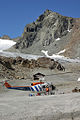 Bell 204 in Pitztal 01.jpg 680 × 1 024; 459 KB
-
 Blick auf den Ort Farst und den gegenüberliegenden Geigenkamm.jpg 11 000 × 3 176; 14,72 MB
-
 Blick auf Rofenhöfe.jpg 3 264 × 2 448; 3,53 MB
-
 Blick in das Ötztal - panoramio.jpg 4 608 × 2 304; 4,93 MB
-
 Blick Richtung Kreuzspitze.jpg 3 456 × 2 304; 2,67 MB
-
 Blick Richtung Norden von der Ultner Hochwart.jpg 3 264 × 2 448; 3,42 MB
-
 Blick von der Lodner Hütte hinab ins Zieltal.jpg 3 264 × 2 448; 4,05 MB
-
 Blick von der Roggalspitze auf die Ötztaler Alpen und das Verwall.jpg 3 264 × 2 448; 1,89 MB
-
 Blick von der Sturzmahd (7863911898).jpg 7 063 × 2 924; 4,93 MB
-
 Blick zur Zwickauer Hütte.jpg 1 073 × 742; 125 KB
-
 Bliggspitze taschachhaus.jpg 1 024 × 768; 446 KB
-
 Bolzano e il Gruppo del Tessa - panoramio.jpg 3 264 × 2 448; 2,09 MB
-
 BrandenbugerHausUndWeisskugel.jpg 2 848 × 2 136; 1,53 MB
-
 BreiterGrieskogel pano.jpg 2 401 × 1 018; 670 KB
-
 Camminando (4815317352).jpg 1 600 × 1 200; 818 KB
-
 Confluence point 47N 11E - panoramio.jpg 10 283 × 2 652; 4,28 MB
-
 Covered Crevasse.jpg 2 592 × 1 944; 2,2 MB
-
 Dreifaltigkeitskapelle Seite, Oetz 05.jpg 5 184 × 3 456; 6,7 MB
-
 EndkopfFromS.jpg 2 402 × 3 685; 2,18 MB
-
 Erenspitze N.JPG 3 472 × 2 468; 5,41 MB
-
 Erlebniswerkstattl Oetz - panoramio.jpg 3 888 × 2 592; 1,72 MB
-
 ETH-BIB-Ötztaler Alpen, Spur zum Brandenburger Haus-Inlandflüge-LBS MH01-007127.tif 6 380 × 4 793; 87,61 MB
-
 ETH-BIB-Ötztaler Alpen-LBS H1-020295.tif 6 374 × 5 029; 91,76 MB
-
 ETH-BIB-Ötztaler Alpen-LBS H1-020298.tif 6 399 × 5 062; 92,73 MB
-
 ETH-BIB-Ötztaler Alpen-LBS H1-020299.tif 6 385 × 5 045; 92,21 MB
-
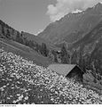
 FeichtenKaunertal.jpg 1 600 × 1 200; 400 KB
-

-
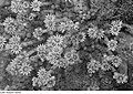
 Fotothek df ps 0000729 Pflanzen ^ Sonstiges.jpg 797 × 820; 238 KB
-
 Fotothek df ps 0000731 Pflanzen ^ Sonstiges.jpg 540 × 820; 184 KB
-
-

-

-
-

-

-

-
 Fotothek df ps 0000903 Pflanzen ^ Sonstiges.jpg 800 × 770; 246 KB
-

-

-
-
-

-

-

-

-

-

-
-

-

-

-

-
-

-

-

-

-

-
 From Hohe Mut with hut.jpg 12 061 × 1 879; 4,64 MB
-
 Gemeinde Längenfeld, Austria - panoramio - Michal Gorski (2).jpg 3 888 × 2 592; 1,62 MB
-
 Gemeinde Sölden, Austria - panoramio (5).jpg 3 456 × 2 592; 1,11 MB
-
 Gemeinde Sölden, Austria - panoramio - sanja mm.jpg 2 592 × 1 944; 1,83 MB
-
 Generated HDR - Tone mapped (Large).jpg 1 024 × 674; 91 KB
-
 GepatschfernerFormS.jpg 1 896 × 1 013; 867 KB
-

-
 Glacier in Ötztal Alps.jpg 3 632 × 2 936; 1,67 MB
-
 Glaciers in Ötztal Alps.jpg 1 221 × 598; 191 KB
-
 Gletscher am Hintereis-Ferner - panoramio.jpg 3 264 × 2 176; 3,12 MB
-
 Granat-oetztaler-alpen hg.jpg 3 361 × 2 604; 993 KB
-
 Granate-oetztaler-alpen hg.jpg 3 465 × 2 747; 1,11 MB
-
 Granatzwilling-oetztaler-alpen hg.jpg 4 036 × 2 820; 1,1 MB
-
 Gueserkopf.JPG 1 840 × 1 232; 344 KB
-
 Guido-Lammer-Biwak-2022.jpg 4 032 × 3 024; 5,92 MB
-
 Gurgler Ache - panoramio (5).jpg 5 184 × 3 456; 9,46 MB
-
 GurglerFerner1 Hochwildehaus.jpg 2 048 × 1 536; 830 KB
-
 GurglerFerner1.jpg 2 048 × 1 536; 2,18 MB
-
 Hairlacher Seekopf S.JPG 2 206 × 1 434; 1,58 MB
-
 Hintereisferner von Im hinteren Eis.jpg 5 200 × 2 168; 1,88 MB
-
 Hinterer und Vorderer Brochkogel.JPG 2 784 × 1 296; 2,4 MB
-
 Hochalt von Nordwesten.jpg 2 304 × 1 728; 828 KB
-
 Hochjochferner.jpg 3 264 × 2 448; 3,83 MB
-
 Hochvernagtspitze N.JPG 3 872 × 2 592; 4,23 MB
-
 Hochwilde Panorama.jpg 27 506 × 3 224; 24,4 MB
-
 Hochwilde Spiegelung HQ.jpg 743 × 475; 48 KB
-
 Hohe Mut 10104 Hochfirst.jpg 1 280 × 960; 564 KB
-
 Hohe Mut 10108 Liebenerspitze.jpg 2 560 × 1 316; 891 KB
-
 Im Hinteren Eis Panorama.jpg 16 880 × 2 048; 6,58 MB
-
 ISS002-E-8398 - View of Switzerland.jpg 3 060 × 2 092; 2,29 MB
-
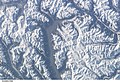 ISS006-E-27684 - View of Austria.jpg 3 032 × 2 064; 1,78 MB
-
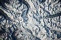
 ISS030-E-18703 - View of Italy.jpg 4 288 × 2 848; 2,08 MB
-
 ISS040-E-132989 - View of Earth.jpg 4 256 × 2 832; 1,73 MB
-
 ISS041-E-104170 - View of Switzerland.jpg 4 928 × 3 280; 2,8 MB
-
 ISS041-E-104172 - View of Austria.jpg 4 928 × 3 280; 2,94 MB
-
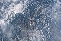 ISS048-E-71198 - View of Earth.jpg 4 928 × 3 280; 1,75 MB
-
 ISS048-E-71199 - View of Earth.jpg 4 928 × 3 280; 1,74 MB
-
 Kapelle Burgstein, Längenfeld 06.jpg 5 184 × 3 456; 7,92 MB
-
 Karköpfe from Farst.jpg 3 349 × 1 685; 2,52 MB
-
 Kaunertal002.jpg 1 170 × 1 114; 846 KB
-
 KaunertalerGletscherstrasse1.jpg 2 048 × 1 432; 427 KB
-
 KaunertalerGletscherstrasse2.jpg 2 048 × 1 432; 542 KB
-
 KesselwandfernerEisbruch.jpg 2 848 × 2 136; 1,67 MB
-
 Kortscher Jöchl.JPG 2 048 × 1 536; 1,44 MB
-
 Kreuzkamm HQ.jpg 741 × 478; 77 KB
-
 Kreuzspitze vom Saykogel.jpg 2 000 × 1 500; 1,64 MB
-
 Kurz vor der Zielalm.jpg 3 456 × 2 304; 5,65 MB
-
 Königstal 0570.jpg 5 568 × 2 785; 3,15 MB
-
 La catena del Tessa nel cielo blu - panoramio.jpg 4 537 × 3 183; 5,58 MB
-
 Lago sopranes 3 - panoramio.jpg 2 816 × 2 112; 2,41 MB
-
 Langtauferer Spitze und davor der Langtauferer Ferner - Ghiacciao di Vallelunga.jpg 2 560 × 1 920; 2,43 MB
-
 Langtauferer Spitze.jpg 1 378 × 1 035; 228 KB
-
 Leiteralm.jpg 773 × 511; 105 KB
-
 Liebenerspitze, Hochfirst E.JPG 3 404 × 1 308; 3,57 MB
-
 Liftstation Bergwerk Platzertal.jpg 1 152 × 864; 413 KB
-
 Lodner Hütte mit Lodner.jpg 3 264 × 2 448; 3,76 MB
-
 Lodner.jpg 1 613 × 1 190; 439 KB
-
 Luftbild Alpen 01 (RaBoe).jpg 750 × 1 000; 554 KB
-
 Luibiskogel S.JPG 3 806 × 2 364; 5,37 MB
-
 LuibiskogelFromSW.jpg 1 637 × 2 183; 1,11 MB
-
 Mandarfen.jpg 977 × 682; 427 KB
-
 Meraner Berge.jpg 768 × 491; 225 KB
-
 Meraner Waalrunde.jpg 708 × 600; 162 KB
-

-
 Morgenstimmung Vordere Ölgrubenspitze Bliggspitze Eiskastenspitze Wurmtaler Kopf.JPG 3 264 × 2 448; 3,61 MB
-
 Mountains under violet sky (Unsplash).jpg 3 648 × 4 864; 822 KB
-
 Mt. Weisskugel 2008-06-15.jpg 3 618 × 2 422; 3,15 MB
-
 Mutmalspitze.JPG 4 032 × 3 024; 1,42 MB
-
 Nice snow powdered mountains in the Otztal at 6 March 2015 - panoramio.jpg 4 288 × 2 848; 2,87 MB
-
 Niedertal bei Vent.jpg 3 264 × 2 448; 3,14 MB
-
 Northern Mendelkamm and Texelgruppe.JPG 3 264 × 2 448; 2,79 MB
-
 Oberer Karsee am Hochalt.jpg 2 304 × 1 728; 839 KB
-
 Oetztal1.JPG 4 000 × 3 000; 3,97 MB
-
 Oetztal2.JPG 4 000 × 3 000; 4,43 MB
-
 Oetztal3.jpg 4 000 × 3 000; 4,1 MB
-
 Oetzthaler Alpen östlich vom Similaun.jpg 7 007 × 2 920; 4,4 MB
-
 Ortsansicht Wenns, Norden.JPG 5 184 × 3 456; 7,72 MB
-
 Otzthal. NYPL1226651.tiff 4 496 × 5 419; 69,71 MB
-
 Panorama Brandenburgerhaus.JPG 13 968 × 3 373; 23,72 MB
-
 Panorama der Oetzthaler Gruppe vom Ramolkogel.jpg 23 231 × 3 115; 19,12 MB
-
 Petersenspitze Northface View to west.JPG 3 264 × 2 448; 3,27 MB
-
 Planferner.JPG 3 872 × 2 592; 6,28 MB
-
 Raggio di sole sul Seebersee e la sua torbiera (BZ) m 2065 - panoramio.jpg 4 000 × 3 000; 2,16 MB
-
 Ramolkogel Latschferner.jpg 4 000 × 3 000; 4,69 MB
-
 Rappenkopf-Süd.jpg 8 192 × 1 856; 4,43 MB
-
 Reiserk7.jpg 1 280 × 960; 385 KB
-
 Rheinland-Pfalz-Biwak.jpg 851 × 581; 84 KB
-
 Rixner.jpg 3 436 × 2 076; 824 KB
-
 Rock glacier austria.jpg 1 600 × 1 051; 386 KB
-
 Roetenspitze.jpg 1 821 × 1 368; 877 KB
-
 Rofen Vent W.JPG 3 156 × 2 272; 5,02 MB
-
 Rofenhoefe.jpg 3 264 × 2 448; 3,46 MB
-
 RofenhoefeKapelle.jpg 1 240 × 930; 360 KB
-
 Rofenkapelle1 FoNo.jpg 4 000 × 3 000; 5,88 MB
-
 Rofental from Breslauer Hütte.jpg 800 × 531; 256 KB
-
 Rotmoos-Wasserfall 0085.jpg 5 567 × 3 024; 4,16 MB
-
 RuesselsheimerHuette.jpg 2 848 × 2 136; 1,58 MB
-
 Rötenspitze NW.JPG 3 872 × 2 592; 5,02 MB
-
 S,Cristina Avelengo.jpg 3 456 × 2 304; 907 KB
-
 Schafstrieb bei Vent am Morgen.jpg 3 264 × 2 448; 3,58 MB
-
 SchalffernerFromNE.jpg 2 048 × 1 536; 1,88 MB
-
 Schenna Klammeben view of Ötztal Alps 2.jpg 4 008 × 6 008; 21,81 MB
-
 Schenna Klammeben view of Ötztal Alps 4.jpg 6 008 × 4 008; 16,27 MB
-
 Schenna Klammeben view of Ötztal Alps 5.jpg 6 008 × 4 008; 16,34 MB
-
 Schenna Klammeben view of Ötztal Alps 6.jpg 6 008 × 4 008; 20,36 MB
-
 Schenna Klammeben view of Ötztal Alps 7.jpg 6 008 × 4 008; 18,61 MB
-
 Schenna View of the Passer Valley from the trail between Klammeben and Staffelalm 1.jpg 6 008 × 4 008; 19,13 MB
-
 Schenna View of the Passer Valley from the trail between Klammeben and Staffelalm 2.jpg 6 008 × 4 008; 18,47 MB
-
 Schenna View of Ötztal Alps from the trail between Klammeben and Staffelalm.jpg 6 008 × 4 008; 22,53 MB
-
 Schermerspitze, Wurmkogel - panoramio - sanja mm (cropped).jpg 1 177 × 877; 446 KB
-
 Schuchtkogel NW.jpg 453 × 187; 102 KB
-
 Schwabenkopf mai 2010.jpg 3 888 × 2 592; 4,67 MB
-
 Sefiarspitze NW.JPG 3 800 × 2 316; 3,73 MB
-
 Sexegertenspitze and other mountains.jpg 1 024 × 680; 310 KB
-
 Snowy mountain Kaunertal - panoramio.jpg 2 160 × 1 440; 207 KB
-
 Spiegelferner beim Aufstieg zum Hinterem Spiegelkogel, Wildspitz rechts hinten.jpg 4 301 × 2 104; 5,69 MB
-
 Spiegelferner mit Hinterem Spiegelkogel.jpg 3 264 × 2 448; 3,75 MB
-
 Stettiner Hut, Ötztal Alps, South Tyrol.jpg 6 032 × 4 032; 4,23 MB
-
 Stubaier Gletscher Panorama.jpg 5 068 × 2 362; 2,06 MB
-
 Sunrise Vordere Ölgrubenspitze Bliggspitze.JPG 3 264 × 2 448; 2,83 MB
-
 Sölden Gaislachkogelbahn 1.jpg 5 760 × 3 840; 15,37 MB
-
 Süd Tirol Meran.JPG 1 280 × 960; 961 KB
-
 Talleitspitze.jpg 5 684 × 3 932; 10,55 MB
-
 TaschachfernerFromMittelbergjoch.jpg 3 695 × 2 444; 2,43 MB
-
 Taschachhaus auf Bergschulter.JPG 3 264 × 2 448; 3,21 MB
-
 Taschachhaus Brunnenkarkopf.JPG 3 264 × 2 448; 4,18 MB
-
 Taschachhaus Haupteingang Terrasse.JPG 3 264 × 2 448; 2,84 MB
-
 Taschachhaus04.JPG 3 264 × 2 448; 4,59 MB
-

-


.jpg)


.jpg)


.jpg)


._Feldthymian,_Arzneiquendel.jpg)
._Feldthymian,_Arzneiquendel.jpg)
._Trollblumen_(Trollius.jpg)
._Spinnwebhauswurz_(S.jpg)
._Spinnwebhauswurz_(S.jpg)
._St%C3%A4ngellose_Eberwurz.jpg)
._Alpenaster_(Aster_a.jpg)


._Berghauswurz_(Sempe.jpg)
._Berghauswurz_(Sempe.jpg)


.jpg)
.jpg)

.jpg)

_A_Choice_Selection_of_Scenes_in_the_Tyrol_Sammlung_ausgew%C3%A4hlter_Ansichten_in_Tirol_(serietitel_op_object),_RP-F-F12577.jpg)


.jpg)


.jpg)


.jpg)

.jpg)


_m_2065_-_panoramio.jpg)


.jpg)


