Category:47-51 Friar Gate, Derby
Jump to navigation
Jump to search
| Object location | | View all coordinates using: OpenStreetMap |
|---|
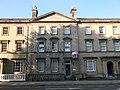
building in City of Derby, Derbyshire, England, UK .jpg) | |||||
| Upload media | |||||
| Instance of | |||||
|---|---|---|---|---|---|
| Location | City of Derby, Derbyshire, East Midlands, England | ||||
| Heritage designation |
| ||||
 | |||||
Media in category "47-51 Friar Gate, Derby"
The following 8 files are in this category, out of 8 total.
-
 47-51 Friar Gate, Derby (1).jpg 4,608 × 3,440; 4.1 MB
-
 47-51 Friar Gate, Derby (2).jpg 4,608 × 3,440; 4.01 MB
-
 47-51 Friar Gate, Derby (3).jpg 4,608 × 3,440; 4.03 MB
-
 47-51 Friar Gate, Derby (4).jpg 4,608 × 3,440; 4.21 MB
-
 47-51 Friar Gate, Derby (5).jpg 4,608 × 3,440; 4.19 MB
-
 47-51 Friar Gate, Derby (6).jpg 4,608 × 3,440; 4.21 MB
-
 47-51 Friar Gate, Derby (7).jpg 4,608 × 3,440; 4.24 MB
-
 47-51 Friar Gate, Derby (8).jpg 4,608 × 3,440; 3.58 MB
.jpg)
.jpg)
.jpg)
.jpg)
.jpg)
.jpg)
.jpg)