Category:A50 road (England)
Jump to navigation
Jump to search

road in England    | |||||
| Upload media | |||||
| Instance of | |||||
|---|---|---|---|---|---|
| Location |
| ||||
| Transport network |
| ||||
| Has part(s) |
| ||||
| Length |
| ||||
 | |||||
Subcategories
This category has the following 11 subcategories, out of 11 total.
B
D
- Derby South Services (4 F)
- Derby with Burton Services (5 F)
H
L
- Leicester North Services (1 F)
R
- Red Bull Aqueduct (11 F)
- Red Lion, Holmes Chapel (4 F)
Media in category "A50 road (England)"
The following 94 files are in this category, out of 94 total.
-
 50 Over 516 - geograph.org.uk - 293576.jpg 640 × 480; 86 KB
-

-
 A50 - A38 junction - geograph.org.uk - 707816.jpg 421 × 640; 137 KB
-
 A50 A511 Junction - geograph.org.uk - 133961.jpg 640 × 480; 70 KB
-
 A50 about to enter Derbyshire (geograph 2335818).jpg 640 × 480; 60 KB
-
 A50 Approaching High Legh - geograph.org.uk - 1522529.jpg 640 × 480; 289 KB
-
 A50 approaching Sudbury roundabout - geograph.org.uk - 2340417.jpg 640 × 480; 64 KB
-
 A50 at Brereton Green - geograph.org.uk - 1918454.jpg 640 × 480; 184 KB
-
 A50 at Brereton Green - geograph.org.uk - 3414594.jpg 640 × 480; 61 KB
-
 A50 at Doveridge - geograph.org.uk - 200467.jpg 640 × 480; 62 KB
-
 A50 at Toft Smithy - geograph.org.uk - 940763.jpg 640 × 480; 62 KB
-
 A50 At Water Tower Junction - geograph.org.uk - 1522510.jpg 640 × 480; 226 KB
-
 A50 At Wrenshot Lane Junction - geograph.org.uk - 1522548.jpg 640 × 480; 197 KB
-
 A50 Bridge - geograph.org.uk - 312329.jpg 640 × 480; 117 KB
-
 A50 eastbound at Hoon Lane bridge - geograph.org.uk - 3596427.jpg 640 × 479; 43 KB
-
 A50 heading for Brereton Green - geograph.org.uk - 3515849.jpg 640 × 434; 48 KB
-
 A50 junction - geograph.org.uk - 131714.jpg 640 × 426; 85 KB
-
 A50 looking East - geograph.org.uk - 5288.jpg 640 × 407; 48 KB
-
 A50 looking to junction with A534 - geograph.org.uk - 1580260.jpg 640 × 480; 54 KB
-
 A50 near Brereton Green - geograph.org.uk - 2245167.jpg 640 × 480; 72 KB
-
 A50 Near Hulme Barns Farm - geograph.org.uk - 1522339.jpg 640 × 480; 218 KB
-
 A50 Near Sworton Heath - geograph.org.uk - 1522505.jpg 640 × 480; 276 KB
-
 A50 Potteries Way, Stoke-on-Trent.jpg 4,608 × 3,456; 3.49 MB
-
 A50 road bridge over River Mersey - geograph.org.uk - 1009595.jpg 640 × 479; 48 KB
-
 A50 roundabout - geograph.org.uk - 1119964.jpg 640 × 480; 46 KB
-

-
 A50 south Derbyshire.jpg 2,448 × 3,264; 3.49 MB
-
 A50 south of Brereton Green - geograph.org.uk - 1918456.jpg 640 × 480; 176 KB
-
 A50 Tunnel, near Etwall Derbyshire - geograph.org.uk - 1660002.jpg 640 × 480; 66 KB
-
 A50 west of junction 1.jpg 1,200 × 675; 286 KB
-
 A50, Groby bypass - geograph.org.uk - 205720.jpg 640 × 427; 89 KB
-
 A50, Longton - geograph.org.uk - 122110.jpg 640 × 480; 67 KB
-
 A50, Looking Toward High Legh - geograph.org.uk - 1522513.jpg 640 × 480; 209 KB
-
 A50- A6 Junction - geograph.org.uk - 9643.jpg 640 × 396; 136 KB
-
 A50Services225.JPG 737 × 486; 283 KB
-
 A50Services24.JPG 1,280 × 960; 614 KB
-
 Access bridge under the A50 - geograph.org.uk - 655311.jpg 640 × 451; 91 KB
-
 Brereton Green - geograph.org.uk - 3927015.jpg 3,434 × 1,979; 2.96 MB
-
-
 County Hall, Glenfield. - geograph.org.uk - 386159.jpg 640 × 345; 109 KB
-
 Cycle and Footpath - geograph.org.uk - 848818.jpg 640 × 427; 187 KB
-
 Cycle crossing on the A50 - geograph.org.uk - 205728.jpg 640 × 427; 82 KB
-
 Drovers Arms, Allostock - geograph.org.uk - 1202450.jpg 640 × 480; 55 KB
-
 Embankment near Toyota - geograph.org.uk - 314820.jpg 640 × 480; 117 KB
-
 Fenton geograph-3516018-by-Ben-Brooksbank.jpg 2,345 × 1,332; 2.64 MB
-
 Field track - geograph.org.uk - 310000.jpg 640 × 480; 114 KB
-
 Graffiti under the A50 - geograph.org.uk - 1196685.jpg 640 × 480; 93 KB
-
 Knutsford - Manchester Road - geograph.org.uk - 1184288.jpg 640 × 480; 167 KB
-
 Knutsford - Manchester Road - geograph.org.uk - 1184302.jpg 640 × 480; 180 KB
-

-
 Lane Markings - geograph.org.uk - 707864.jpg 427 × 640; 207 KB
-
 Layby on A50 - geograph.org.uk - 9644.jpg 640 × 522; 141 KB
-
 London Road Bridge 2153.JPG 3,264 × 2,448; 3.13 MB
-
 London Road Bridge 2154.JPG 3,264 × 2,448; 3.28 MB
-
 Looking down on the A50 - geograph.org.uk - 707726.jpg 640 × 427; 246 KB
-
 Mere Crossroads on A50 - geograph.org.uk - 1580250.jpg 640 × 480; 117 KB
-
 Moor Lane diversion - geograph.org.uk - 679399.jpg 640 × 429; 64 KB
-

-
 Overgrown Mere - geograph.org.uk - 310007.jpg 640 × 480; 112 KB
-
 Passing Under the A50 - geograph.org.uk - 1196705.jpg 640 × 480; 157 KB
-

-
 Remind me to check my water^ - geograph.org.uk - 1377779.jpg 640 × 480; 66 KB
-
 Road junction sign, A50 - geograph.org.uk - 1617503.jpg 480 × 640; 93 KB
-
 Road signs, northbound on the A50 - geograph.org.uk - 1617478.jpg 640 × 480; 95 KB
-
 Roundabout over the A50 - geograph.org.uk - 707819.jpg 640 × 427; 134 KB
-
 Slip road from A50 - geograph.org.uk - 461621.jpg 440 × 640; 107 KB
-
 Steps and Signpost - geograph.org.uk - 1196845.jpg 480 × 640; 104 KB
-
 The A50 Bridge over the Dove - geograph.org.uk - 1196811.jpg 480 × 640; 78 KB
-
 The A50 from Dove Bridge - geograph.org.uk - 1196835.jpg 480 × 640; 104 KB
-
 The footbridge over the A50. - geograph.org.uk - 309940.jpg 640 × 480; 116 KB
-
 The Salamanca, Fourlanes End - geograph.org.uk - 194823.jpg 640 × 480; 74 KB
-
 This is South Derbyshire.jpg 3,008 × 1,200; 2.37 MB
-
 Two Bridges over the Dove - geograph.org.uk - 1196741.jpg 640 × 365; 69 KB
-
 UK road A50.PNG 568 × 184; 7 KB
-
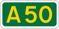 UK road A50.svg 387 × 191; 2 KB
-
 Underpass under the A50 - geograph.org.uk - 200492.jpg 640 × 480; 74 KB
-
 White Roundabout - geograph.org.uk - 843164.jpg 640 × 427; 224 KB
-
 A50 - geograph.org.uk - 461616.jpg 618 × 640; 107 KB
-
 A50 at Cottons Hotel, Mere - geograph.org.uk - 1184346.jpg 640 × 480; 127 KB
-
 A50 at Sugar Pit Lane, Knutsford - geograph.org.uk - 1184310.jpg 640 × 480; 209 KB
-
 A50 East - geograph.org.uk - 159712.jpg 640 × 480; 74 KB
-
 A50 near Uttoxeter - geograph.org.uk - 354407.jpg 640 × 427; 73 KB
-
 A50, Bradgate Hill near Markfield - geograph.org.uk - 271136.jpg 640 × 427; 98 KB
-
 Castle Donington Roundabout, A50 - geograph.org.uk - 6413.jpg 640 × 480; 133 KB
-

-
 Mere Corner (Cross roads) - geograph.org.uk - 84600.jpg 640 × 480; 118 KB
-

-
 Rose and Crown, Arclid crossroads - geograph.org.uk - 230394.jpg 640 × 480; 32 KB
-
 The A50 - geograph.org.uk - 684547.jpg 640 × 410; 196 KB
-
 The A50 - geograph.org.uk - 684556.jpg 640 × 427; 201 KB
-
 The A50 - geograph.org.uk - 707759.jpg 427 × 640; 187 KB
-
 The A50 at dawn - geograph.org.uk - 709469.jpg 640 × 441; 56 KB
-
 The A50 Groby Road, Leicester. - geograph.org.uk - 386186.jpg 640 × 442; 101 KB
-
 Three levels, five directions - geograph.org.uk - 707831.jpg 640 × 427; 166 KB


.jpg)


.jpg)


_-_geograph.org.uk_-_84600.jpg)


