Category:A628 road (England)
Jump to navigation
Jump to search
major road in the north of England  | |||||
| Upload media | |||||
| Instance of | |||||
|---|---|---|---|---|---|
| Location | |||||
| Transport network |
| ||||
| Length |
| ||||
 | |||||
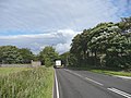
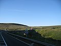
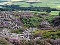
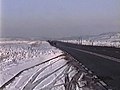
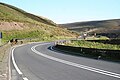
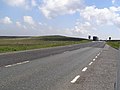
English: The A628 is a major road in the north of England connecting Greater Manchester and South Yorkshire by crossing the Pennine chain of hills by way of the Woodhead Pass through the Peak District National Park. The height and the exposure of the road often creates problems during poor weather in winter and the road is sometimes closed due to snowfall or high winds. There are plans for a bypass around Mottram in Longdendale, Hollingworth and Tintwistle. (→A628 road)

Subcategories
This category has the following 5 subcategories, out of 5 total.
Media in category "A628 road (England)"
The following 113 files are in this category, out of 113 total.
-

-

-
 A small round building, A628, Dunford - geograph.org.uk - 931358.jpg 640 × 480; 72 KB
-
 A Traffic Jam in the making - geograph.org.uk - 426554.jpg 640 × 480; 117 KB
-
 A628 and New Sign - geograph.org.uk - 264442.jpg 640 × 386; 24 KB
-
 A628 at Longside End - geograph.org.uk - 490195.jpg 640 × 480; 75 KB
-
 A628 at Salters Brook Bridge - geograph.org.uk - 857971.jpg 640 × 480; 38 KB
-
 A628 at The Dog and Partridge - geograph.org.uk - 1476923.jpg 640 × 480; 40 KB
-
 A628 by the Woodhead Reservoir - geograph.org.uk - 264400.jpg 640 × 336; 46 KB
-
 A628 Crowden - geograph.org.uk - 486115.jpg 640 × 472; 70 KB
-
 A628 Crowden looking to Barnsley - geograph.org.uk - 486103.jpg 640 × 480; 85 KB
-
 A628 Crowden looking to Manchester - geograph.org.uk - 486107.jpg 640 × 480; 69 KB
-
 A628 Lay-by - geograph.org.uk - 264432.jpg 640 × 346; 25 KB
-
 A628 Market Street, Hollingworth - geograph.org.uk - 3043236.jpg 640 × 480; 60 KB
-
 A628 on the bend - geograph.org.uk - 486123.jpg 640 × 480; 95 KB
-
 A628 road from Near Black Clough - geograph.org.uk - 457299.jpg 640 × 480; 77 KB
-
 A628 Salter's Brook Bridge - geograph.org.uk - 264437.jpg 640 × 260; 20 KB
-
 A628 Woodhead pass lay-by - geograph.org.uk - 1128902.jpg 640 × 470; 92 KB
-
 Above Woodhead Tunnel - geograph.org.uk - 130240.jpg 640 × 480; 84 KB
-

-

-
 Beverley Arms public house - geograph.org.uk - 701771.jpg 640 × 480; 67 KB
-
 Bleak House on the A628 - geograph.org.uk - 486156.jpg 640 × 477; 130 KB
-
 Christ Church - geograph.org.uk - 509319.jpg 640 × 480; 63 KB
-
 Christ Church Tintwhistle - geograph.org.uk - 1128920.jpg 640 × 427; 73 KB
-

-
 Crossing of the A628, at Long Side - geograph.org.uk - 130251.jpg 640 × 480; 78 KB
-
 Culvert complete with discarded tyres - geograph.org.uk - 836386.jpg 640 × 480; 82 KB
-
-
 Dodworth Business Park - geograph.org.uk - 252830.jpg 640 × 451; 25 KB
-
 Dunford Bridge Junction - geograph.org.uk - 264446.jpg 640 × 338; 24 KB
-
 Emergency telephone, A628, Dunford - geograph.org.uk - 936824.jpg 640 × 480; 56 KB
-

-
 Guide Post, High Ackworth.jpg 600 × 800; 138 KB
-

-
 Keep in low gear - geograph.org.uk - 570860.jpg 640 × 429; 84 KB
-
 Longdendale dusk - geograph.org.uk - 604460.jpg 640 × 398; 20 KB
-

-
 Mary Lowther Alms Houses - geograph.org.uk - 339710.jpg 640 × 480; 98 KB
-
 Milepost in High Ackworth (geograph 4408847).jpg 5,015 × 3,727; 5.29 MB
-
 Milestone near Brierley.jpg 480 × 640; 66 KB
-
 Milestone near Cliffe Kennels, Penistone.jpg 480 × 640; 412 KB
-
 Milestone near Dog and Partridge.jpg 541 × 480; 62 KB
-
 Milestone near Fulshaw Cross, Penistone.jpg 480 × 640; 424 KB
-
 Milestone opposite 351 Manchester Road.jpg 480 × 640; 355 KB
-
 Milestone opposite Towngate, Thurlstone.jpg 480 × 640; 364 KB
-
 Milestone, Barnsley Road, Penistone.jpg 480 × 640; 395 KB
-
 Milestone, Dodworth Road.jpg 640 × 480; 89 KB
-
 Milestone, Fiddler's Green.jpg 642 × 800; 79 KB
-
 Milestone, High Ackworth.jpg 480 × 640; 324 KB
-
 Misty lay-by on the A628 - geograph.org.uk - 1010022.jpg 640 × 418; 25 KB
-
 Moor Top Hill - geograph.org.uk - 978858.jpg 640 × 375; 79 KB
-
 Nasty Bend on the A628 - geograph.org.uk - 264457.jpg 640 × 373; 47 KB
-
 Near Black Clough to the A628 - geograph.org.uk - 457304.jpg 640 × 480; 71 KB
-
 New Dodworth Bypass - geograph.org.uk - 252329.jpg 640 × 399; 20 KB
-
 New road by passing Cudworth - geograph.org.uk - 1143170.jpg 640 × 480; 73 KB
-
 Old milepost (geograph 7027196).jpg 1,200 × 1,600; 605 KB
-
 Old milepost (geograph 7145807).jpg 1,200 × 1,600; 439 KB
-
 Old Milestone by the A628, Ackworth Moor Top (geograph 6035547).jpg 480 × 640; 349 KB
-
 Penistone - A628 road bridge over River Don - geograph.org.uk - 2632114.jpg 1,600 × 1,191; 652 KB
-
 Pikenaze Farm and Farmland by A628 - geograph.org.uk - 264413.jpg 640 × 230; 21 KB
-
 Pontefract Road (A628), High Ackworth - geograph.org.uk - 339713.jpg 640 × 480; 105 KB
-
 Quaker School, Ackworth - geograph.org.uk - 75248.jpg 640 × 479; 111 KB
-
 Rose Clough - geograph.org.uk - 34717.jpg 640 × 480; 84 KB
-
 Salter's Brook Bridge - geograph.org.uk - 1204754.jpg 640 × 480; 139 KB
-
 Salter's Brook Bridge and the A628 - geograph.org.uk - 818836.jpg 640 × 480; 84 KB
-
 Salter's Brook Bridge, A628, Dunford - geograph.org.uk - 931287.jpg 640 × 480; 49 KB
-
 Salters Brook Bridge - geograph.org.uk - 34385.jpg 640 × 480; 58 KB
-
 Slow bend ahead - geograph.org.uk - 1010025.jpg 640 × 383; 32 KB
-
 St James Chapel track to the A628 - geograph.org.uk - 486164.jpg 640 × 480; 93 KB
-
 Stonebrake Quarries to Townhead Farm - geograph.org.uk - 524506.jpg 640 × 480; 139 KB
-
 Subway under the Hemsworth bypass - geograph.org.uk - 1258758.jpg 640 × 480; 112 KB
-
 The A628 and Torside Reservoir - geograph.org.uk - 883030.jpg 640 × 480; 91 KB
-
 The A628 at Gallows Moss - geograph.org.uk - 757240.jpg 640 × 476; 69 KB
-
 The A628 crossing Woodhead Bridge - geograph.org.uk - 777270.jpg 640 × 480; 55 KB
-

-
 The A628 looking towards Silkstone - geograph.org.uk - 939011.jpg 640 × 480; 80 KB
-
 The A628 Woodhead - geograph.org.uk - 490118.jpg 640 × 480; 84 KB
-
 The A628 Woodhead Pass - geograph.org.uk - 857939.jpg 640 × 480; 38 KB
-
 The A628 Woodhead Pass at Long Side (geograph 5855621).jpg 640 × 480; 76 KB
-
 The A628 Woodhead Road - geograph.org.uk - 579603.jpg 640 × 480; 65 KB
-
 The A628, Langsett - geograph.org.uk - 936951.jpg 640 × 431; 66 KB
-

-

-

-
 The River Etherow - geograph.org.uk - 392099.jpg 640 × 480; 92 KB
-

-
 Thurlstone - Wesleyan Church.jpg 1,600 × 1,405; 562 KB
-

-
 Torside Reservoir - geograph.org.uk - 883002.jpg 640 × 480; 68 KB
-
 Track off the A628 near Ackworth. - geograph.org.uk - 1258849.jpg 640 × 480; 50 KB
-
 Trans-Pennine Trail - geograph.org.uk - 245900.jpg 640 × 480; 126 KB
-
 UK road A628.PNG 568 × 184; 9 KB
-
 Woodhead in Winter - geograph.org.uk - 911663.jpg 639 × 480; 36 KB
-
 Woodhead Pass - geograph.org.uk - 983470.jpg 640 × 427; 65 KB
-
 Woodhead Pass, A628 - geograph.org.uk - 1193982.jpg 640 × 479; 133 KB
-
 Woodhead Reservoir Overflow Channel - geograph.org.uk - 436853.jpg 640 × 353; 86 KB
-
 Woodhead Summit - geograph.org.uk - 1638995.jpg 640 × 506; 40 KB
-
 WoodheadDam8492.JPG 2,048 × 1,536; 760 KB
-
 WoodheadDam8494.JPG 2,048 × 1,536; 773 KB
-
 A628 Lay-by - geograph.org.uk - 264449.jpg 640 × 284; 23 KB
-
 A628 near Fullshaw Farm - geograph.org.uk - 264459.jpg 640 × 264; 21 KB
-
 A628 Roundabout - geograph.org.uk - 264454.jpg 640 × 274; 25 KB
-
 Ellerslie Lodge - geograph.org.uk - 264453.jpg 640 × 308; 42 KB
-
 Millennium Bridge - geograph.org.uk - 264460.jpg 640 × 354; 39 KB
-
 Refuge - geograph.org.uk - 58288.jpg 640 × 480; 117 KB
-
 Roadside cafe on the A628 - geograph.org.uk - 656689.jpg 640 × 342; 34 KB
-
 South Nab - geograph.org.uk - 453370.jpg 640 × 480; 74 KB
-
 Telephone Line Repairs - geograph.org.uk - 264461.jpg 640 × 539; 66 KB
-
 The A628 Looking to Upper Dead Edge - geograph.org.uk - 579582.jpg 640 × 480; 69 KB
-
 The Cross Junction with the A628 - geograph.org.uk - 496290.jpg 640 × 480; 84 KB
-
 Tintwistle - geograph.org.uk - 48471.jpg 640 × 438; 121 KB
-
 Welcome to Barnsley Sign - geograph.org.uk - 117722.jpg 640 × 480; 69 KB


.jpg)


.jpg)
.jpg)
.jpg)

,_High_Ackworth_-_geograph.org.uk_-_339713.jpg)


.jpg)


