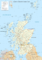
Category:A98 road (Scotland)
Zur Navigation springen
Zur Suche springen
Main Wikipedia article: A98 road.

Straße in Schottland   | |||||
| Medium hochladen | |||||
| Ist ein(e) | |||||
|---|---|---|---|---|---|
| Ort |
| ||||
| Transportnetz |
| ||||
| Besteht aus |
| ||||
| Länge |
| ||||
 | |||||
Unterkategorien
Diese Kategorie enthält folgende Unterkategorie:
In Klammern die Anzahl der enthaltenen Kategorien (K), Seiten (S), Dateien (D)
B
- Banff Bridge, over River Deveron (13 D)
Medien in der Kategorie „A98 road (Scotland)“
Folgende 26 Dateien sind in dieser Kategorie, von 26 insgesamt.
-
 A98 Macduff to Fraserburgh road - geograph.org.uk - 821256.jpg 640 × 480; 66 KB
-
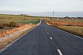
 A98 near Craigmaud - geograph.org.uk - 538674.jpg 640 × 480; 65 KB
-
 A98-map.png 2.400 × 3.450; 6,69 MB
-
 Castle Terrace - geograph.org.uk - 248062.jpg 640 × 355; 206 KB
-
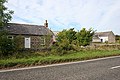
 Cottage at Smiddyboyne - geograph.org.uk - 278616.jpg 640 × 480; 116 KB
-
 Exiting Banff on the A98. - geograph.org.uk - 239337.jpg 640 × 426; 85 KB
-
 Fordyce Parish Church, Portsoy - geograph.org.uk - 3106011.jpg 1.824 × 1.368; 708 KB
-

-
 Junction of A98 and A947 - geograph.org.uk - 1762742.jpg 594 × 640; 307 KB
-

-
 Overton Farm - geograph.org.uk - 821237.jpg 640 × 480; 83 KB
-
 Pampas Grass - geograph.org.uk - 560606.jpg 640 × 268; 151 KB
-
 RAF memorial near Banff - geograph.org.uk - 373107.jpg 640 × 480; 87 KB
-
 Seafield Farm - geograph.org.uk - 1762804.jpg 640 × 397; 220 KB
-
 Seafield Street, Portsoy - geograph.org.uk - 2744849.jpg 640 × 480; 91 KB
-
 Seafield Terrace, Portsoy, with parish church - geograph.org.uk - 2616854.jpg 3.648 × 2.736; 4,6 MB
-
 Shops on the High Street, Portsoy - geograph.org.uk - 2616841.jpg 3.648 × 2.736; 4,98 MB
-

-
 UK road A98.PNG 568 × 184; 8 KB
-
 UK road A98.svg 387 × 191; 3 KB
-
 Westertown - geograph.org.uk - 959078.jpg 640 × 427; 244 KB
-
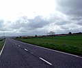 A98 near Ladysford - geograph.org.uk - 433899.jpg 640 × 528; 60 KB
-
 Approaching Tyrie on the A98 - geograph.org.uk - 295835.jpg 640 × 427; 229 KB
-

-

-


,_Portsoy_-_geograph.org.uk_-_3105964.jpg)


