Category:Moray
Jump to navigation
Jump to search

Traditional counties (shires) of Scotland: Aberdeenshire · Angus · Argyll ≈ Argyllshire · Ayrshire · Banffshire · Berwickshire · Buteshire · Caithness · Clackmannanshire · Cromartyshire · Dumbartonshire · Dumfriesshire · East Lothian · Fife · Inverness-shire · Kincardineshire · Kinross-shire · Kirkcudbrightshire · Lanarkshire · Midlothian · Moray · Nairnshire · the Orkney Islands ≈ Orkney Islands · Peeblesshire · Perthshire · Renfrewshire · Ross-shire · Roxburghshire · Selkirkshire · the Shetland Islands ≈ Shetland Islands · Stirlingshire · Sutherland · West Lothian · Wigtownshire
Council areas (municipalities) of Scotland: Aberdeen · Aberdeenshire · Angus · Argyll and Bute · Clackmannanshire · Dumfries and Galloway · Dundee · East Ayrshire · East Dunbartonshire · East Lothian · East Renfrewshire · Edinburgh · Falkirk · Fife · Glasgow · Highland · Inverclyde · Midlothian · Moray · North Ayrshire · North Lanarkshire · Outer Hebrides · Orkney Islands · Perth and Kinross · Renfrewshire · Scottish Borders · Shetland Islands · South Ayrshire · South Lanarkshire · Stirling · West Dunbartonshire · West Lothian


council area of Scotland   | |||||
| Upload media | |||||
| Instance of | |||||
|---|---|---|---|---|---|
| Part of |
| ||||
| Location |
| ||||
| Capital | |||||
| Population |
| ||||
| Area |
| ||||
| Different from | |||||
| official website | |||||
 | |||||
Subcategories
This category has the following 25 subcategories, out of 25 total.
A
- Aerial photographs of Moray (10 F)
- Aikenway Castle (4 F)
C
E
G
H
I
- John de Innes (1 F)
M
N
P
- Panoramics of Moray (4 F)
- Postcards of Moray (1 F)
S
T
V
Media in category "Moray"
The following 200 files are in this category, out of 668 total.
(previous page) (next page)-
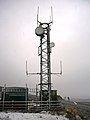
 "5 to The Gallon." Sheep dip^ - geograph.org.uk - 545399.jpg 640 × 426; 113 KB
-
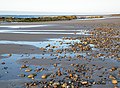
 'The Gut' Culbin - geograph.org.uk - 2229937.jpg 2,560 × 1,920; 1.04 MB
-

-
 A "Head count" at Altyre estate - geograph.org.uk - 1560206.jpg 640 × 426; 86 KB
-
 A captive audience at Culquoich. - geograph.org.uk - 384391.jpg 640 × 480; 98 KB
-
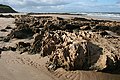
 A dry ridge, The Gut - geograph.org.uk - 5884247.jpg 1,024 × 575; 278 KB
-
 A Flurry of Snow by Kylnadrochit - geograph.org.uk - 1149666.jpg 640 × 480; 48 KB
-
 A Geological Conundrum - geograph.org.uk - 2636519.jpg 640 × 422; 482 KB
-
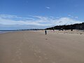
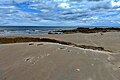
 A grey evening at Lossiemouth West Beach - geograph.org.uk - 4009238.jpg 640 × 480; 150 KB
-

-
 A Hideous Grin - geograph.org.uk - 1369679.jpg 640 × 464; 292 KB
-

-
 A Track by the Loch - geograph.org.uk - 1347085.jpg 640 × 480; 159 KB
-

-
 A Victim of the Storm - geograph.org.uk - 1347350.jpg 640 × 486; 151 KB
-
 A view to a kill - geograph.org.uk - 642032.jpg 480 × 640; 96 KB
-
 A96 at Ardgilzean - geograph.org.uk - 1284270.jpg 640 × 416; 270 KB
-
 Access to Auchorachan - geograph.org.uk - 1340178.jpg 544 × 384; 52 KB
-
 Access to Covesea Beach - geograph.org.uk - 2636429.jpg 418 × 640; 343 KB
-
 Aitnoch Croft in Autumn. - geograph.org.uk - 253568.jpg 640 × 458; 86 KB
-
 An example of the fungus, Black Spot. - geograph.org.uk - 274627.jpg 640 × 449; 137 KB
-

-
 Anti-glider posts, Lossiemouth - geograph.org.uk - 6012251.jpg 1,024 × 575; 243 KB
-
 Approaching Blackstob Wood - geograph.org.uk - 244549.jpg 640 × 480; 72 KB
-
 Aswanley - geograph.org.uk - 1434851.jpg 640 × 480; 43 KB
-
 At the Boar’s Head - geograph.org.uk - 6273044.jpg 1,280 × 960; 270 KB
-
 Auchinhandock - geograph.org.uk - 380859.jpg 640 × 480; 79 KB
-
 Auchtertyre Cottage - geograph.org.uk - 1395563.jpg 640 × 427; 91 KB
-
 Bailliemore - geograph.org.uk - 380125.jpg 640 × 480; 103 KB
-
 Bankhead - geograph.org.uk - 413841.jpg 640 × 427; 235 KB
-
 Barluack - geograph.org.uk - 384237.jpg 427 × 640; 297 KB
-
 BBQ at Roseisle - geograph.org.uk - 3078908.jpg 640 × 475; 80 KB
-
 Beach Access - geograph.org.uk - 1893987.jpg 440 × 640; 254 KB
-
 Beach at Covesea - geograph.org.uk - 2602231.jpg 640 × 480; 561 KB
-
 Beach at Findhorn - geograph.org.uk - 3569771.jpg 640 × 473; 255 KB
-
 Beach beneath Covesea Quarry - geograph.org.uk - 6011529.jpg 1,024 × 683; 282 KB
-
 Beach Sleepers - geograph.org.uk - 3506532.jpg 640 × 420; 406 KB
-
 Beach West of Covesea Lighthouse - geograph.org.uk - 2602255.jpg 640 × 472; 426 KB
-
 Beach, Covesea - geograph.org.uk - 6011892.jpg 1,024 × 575; 200 KB
-
 Beach, Roseisle Forest - geograph.org.uk - 5894045.jpg 1,024 × 683; 266 KB
-
-
 Binsness House - geograph.org.uk - 5752143.jpg 640 × 480; 133 KB
-
 Binsness Point - geograph.org.uk - 4610506.jpg 640 × 360; 63 KB
-
 Birds on the Surf - geograph.org.uk - 5303261.jpg 4,272 × 2,848; 2.42 MB
-
 Black Foot - geograph.org.uk - 5118341.jpg 4,253 × 2,835; 1,007 KB
-
 Blackhillock - geograph.org.uk - 343288.jpg 640 × 427; 262 KB
-
 Boathouse at Binsness - geograph.org.uk - 2349974.jpg 640 × 480; 126 KB
-
 Bog Pool - geograph.org.uk - 794268.jpg 640 × 427; 290 KB
-
 Boundary fences by Terriemore - geograph.org.uk - 574385.jpg 640 × 426; 82 KB
-
 Bow Fiddle Rock, Portknockie, Moray (43941629382).jpg 6,664 × 4,443; 15.39 MB
-
 Bowmans - geograph.org.uk - 341408.jpg 640 × 427; 249 KB
-
 Bracken - geograph.org.uk - 870822.jpg 640 × 427; 256 KB
-
 Bracket Fungi - geograph.org.uk - 793507.jpg 640 × 427; 306 KB
-
 Brick Block by the Beach - geograph.org.uk - 4479816.jpg 471 × 640; 432 KB
-
 Bridge over Muckle Burn at Wellhead Farm - panoramio.jpg 960 × 1,280; 502 KB
-
 Broadrashes - geograph.org.uk - 14412.jpg 640 × 425; 224 KB
-
 Brow Mor - geograph.org.uk - 1048306.jpg 640 × 427; 46 KB
-
 Brown Muir - geograph.org.uk - 1199019.jpg 640 × 427; 268 KB
-
 Burghead Bay - geograph.org.uk - 4610711.jpg 640 × 360; 57 KB
-
 Burghead Bay - geograph.org.uk - 5548940.jpg 1,024 × 768; 196 KB
-
 Burghead Bay View - geograph.org.uk - 3078873.jpg 640 × 464; 95 KB
-
 Burn Treble - geograph.org.uk - 341415.jpg 640 × 427; 232 KB
-
 By Balnallan - geograph.org.uk - 219778.jpg 640 × 424; 84 KB
-

-
 Carn Luig Plantation. - geograph.org.uk - 544187.jpg 640 × 426; 92 KB
-
 Carrot crop protected with straw - geograph.org.uk - 264634.jpg 640 × 480; 195 KB
-
 Clashach - geograph.org.uk - 5716536.jpg 640 × 427; 372 KB
-
 Clashach Cove - geograph.org.uk - 3128523.jpg 2,272 × 1,704; 2.06 MB
-
 Clashach Cove - geograph.org.uk - 3506496.jpg 640 × 417; 366 KB
-
 Clashach Cove - geograph.org.uk - 3506540.jpg 640 × 410; 409 KB
-
 Clashach Cove - geograph.org.uk - 3840488.jpg 640 × 427; 71 KB
-
 Clashach Cove - geograph.org.uk - 6011503.jpg 1,024 × 683; 339 KB
-
 Clear Felled Compartment - geograph.org.uk - 960229.jpg 640 × 427; 272 KB
-
 Cliffs at Covesea - geograph.org.uk - 5480318.jpg 1,024 × 434; 164 KB
-
 Coast near Clashach - geograph.org.uk - 3506556.jpg 640 × 415; 392 KB
-
 Coastal defenses on Roseisle Beach - geograph.org.uk - 2466332.jpg 640 × 428; 63 KB
-
 Coastal rocks at Covesea - geograph.org.uk - 5121310.jpg 640 × 480; 264 KB
-
 Coastal rocks at Covesea - geograph.org.uk - 5121315.jpg 640 × 480; 232 KB
-
 Coat of arms of Moray Area Council.svg 540 × 848; 229 KB
-
 Cock Pheasant - geograph.org.uk - 282817.jpg 640 × 446; 282 KB
-
 Collapsed anti-tank defences - geograph.org.uk - 3122994.jpg 2,272 × 1,704; 2.38 MB
-
 Communicating - geograph.org.uk - 254666.jpg 640 × 480; 103 KB
-
 Contorted Rock - geograph.org.uk - 2636505.jpg 640 × 425; 390 KB
-
 Converted Chapel - geograph.org.uk - 282826.jpg 640 × 427; 207 KB
-
 Cottage near Bridgend - geograph.org.uk - 1201546.jpg 640 × 480; 100 KB
-
 Cottertown of Auchanachie - geograph.org.uk - 338274.jpg 640 × 427; 277 KB
-
 Cove at Tronach Head - geograph.org.uk - 4798927.jpg 640 × 427; 79 KB
-
 Covesea Beach - geograph.org.uk - 2636445.jpg 640 × 368; 309 KB
-
 Covesea Beach - geograph.org.uk - 2636482.jpg 640 × 417; 301 KB
-
 Covesea Beach - geograph.org.uk - 2636490.jpg 640 × 424; 326 KB
-
 Covesea Beach - geograph.org.uk - 3839704.jpg 640 × 427; 27 KB
-
 Covesea Beach - geograph.org.uk - 3839736.jpg 640 × 427; 55 KB
-
 Covesea beach - geograph.org.uk - 5121301.jpg 640 × 480; 220 KB
-
 Covesea beach - geograph.org.uk - 5121311.jpg 640 × 480; 168 KB
-
 Covesea beach - geograph.org.uk - 5121317.jpg 640 × 480; 174 KB
-
 Covesea Beach - geograph.org.uk - 5471424.jpg 640 × 400; 47 KB
-
 Covesea Beach - geograph.org.uk - 6011895.jpg 1,024 × 575; 232 KB
-
 Covesea beach - geograph.org.uk - 6011900.jpg 1,024 × 575; 238 KB
-
 Covesea beach - geograph.org.uk - 6216197.jpg 3,968 × 2,976; 807 KB
-
 Covesea Beach and Lighthouse - geograph.org.uk - 3839714.jpg 640 × 427; 36 KB
-
 Covesea Beach and lighthouse - geograph.org.uk - 6011899.jpg 1,024 × 575; 234 KB
-
 Covesea coastline - geograph.org.uk - 6209097.jpg 640 × 427; 105 KB
-
 Covesea Lighthouse - geograph.org.uk - 3839689.jpg 640 × 427; 50 KB
-
 Covesea Lighthouse - geograph.org.uk - 3839697.jpg 640 × 427; 37 KB
-
 Covesea Lighthouse - geograph.org.uk - 3839699.jpg 640 × 427; 36 KB
-
 Covesea Lighthouse - geograph.org.uk - 5121303.jpg 480 × 640; 205 KB
-
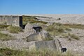
 Covesea Pillbox - geograph.org.uk - 5072708.jpg 640 × 427; 162 KB
-
 Covesea Skerries Lighthouse - geograph.org.uk - 6186525.jpg 640 × 427; 62 KB
-
 Crannich - geograph.org.uk - 59557.jpg 500 × 375; 73 KB
-
 Creag Loisgte - geograph.org.uk - 905733.jpg 587 × 440; 380 KB
-
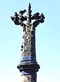
 Cross of Knockando - geograph.org.uk - 389350.jpg 640 × 480; 93 KB
-

-

-
 Crumbling Tank Traps - geograph.org.uk - 6278836.jpg 640 × 427; 393 KB
-
 Culbin bar 2010 - geograph.org.uk - 2237159.jpg 4,320 × 3,240; 4.71 MB
-
 Culbin Bar Dec 2010 - geograph.org.uk - 2229899.jpg 1,920 × 2,560; 1.04 MB
-
 Culbin Beach - geograph.org.uk - 2525638.jpg 640 × 480; 43 KB
-
 Culbin Beach - geograph.org.uk - 2525647.jpg 640 × 480; 59 KB
-
 Culbin Beach - geograph.org.uk - 2525657.jpg 640 × 480; 44 KB
-
 Culbin Dunes - geograph.org.uk - 1254430.jpg 640 × 480; 74 KB
-
 Culbin Forest - geograph.org.uk - 2525699.jpg 640 × 480; 69 KB
-
 Culbin Forest - geograph.org.uk - 6197546.jpg 640 × 480; 94 KB
-
 Culbin Forest - geograph.org.uk - 6243012.jpg 640 × 457; 100 KB
-
 Culbin Forest - geograph.org.uk - 6243104.jpg 1,024 × 768; 367 KB
-
 Culbin Forest at The Gut - geograph.org.uk - 6243111.jpg 640 × 400; 74 KB
-
 Culbin Forest Beach - geograph.org.uk - 2349649.jpg 640 × 480; 27 KB
-
 Culbin Forest Beach - geograph.org.uk - 2352075.jpg 640 × 480; 59 KB
-
 Culbin Salt Marsh - geograph.org.uk - 2349904.jpg 640 × 480; 103 KB
-
 Culbin Salt Marsh - geograph.org.uk - 2526005.jpg 640 × 480; 43 KB
-
 Culbin Salt Marsh - geograph.org.uk - 2526013.jpg 640 × 480; 57 KB
-
 Culbin Salt Marsh - geograph.org.uk - 2526024.jpg 640 × 480; 81 KB
-
 Culbin Salt Marsh and Mud Flats - geograph.org.uk - 2526017.jpg 640 × 480; 50 KB
-
 Culbin Sand Bar - geograph.org.uk - 2525671.jpg 640 × 480; 51 KB
-
 Culbin Sand Bar - geograph.org.uk - 2525684.jpg 640 × 480; 75 KB
-
 Culbin Sand Bar - geograph.org.uk - 2525687.jpg 640 × 480; 54 KB
-
 Culbin sand bar - geograph.org.uk - 3129115.jpg 2,272 × 1,704; 2.05 MB
-
 Culbin Sand Dunes - geograph.org.uk - 2226668.jpg 640 × 480; 59 KB
-
 Culbin Sands - geograph.org.uk - 2578856.jpg 640 × 480; 40 KB
-
 Culbin Sands - geograph.org.uk - 5877945.jpg 1,024 × 575; 228 KB
-
 Culbin Sands - geograph.org.uk - 5877947.jpg 1,024 × 575; 227 KB
-
 Culbin Sands - geograph.org.uk - 5879722.jpg 1,024 × 575; 161 KB
-
 Culbin Sands - geograph.org.uk - 5879752.jpg 640 × 359; 39 KB
-
 Culbin Sands - geograph.org.uk - 5884214.jpg 1,024 × 575; 227 KB
-
 Culbin Sands - geograph.org.uk - 6197607.jpg 800 × 482; 89 KB
-

-
 Cullen Bay - geograph.org.uk - 2620589.jpg 3,648 × 2,736; 4.86 MB
-
 Cullen Sands at High Tide - geograph.org.uk - 4280066.jpg 1,600 × 1,200; 445 KB
-
 Cup and Ring Mark - geograph.org.uk - 1719660.jpg 640 × 427; 284 KB
-
 Cup and Ring Marked Rocks - geograph.org.uk - 1719643.jpg 640 × 427; 295 KB
-
 Daffodils at Brodie - geograph.org.uk - 1278413.jpg 640 × 395; 188 KB
-
 Daffodils, Scotland.jpg 3,000 × 4,000; 8.15 MB
-
 Dallas Cross - geograph.org.uk - 217441.jpg 469 × 640; 171 KB
-
 Dark Cloud Over Findhorn Bay - geograph.org.uk - 2352197.jpg 640 × 480; 34 KB
-

-
 Dava Orange Tower - geograph.org.uk - 283140.jpg 450 × 600; 93 KB
-
 Daybreak Over Findhorn Estuary - geograph.org.uk - 3180608.jpg 1,600 × 1,067; 133 KB
-
 Derelict but and ben near Lochhill - geograph.org.uk - 269792.jpg 640 × 426; 117 KB
-
 Derelict cottage on the hill of Mayen. - geograph.org.uk - 256064.jpg 640 × 426; 168 KB
-
 Derelict Jetty at Binsness - geograph.org.uk - 4610510.jpg 640 × 360; 95 KB
-
 Details on Bridge of Advie, Near Tulchan - geograph.org.uk - 330228.jpg 640 × 480; 158 KB
-
 Dewatering Structure - geograph.org.uk - 2636516.jpg 640 × 422; 404 KB
-
 Disintegrating tank defences - geograph.org.uk - 3130071.jpg 2,272 × 1,704; 1.57 MB
-
 Disturbed Sandstone - geograph.org.uk - 2636499.jpg 640 × 426; 425 KB
-
 Ditch by the woods southwest of Lurg. - geograph.org.uk - 376715.jpg 640 × 426; 107 KB
-
 Ditch outflow - geograph.org.uk - 6209054.jpg 640 × 427; 151 KB
-

-
 Doocot (geograph 4033768).jpg 427 × 640; 477 KB
-

-
 Dry skerries, Covesea - geograph.org.uk - 6209059.jpg 640 × 427; 58 KB
-
 Dunes at Roseisle - geograph.org.uk - 3078897.jpg 640 × 480; 111 KB
-

-
 Earl of moray.png 6,000 × 7,200; 741 KB
-
 Earnhill Farm - geograph.org.uk - 264635.jpg 640 × 480; 197 KB
-
 Earnhill House - geograph.org.uk - 264637.jpg 640 × 480; 154 KB
-
 Easter Rynaballoch - geograph.org.uk - 212687.jpg 640 × 424; 65 KB
-
 Easter Torrans - geograph.org.uk - 139516.jpg 640 × 480; 144 KB
-
 Eastwards from Terriemore - geograph.org.uk - 574365.jpg 640 × 426; 84 KB
-
 Edge of Culbin Forest at Findhorn Bay - panoramio.jpg 1,280 × 960; 502 KB
-
 Elsa waits patiently. - geograph.org.uk - 869120.jpg 640 × 480; 59 KB
-
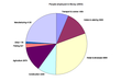 Employmentmoray.png 977 × 600; 24 KB
-
 Entrance to Lesmurdie House - geograph.org.uk - 1066843.jpg 640 × 420; 114 KB
-
 Entrance to Moy House - geograph.org.uk - 264620.jpg 640 × 480; 179 KB
-

-
 Erosion of Culbin Forest beach - geograph.org.uk - 2710048.jpg 2,558 × 1,209; 354 KB
-
 Erosion Protection in Findhorn Bay - geograph.org.uk - 2344903.jpg 640 × 480; 98 KB
-
 Erosion, Culbin Sands - geograph.org.uk - 5884196.jpg 1,024 × 575; 255 KB
-
 Estate gateposts and path sign - geograph.org.uk - 264618.jpg 640 × 480; 189 KB
-
 Farm road to Glack - geograph.org.uk - 378760.jpg 640 × 427; 97 KB
-
 Fence on Jock's Hill - geograph.org.uk - 1369671.jpg 640 × 427; 280 KB
-
 Fence,ski-tracks, Black Hill - geograph.org.uk - 1157115.jpg 480 × 640; 22 KB
-
 Field and trees near Balnallan - geograph.org.uk - 1805936.jpg 800 × 531; 169 KB
-
 Field Gentian (Gentianella campestris) - geograph.org.uk - 6278844.jpg 640 × 640; 377 KB
-
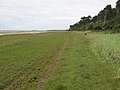
 Findhorn Bay - geograph.org.uk - 2304431.jpg 640 × 403; 368 KB
-
 Findhorn Bay - geograph.org.uk - 2344844.jpg 640 × 480; 50 KB
-
 Findhorn Bay - geograph.org.uk - 2344897.jpg 640 × 480; 73 KB
-
 Findhorn Bay - geograph.org.uk - 2509671.jpg 640 × 480; 50 KB
-
 Findhorn Bay - geograph.org.uk - 2532141.jpg 640 × 480; 42 KB
-
 Findhorn Bay - geograph.org.uk - 2532154.jpg 640 × 480; 70 KB
-
 Findhorn Bay - geograph.org.uk - 2532588.jpg 640 × 480; 59 KB
-
 Findhorn Bay - geograph.org.uk - 2896563.jpg 640 × 424; 424 KB


.jpg)


.jpg)


_-_geograph-2348163.jpg)


_at_Brodie._-_geograph.org.uk_-_1247140.jpg)
.jpg)


_-_geograph.org.uk_-_6278844.jpg)


