Category:Acre, Lancashire
Jump to navigation
Jump to search
English: Acre is a village on the A56 between Accrington and Haslingden in Lancashire, about one mile north of Haslingden town centre.
village in United Kingdom  | |||||
| Upload media | |||||
| Instance of | |||||
|---|---|---|---|---|---|
| Location | Rossendale, Lancashire, North West England, England | ||||
 | |||||
Media in category "Acre, Lancashire"
The following 20 files are in this category, out of 20 total.
-
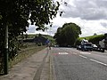
 A56 towards Rising Bridge - geograph.org.uk - 490973.jpg 640 × 292; 53 KB
-
 A680 Blackburn Road, Acre - geograph.org.uk - 947214.jpg 640 × 480; 88 KB
-
 A680 Blackburn Road, Acre - geograph.org.uk - 947219.jpg 640 × 313; 40 KB
-
 Bridge Caterering Fabrications Ltd - geograph.org.uk - 1324634.jpg 640 × 480; 50 KB
-

-
 Mill Street, Haslingden - geograph.org.uk - 1324649.jpg 640 × 480; 84 KB
-
 New Houses Back Lane - geograph.org.uk - 491034.jpg 640 × 480; 117 KB
-
 Remains of Hazel Mill - geograph.org.uk - 1095286.jpg 640 × 311; 48 KB
-
 Remains of Hazel Mill - geograph.org.uk - 1095287.jpg 640 × 287; 33 KB
-
 Remains of Hazel Mill - geograph.org.uk - 1095289.jpg 640 × 480; 90 KB
-
 Remains of Hazel Mill - geograph.org.uk - 1095297.jpg 640 × 480; 102 KB
-

-
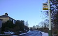
 Rising Bridge Junction - geograph.org.uk - 432896.jpg 640 × 480; 86 KB
-
 Rising Bridge Road - geograph.org.uk - 1108583.jpg 640 × 480; 68 KB
-
 Rising Bridge Road - geograph.org.uk - 1108592.jpg 640 × 480; 94 KB
-
 Rising Bridge Road - geograph.org.uk - 1108596.jpg 640 × 395; 56 KB
-
 Stream, Northfield Road, Rising Bridge - geograph.org.uk - 751498.jpg 480 × 640; 108 KB
-
 Tanner Barn - geograph.org.uk - 941762.jpg 640 × 480; 197 KB
-
 The Great Tree Acre - geograph.org.uk - 491011.jpg 640 × 424; 91 KB
-
 Vale Street Mill - geograph.org.uk - 1324639.jpg 640 × 480; 58 KB


